Tauresium Archaeological Park: A Late Antique Fortified Settlement in North Macedonia
Site at a Glance
- Rating
- 4.2
- Popularity
- Very Low
- Country
- North Macedonia
- Primary era
- Medieval
- External website
- Open
- Eras represented
- Classical, Medieval
- Civilizations
- Byzantine, Roman
- Site type
- Military
- Remains
- Fortified Town
On this page19 sections
History
Tauresium Archaeological Park is a Late Antique archaeological settlement in North Macedonia, near Taor, associated with the Roman and Byzantine world of the Dardanian region. Occupation at the site spans the Early Bronze Age, Late Antiquity, and the early medieval period, while the settlement’s proposed identification with Tauresium gives it a possible connection with Byzantine Emperor Justinian I, who ruled from 527 to 565.
From prehistoric occupation to Late Antiquity
The earliest known activity belongs to an Early Bronze Age horizon dated approximately 2200 to 1700 BC. The earliest artefacts are sporadic and occur within later ancient layers. A later Late Antique settlement developed in two main phases. The first lasted from the fourth century to the early sixth century, ending with the earthquake of 518. The second followed the earthquake and continued until the end of the sixth century.
The settlement formed part of a wider regional landscape linked by the Roman road known as the Via Axia. This route followed the Vardar valley north of the site and connected Scupi, the ancient city at present-day Skopje, with Stobi and Thessalonica, now Thessaloniki.
The proposed identification with Tauresium
The site is also known as Gradište and has been identified by some researchers with Tauresium, the birthplace of Justinian I. The proposal rests chiefly on the sixth-century historian Procopius, Justinian’s biographer, who described Tauresium near the castle of Baderiana, and on the similarity between the names Tauresium and Taor. Baderiana has been associated with the modern village of Bader, about 6 kilometres east of Taor.
This identification remains disputed. Some researchers argue that Taor-Gradište had another ancient name and place Tauresium and Baderiana near Naissus, in present-day Serbia. The related identification with Justiniana Prima, an important ecclesiastical centre associated with Justinian in the surrounding region, is therefore an interpretation rather than an archaeologically settled fact.
A fragment from a large storage vessel bears a monogram attributed to Justinian I. This discovery has strengthened the proposed connection between the settlement and Tauresium, although it remains part of the wider debate about the site’s ancient identity.
Earthquake, renewal, and abandonment
The earthquake of 518, whose epicentre was at nearby Scupi, destroyed the settlement. It was then substantially renewed, traditionally with Justinian’s support as an expression of gratitude toward his birthplace. The rebuilding introduced defensive walls, a water-supply system, and drainage works, transforming the settlement during the second Late Antique phase.
Several raids by Avars and Slavs in the late sixth century brought this occupation to an end. After a hiatus of about two centuries, habitation resumed during the ninth and tenth centuries, although the early medieval phase was relatively brief.
Archaeological investigation
Arthur Evans, the British explorer and archaeologist, first recorded the site and identified it as Tauresium in the late nineteenth century. Systematic archaeological exploration began in 2000 under the Skopje City Museum and continued under the direction of archaeologist Kiro Ristov. Excavations have defined the prehistoric, Late Antique, and early medieval cultural horizons and have brought the settlement’s buildings, fortifications, artefacts, and later alterations into clearer view.
Remains
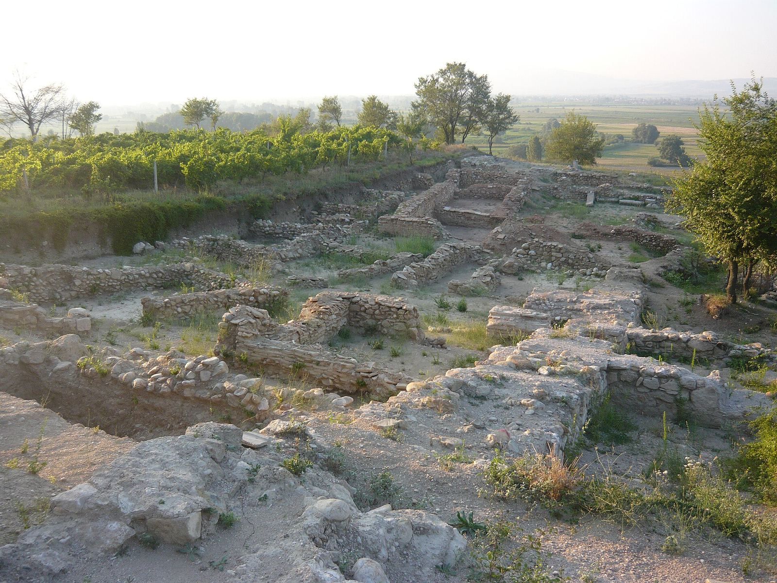
The settlement occupies a high hill organized around an acropolis and two terraces. The excavated area covers approximately 1.6 hectares, while the fortified area, lower walls, and fortified terraces extend across about 2.2 hectares. The surviving architecture is concentrated in the Late Antique fortified settlement, where walls, towers, domestic buildings, columns, water works, drainage features, and a necropolis reveal the arrangement and changing use of the site.
Fortifications and entrance
Triangular fortress
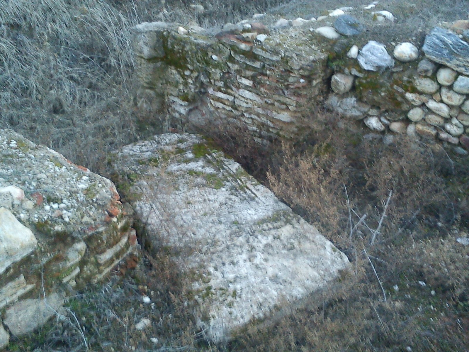
The Late Antique fortress has a roughly triangular plan with corner towers and a projecting frontal bastion, a defensive structure built out from the wall. It is also described as a Tetrapyrgia, a fortification with four towers. About 70 metres of the eastern wall and 5 metres of the northern wall have been exposed. The wall is approximately 1.60 metres wide and consists of large dressed stones and massive outer slabs surrounding a rubble-and-mortar core.
Northeastern tower and gate
A rectangular tower stood at the northeastern corner. From it, the wall ran southward, climbed toward the northern acropolis terrace, and met the western wall at a strong tower or bastion on the site’s highest point. About 22 metres south of the corner tower, an entrance approximately 1.70 metres wide opened through the fortification. It was probably closed by a wooden door, and a marble funerary stele was found within the entrance.
Public and communal buildings
Colonnaded building
On the northeastern side of the settlement stood an east-west building with a colonnade. Its northern and eastern walls reused the defensive wall. Three rooms of different sizes opened southward onto a corridor with an open colonnade facing an atrium, an open central court around which rooms may be arranged. The walls survive to about 1 metre above floor level and are approximately 1 metre thick, built from stone bonded with lime mortar.
Square marble blocks of varying sizes were set into the floors of the three rooms as bases. The upper-storey colonnade included three undecorated marble columns, each about 1.60 metres high, together with two bases and three impost capitals. An impost capital is a block placed above a column capital to support an arch or another upper structure.
Atrium building
South of the colonnaded building was an east-west architectural unit constructed as two separate structures. It comprised a central atrium and three rooms of different sizes within an irregular, almost trapezoidal plan oriented north-south. The walls were made of dressed stone bonded with high-quality lime mortar, and the atrium floor was paved with building brick.
Major destruction in the second half of the sixth century was followed by alterations in the late sixth or early seventh century. An oven for baking bread was installed in the southeastern part, openings in the western and southern walls were blocked with stone and mud, and a substantial northern wall with steps was built to provide access to the defensive wall.
Domestic buildings
Houses 1 to 3
House 1 stood 1.10 metres west of the atrium building and was oriented east-west. Kitchen and storage pottery, everyday objects, and coins indicate occupation from the fourth century through the end of the sixth century. Houses 2 and 3 stood farther west. House 2 had a floor of light-yellow refined clay laid over firmly compacted gravelly soil, while House 3 was oriented north-south and divided into two rooms by an internal partition. Pottery, coins, and other finds place House 3’s occupation from the fourth century through the end of the sixth century, while House 2 was used from the fourth through the sixth century.
Houses 4 and 5
House 4, southeast of House 2, had an irregular, almost trapezoidal plan. Its rubble-stone walls were bonded with mud. Finds included pottery, scales and scale weights, an iron cross, other metal objects, and a small coin deposit dating from the end of the sixth century.
House 5 formed a later addition on the southern side of House 4. Its broad entrance probably held a double-leaf door, and the room may have served as a livestock area or auxiliary space. Pottery, coins, a balance with weights, and agricultural tools date from the fourth to the sixth centuries. A refuse pit beside the entrance contained animal bones and iron nails.
House 6
House 6 stood south of House 5 and had a rectangular, north-south plan divided into two rooms, with the southern room added later. Fire-damaged structural debris, building stone, and compact light-yellow clay were found within the building. The northern room contained a hearth with a chimney and a fragmented storage vessel to its north. Small knives, lead balance weights, a sickle, and about twenty hooks of different sizes were also recovered.
Houses 7 and 8
House 7 stood south of the entrance near the second tower of the defensive wall and consisted of two independent rooms. Two large storage vessels, or pithoi, were sunk into the floor in its southwestern corner. Pottery, coins, and other finds indicate activity from the fourth through the sixth century or possibly the beginning of the seventh century.
House 8 stood north of House 7. It contained one room with a corridor along its western side, a storage vessel in its northeastern corner, and a hearth with a large quantity of ash in the southern half.
Religious, funerary, and water features
Excavations have revealed a Late Antique necropolis, along with parts of a water-supply system and drainage works. Stone columns near the local church are identified as remains of an Early Christian basilica, a large hall-type building commonly adapted for Christian worship in Late Antiquity. Marble architectural fragments include columns, bases, and capitals, some of which carry Early Christian motifs.
Artefacts and evidence of occupation
The excavated material includes ceramic vessels, glassware, window panes, jewellery such as earrings, fibulae, and rings, bone artefacts, weapons, military equipment, tools, construction implements, locks, and keys. Approximately 250 coins were issued by rulers of the fourth to sixth centuries. A fragment of a marble bust and the sealed storage-vessel fragment carrying the monogram attributed to Justinian I add to the range of evidence used to interpret the settlement’s history and proposed identity.