Burgstall Wahlmich: A Medieval Castle and Probable Ancestral Seat
Site at a Glance
- Popularity
- Very Low
- Country
- Germany
- Primary era
- Medieval
- Eras represented
- Medieval
- Civilizations
- Holy Roman Empire
- Site type
- Military
- Remains
- Castle
On this page11 sections
History
Burgstall Wahlmich is the site of a high-medieval castle near Waldaschaff, Germany, probably established by the Lords of Weiler several decades before it was named in a record of 1286. That record identifies it as the family’s ancestral seat, and the castle is considered the probable first such seat of the Lords of Weiler. Its history is also associated with the origins of the settlement of Waldaschaff.
The Lords of Weiler held land as vassals, meaning they served more powerful lords, in this case the Counts of Rieneck. Wahlmich stood between the territory governed by the archbishops of Mainz, known as Kurmainz, and Spessart lands linked to Rieneck and the Bishopric of Würzburg, an ecclesiastical principality. Its position allowed control of the Aschaff valley and routes into the Spessart.
Abandonment and dismantling
Archaeological interpretation identifies Wahlmich as a high-medieval hilltop castle rather than simply a motte castle, a fort centered on a raised mound. Although its destruction was once associated with the German Peasants’ War, the uprising in German-speaking lands in 1524-1525, the castle appears to have been abandoned and deliberately dismantled during conflict between Rieneck and Mainz, no later than 1271. This dating places its end well before the later explanations that the family left after establishing another seat nearby.
Later family history
The Lords of Weiler developed their later seat at nearby Weiler into Schloss Weiler after the German Peasants’ War. In 1648, a Mainz fief charter records the sale of the family’s estates to Philipp Erwein von Schönborn, a member of the noble House of Schönborn. The charter calls Wahlmich Waldburg and also mentions nearby Hockenhof. The Lords of Weiler family became extinct in 1655.
Landscape change and archaeological investigation
Clay extraction from pits altered the castle site into the early nineteenth century. Later expansion work on the A3 removed a possible outer bailey or settlement northeast and below the castle, without archaeological investigation. The castle site is protected as an archaeological monument in Bavaria.
Research became a major project for the Waldaschaff local heritage association. Excavations by the Spessart Archaeological Project and volunteers began on 3 May 2016. Six trenches that year covered less than two percent of the protected area, including three in the central and western parts of the hill. Work resumed in May 2018 in the north and extended the known course of the defensive wall. Most areas opened in 2016 were later covered with a protective layer, while selected wall sections were rebuilt as ruins to convey the castle’s scale.
Remains
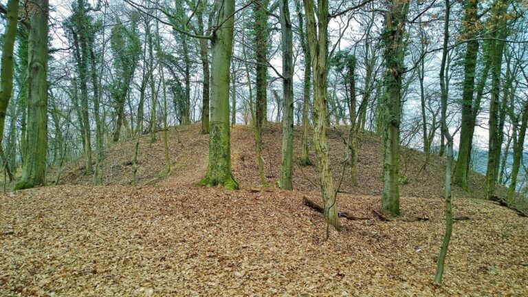
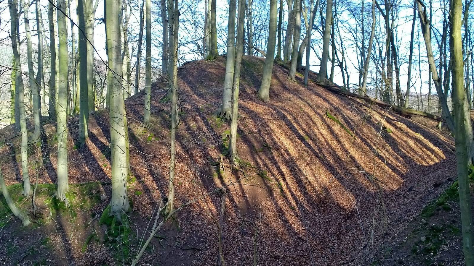
The castle occupied an oval area on a north-facing hillside, about 210 metres above sea level and roughly 1.5 kilometres west of Waldaschaff’s church, near present-day Schloss Weiler. The area between the outer ditch and former ring wall measured about 2,700 square metres, and the site was approximately 200 metres long. An outer ditch or steep slope enclosed about 3,800 square metres. The position overlooks the Aschaff valley toward the Spessart.
Earthworks and defenses
Outer enclosure
The line of the outer ring ditch remains clearly traceable in the terrain. Together with the steep slope, it formed the wider enclosure around the castle. Clay pits and later ground disturbance altered parts of the site.
Castle walls and shield wall
Excavations exposed several stretches of masonry built with large stone blocks, including a collapsed section of the western wall. The collapse may have resulted from undermining during the castle’s dismantling. In the northern area, the defensive wall was traced at slightly more than two metres thick. Before excavation, no castle remains stood above ground; selected exposed sections have since been rebuilt as ruins.
Farther south, two trenches revealed the foundations and southeastern corner of a shield wall that protected the castle spur against the hillside. A small number of blocks have raised, roughly dressed central faces, suggesting this treatment was used at the polygonal corners of the castle wall. The southernmost trench uncovered a pointed-profile ditch up to six metres deep, filled with substantial debris from the collapsed shield wall.
Buildings and finds
Residential building
A cellar belongs to a building thought to have served as the principal residential hall. Bones and antler remains lay beside its foundation, and some antler had been made into a crossbow nut, the catch that holds a crossbow’s bowstring before release. A roasting spit was also recovered, preserved apart from its wooden portion.
Objects and materials
Finds include a silver bracteate, a thin coin struck on one side, depicting Frederick I, a twelfth-century Holy Roman Emperor. The coin names Altenburg as its mint. Other objects include delicate hairpins, a brooch, gilded pieces of horse harness, arrowheads, and crossbow bolts.
Ceramic and earthenware fragments include relief-decorated floor tiles and beaker-shaped stove tiles with pinched feet. Pottery containing mica came from the Vorspessart region. Thin fragments of flat and hollow glass are among the oldest known from the Spessart region. Finds also include a horse-shaped vessel used for pouring water.
A nearly complete, shoe-last-shaped stone celt, a Neolithic woodworking tool, was probably reused at the castle as a so-called thunderstone, a stone associated with lightning protection, and built into the area of the castle buildings. Comparable tools have been found at the residential tower of Ketzelburg and during excavations at Elisabethenzell monastery.