Kohlstädt Castle Ruins: A Medieval Customs and Supply Station

Site at a Glance
- Rating
- 4.7
- Popularity
- Very Low
- Country
- Germany
- Primary era
- Medieval
- Eras represented
- Medieval
- Civilizations
- Holy Roman Empire
- Site type
- Military
- Remains
- Castle
On this page6 sections
History
Kohlstädt Castle Ruins in Schlangen, Germany, are the remains of a lowland castle probably built around 1100, during the medieval period. The fortification was likely established by the Counts of Schwalenberg, who served as protective bailiffs, secular officials safeguarding the property and interests of a religious institution, for Corvey Abbey. Positioned near the pass over the Kleine Egge and the junction with the Sennehellweg, an important route through the Senne region, the castle controlled movement and supported local supply.
Schwalenberg and Lippe
The castle, also known as Kleine Herrenburg, probably took shape between 1000 and 1200. Masonry techniques and archaeological finds from Leo Nebelsiek’s partial excavations in 1932 point more specifically to a date around 1100. In 1365, the site passed to the noble lords of Lippe, the ruling family of the territory of Lippe, and served as protection toward Paderborn.
By the end of the fourteenth century, the inhabitants had abandoned the Herrenburg. The site then entered a long period of decay and became a ruin. Later generations proposed different explanations for its former purpose. Practical interpretations included an iron-smelting works or lime kiln, while other traditions described it as a pre-Christian pagan church or the tower of Veleda, a Germanic prophetic woman known from Roman-era accounts and later treated in legend as a supernatural or religious figure. In 1704, treasure hunters were punished after performing superstitious ceremonies intended to secure success.
Changing interpretations
The castle is now understood as a former customs and supply station. Its position allowed it to protect and control the crossing of the Kleine Egge and the nearby route junction. The ruin remains privately owned, and entering it is unsafe because masonry may fall.
Remains
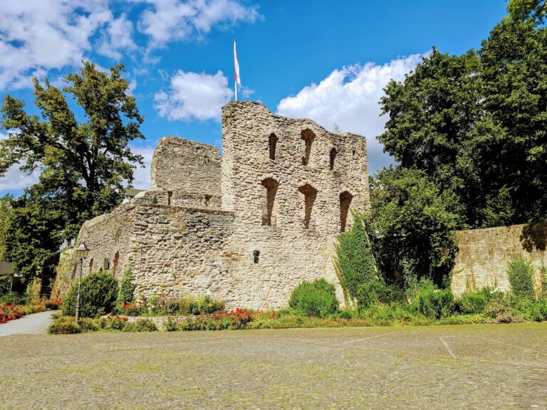
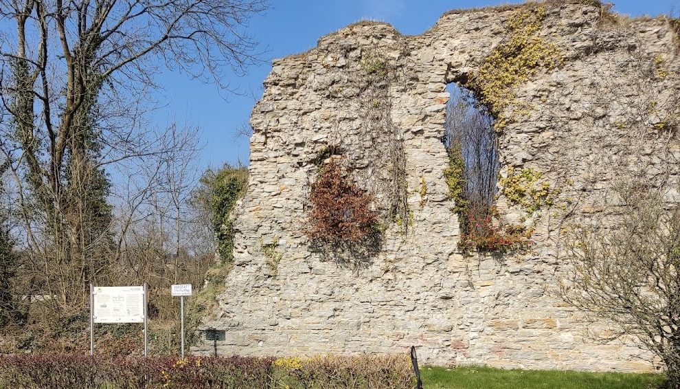
The surviving structure stands near the Strothe stream in the southern Teutoburg Forest. It represents a lowland castle, meaning a fortification built on relatively level or gently raised ground rather than on a steep mountain or rocky summit. The castle occupied a hill that was probably a motte, a raised earth mound forming the defensive core of a castle. That mound is now barely recognizable. The surviving layout centers on a square defensive tower with the foundations of an attached ancillary building.
Defensive tower
The square tower is the principal surviving feature of the castle. Its walls are almost 2.40 metres thick and still reach up to 12 metres in height. They were built with a special pseudo-herringbone masonry technique, in which the stonework creates a pattern resembling the bones of a fish. The walls originally contained defensive openings approximately 15 centimetres wide and 1 metre high.
The tower’s entrance was placed on the first upper floor, while a spiral staircase provided access to the higher storeys. These arrangements formed part of the tower’s defensive design and separated the main entrance from ground level. The structure now survives only as a ruin.
Attached building
Foundations of an ancillary building remain attached to one side of the tower. They preserve evidence of a secondary part of the castle’s arrangement, although the overall complex is fragmentary. Together with the tower, these foundations define the surviving physical remains of the former fortification.
Nearby sites