Burg Wittelsbach: Ancestral Castle of the Wittelsbach Dynasty in Germany
Site at a Glance
- Rating
- 4.3
- Popularity
- Very Low
- Country
- Germany
- Primary era
- Medieval
- Eras represented
- Medieval, Modern
- Civilizations
- German, Holy Roman Empire
- Site type
- Military
- Remains
- Castle
On this page14 sections
History
Burg Wittelsbach was a medieval castle in Germany, located at Oberwittelsbach, now part of Aichach. Its earliest history is uncertain, but the original castle is generally dated to around the year 1000 or later. In the High Middle Ages, it became the ancestral seat of the Wittelsbach dynasty and the starting point of a ruling house that governed Bavaria for centuries.
Origins and the Counts of Wittelsbach
The castle’s name appears as “Witilinesbac” in a document of 1115, where it identifies the place of origin of Otto IV, Count of Scheyern. One tradition connects the name with Vitilo or Vitilis, a ministerial, meaning a dependent member of the medieval service nobility, who may have served as a castellan. Another interpretation derives it from Latin words associated with a calf and understands the name as “calf brook.” Neither explanation is certain.
In 1119, Otto IV moved his residence from Scheyern Castle to Wittelsbach. From 1120, the Counts of Scheyern styled themselves Counts Palatine of Wittelsbach. Counts palatine were high-ranking territorial rulers whose office originally involved representing a king or emperor. The move therefore made the castle the dynastic seat from which the Wittelsbach name entered European political history.
The House of Wittelsbach later supplied counts palatine, dukes, electors, and kings of Bavaria, as well as electors of the Palatinate. Burg Wittelsbach consequently became associated with the origins of the Bavarian ruling house, even after the castle itself ceased to function as a residence.
Abandonment and ecclesiastical reuse
Local tradition holds that the castle was destroyed in 1209 as retaliation for the assassination of King Philip of Swabia. Otto VIII of Wittelsbach killed Philip in Bamberg on 21 June 1208. Duke Ludwig I of Bavaria, known as Ludwig the Kelheimer, belonged to the Wittelsbach family and supported the Staufers, the dynasty to which Philip belonged. He was reportedly involved in the destruction of the castle.
Excavations from 1978 to 1980 found no destructive fire layer or clear evidence of a violent demolition. The castle appears instead to have been abandoned and gradually dismantled, after which its ruins were quarried for building material. A direct connection between this process and the assassination remains unconfirmed.
After the castle fell out of use, the hill served ecclesiastical purposes. The beginnings of this reuse, including any relationship to an earlier castle chapel, are unknown. In the fifteenth century, a late Gothic pilgrimage church dedicated to Mary of Victory was built on the former castle grounds. The church belonged to the Teutonic Order. Later tradition described it as an expiatory church, meaning a place founded as penance for a serious crime, and linked its creation to the Wittelsbachs, possibly Ludwig the Kelheimer. No documentary evidence supports that interpretation.
The monument and modern investigation
From approximately the sixteenth century until the early nineteenth century, small farmers and soldiers lived on the castle grounds. Their settlements were removed during the nineteenth century to make way for a Bavarian national monument. The Wittelsbach National Monument was inaugurated on 25 August 1834 from a design by Joseph Daniel Ohlmüller. Hundreds of spectators attended the ceremony, while more than 20,000 people were reportedly present in and around Aichach, including about 1,000 mounted peasants. King Ludwig I was represented by Regierungspräsident Franz Arnold Ritter von Linck.
Oberwittelsbach then became a popular excursion destination because of its association with the Bavarian royal dynasty and appeared in numerous engravings and lithographs. King Maximilian II visited the former ancestral castle on 9 September 1857, the first Wittelsbach ruler known to have returned to the site in the modern period.
Archaeological work carried out from 1978 to 1980 prepared the site for the exhibition The Wittelsbachs and Bavaria and appears to have been the first extensive investigation of the castle hill. The excavated walls and foundations were later strengthened and raised with modern brickwork so that the former plan could be more easily understood. Today, the church, the neo-Gothic national monument, and a memorial stone commemorate the former castle. The name “Wittelsbacher Land” is also used for part of the Aichach-Friedberg district in remembrance of the site and its dynastic association.
Remains
Burg Wittelsbach occupied a hill about 515 metres above sea level. Its elongated, curved plan followed the natural contours of the hill and broadly resembled a crescent that widened toward the east. The slopes of the main castle fell approximately 20 metres toward the surrounding valley. The entire complex extended for about 200 metres and comprised an elongated core castle with two outer baileys, or fortified subsidiary enclosures, divided by banks and ditches.
Fortifications and earthworks
Early defensive position
The earliest known defensive installation stood on an eastern spur and measured approximately 35 by 45 metres. A crosswise rampart of uncertain date protected it, probably together with a ditch. During the High Middle Ages, a shield wall, a substantial defensive wall protecting the vulnerable approach, was built along the rampart crest. The neck ditch was widened, and a stone enclosing wall was constructed around the main castle.
Main castle and outer baileys
After the Counts of Scheyern took possession in the early twelfth century, the earlier neck ditch was filled. The shield wall disappeared, while the enclosing wall was strengthened, partly rebuilt, and extended. The core castle measured about 115 metres, and the outer-bailey area was approximately 90 metres wide. Two additional ditches protected the southern side of the hill. Parts of the earthworks remain traceable, although sections of the inner bailey’s bank and ditch have been levelled or built over. The outer-bailey earthworks remain especially visible near the playground, and a road to Aichach follows part of the former ditch area.
Enclosing wall
The enclosing wall was built from sandstone fragments, probably taken from local deposits that were exhausted during the castle’s construction. It was approximately 1.5 metres thick. Exposed masonry reached up to 1.7 metres in height, while one area within an older ditch preserved twenty courses of stone to a height of about 3.2 metres.
Cistern and water installation
Excavation in the area of the first neck ditch, in front of the church, revealed a circular cistern lined with brick. Its floor incorporated parts of several millstones, and a connected soakaway was filled with rubble. Shortly before the castle was abandoned, the cistern was probably used as a rubbish pit after it failed to provide enough water. The bottom of its drawing shaft, approximately 2 metres wide, lies about 6 metres below the present ground level.
The excavation trenches were refilled after the archaeological work. Much of the masonry visible today consists of excavated foundations raised above ground level with modern brickwork during work in the 1980s. These reconstructed lines make the former castle layout easier to read while distinguishing the visible remains from the buried medieval fabric.
Church and commemorative structures
Church of Mary of Victory
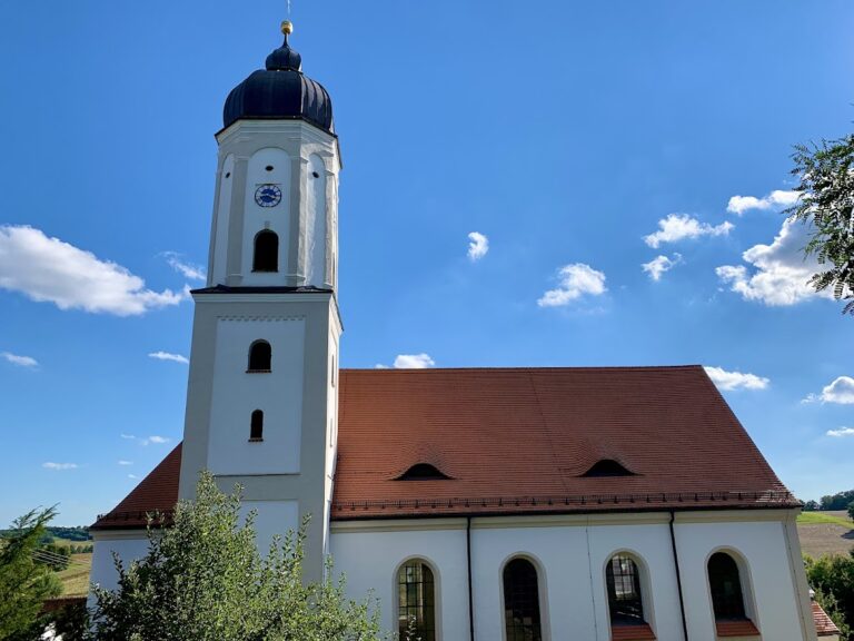
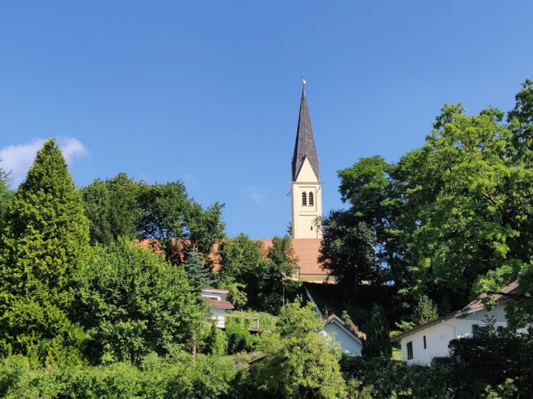
The surviving church on the former castle grounds is a small late Gothic, single-nave brick building. It has a saddle-roofed tower and a recessed choir. The west facade was altered in the nineteenth century, and the window tracery also dates from that period. The church stands behind the filled ditch of the earlier castle. Walls beside and east of the building are modern archaeological reconstructions.
Wittelsbach National Monument
The Wittelsbach National Monument rises above the northern end of the neck ditch. Designed by Joseph Daniel Ohlmüller, it is a tall neo-Gothic pinnacle, meaning a nineteenth-century revival structure using medieval Gothic forms. Its dedication reads, “Faithful Bavaria to its thousand-year ruling dynasty.” The monument was intended to honour the Wittelsbach dynasty as a Bavarian national house.
Klingenberg motte castle
Approximately 150 metres northeast of the main castle, on a separate ridge, lies the small motte castle of Klingenberg. A motte castle is a fortification built around a raised mound that usually supported a tower or residence. A stream valley separates Klingenberg from Burg Wittelsbach, while the smaller castle’s function and precise date remain uncertain.
Nearby sites