Burg Wachtendonk: A Ruined Lowland Castle on the Niers


Site at a Glance
- Rating
- 4.4
- Popularity
- Low
- Country
- Germany
- Primary era
- Medieval
- Eras represented
- Medieval, Early Modern
- Civilizations
- Holy Roman Empire
- Site type
- Military
- Remains
- Castle
On this page12 sections
History
Burg Wachtendonk is a ruined lowland castle in Germany, built in the late medieval period on an island in the Niers. Closely linked with the town and fortress of Wachtendonk, it guarded the easternmost border of the Duchy of Guelders and became the most important military position in the duchy’s Upper Quarter during the sixteenth and seventeenth centuries.
Origins and the Lords of Wachtendonk
The area around present-day Wachtendonk was known as Geisseren from the ninth century and belonged to the territory governed by the Electorate of Cologne. Officials of the archbishop, known as vogts, established an early castle on a raised area called a donk within the marshes of the Niers. The castle was named Vogtendonk, a name that later developed into Wachtendonk and was also adopted by the settlement that grew under its protection.
The castle’s owners probably took the name Wachtendonk in the twelfth century. Arnold of Wachtendonk appears in a record from 1196, while Godefridus de Wachtindunc was named as a witness in 1200. An independent lordship can be securely identified from the mention of Arnold, Lord of Wachtendonk.
A fortified house, a mill, and a fortified settlement were recorded in 1326, when Arnold of Wachtendonk owned them. Timber recovered around the castle has been dated by tree-ring analysis to 1252 and 1257, showing that the settlement and castle were already substantially older than that document. The form of the inner castle points to an origin in the fourteenth century.
Between Guelders and Cologne
The Lords of Wachtendonk maintained their independence for a long period by balancing the interests of the Dukes of Guelders and the Electors of Cologne, although Wachtendonk was held as a Guelders fief, meaning property granted by a superior lord in return for obligations. On 5 March 1390, Arnold IV of Wachtendonk confirmed the feudal relationship with Guelders. On 20 December that year, he declared the castle an open house of Archbishop Friedrich III of Saarwerden. This arrangement gave the archbishop the right to use the fortification, but not for military action against Guelders.
Duke Rainald IV of Guelders conquered Wachtendonk by force in 1407 and made it an administrative district. Goswin Spede of Langenfeld became its first territorial administrator, having previously held office at Guelders Castle. Rainald then gave the castle to his illegitimate son Wilhelm of Jülich and Johanna, Arnold IV’s heiress, as a wedding gift, while leaving its feudal status unchanged.
In 1426, Wilhelm again granted the Archbishop of Cologne the right to open the Wachtendonk complex. An agreement made in 1431 also required Wilhelm to support the Duke of Guelders with his castle during military campaigns. In 1434, Wilhelm and his second wife, Hermanna of Batenburg, sold the castle, town, and territory of Wachtendonk, together with their rents and revenues, to Duke Arnold of Egmond.
Captures, pledges, and rebuilding
United forces from Berg and Cologne briefly captured the castle during Adolf, Duke of Berg’s attempt to challenge Arnold of Egmond’s ducal title in Guelders. Wilhelm and Hermanna had not yet departed, and the attackers took valuables that included jewelry, gilded silverware, and furnishings from the castle chapel. Wilhelm prepared a detailed account of the losses and sought compensation from the Duke of Guelders. Repairs followed between 1436 and 1439 under Johann of Gemen, the Guelders official.
In December 1440, Guelders pawned the castle to the Duke of Cleves, who appointed Heinrich of Wittenhorst as its first Cleves official. Duke Adolf of Guelders redeemed the pledge in 1469 and appointed Siebert of Eyll. By then the castle was severely deteriorated. A report from 1470 stated that it had “fallen down” and required 100,000 bricks for repair.
The restored castle passed permanently to Cleves in 1473, when Charles the Bold gave it to Duke Johann I of Cleves. In 1503, Otto Schenk of Nideggen, Lord of Walbeck and an official at Guelders Castle, captured Wachtendonk’s town for Charles of Guelders. After a siege lasting from September 1503 until Easter 1504, he took the castle as well and became its Guelders official.
The 1504 capture caused extensive fire damage. In 1505, Otto transferred his allegiance to Philip the Fair, who restored Wachtendonk as an independent lordship. Otto and the Duke of Guelders reconciled in 1517. Their agreement kept Otto in office until the duke repaid the 17,000 Rhenish gulden that Otto had spent rebuilding the castle.
Firearms and the Eighty Years’ War
The pledge remained valid after Guelders was united with the Duchy of Cleves in 1538 and ceded to Burgundy by the Treaty of Venlo in 1543. On 15 October 1547, Emperor Charles V, acting as Duke of Guelders, sold the town, castle, and lordship of Wachtendonk to Godart of Bocholtz. The sale required the pledge sum to be paid to Heinrich Schenk of Nideggen’s second wife, Otto’s daughter-in-law. Godart repaired the castle and adapted its defenses for firearms.
During the Eighty Years’ War, the long conflict in which the Dutch provinces rebelled against Habsburg rule, troops led by William of Orange briefly occupied the castle in 1572. From 1578, it was held for a longer period by the Dutch States-General. Spanish troops under Peter Ernst I of Mansfeld besieged, bombarded, and captured it in 1588 after three months. Godart’s son-in-law Arnold Huyn of Amstenrade, who had married Margaretha of Bocholtz in 1586, then became governor of the castle and town.
The capture of 1588 destroyed the slate roof and devastated the buildings through bombardment. Arnold began rebuilding the collapsed tower and repairing the damaged structures in 1589.
Dutch soldiers under Count Ludwig of Nassau captured the castle again in 1600 after a severe winter froze the surrounding marshes and made an approach possible. Spanish forces recovered it briefly in 1602, but were driven out six days later. The castle returned to Spanish control in 1603, although the town did not. In 1605, forces led by Charles Bonaventure de Longueval, Count of Bucquoy, captured the town after summer drought had dried the marshes. The castle had probably been severely damaged during the 1603 capture and was not rebuilt. Its remains were demolished in 1605 to create the town’s belt of fortifications.
Excavation and interpretation
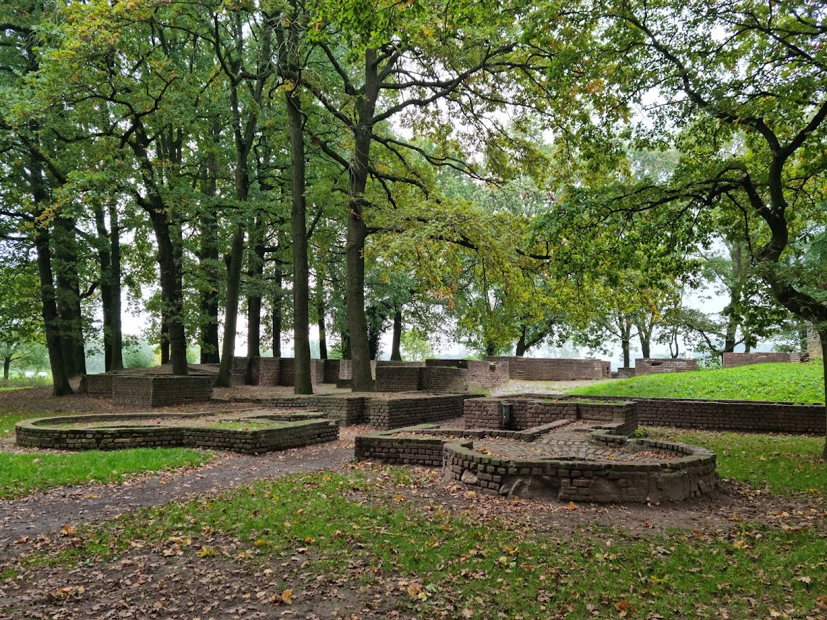
Excavations directed by Günther Binding from 1967 to 1978 exposed and secured parts of the inner castle. Some of the foundations were rebuilt in masonry, making the ground plan legible. Proposals to reconstruct the castle and develop the site more extensively for tourism were not implemented.
Remains
Burg Wachtendonk was arranged as a two-part complex, with an inner castle and a bailey, or outer enclosed part of a castle, to its northwest. Both stood on an island in the Niers, in an arrangement characteristic of late medieval castle construction in the Lower Rhine region. The surviving remains consist chiefly of excavated and partly rebuilt foundations and other secured ruins of the inner castle.
Inner castle
The inner castle developed in several stages and occupied an approximately 34 by 32 metre area. A curtain wall enclosed its defended sides and carried a wall-walk, a passage along the top of the wall. A round stair tower stood between the two residential buildings and provided access to their upper floors. The complex is largely reconstructed from excavated remains, while the oldest pottery beneath the keep dates from the early fifteenth century.
Keep
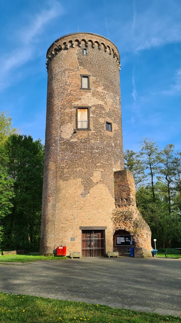
The round keep stood on the southwest side and was probably the highest building in the castle. Its walls were approximately three metres thick, enclosing an interior 4.20 metres in diameter. The ground-floor chamber had a domed vault. Above ground, the tower measured 10.40 metres across, while its funnel-shaped foundation widened underground to 15.10 metres.
Residential buildings
An attached residential building occupied the southeast side of the inner castle. It included a basement, and the remains of fireplaces and a well indicate that the castle kitchen was located there. A second residential building stood at right angles on the northeast side and dated from the early sixteenth century. An eastern addition to the southern building was constructed in the second half of the fifteenth century.
Gate building and rooms
A representative gate building on the northwest side connected the inner castle with the bailey. Constructed in the second half of the fifteenth century, it had two round towers flanking and protecting the entrance. An inventory from 1463 lists a chapel, hall, kitchen, wine cellar, rooms above the inner gate, a maids’ chamber, a sleeping room for the guards, a lower tower room, and a brewhouse.
A depiction from 1588 presents the castle as three groups of buildings on an island in the middle of the Niers. This view complements the excavated plan of the inner castle and reflects the complex’s developed late medieval and early modern form.
Early modern defensive work
North of the inner castle are the remains of a sandstone-block bastion, a projecting defensive work designed to strengthen fortifications against artillery. It measures approximately two metres in diameter and dates from the first half of the sixteenth century. Earthworks probably connected it with the castle and town. Its identification remains uncertain because the structure may instead have been a brewing oven.