Burg Krems: A Medieval Castle Ruin in Austria


Site at a Glance
- Rating
- 4.4
- Popularity
- Very Low
- Country
- Austria
- Primary era
- Medieval
- Eras represented
- Medieval, Early Modern
- Civilizations
- Duchy of Styria, Holy Roman Empire
- Site type
- Military
- Remains
- Castle
On this page18 sections
History
Burg Krems is a castle ruin in Austria, east of Voitsberg in the Krems locality of Styria. The Archbishop of Salzburg commissioned an early defensive structure here during the eleventh or twelfth century, probably a simple wooden fortification. Its position above the Kainach gave the site a strong defensive setting and later supported the development of a more substantial noble residence.
Origins and Medieval Lords
A knightly family of Krems appears in the records around 1150, and the name Cremese is documented in 1151. The name probably derives from an older watercourse or landscape name associated with a sharply cut valley or rocky ridge. This origin differs from the Slavic place-names common in the surrounding area.
At the beginning of the thirteenth century, the wooden fortification was probably replaced with a stone castle. The work is associated with Otto von Krems-Leonrode, who also held Alt-Leonroth Castle. After Otto died in 1234, Burg Krems passed through his widow to Hartnit von Rabenstein.
The castle was named as castrum Chremse in 1248, when it hosted an assembly of nobles. At that time, the front section around the keep was held as a fief from the Archbishop of Salzburg, the senior ecclesiastical and secular ruler of the Salzburg archbishopric. The rear, or southern, section was the castle lord’s free property.
The Rabenstein family lost its possessions after taking part in the Landsberger Bund, an alliance involved in a Styrian aristocratic revolt against Duke Albrecht. Around 1300, Krems passed to the Lords of Walsee, who governed it through appointed burgraves. Eberhard V von Walsee sold the castle to Leutold von Stadeck in 1363. After the Stadeck family died out, Counts Haug and Ulrich von Montfort obtained the complex through marriage around 1400 and continued to administer it through stewards.
The Lordship of Krems
Burg Krems formed the centre of a wider lordship. During the fourteenth century, the offices of Obergraden and Gößnitz came under its control. The lordship also included peasant subjects in Gasselberg, Klein-Gaisfeld, Lobming, Muggauberg, and Thallein, together with the offices of Modriach, Pack, and Salla.
The lordship exercised extensive lower jurisdiction, dealing with lesser legal matters. Serious offenders were handed over to the regional judge in Voitsberg. This administrative role connected the castle with settlements and estates beyond its hilltop enclosure.
Renaissance Expansion and Decline
Because the heavily indebted Montfort counts had to sell property, Burg Krems and its lordship passed in 1589 to Baron Sigmund Friedrich von Herberstein. Under Sigmund and his son Otto Heinrich von Herberstein, the complex was expanded and richly furnished as a Renaissance castle by 1623. Otto Heinrich also enlarged the lordship through further acquisitions and established a large animal park below the castle.
The cost of this expansion left Otto Heinrich in debt. In 1629 he sold Burg Krems and its lordship to Maximilian Leymann von Liebenau. Liebenau could not pay the purchase price and resold the castle in 1634 to Baron Salomon von Meillegg, who carried out additional alterations.
Count Karl Saurau, then governor of Styria, seized the lordship after Meillegg proved unable to maintain it. Saurau acquired Krems and united it with his lordship of Ligist. Before the takeover, Meillegg removed valuable furnishings, including gilded wallpaper and the complete contents of the armory, even though the sale had included the furnishings. Their value was placed at approximately one million schillings. Meillegg escaped punishment after apologizing, pleading poverty, and citing responsibility for his children.
Saurau installed an administrator, but the complex later fell into neglect. In 1730, administration moved to Ligist Castle. Burg Krems was then occupied only by servants before it was left to decay. Around 1790, the domain’s forests had been cleared, its own land was uncultivated, and its revenues were leased. Proposed purchases and repairs failed because of their high cost.
Damage, Ownership, and Conservation
After heavy rain in 1817, part of the castle slid or collapsed on the southeastern side. Archduke Johann of Austria, who also owned the ironworks at Krems, acquired the lordship in 1857. The ruin later passed to the Vordernberg-Köflacher Montan Industrie Gesellschaft in 1869, Countess Anna von Saurau in 1877, the cellulose manufacturer Klusemann in 1880, and subsequently the Steiermärkisch-Salzburgische Holzwerke AG. The innkeeper family Töscher followed the Holzwerke as owner.
The ruins received legal protection as a monument on 20 March 1936. Work to secure the complex and make it accessible began afterward. A castle association undertook renovation in the 1960s. The association Licht im Leben has owned Burg Krems since 1988, while the re-established Burg Krems association has maintained and restored it since 1993.
A path along the outer wall was built during the winter of 1998 to 1999. The keep was renovated and reopened for access between 1999 and 2000. In 2011, a wooden structure based on a seventeenth-century copperplate image was placed over the surviving stump of the northwestern corner tower of the outer bailey. A small museum room opened in May 2015 and presents the history of the castle complex.
Local tradition describes Burg Krems as a home of robber barons. According to the legend, a White Woman, a supernatural female apparition known in Central European folklore, appeared to one lord on his wedding night while wearing long black gloves. He interpreted the encounter as a bad omen, and his young bride died several days later.
Remains
Burg Krems occupies a hilltop ridge south of Thallein and toward the Kainach, at about 330 metres above sea level. The ridge falls steeply to the east, south, and west, while a deep cutting created during expansion of the Kainachtal road separates it from the hinterland. Defensive earthworks shaped parts of the surrounding slopes. On the north, a cross ditch divides the castle area from the hinterland, and remnants or piers of a modern bridge cross the ditch.
Keep and Early Castle
The Keep
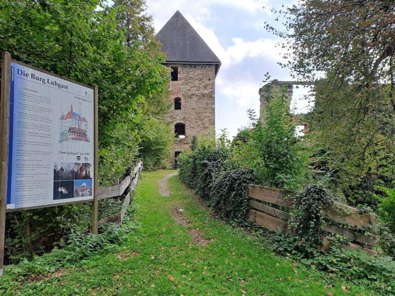
The oldest surviving part lies in the western section beside the five-storey keep. The tower stands directly on an isolated rock outcrop at the edge of the steep slope. Its regular rubble-stone masonry indicates a thirteenth-century date. The keep has a semicircular western side and an irregular polygonal plan toward the east.
The original entrance was placed in the first upper storey, about eight metres above ground. Partly broken dressed-stone door jambs survive there. A door at ground level was opened only in modern times, while the original ground floor could be reached through an opening in the vault. The ground floor and first upper storey retain vaulted ceilings. A stairway within the wall leads from the first to the second upper storey, and wall offsets show that the second and third upper storeys once had beam ceilings.
Narrow window openings light all the storeys. A doorway on the southern side suggests that the third storey probably had a balcony. The repaired keep can be climbed to a platform enclosed by battlements, which also forms its fourth upper storey. An inscription dated 1623 records the Herberstein expansion. Much of the masonry north and south of the keep resembles the tower’s construction.
Ring Wall and Defensive Features
Ring Wall
A ring wall from the fourteenth or fifteenth century encloses the complex. In the southwestern section, two defensive openings contain horizontal, funnel-shaped loopholes carved from single blocks of stone. They are probably reused Roman stones, possibly taken from funerary monuments beside a nearby Roman road, although their precise origin remains uncertain.
On the western courtyard side, much of the wall is buried, while its exterior rises as much as three metres above ground. The lowest courses of the eastern wall belong to the fourteenth or fifteenth century. Its upper section belongs to a later sixteenth-century phase, identifiable through its different masonry. A semicircular flanking tower was inserted into the wall during that later phase.
Firing Galleries
North of the flanking tower, the inner courtyard formerly contained two firing galleries arranged one above the other. Their loopholes were intended for muskets. The galleries survive through wall offsets, while five battlements remain on the ring wall.
Residential Buildings
Square Residential Tower
The southern side of the complex is closed by a square residential tower built with fourteenth-century rubble-stone masonry. Flat-arched niches with large windows were inserted in the sixteenth or seventeenth century, when the tower served as a residence. A niche for a spiral staircase in the northern outer wall probably belongs to the same period.
Palas and Northern Residential Building
Two residential buildings adjoin the square tower to the north. The five-storey northwestern building served as the palas, the principal medieval residential building, and dates from the fourteenth or fifteenth century. The second building belongs to the sixteenth or seventeenth century and probably contained arcades along the courtyard.
Connecting Wing and Gate Hall
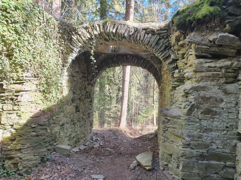
During the sixteenth century, a connecting wing was built between the eastern ring wall and older fabric east of the keep. Its irregular rubble-stone masonry includes brick inclusions. A gate hall through the wing linked the northern, newer courtyard with the southern, older inner courtyard.
The inner courtyard is bounded by the ring wall on the east and west, the two residential buildings on the south, and the rise containing the keep on the north. The connecting wing probably had two storeys of residential rooms above the gate hall. Rectangular windows set within flat-arched niches remain visible.
Outer Bailey and Water Supply
Outer Bailey
The northern outer bailey is the youngest part of the complex. Built as a transverse structure in the late sixteenth century, it had two small square corner towers. The northeastern tower survives to its full height and contains brick-built keyhole loopholes. The northwestern tower survives only as a wall stump, now covered by the wooden structure added in 2011.
The outer bailey contained a small garden and a large stable built against the ring wall. A neck ditch lies beyond the northern outer wall. A substantial later bridge once crossed it, and its surviving piers mark the bridge’s former position.
Water Supply
The castle’s water supply initially came from a cistern and later from a well. Wooden pipes conveyed water into the complex from Thallein.
Nearby sites