Burg Freienstein: A Medieval Hillside Castle Ruin in Germany

Site at a Glance
- Rating
- 4
- Popularity
- Low
- Country
- Germany
- Primary era
- Medieval
- Eras represented
- Medieval, Early Modern
- Civilizations
- Holy Roman Empire
- Site type
- Military
- Remains
- Castle
On this page16 sections
History
Burg Freienstein is a medieval hillside castle ruin above Gammelsbach in Germany, now part of Oberzent in Hesse. Its construction probably began before its first mention in 1297, although the builders are uncertain. The castle emerged during the redistribution of lands after the dissolution of Lorsch Abbey, an imperial monastery whose possessions were held directly from the Holy Roman Emperor. Regional powers, including the Palatine counts, the Schenks of Erbach, and the Electorate of Mainz, competed for influence in the area.
Origins and Erbach connections
Lords of Freienstein appear in records from 1280 and were later identified as castle retainers of the Erbach family. The Echter family, the Lords of Schollenbach, and possibly the Lords of Hochhausen were also associated with the castle. These families were ministeriales, officials or military retainers who served a medieval lord and could rise to noble status, and they were active within the sphere of the County of Erbach.
Freienstein became connected to a group of settlements and estates that included Gammelsbach, Hebstahl, Schollenbach, Hohenberge, Beerfelden, Etzean, Erlenbach, Hüttental, and Hiltersklingen. In 1366, Count Palatine Rupert I approved Schenk Konrad of Erbach’s assignment of a widow’s provision to his wife Margarete. Such a provision consisted of property or income intended to support a noblewoman after her husband’s death.
Further agreements show the castle’s feudal importance. In 1388, Rupert approved Schenk Eberhard of Erbach’s assignment of a widow’s provision on one-quarter of the “fortress of Freienstein” and its possessions. The following year, Schenk Konrad was allowed to pledge his quarter-share to Contz of Helmstadt with the count palatine’s consent. In 1398, Rupert enfeoffed Schenk Eberhard with the entire castle and its associated possessions. An enfeoffment was the formal granting of property by a superior lord to a vassal. The Palatine counts renewed such grants to the Erbach family in 1443, 1653, and 1720.
Frontier administration and residence
During the later Middle Ages and the early modern period, the Erbach counts used Freienstein to secure the southern boundary of their lordship, supervise movement through the Gammelsbach valley, and administer the Amt Freienstein. The castle’s name was transferred to this administrative district. Freienstein remained in the undivided possession of the Erbach line of Schenks until that line died out in 1503. The surrounding Beerfelden cent, a territorial judicial and administrative district, was jointly held by the Erbach line and the Reichenberg-Fürstenau line.
By the end of the Middle Ages, the castle no longer met contemporary military needs. Around 1550, it was remodelled with compact residential buildings intended for a more representative use. The Erbach counts then used Freienstein for occasional hunting stays and as a secondary residence rather than as a continuously occupied fortress.
Decline and preservation
From the period of the Thirty Years’ War, a major European conflict from 1618 to 1648, the castle received little maintenance and increasingly deteriorated. Bavarian cavalry plundered it in May 1622. Nevertheless, an image by Eberhard Kieser in the Thesaurus Philopoliticus of 1629 shows Freienstein still relatively intact. The castle ceased to be permanently inhabited after 1700.
The Erbach partition of 1717 transferred Freienstein to the Erbach-Fürstenau line, which continues to own it. After the Beerfelden town fire of 1810, Count Albert of Erbach-Fürstenau allowed people affected by the fire to take stone, bricks, and timber from the castle. This removed part of the historic fabric. Water entering the unprotected sandstone masonry then caused lasting deterioration.
The surviving section of the gatehouse collapsed in 1887. Safety work followed, including measures carried out between 1906 and 1914. Around 1890, a tie rod secured the shield wall, although the wall was lowered by three metres in 1938. Part of it collapsed in 1987, and further securing work begun in 1988 was accompanied by additional falls. The exterior walls underwent extensive restoration between 1990 and 1994. Freienstein is protected as a cultural heritage monument in Hesse, and the castle together with adjoining parcels forms the protected Schlossberg heritage ensemble, established to preserve the site’s long-distance visual effect and surrounding landscape. The castle remains the defining landmark of the Gammelsbach valley.
Remains
Setting and defensive layout
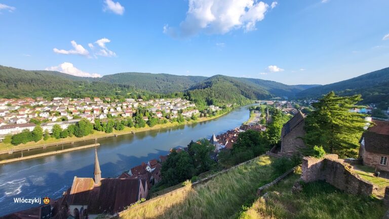
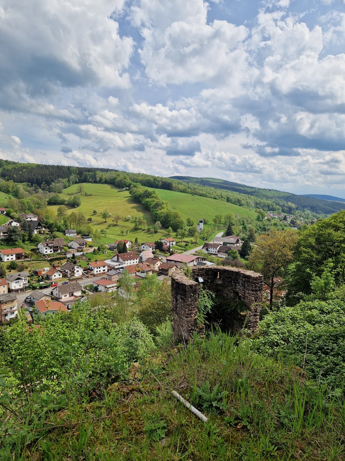
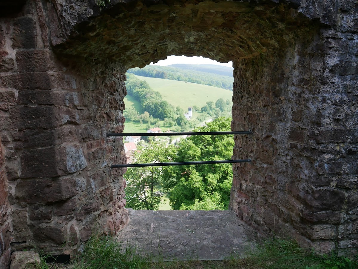
Freienstein occupies a spur-like position at approximately 328 metres above sea level above the Gammelsbach, a tributary of the Neckar. The eastern promontory belongs to the Weckberg, part of the north-south Hirschhorn Heights ridge between the Gammelsbach and Finkenbach valleys. Its position controlled the narrow Gammelsbach valley and the route between the Neckar region to the south and the Main valley to the north. It also marked the southernmost point of the Erbach possessions.
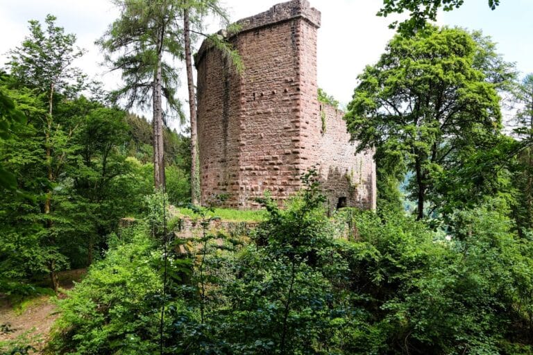
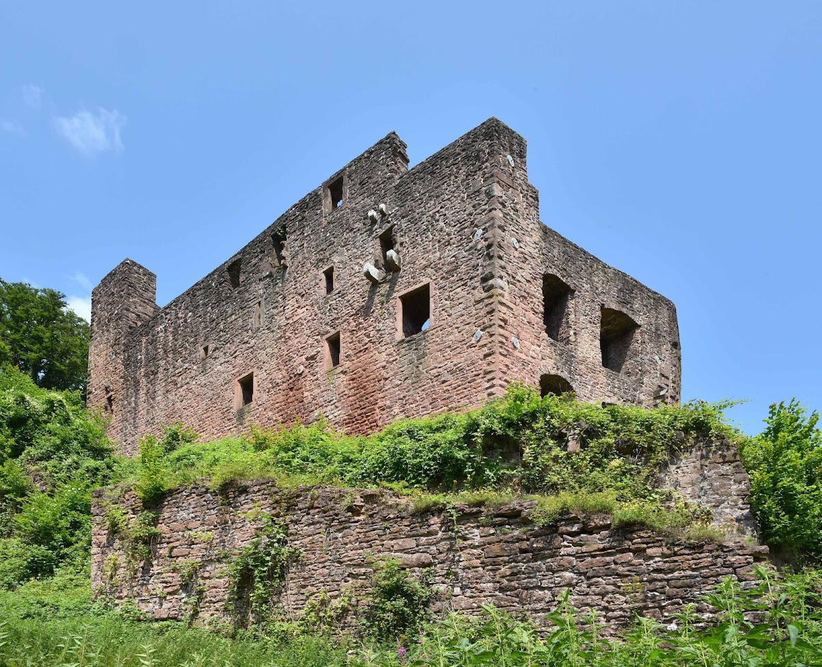
The compact core castle is dominated by the surviving remains of its shield wall, a particularly strong defensive wall designed to protect the castle from bombardment from higher ground. The wall is approximately 2.50 metres thick, and surviving sections reach up to 24 metres high. A deep neck ditch and an enclosed outer defensive area separated the western side of the spur from the ridge. On the valley side, a double outer defensive enclosure included half-round towers. A larger round tower probably served as a prison.
Shield wall and earlier high tower
Defensive wall
A view from 1629 indicates that a fighting platform on the shield wall performed the defensive role commonly assigned to a highest tower. The wall was probably built after an earlier collapse and incorporated three outer walls of the former principal residential and defensive tower, or donjon. Its present form therefore preserves part of an earlier building phase as well as the later defensive arrangement. The shield wall was secured and partly lowered during twentieth-century safety work, but substantial sections survived the collapses of 1987 and the following years.
Earlier residential towers
The first core castle probably included a substantial residential tower on the site later occupied by the shield wall. This earlier arrangement appears to have contained three residential towers: the tower incorporated into the shield wall, the smaller chapel building, and a predecessor of the palace. Their separation apparently provided distinct residential spaces for different families of castle retainers.
Entrance and outer enclosure
Northern gate complex
The entrance lay on the north side of the castle. The gate complex collapsed in 1887, so its former position is no longer visible in the surviving structure. Several ancillary buildings stood within the outer defensive enclosure near the gate, but these buildings do not survive.
Valley-side defenses
The valley side was protected by a double outer defensive enclosure with half-round towers. A larger round tower probably functioned as a prison. Together with the deep neck ditch on the western side, these defenses separated the castle from the higher ridge and reinforced its position on the spur.
Core-castle buildings
Palace
To the left of the former entrance stands the tower-like palace, built on an almost square plan. Its masonry retains sections dating from the thirteenth century. The palace formed one of the principal buildings within the core castle and was part of the residential complex that later supported the Erbach counts’ use of Freienstein as a hunting residence and secondary seat.
Hall building
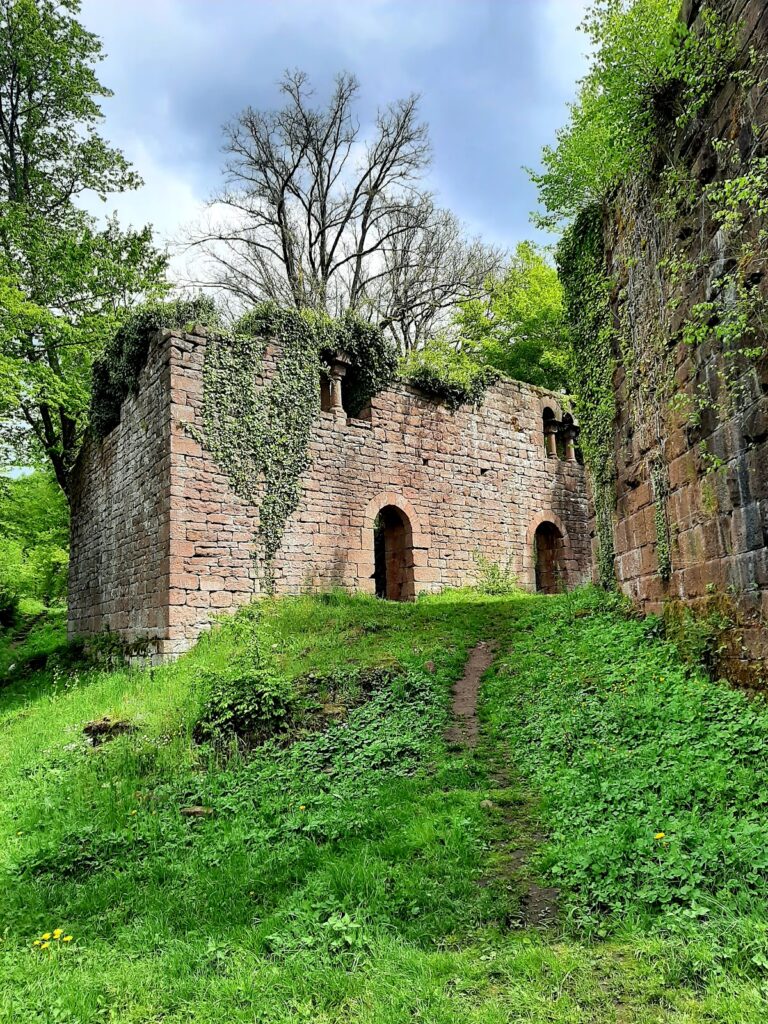
The former four-storey hall building occupied the southwest side of the core castle and probably stood on the position of an earlier residential tower. Its surviving remains consist of exterior walls, windows, and wall niches. Most of the visible windows and niches date from the sixteenth-century remodelling, when the castle’s residential character became more representative.
Chapel building
The southeast building is also known as the chapel building. It formed part of the unusual group of three residential towers in the earlier core castle arrangement. Two blocked Gothic pointed-arch windows, probably dating from the second half of the thirteenth century, survive among the castle remains. The exterior walls of the core buildings were extensively restored between 1990 and 1994 after earlier collapse and deterioration.