Burgstall Waldau: Medieval Water Castle Site in Germany


Site at a Glance
- Rating
- 4.4
- Popularity
- Low
- Country
- Germany
- Primary era
- Medieval
- External website
- Open
- Eras represented
- Medieval
- Civilizations
- Holy Roman Empire
- Site type
- Military
- Remains
- Castle
On this page11 sections
History
Burgstall Waldau is the site of a medieval lowland water castle in Germany, south of Wahlen in present-day Grasellenbach. Its origins lie in the second half of the twelfth or the early thirteenth century. The castle was associated with the Waldau family and with Lorsch Abbey, a major medieval imperial monastery whose regional possessions became the subject of political and legal disputes after its subordination to Mainz in 1232.
The Waldau family and Lorsch Abbey
The castle first enters the historical record indirectly in 1255, when Berthold von Waldow, identified with Waldau and Wahlen, and his wife Gertrud settled a dispute with Lorsch Abbey. The disagreement concerned revenues owed from their possessions at Bensheim and Heppenheim. They transferred ten morgen of arable land near Heppenheim and an annual payment of five malter of grain from Bensheim to the abbey. A morgen was a traditional measure of farmland, while a malter measured grain, with both units varying according to place and period. Berthold and Provost J. Ulrich von Steinach sealed the agreement.
Berthold’s seal indicates a relatively high social position, and the payments suggest that he held property along the Bergstrasse. The identification of Waldow with Waldau is supported by the fact that Wahlen was called Waldau until the fifteenth century. No other place with the same name is known in the wider area.
Uncertain ownership and destruction
The castle’s ownership remains uncertain. Rudolf Knappe considered the noble family of Waldau, probably extinct by the end of the thirteenth century, to have held the castle as a fief from Lorsch Abbey. After Lorsch’s holdings were dissolved in 1232, these fiefs may have passed to the Counts Palatine, territorial princes who governed the Palatinate.
A sale in 1359 received the authorization of Count Palatine Ruprecht. Hartmut VI of Cronberg, the Mainz burgrave at Starkenburg, sold Waldau to Rudolf of Beckingen the Younger. A burgrave was responsible for the administration and military oversight of a castle or fortified district. Waldau was mentioned for the last time in 1423.
Thomas Steinmetz proposed another sequence of ownership, in which the castle later belonged to the Schenks of Erbach, a regional noble family of the Odenwald. He connected its destruction with conflicts between Mainz and the Palatinate over the inheritance of Lorsch Abbey, and regarded nearby Güttersbach Castle as its direct successor. He also linked Waldau with Freienstein Castle through references to Waldau fiefs. These interpretations remain distinct from Knappe’s reconstruction.
Function and archaeological investigation
The castle’s purpose in a sparsely populated area is uncertain. It may have been established during a late phase of forest clearance, or it may have protected developing iron-ore mining and smelting. Iron deposits in the region were mentioned in the 773 boundary description of the Heppenheim March, an early medieval territorial and administrative district centred on Heppenheim. The area’s political importance is also reflected in the 1264 arbitration of Hemsbach, which allowed Count Palatine Ludwig II to establish an unfortified town at Michelenbach even though the place belonged to Lorsch.
Waldau was probably systematically destroyed during the second half of the thirteenth century. Fire traces on wooden finds support destruction by fire. Excavations followed in the summer of 1890 and the autumn of 1893 under district sergeant Heinrich Giess, commissioned by the Historical Association for the Grand Duchy of Hesse and the Odenwald Club. Karl Nahrgang carried out further unpublished excavations in 1937, and the Hessian State Office for Monument Preservation opened an unpublished trial trench in 1993.
In about 1890, the ditches and raised interior were still clearly visible. Grading work in 1930 seriously damaged the site, while industrial development after 1945 almost levelled it. The castle area escaped complete construction, but the former earthworks are now barely recognizable. An information board belonging to the Bergstrasse-Odenwald Geo-Nature Park provides the main indication of the site.
Legend of Eberhard of Erbach
An Odenwald legend tells that the knight Eberhard of Erbach wished to marry the daughter of Waldau’s lord. After his proposal was rejected, he is said to have besieged and burned the castle, rescued his beloved from the ruins, and built Freienstein Castle as their residence. The tradition further claims that he continued to hold his property as a Waldau fief.
Remains
Water defences and castle mound
Waldau was a motte-type water castle in the floodplain on the right bank of the Ulfenbach, in the north-south Ulfenbach valley. A motte is a castle centred on a raised artificial mound, usually accompanied by a ditch and timber or masonry buildings. The stream probably supplied two encircling water ditches. Its course suggests either that water was diverted for the castle or that a natural branch was incorporated into the defences.
Excavation revealed a circular complex more than 50 metres across. Two concentric water ditches surrounded it, with a combined outer diameter of about 100 metres. The raised interior and ditches formed the principal earthworks, although industrial development has levelled them so severely that the original layout is difficult to discern. The former castle area lies at approximately 350 metres above sea level.
Buildings and access
Chapel or keep
The only building remains found within the inner ditch belonged to a freestanding rectangular structure measuring 7.50 by 6.30 metres. A semicircular apse, the rounded eastern end commonly used in a chapel, projected 2.50 metres from its east side. The walls were 85 to 95 centimetres thick.
The building stood on solid cast foundations designed to prevent groundwater from entering. Its form led to its interpretation as a chapel, although the rectangular section may instead have been a keep, the principal fortified tower of a castle. Most of the other buildings were probably made mainly of wood, since no additional building foundations were found inside the inner ditch.
Enclosing wall and entrance
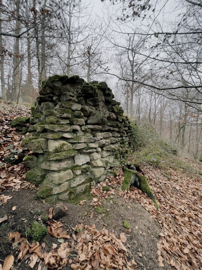
Wall remains in the ditch indicate that an enclosing wall surrounded the complex. Only individual stone blocks with dressed margins were recovered from it. A drafted-margin, or bossed, block has worked edges and a projecting or roughly finished central face. The entrance probably lay to the northeast and was approached by a trestle bridge made from oak trunks.
Excavated objects
The 1890 and 1893 excavations produced two vault keystones, fragments of earthen vessels, horseshoes, iron nails, numerous wooden objects, and sixteen sandstone balls measuring 12 to 16 centimetres in diameter. The wooden objects bore traces of fire, contributing to the interpretation that the castle was destroyed by burning. Stones identified by Rudolf Knappe as bossed masonry blocks from the castle were reportedly reused in old farmhouses in Wahlen.