Bangarh: The Ancient City of Koṭivarṣa and Devikot
Site at a Glance
- Rating
- 4.2
- Popularity
- Low
- Country
- India
- Primary era
- Medieval
- Eras represented
- Classical, Medieval
- Civilizations
- Gupta, Mauryan
- Site type
- City
On this page12 sections
History
Bangarh is the archaeological site of the ancient and medieval city of Koṭivarṣa, also known as Devikot, in Gangarampur, West Bengal, India. The settlement developed into an important town by the Śuṅga period, approximately the second and first centuries BCE, and its remains trace urban life from the Mauryan or early Śuṅga period through the medieval age.
Early settlement and the Śuṅga period
Koṭivarṣa appears in early literary references in the Vāyu Purāṇa and Bṛhat Saṃhitā. Later writers connected the city with names including Bāṇapura, Devīkoṭa, Umāvana, Uṣāvana, and Śoṇitapura. The present name Bangarh probably developed from Bāṇapura, which tradition associated with the mythical king Bāṇa.
Archaeological evidence places the first substantial development of the settlement in the early historic period, probably by the Śuṅga age. Its earliest phase was modest and may have been protected by a mud wall. During the Śuṅga period, Bangarh grew into a prosperous town. Numerous terracotta images of goddesses from this phase indicate that goddess worship already held an important place in local religious life.
Koṭivarṣa under Gupta administration
Koṭivarṣa remained continuously inhabited from the Śuṅga period through the Pāla period. During the Gupta period, which broadly extended from the third to the sixth centuries CE, it formed a viṣaya, or district, within Pauṇḍra bhukti, a provincial administrative unit. Copper-plate inscriptions dated between 444 and 543 CE describe the city’s administrative position and economic conditions.
The city was governed by a nagaraśreṣṭhin, a leading urban official commonly translated as mayor or chief of a city. He was assisted by a three-member board comprising a prominent merchant, an artisan, and an administrator. The inscriptions also indicate stable land prices during a period of monetary debasement, suggesting that Koṭivarṣa maintained local administrative and economic stability.
Religious development
Between approximately 550 and 650 CE, Koṭivarṣa became a centre of goddess-oriented Tantric Śaivism, a form of Śaivism based on esoteric rituals, sacred diagrams, specialized texts, and deity practices. The city also retained importance for Vaiṣṇavism and Buddhism. At least one Tantric Buddhist text presents Devīkoṭa as a pilgrimage destination.
The Koṭīvarṣa-Māhātmya, preserved in an early recension of the Skanda Purāṇa from roughly this period, tells how the seven mother goddesses and other goddesses defeated demons who oppressed the people of Koṭivarṣa. It associates the city with Śiva as Hetukeśvara and with Bahumāṃsā, described as the chief of the mother goddesses. The same tradition says that Bahumāṃsā created the sacred pond Śūlakuṇḍa after killing the demons with a śūla, a lance or ritual spear.
The religious traditions associated with Koṭivarṣa also connect the city with the composition of Yāmala scriptures and with esoteric worship through which women could become Yogeśvarīs, female figures associated with yogic or Tantric power. Later interpretations changed the emphasis of the cult. A later recension of the Skanda Purāṇa, dated approximately to 800–1100 CE, presents Śiva as Bhairava-Hetukeśvara, with Bhairava understood as a fierce form of Śiva, and does not mention Bahumāṃsā.
The Brahmayāmala associates Koṭivarṣa with a sacred maṇḍala, a ritually organized diagram of deities or realms, eight directional cremation grounds, Bhairava-Hetukeśvara, and six yoginīs. The Niśisaṃcāra, probably dating to around the twelfth century, names Karṇamoṭī and Hetuka as guardian deities of Koṭivarṣa. By the sixth or seventh century, the earlier local goddess seems to have been incorporated into Śaivism as a Cāmuṇḍā-type deity, while Śiva as Hetukeśvara became the city’s principal tutelary god. Pāla-period evidence connects related forms of the goddess with Carcikā.
Pāla prosperity
During the Pāla period, generally associated with the eighth to twelfth centuries in Bengal, Koṭivarṣa experienced renewed prosperity and substantial building activity. The city remained a religious centre for Śaivism, Vaiṣṇavism, and Buddhism, and a Buddhist monastery stood at Devīkoṭa.
Inscriptions from around the reign of Nāyapāla record royal patronage, including the construction of a large stone temple dedicated to Hetukeśvara Śambhu at Devīkoṭa. An inscription from Shibbari near Bangarh refers to a statue of the Saiddhāntika teacher Mūrtiśiva and includes verses dedicated to the goddess Carcikā. Saiddhāntika Śaivism, a major tradition concerned with ritual, temple worship, and liberation, had therefore become established at Koṭivarṣa by the eleventh century.
Muslim rule and archaeological investigation
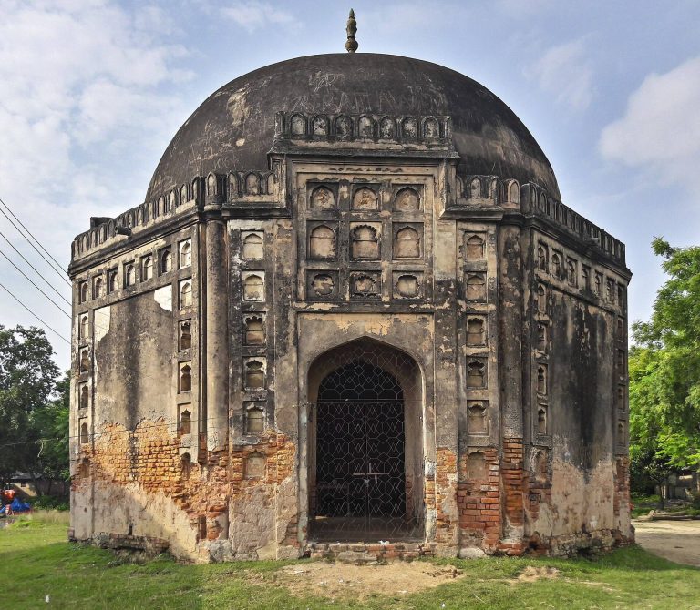
Muslim rule was established in Bengal in 1204 by Muhammad Bakhtiyar Khalji. His kingdom, known as Lakhnawati or Lakhnauti, sometimes had its capital at Lakhnawati and sometimes at Devikot. Bakhtiyar Khalji died at Devikot in 1205–1206, possibly after being killed by Ali Mardan Khalji, the governor of Naran-Koh.
Devikot continued to function as an administrative centre under later Muslim rule. The Ain-i-Akbari lists it as a mahal, or revenue unit, in the sarkar of Lakhnauti and identifies it as the seat of a larger subdivision containing six other mahals. It was still recognized as a district capital in the 1590s.
The first excavations at Bangarh were conducted by a team led by K. G. Goswami between 1938 and 1941. The Archaeological Survey of India began a second excavation in 2011. Together, the excavations established the site’s urban character and identified five cultural phases extending from the Mauryan period to the medieval period.
Remains
Citadel and defensive works
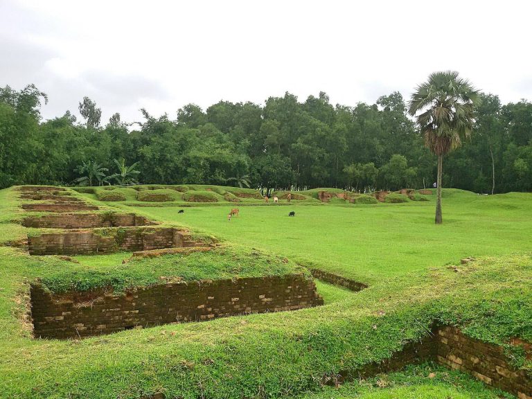
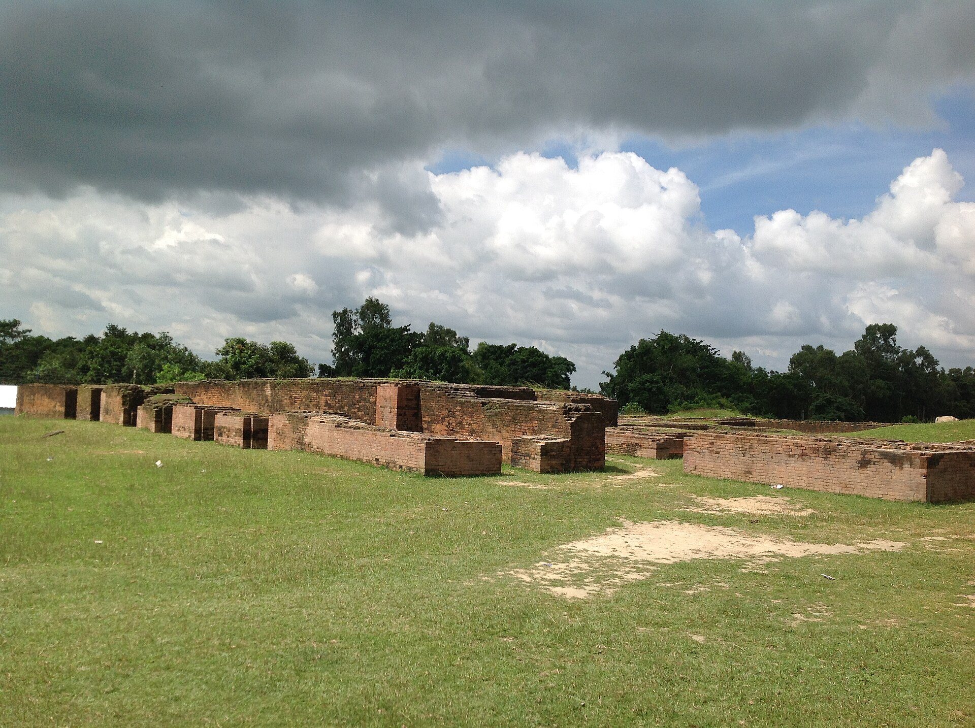
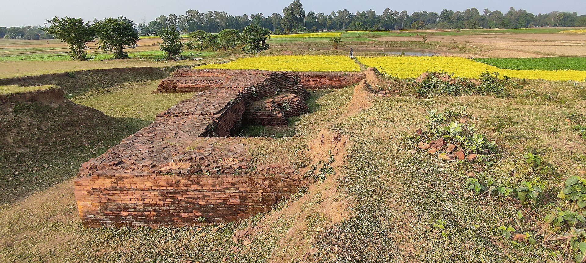
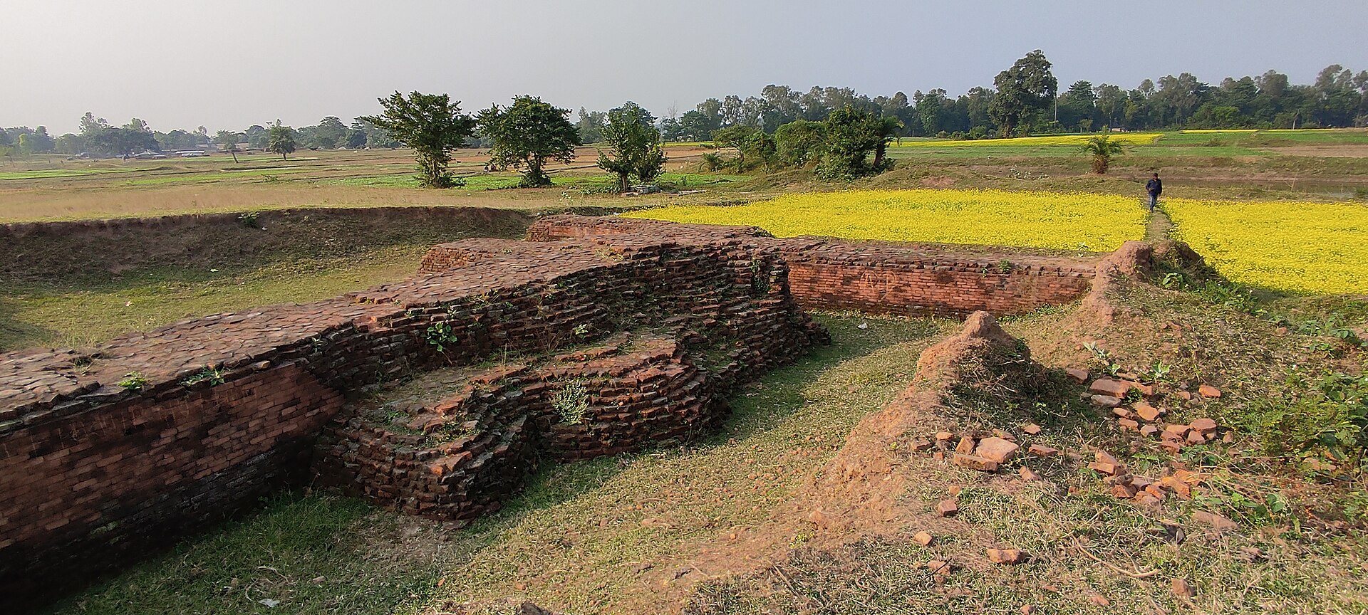
Bangarh lies on the eastern bank of the Punarbhaba River. Its principal mound is approximately rectangular, measuring about 549 by 457 metres, and runs northeast to southwest, parallel to the river. A moat surrounds the main area on the west, south, and east, while ramparts enclosed all four sides. The central citadel covered approximately 25 hectares and was originally protected by mud ramparts.
The lowest archaeological layer, tentatively assigned to the Mauryan or early Śuṅga period, contains few objects. A ring well is the only structure identified in this phase, while the materials used for its houses remain uncertain. The settlement was probably enclosed by a mud defensive wall.
Early historic town
The early historic urban phase contains a substantial defensive wall made of burnt brick, together with houses, drains, and cesspits. Another brick-built phase, dated approximately to 200 BCE–300 CE, includes large residences, drainage systems, and covered drains. These remains show the development of a planned and increasingly substantial town.
Terracotta seals from the early historic levels include examples written in early Brāhmī script. One seal, palaeographically dated to approximately the first century BCE or first century CE, names a śramaṇa called Vilala and identifies him as an inhabitant of Chhatragrha, a place whose location is otherwise unknown. Numerous terracotta plaques and sculptures depicting goddesses, particularly from the Śuṅga-associated layer, provide material evidence for the importance of goddess worship at Bangarh.
Gupta-period construction
Gupta-period structures generally had very thin walls that may not have supported roofs. Roof tiles and two ceramic finials, probably from the upper front corners of a building, were also recovered. A very large structure from this period probably formed a spacious quadrangle beside a temple, where people may have gathered for religious, social, or commercial purposes.
Pāla-period buildings and installations
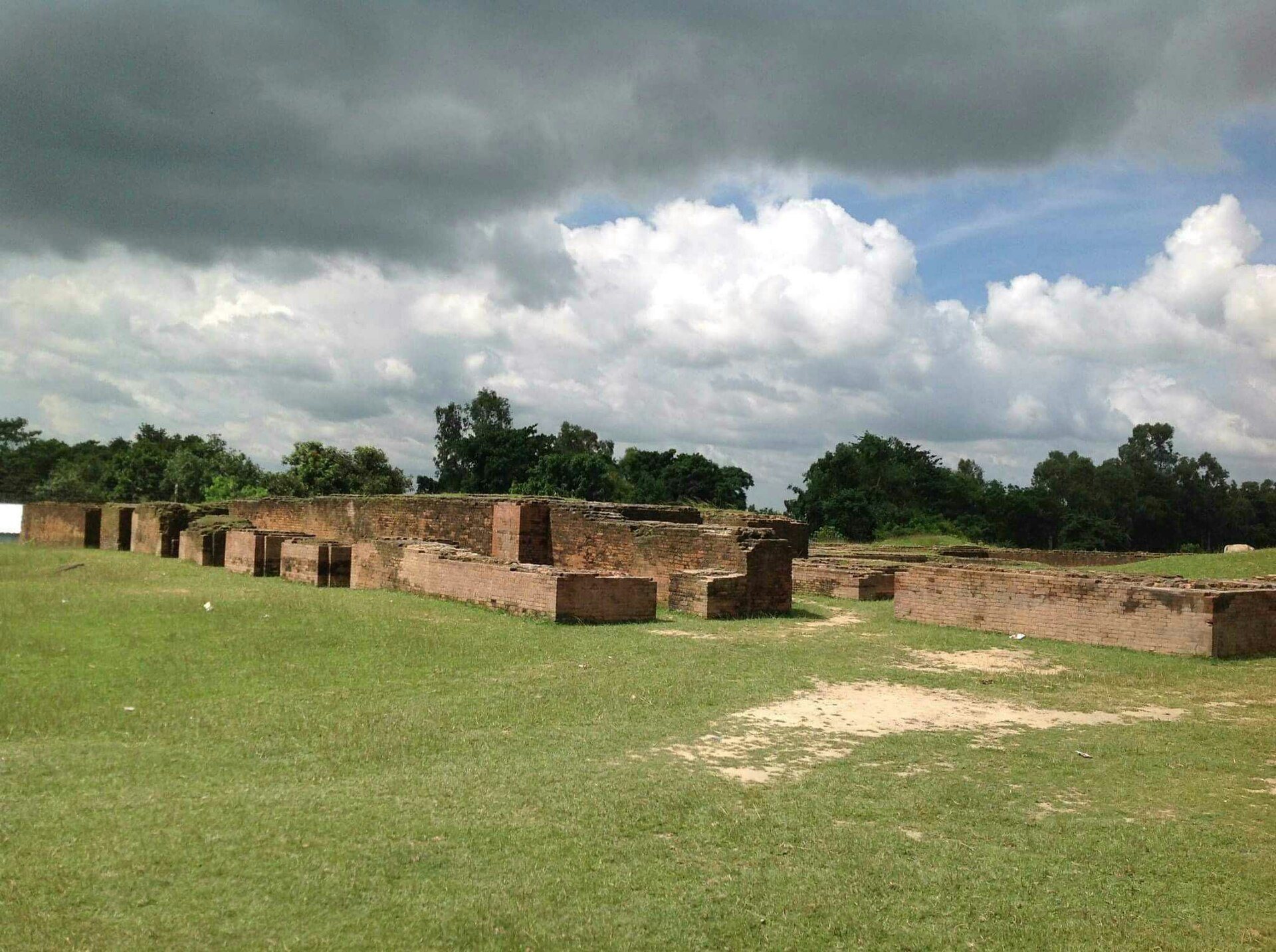
The Pāla-period remains include houses, a granary, and a rampart wall with at least one bastion, a projecting defensive platform. A pillared hall contained a lotus-shaped kuṇḍa, a ritual or architectural basin associated with water or sacred rites. A probable temple was surrounded by an ambulatory passage for movement around the shrine.
Other remains from this period include compound walls, residential quarters, temples enclosed by walls, damp-proof granaries, bathrooms, drains, and ring wells. Their number and construction quality indicate substantial urban development. The Shibbari area near Bangarh has also yielded a statue of Mūrtiśiva, probably the image referred to in the Shibbari inscription, along with additional Pāla-period religious images representing Śaivism, Vaiṣṇavism, and Buddhism.
Religious landscape and later occupation
The Brahmayāmala’s Koṭivarṣa Maṇḍala presents the city as one of eight directional cremation grounds. At its centre is a lotus-shaped sub-maṇḍala containing Śiva as Hetukeśvara. The design also includes a śūla and a pond called Śūlodaka, elements that may preserve indirect references to the local goddess tradition and its association with Śūlakuṇḍa.
The uppermost archaeological layer belongs to the Muslim period. Its buildings were often poorly constructed, reused materials from earlier structures, and were frequently placed over older remains. Later agricultural activity caused further damage, leaving the surviving remains in poor condition. The archaeological site as a whole includes the citadel, ramparts, moat, residential areas, religious buildings, water installations, drainage systems, and associated artefacts.