Ballybeg Priory St. Thomas: An Augustinian House in Ireland


Site at a Glance
- Rating
- 4.5
- Popularity
- Low
- Country
- Ireland
- Primary era
- Medieval
- Eras represented
- Medieval
- Civilizations
- English
- Site type
- Religious
- Remains
- Monastery
On this page11 sections
History
Ballybeg Priory St. Thomas in Ireland was founded in 1229 as an Augustinian house in the Early English Gothic period, dedicated to Saint Thomas Becket, the archbishop of Canterbury murdered in 1170 and venerated as a martyr. The priory belonged to the Diocese of Cloyne, and its foundation is attributed to Philip de Barry, a major Cambro-Norman landowner in medieval County Cork, although his son William de Barry may also have been responsible.
Foundation and endowment
The de Barry family continued to support the house. Philip’s grandson, David Óg de Barry, the first Baron Barry, increased its revenues in 1235, and further land was granted in 1237. The Augustinian Canons Regular, priests who followed a communal rule based on the teachings of Saint Augustine, received about 2,060 acres and several rectories through the right of advowson, which allowed them to administer parish church appointments.
The priory’s endowment included a demesne of about 60 acres of arable land and 40 acres of pasture, another 120 acres in Ballybeg, the church, cemetery, and buildings, together with appropriated rectories at Ballybeg, Kilkeran, Ardosoyll, Rathbarry, Ballycloghie, Ballycastell, Drusmallyny, Carryketwohill, Castleheghan, Kilcoryhin, Kilmallaghe, Rossaghe, Downeraghill, and Caherdowgan. Around 1270, Ballybeg provided the starting point for a new Augustinian house at Crossmolina in the Diocese of Killala, which became dependent on Ballybeg.
Rights and institutional history
William Fitz Richard de Barry granted the church of Cahirduggan to Ballybeg by a charter completed on 28 September 1273. The priory was probably held from the de Barrys in frankalmoign, a medieval form of landholding for religious purposes. It may also have exercised manorial rights, including gallows and baronial courts for disputes involving tenants and bondsmen, while matters reserved to the Crown remained outside its jurisdiction.
The priory’s wider institutional network experienced disciplinary difficulties. In 1342, Prior John FitzRichard was charged in Dublin with mistreating a man. John Baret was removed as prior of Crossmolina in 1401, appointed prior in commendam of Ballybeg in 1410, and later became provost in commendam of Killala. He abandoned his religious habit and was subsequently charged with misconduct.
Dissolution and later use
Ballybeg was suppressed in 1541 during the Reformation under Henry VIII, whose religious reforms brought about the dissolution of monasteries and religious houses in Ireland and England. Its property was then assessed as including more than 200 acres and 14 parishes. The estate was valued at more than £54 but assessed at slightly over £12 because of contemporary rebellions.
Elizabeth I granted the priory’s property to Viscount Barrymore in 1568, passing it to a descendant of the founder. Around 1573 it was leased to George Bouchier, and after Bouchier failed to pay the rent, Stephen Water became tenant in 1583. Crossmolina remained part of the estate at that time, which amounted to 2,060 Irish acres in 1622. After the dissolution, the lands were farmed and the tithes passed to lay impropriators. The property changed hands several times before being acquired by the Jephson family in 1609. During the Cromwellian period, William Norcote later acquired the Ballybeg, Lagg, and Old Grange townlands.
Much of the priory was quarried for building stone after the dissolution, while the bell tower was converted into a cow byre. The property also passed through the hands of the Master of Ordinance, Sir George Bouchier, and other patentees, including Elizabeth Norreys, Sir John Jephson, and Sir David Norton. The last recorded titular prior was John Baptist Sleyne, Bishop of Cork and Cloyne, who lived from 1635 to 1712 and died in exile in Lisbon. By at least the mid-eighteenth century Ballybeg was a ruin, although the central part of the nave and the western tower continued to serve as an agricultural residence until the early twentieth century.
A stone coffin was excavated from the ruins at an earlier, unspecified date and was said to contain a skeleton decorated with a cross and golden chains. In 1898, a sarcophagus found near the clapper bridge was said to contain the remains of a friar. Ballybeg Priory, its dovecot, and the nearby tower known as Ballybeg Castle or Ballybeg Tower are collectively designated National Monument in State Care number 301.
Remains
Ballybeg Priory stands on the dry side of the Awbeg River valley, about 200 metres south of the river. Its buildings were constructed from local pale-grey limestone. The complex included an east-west church, a cloister to its south, a residential tower, a large dovecot, a fishpond, and a thirteenth-century clapper bridge crossing the Awbeg. The priory’s fabric is heavily ruined through the removal and reuse of stone, while the dovecot survives in an almost complete state.
Church and cloister
The church
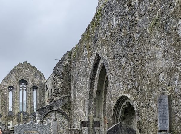
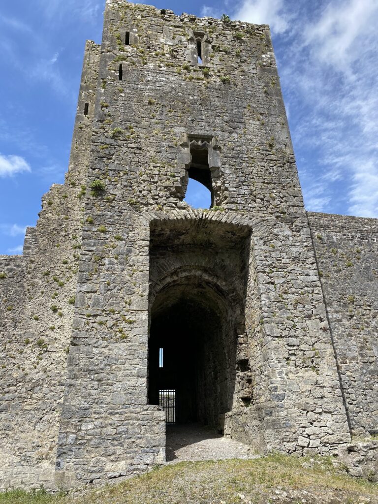
The church was a long, single-nave building measuring about 166 feet, or 51 metres, in length and 26 feet, or 7.9 metres, in width. Sections of the walls around the former chancel window and the western end remain. The original west gable contained two lancet windows, narrow openings with pointed arches, dating from the late thirteenth century. A tower was later incorporated into the west end, and its vault partly obscures the lancets. The tower belongs to the fourteenth or fifteenth century.
The arches inside the lancets meet at a decorated capital bearing foliage and sculptures of three human heads. The carving resembles the west window of the church at Gowran but is less technically accomplished. Other surviving decoration includes stiff-leaf capitals. The southern masonry belongs to a later alteration, and the remaining church fabric preserves only part of the original building.
The cloister and residential tower
The cloister occupied the area south of the church and formed a square measuring about 90 feet, or 27 metres, on each side. The entrance to the chapter house remains identifiable on the eastern side of the cloister garden.
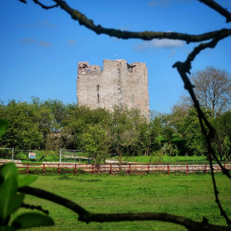
A late-medieval residential tower stands at the northwestern corner of the cloister garden, outside the cloister. It may once have been taller and may have formed part of the curtain walls, but its precise function remains uncertain.
Agricultural and river features
The dovecot
The medieval dovecot, or pigeon house, stands separately southeast of the church and chancel. It occupies a round tower about 8.5 metres high, with an internal diameter of approximately 4.75 metres and walls about 1.14 metres thick. The inner wall contains 352 nesting compartments arranged in 11 tiers of 32 niches, rising to about 4.5 metres above ground. Above the nesting tiers, projecting stone slabs gradually narrow the interior until only a circular opening remains at the top for the birds’ movement.
A surviving string course around the outside strengthened the tower and helped prevent vermin from climbing to the entrances. The dovecot’s principal agricultural purpose was producing pigeon fertilizer for herb gardens and hemp cultivation. Its size has been interpreted in relation to the priory’s substantial medieval landholding, although the estate had been reduced to less than two carucates, a medieval area based approximately on the land a plough team could cultivate, by the time of dissolution.
The fishpond and clapper bridge
Remains of a fishpond survive near the priory. Fishponds were associated with the rights of landed proprietors and formed part of the wider agricultural resources connected with the complex.
A medieval clapper bridge, a simple crossing made from large stone slabs laid across supports, crosses the Awbeg near Ballybeg. Dating from the thirteenth century, it was built from thick limestone slabs about 10 feet, or roughly 3 metres, long, each weighing more than an imperial tonne. In 1910 the Awbeg was dredged and its course altered. Half of the bridge site was removed, leaving the bridge standing over dry land rather than over the river.
Nearby sites