Baku Fortress: The Medieval Walls of Baku’s Old City




Site at a Glance
- Rating
- 4.7
- Popularity
- Very Low
- Country
- Azerbaijan
- Primary era
- Medieval
- Eras represented
- Medieval, Early Modern, Modern
- Civilizations
- Russian, Safavid, Shirvanshah
- Site type
- Military
- Remains
- Wall
On this page13 sections
History
Baku Fortress is the fortified enclosure of Baku’s medieval Old City in Azerbaijan, built and expanded by the Shirvanshahs and later rulers from the twelfth century onward. The surviving walls belong chiefly to the first half of the twelfth century, when Shirvanshah Minuchihr III the Great, ruler of the Shirvanshahs, the dynasty governing the historical region of Shirvan, ordered their construction during his reign from 1120 to 1160. The fortress protected the medieval city and formed part of Baku’s changing relationship with the Caspian Sea.
Medieval Foundations
Earlier fortifications had surrounded the developing feudal city before the walls associated with Minuchihr III. These defenses extended toward the Caspian coast, with towers and wall lines reaching in the direction of Bayil Castle in Baku Bay. In the medieval period, Baku was enclosed by two rows of walls. Accounts described five entrances, while the fortress and its defenses were noted by travelers from the fifteenth through the nineteenth centuries, including Abd al-Rashid al-Bakuwi in 1403 and Evliya Celebi in 1647.
The city’s defensive system continued to develop as political control changed. In the seventeenth century, the existing walls were restored in 1608–1609 under Shah Abbas I, a Safavid ruler of Iran whose reign extended into the early seventeenth century. Zulfiqar Khan ordered the construction of an outer wall line during the same period. An inscription at a gate gives the date as 1017 in the Hijri calendar, corresponding to 1608–1609.
Russian Military Fortification
Baku joined the Russian Empire in 1806, after which the fortress was placed under the Engineering Department of the Ministry of War as a first-class regular military fortress. Field fortifications and bastions were replaced or repaired between 1808 and 1810, and these alterations appeared on the general plan of Baku Fortress drawn in 1817. Russian military engineers had added six bastions in the eighteenth century, although these were later abandoned after Russian forces left the fortress.
A Russian plan dated 10 July 1796 proposed extending the fortress toward the area later occupied by the Seyid Mirbabayev Palace, but the project was not carried out. Another plan from 1796 recorded destruction in the eastern parts of both wall lines. The first Russian army plan of Baku, prepared in 1723, showed the Shemakhi Gate, the Mountain or Salyan Gates, the fortress walls, and three sea gates. A plan from 1738 depicted bastions, a field fortification, and bonnettes, small defensive outworks protecting a larger fortification.
Dismantling and Reinterpretation
Baku Fortress ceased to be classified as a military fortress in 1867. Around the same period, new Upper Gates, also called Taghiyev Gates, were built above the Shemakhi Gate at the initiative of the merchant Haji Zeynalabdin Taghiyev. In 1879, Baku governor Lieutenant-General V. M. Pozen established a special commission to inspect the walls.
Urban improvement proposals made in 1868 and approved in 1870 led to the dismantling of the outer wall between 1883 and 1888. New gates were opened in 1887. During the removal of the second wall line, the Zulfiqar Khan Gate was moved beside the Shemakhi Gate of the earlier wall. Together, these entrances became known as the Double Fortress Gates, or Gosha Gala Gapisi. The matter of removing the outer defenses was reconsidered by the Baku City Duma in 1886.
Archaeology and Conservation
In 1954, part of a northern wall half-tower collapsed and revealed a large stone slab carrying part of a three-line twelfth-century Arabic inscription in Kufic, an angular form of Arabic script widely used on medieval monuments. The inscription names Minuchihr III and records the construction of the city walls in the first half of the twelfth century. The slab is now held by the National History Museum of Azerbaijan in Baku.
A circular street was laid along the inner perimeter of the walls in the early nineteenth century. It is now known as Little Fortress Street, or Kichik Gala. The gates were restored in 1956–1957, while the Double Fortress Gates had already undergone restoration in 1864 and repair and strengthening between 1952 and 1957. Conservation of sections of the walls and the Double Fortress Gates took place in 2018–2019, followed by related restoration and strengthening work in Icherisheher completed in 2020.
Baku’s walled Old City, including the Shirvanshah’s Palace and Maiden Tower, entered the UNESCO World Heritage List in 2000 as a cultural property under criterion (iv), which concerns an outstanding example of a type of building, architectural ensemble, or landscape illustrating an important stage in history. It is listed as property number 958.
Remains
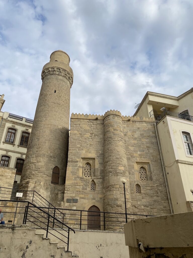
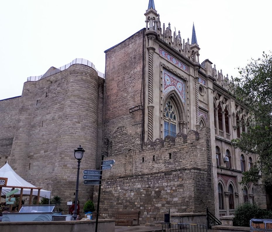
The surviving fortifications form a high stone enclosure around the medieval Old City. The present wall extends for approximately 500 metres, compared with about 1,500 metres in the medieval period. It is roughly 3.5 metres thick and generally 8–10 metres high. Towers, loopholes, wall walks or banquettes, and machicolations remain incorporated into the defenses. A machicolation is a projecting opening through which defenders could drop or pour material onto attackers below. Medieval descriptions refer to 70 semicircular defensive towers capable of supporting gunfire, while 25 semicircular towers and one rectangular tower remain after later alterations and restoration.
Walls, Moat, and Sea-Facing Defenses
The fortress formerly reached the Caspian Sea. Changes in the coastline and a substantial fall in sea level left the walls separated from the water by a broad strip of land, later occupied by the seafront boulevard and Neftchilar Avenue. On the landward side, a broad, deep moat received spring water through underground conduits approaching from three directions. The southern, seaward side had a single wall line.
Remains of an earlier sea-facing wall were found in 1927 during sewer construction near Maiden Tower, at a depth of 2.75 metres. Earlier drawings, including Engelbert Kaempfer’s depiction of Baku, show defensive walls and towers extending toward the sea and Bayil Castle. The foundation of the second outer wall line also survives.
Gates and Entrances
Double Fortress Gates
The principal landward entrance is the Double Fortress Gates on the northern side of the enclosure. The Shemakhi Gate belongs to the twelfth-century wall, while the Zulfiqar Khan Gate was built for the seventeenth-century outer defenses and relocated beside it between 1883 and 1886. The gates originally stood about 15 metres apart in their respective wall lines before being brought together. They are nearly identical in size and form, and both incorporate loopholes and machicolations.
Salyan Gate
The Salyan Gate occupies the southwestern wall, where it opens into a garden leading toward Azneft Square. Its domed form is framed by an arch and forms part of the surviving system of entrances through the fortress walls.
Eastern Tower and Underground Passage
Rectangular Donjon
A rectangular fortress tower, or donjon, stands beside the eastern wall and reinforces the northern defenses. A donjon is a principal fortified tower used for defense, storage, or refuge. The tower is 16 metres high, with walls approximately 2 metres thick, and lies within the line of the city wall rather than at the center of the settlement.
The tower served as an arms store in both peace and war, helped control the surrounding area, and strengthened the northern defenses. A well in its southern corner supplied water to people sheltering inside. An underground passage ran along the lower part of the wall toward the Double Fortress Gates and around the northern side of the city. The tower’s date remains debated, with interpretations placing it in the twelfth century or the late fourteenth to early fifteenth century. A fifteenth-century construction, possibly from 1428–1429, has been associated with works commissioned by Kazanfar Shah, ruler of Baku and brother of Shirvanshah Khalilullah I.
Maiden Tower
Maiden Tower stands near the southeastern part of the old walls, close to the former shoreline and seafront park, as a separate defensive structure associated with the fortress. It is 28 metres high. Its first level has a diameter of 16.5 metres, while the walls reach approximately 5 metres in thickness. The interior is divided into eight levels built of dressed stone, each covered by a domed ceiling.
Circular openings align vertically through the domes, allowing the floor of the first level to be seen from the opening at the eighth. The entrance is on the western side, through an arched doorway 1.1 metres wide and about 2 metres above the former ground level. The tower’s original purpose remains disputed. Interpretations have included a ziggurat-like Absheron structure, a fire-worship temple, a tower of silence, a watchtower, an observatory, and a passive defensive structure. Its thick walls, internal well, attached fortified wall, and organization resemble features of circular towers elsewhere on the Absheron Peninsula. Maiden Tower began serving as a museum in 1964.