Assos Archaeological Site: An Ancient Greek City in Türkiye



Site at a Glance
- Rating
- 4.5
- Popularity
- Medium
- Country
- Turkey
- Primary era
- Classical
- External website
- Open
- Eras represented
- Classical, Medieval
- Civilizations
- Ancient Greek, Byzantine, Kingdom of Pergamon, Ottoman, Roman
- Site type
- City
On this page26 sections
History
Assos Archaeological Site is the remains of an ancient Greek city in Türkiye, at Behramkale on the southern coast of the Troad. The city was established or substantially developed by Aeolian colonists from Lesbos during the Archaic period, although settlement on the steep volcanic hill continued from the Bronze Age. Its position opposite Lesbos and above the Adramyttian Gulf gave Assos both a defensible acropolis and access to two harbors.
From Aeolian city-state to Persian rule
Assos was a polis, an ancient Greek self-governing city-state with an urban center and surrounding territory. It came under Lydian control around 560 BC. When the Lydian kingdom fell in 546 BC, Persian authority replaced it. After a temporary withdrawal of Persian power, Assos joined the Delian League, the Athenian-led alliance of Greek states, and appears in its tribute records. Persian control was restored under the King’s Peace of 387 BC, a settlement that returned many Greek cities in Asia Minor to Persian authority.
During the fourth century BC, Eubulus ruled Assos and Atarneus as an independent ruler. After his death, Hermias of Atarneus took power. A former slave and a student of Plato’s Academy, Hermias invited philosophers to Assos and ruled approximately from 355 to 344 BC. His independence ended when the Persian commander Memnon captured and executed him, bringing the city back under Persian rule.
Aristotle and the fourth-century intellectual community
Assos became associated with Aristotle during Hermias’s rule. Aristotle lived in the city for about three years, married Hermias’s niece Pythias, and founded a philosophical school there in 347 BC. Together with other philosophers, he studied zoology, biology, and the living world. He left Assos in 344 BC and later became tutor to Alexander, the son of Philip II of Macedon. Modern philosophical workshops known as “Philosophy in Assos,” established in 2000, continue this cultural association with the city.
Hellenistic and Roman Assos
Persian rule ended after Alexander the Great’s victory in 334 BC. Following Alexander’s death, Assos was initially connected with the Seleucid realm and later became part of the kingdom of Pergamon. The city was also attacked by the Gauls during the Hellenistic period. In 133 BC, the Pergamene king Attalus III bequeathed his kingdom to Rome, bringing Assos under Roman rule.
Assos prospered under Rome through its agricultural production, harbor, and commercial links. The surrounding region was known for grain, and the city continued to mint coins into the Roman imperial period, the era when Rome was governed by emperors. During the first century AD, Assos remained an important port and was visited by Paul the Apostle. Christian tradition also connected the city with Luke the Evangelist.
Religious life in the early imperial period included cults of Athena Polias, Athena as protector of the city, Zeus Soter, and Asklepios. Assos also participated in the imperial cult of Augustus and Livia. Between AD 381 and 390, many temples were closed or demolished under Christian and imperial pressure. Their stone was reused in churches and houses, while marble was burned for lime near the agora. The Temple of Athena and its altar were destroyed during this transformation.
Late Roman, Byzantine, and medieval periods
Assos declined in importance from the middle of the third century AD. It became a bishopric by the fourth or fifth century, while the settlement retained local religious and defensive importance during the Byzantine Middle Ages. Urban life declined sharply by the seventh century, but episcopal and fortified uses continued into the medieval period. Attacks and population movements in the early fourteenth century eventually brought the settlement’s occupation to an end.
Control of the city and surrounding region changed several times. Byzantines, Seljuk Turks, the Karesi principality, and the Ottoman state each held Assos at different periods. Seljuk rule began in 1080 and lasted seventeen years before Byzantine control was restored. Assos became Ottoman territory in 1359, when the surrounding region was sold to Sultan Murad I.
Rediscovery and archaeological investigation
Piri Reis noted the ruins in 1521. John Covel visited in 1672, followed by Choiseul-Gouffier in 1785. In 1835, Charles Texier prepared a detailed plan and drawings of the temple friezes. The first systematic excavations took place from 1881 to 1883 under J. T. Clarke and Francis H. Bacon for the Archaeological Institute of America, with Robert Koldewey also associated with the work. These excavations exposed major architectural remains, and some finds were taken to museums in the United States and Europe.
Excavation resumed in 1981 under Ümit Serdaroğlu and continued until his death in 2005. His work included the western necropolis, agora, theatre, and acropolis. Since 2005, excavations have been directed for Çanakkale Onsekiz Mart University by Nurettin Arslan. Systematic surface survey and related test excavations began in 2009, mapping visible remains and identifying activity from the Bronze Age, Archaic, Hellenistic, Late Roman, and Early Byzantine periods.
Later investigations found a Byzantine building with an apse east of the West Gate and revealed a street with fallen columns from the gymnasium’s covered colonnade. Restoration of the Temple of Athena began in 2009. Concrete and earlier iron reinforcement were removed from the columns, while andesite column drums, capitals, and missing blocks of the southern and eastern upper temple steps were repositioned or reconstructed from original material. Excavation south of the temple exposed Byzantine walls and helped clarify the successive uses of the acropolis.
Assos has been included on UNESCO’s Tentative World Heritage List since 2017. The designation reflects the archaeological importance of a site whose remains preserve a long sequence of occupation, from Bronze Age settlement through Greek, Roman, Byzantine, and later periods.
Remains
Hilltop, harbors, and fortifications
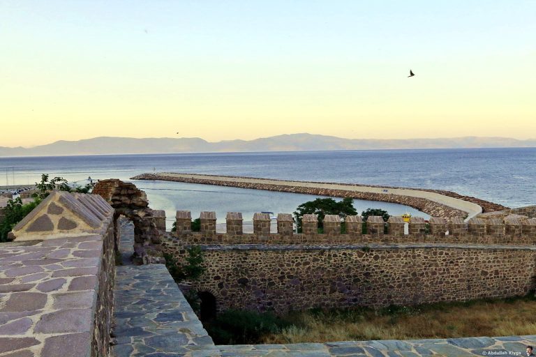
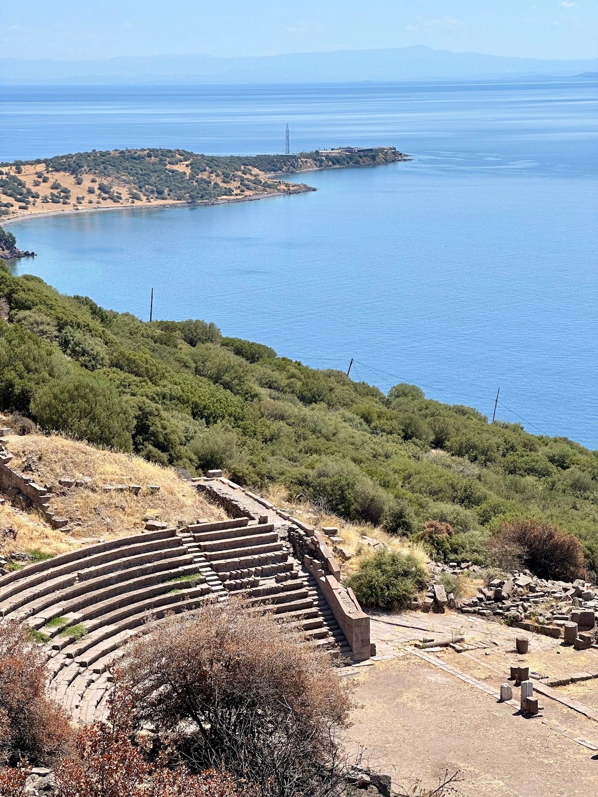
The site occupies the summit and slopes of a steep volcanic hill rising approximately 234 to 238 metres above sea level. The acropolis overlooks the Aegean and the Adramyttian Gulf. Lesbos lies about 11 kilometres to the south, while the elevated parts of the site provide views toward Pergamon and Mount Ida. Two adjacent harbors lay below the city, protected by artificial breakwaters whose remains survive. They were equipped for hauling vessels ashore during rough weather.
Assos was enclosed by fortifications about five kilometres long, surrounding approximately 55 hectares and extending down to the sea so that both harbors lay within the defended area. The principal circuit is generally dated to the fourth century BC and incorporated parts of earlier Archaic walls. Two major gates flanked by towers stood on the western and eastern sides, together with seven smaller gates. Square and circular towers formed part of the circuit. Some sections of wall survive more than nine metres high, while certain towers reach approximately 18 to 20 metres.
The acropolis had its own fortified circuit, attested by 365 BC and repaired during the Roman period and again in the Middle Ages. Across the wider city, numerous retaining walls supported terraces for buildings and houses, adapting the urban area to the steep hillside.
Acropolis sanctuary
Temple of Athena Polias
The Temple of Athena Polias stood at the highest point of the acropolis. Built around 540 to 530 BC, it was a Doric temple, a Greek form known for sturdy columns, simple capitals, and a relatively austere horizontal structure. The building measured approximately 14 by 30 metres, with six columns on each short side and thirteen on each long side. Its interior contained a pronaos, or entrance vestibule, with two columns between projecting walls, followed by the cella, the main sacred chamber. The temple had no rear chamber, or opisthodomos.
The temple stood on a two-step crepidoma, the stepped platform supporting a Greek temple, and the natural rock formed part of the lower foundation level. Its entablature, the horizontal architectural assembly above the columns, included sculpted metopes, decorated panels in a Doric frieze. Surviving subjects include a sphinx, a centaur, and Europa riding a bull. The carved architrave, the lowest main member of the entablature, shows Ionic influence, while the triangular pediment was undecorated.
Six of the original 38 columns are reported to remain, and some columns have been re-erected. Portions of the frieze are held by the Istanbul Archaeological Museums, the Louvre, and the Museum of Fine Arts, Boston. Excavation and restoration around the temple have also revealed Byzantine walls and evidence for later use of the acropolis.
Agora and civic buildings
Agora terraces
The agora occupied a series of terraces on the southern slope of the acropolis. Its principal buildings were constructed or substantially developed during the Pergamene and Hellenistic periods. The civic area measured approximately 150 metres from east to west and 60 metres from north to south, with entrances at its western and eastern ends.
Bouleuterion
At the eastern end of the agora stood the square-plan bouleuterion, the meeting hall of the city council. Dating approximately to 300 to 100 BC, it measured 20.60 by 20.60 metres and incorporated Doric architectural features. Its five-column façade opened onto an interior where four columns arranged in a square supported the roof. The seating for the assembly was probably made of wood. During the Roman period, the building continued as a meeting place, and statues were erected along its northern wall.
North Stoa
The North Stoa occupied the northern side of the agora. A stoa was a covered colonnade used for shelter, circulation, commerce, or civic activity. This two-storey building measured approximately 111.5 metres in length, 12.4 metres in width, and 11.3 metres in height at the façade. The lower façade had 37 columns, while a central row divided each level into two aisles. The lower level had 20 columns in this internal row.
Excavation beneath the North Stoa identified an earlier, probably stoa-like building aligned northeast to southwest with the bouleuterion and dated to the Hellenistic period. Many stones from that earlier structure were reused in the later building. Coins and ceramics in the overlying fill show that the area continued to be used during Roman phases.
South Stoa and western temple
The South Stoa ran along the southern edge of the agora. It measured approximately 69.1 metres long and 10.6 metres wide, presenting a single storey toward the agora while its lower levels were built into the slope. Its total height was approximately 24.9 metres. A heroon, a shrine or monument associated with a hero or honored person, stood at its western end.
A small Doric prostyle temple stood at the western end of the agora. A prostyle temple has a row of columns across its front. Broadly dated to 200 to 100 BC, the building opened eastward and contained a cella and a pronaos with four columns.
Gymnasium, road, and theatre
Gymnasium
The gymnasium lay north of the road connecting the West Gate with the agora. Built during the Hellenistic period, probably in the second century BC, it was organized around a peristyle courtyard, a courtyard surrounded by columns, measuring approximately 32 by 40 metres. A Doric colonnade supported a covered walkway around the courtyard. The northern side contained an ephebeion, a space connected with the education and training of young male citizens, and a circular bath. A stoa occupied the western side.
An inscription on the architrave records that Quintus Lollius Philetaerus funded a stoa. During the Byzantine period, part of the gymnasium was converted into a church. Later investigation also exposed a street and fallen columns belonging to the gymnasium’s covered colonnade.
Paved road
A paved road descended from the West Gate toward the baths and theatre. The main excavated section was approximately 6.5 metres wide and surfaced with regular rectangular blocks of andesite, a volcanic stone. Channels along its northern and southern edges carried rainwater toward cisterns. Beneath the road lay Hellenistic ceramics, an Archaic layer, and a Bronze Age layer approximately 0.15 to 0.20 metres thick above bedrock. Late Roman and Early Byzantine material also occurred in the road fill.
Theatre and baths
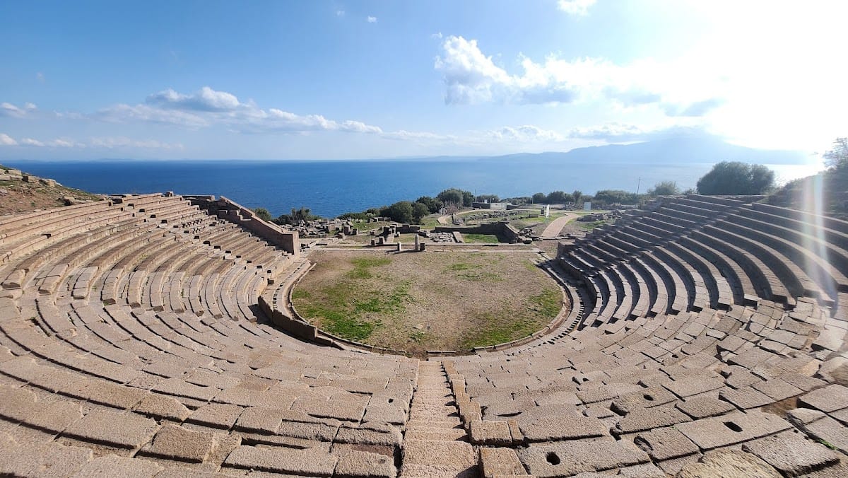
The theatre stood south of the agora on the southern slope of the acropolis, where a natural hollow formed its setting. Dating to the Hellenistic period, it could accommodate approximately 5,000 spectators. Its semicircular seating was cut into the hillside around a horseshoe-shaped orchestra, with views toward Lesbos.
A large Roman bath known as the Baths of Lollia stood south of the agora and west of the theatre. Another bath complex near the agora had four levels, a large hall, 26 chambers, an elevated water basin concealed by stone partitions, and a second reservoir.
Necropolis and burial remains
Roadside necropolis
The necropolis extended along the roads leading to the western and eastern gates. It contains graves from the Archaic, Classical, Hellenistic, and Roman periods, together with numerous sarcophagi. Some sarcophagi exceed three metres in length. Local coffins were made from andesite, a stone reputed in antiquity to accelerate the decomposition of bodies, giving both the material and the coffins made from it a broad ancient reputation.
Aristios family grave
Excavation in 2018 uncovered an undamaged Hellenistic family grave marked with the name Aristios. The burial contained the remains of 21 people. One person had been interred, while the remains of 20 others had been cremated and placed in urn-like vessels whose lids were sealed with cement. Numerous strigils, curved implements used in antiquity to scrape oil, sweat, or dirt from the body, were also recovered. Both iron and bronze examples were found.
Later religious and domestic features
Lime kiln
A lime kiln occupied a terrace south of the agora. Its substantial wall was approximately two metres wide, and two entrances opened on its southeast and northwest sides. Incompletely burned marble fragments remained inside. After the kiln ceased operating, it was filled and covered with stone blocks. An east-west Hellenistic foundation lay beneath its floor.
Ayazma Church
The Ayazma Church west of Assos was built over the podium of an Early Roman monumental tomb. An earlier tile pavement beneath the church’s andesite floor probably belonged to that tomb. Two apsidal chapels east of the church’s apse contained small stone-lined graves holding the remains of children generally aged between one and three years. The southern chapel included a baptismal basin with reused marble facing and a central drain. Some reused marble blocks bear inscriptions. After the church fell out of use, the area became a cemetery.
Other excavated remains
Residential remains survive throughout the urban area. At the ancient port, port columns lay in the harbor for more than a millennium and were probably later sold. A Hellenistic lion sculpture approximately 2,200 years old was found in a structure later used as an inn. A Byzantine stone oven approximately 1,500 years old was also recovered, and one Byzantine cooking installation contained three pots.
Other surviving and excavated material includes sculptures, inscriptions, architectural blocks, temple reliefs, and coins. The earliest coins of Assos, bearing the inscription “Assion,” are rare, while Roman-period coins are more common. Some architectural and sculptural material removed during earlier excavations is held in museums in Istanbul, Boston, and the Louvre. A modern statue of Aristotle stands at the entrance to the archaeological site. Near the ruined temple, the Hüdavendigar Mosque and its associated bridge on the road toward Ayvacık date to the second half of the fourteenth century.