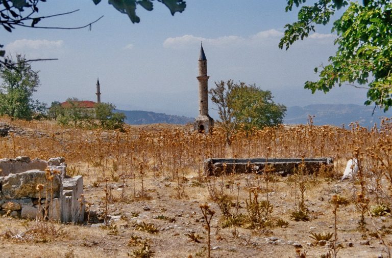
Tripolis: An Ancient City in Türkiye

Site at a Glance
- Rating
- 4.6
- Popularity
- Medium
- Country
- Turkey
- Primary era
- Classical
- External website
- Open
- Eras represented
- Classical, Medieval
- Civilizations
- Byzantine, Kingdom of Pergamon, Roman
- Site type
- City
On this page27 sections
History
Tripolis is an ancient city in Türkiye near Yenicekent, founded under the Kingdom of Pergamon and developed into a prosperous urban center during the Roman period. It stood on the northern bank of the upper Maeander River, now generally called the Büyük Menderes, near the meeting area of Lydia, Phrygia, and Caria. Its most visible remains belong to the Roman and Byzantine periods, especially the first to third centuries AD.
Pergamene Foundation and Regional Position
The city occupied the road linking Sardis, Philadelphia, and Laodicea, approximately 20 kilometers northwest of Hierapolis. This position connected the regions of Lydia, Phrygia, and Caria and supported trade, helping Tripolis become one of the wealthier cities in the area. Its name Tripolis ad Maeandrum means Tripolis on the Maeander. Ancient and later geographical traditions placed the city inconsistently in Lydia or Caria, while some modern archaeological presentations associate it with Phrygia.
Tripolis was also known as Apollonia, Antoniopolis, and Neapolis. In the first century BC, its political and social life was associated with tyrants named Dionysius, Ptolemy, and Lysanias. The city initially had a defensive purpose before restoration and urban development transformed it into a prosperous center. It minted its own coins, including examples depicting Leto, the Greek goddess who was the mother of Apollo and Artemis.
Roman and Byzantine Development
Urban construction and expansion continued during the Roman period. The main roads, public buildings, baths, theater, and other visible structures reflect the city’s development during the Roman centuries from the first to the third century AD. Tripolis also became an episcopal see subordinate to Sardis. A bishopric was the administrative territory of a bishop, while a subordinate, or suffragan, see operated under a metropolitan bishopric.
Agogius, the bishop of Tripolis in Lydia, is reported to have attended the First Council of Nicaea in AD 325, a major Christian council concerned with doctrine and church organization. Other recorded bishops include Leontius, Commodus, Paulus, Joannes, Anastasius, and Sisinnius. Commodus is associated with the Councils of Chalcedon and Ephesus, while Paulus and Joannes are recorded in AD 451. The bishopric later remained on the Catholic Church’s list of titular sees, with Nicolas Fryes de Brisaco appointed to the titular see on June 21, 1456, and listed until July 17, 1498.
Earthquakes, Conflict, and Decline
Tripolis was repeatedly affected by earthquakes because it stood near active fault lines. A major earthquake-related destruction is dated to AD 494. Earthquakes, together with conflicts between the Turks and Byzantines, contributed to the city’s decline, abandonment, and partial destruction.
During the later Byzantine period, defensive works were strengthened in response to Turkish incursions. A western defensive line and a fortress with a round tower formed part of the measures used against Turkish attacks in the thirteenth century. These fortifications represent the city’s later role as a defended settlement after its earlier Roman prosperity.
Archaeological Investigation
The Denizli Museum Directorate undertook a small excavation in 1993. Systematic excavation and research began in the summer of 2007 under Ege University, first focusing on the Roman street and the eastern necropolis. Work in the eastern cemetery also addressed damage to tombs caused by looting. Excavations continued in 2008, were interrupted after 2009 by bureaucratic problems, and resumed in 2012 under the Denizli Museum with scientific supervision from Bahadir Duman of Pamukkale University.
The 2023 program examined residential areas, the eastern city wall, ground south of the stone-cutting workshop, the eastern portico of the State Agora, and Theater Hill. Investigations there included military positions from the period of the Turkish National Struggle, the Turkish independence movement of the early twentieth century, and the Theater Hill Church. A church was uncovered in 2013, and four Early Byzantine churches have been identified across the site.
Remains
Tripolis preserves an urban landscape of Roman and Byzantine streets, public squares, baths, entertainment buildings, civic structures, defensive walls, churches, markets, and cemeteries. A mound approximately 2.5 kilometers northwest of the city has produced pottery fragments and stone tools dating from the Chalcolithic period through the Late Bronze Age, approximately 4000 to 1200 BC.
Streets and Entrances
Colonnaded Street
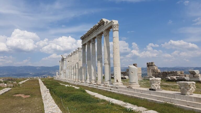
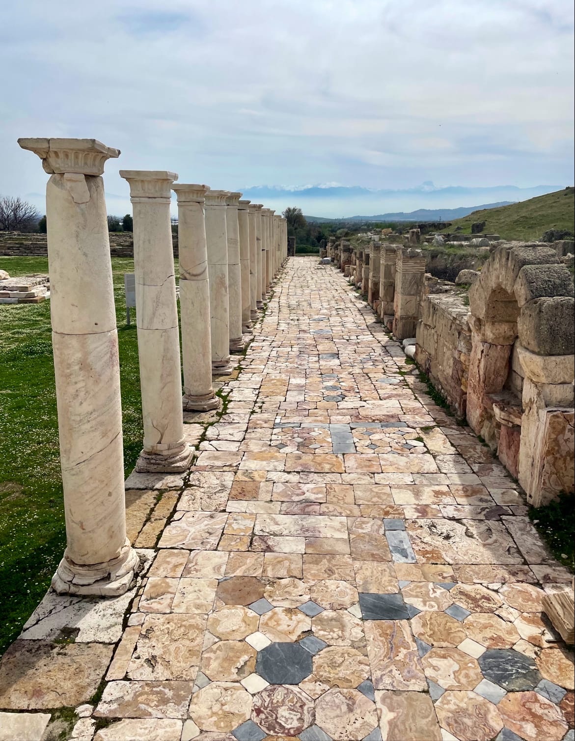
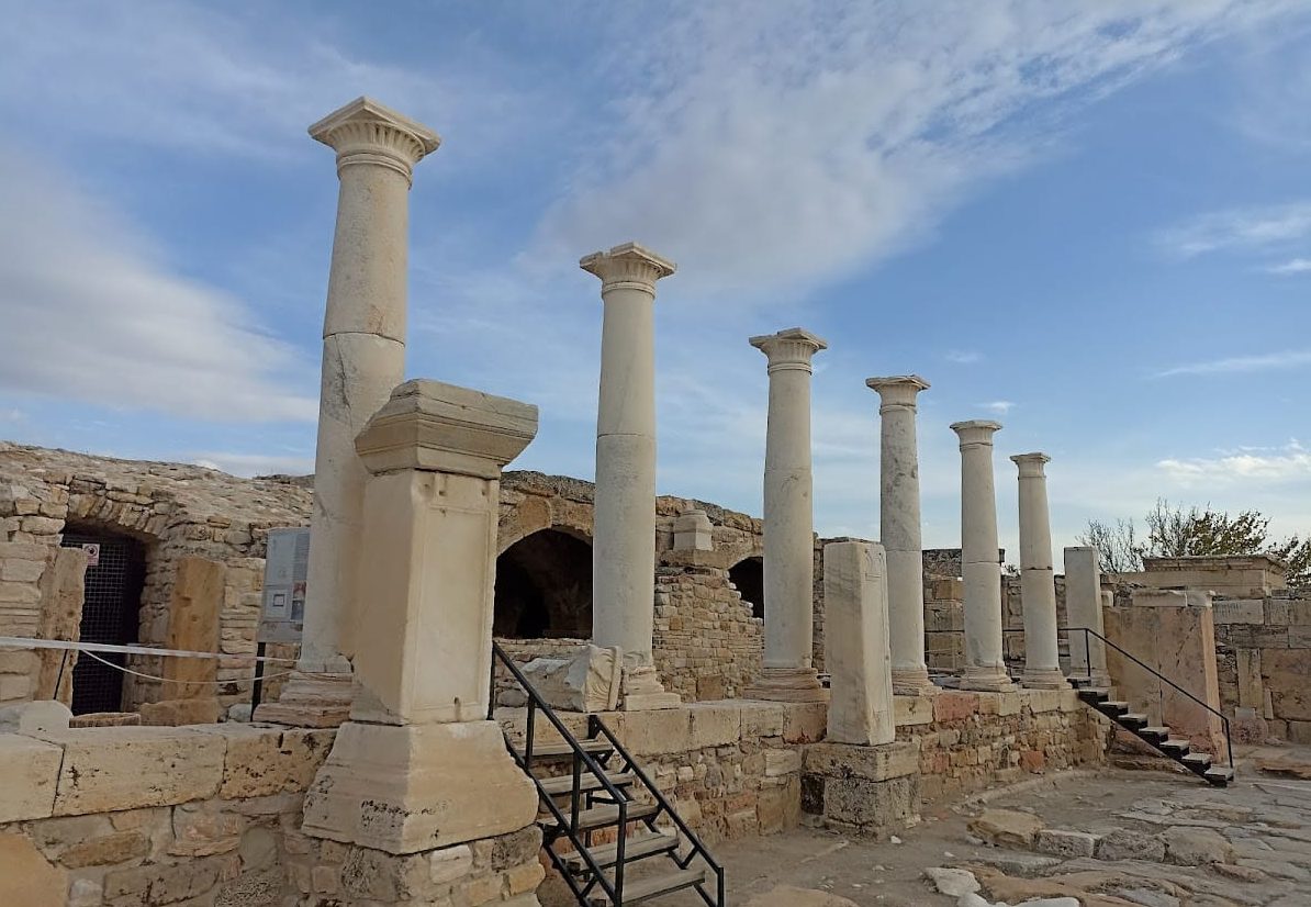
The principal colonnaded street extends for approximately 450 meters. It was originally 10 meters wide and was later narrowed to 7 meters on its northern side by fifth-century city walls. Travertine slabs paved the route, while an 8-meter-wide portico, a roofed colonnaded walkway, ran along its southern side. Polychrome mosaic fragments survive in the portico, which originally contained 13 columns beneath a wooden roof. Six columns remain. Six rooms along the street were probably shops.
Hierapolis Street
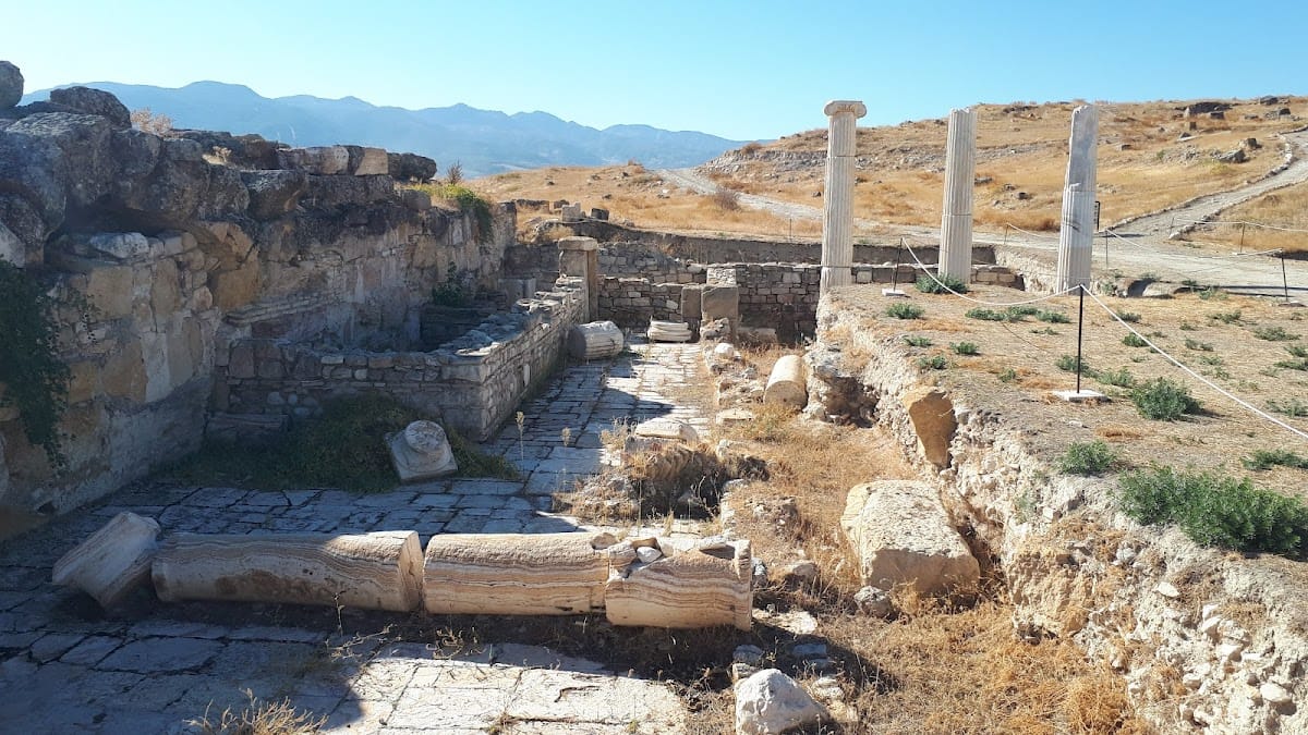
Hierapolis Street crossed the colonnaded street from north to south. The two routes were built during the same Roman construction phase. The excavated section has a travertine surface laid above sewer pipes that carried waste and rainwater out of the city.
City Gates
The Hierapolis Gate stood on the southern side of Tripolis. Built in the mid-second century AD, it took the form of a marble arch supported by travertine columns and is now heavily ruined and covered by shrubs. The Philadelphia Gate occupied the western side and was approached by the road from Thyatira through Sardis and Philadelphia.
During the city’s flourishing period, the principal gate complex had six piers supporting two arches. A surviving pier measures 7.65 meters in height and has undergone conservation and renewal. Two further gates remain in relatively good condition along the colonnaded street. One served arrivals from Hierapolis, while the other opened toward the Late Roman Agora.
Nymphaeum of Orpheus
At the crossing of the principal streets stood the Nymphaeum of Orpheus, a monumental fountain and fountain shrine. It rested on a marble platform, with walls faced in onyx and white marble. Terracotta pipes brought water from a reservoir east of the colonnaded street.
Civic and Commercial Buildings
Agoras
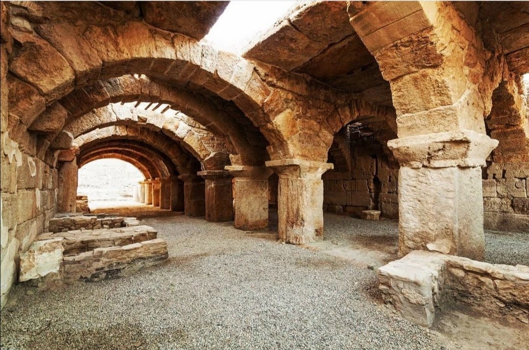
Two agoras, public civic and commercial spaces, have been identified. The arched agora lay north of the colonnaded street and covered approximately 1,000 square meters. Surface remains show rows of arches resting on piers. A second agora belongs to the Late Roman period, with its eastern and western porticoes surviving.
Bouleuterion
The city council building, or bouleuterion, stood at the center of Tripolis. Built from stone blocks, it measured 64 by 44 meters. Parts of its walls remain visible above ground.
Covered Market
A covered market survives in an exceptionally well-preserved condition. Its long burial protected the structure for many centuries, and the building has been described as unusual among ancient Mediterranean cities.
Monumental Fountain
A monumental fountain found during the 2019 excavations measures approximately 32 meters in width and 7 meters in length. It is provisionally dated to the second century BC, placing it among the earlier monumental features identified at Tripolis.
Baths and Entertainment Buildings
Great Baths
At least two baths date from the second century AD. The Great Baths stood near the western entrance, with rooms arranged from west to east. A gymnasium lay to their north.
Theater Baths
The Theater Baths stood near the theater, with rooms oriented from north to south. Four-room cisterns beside the baths supplied water for their use.
Theater
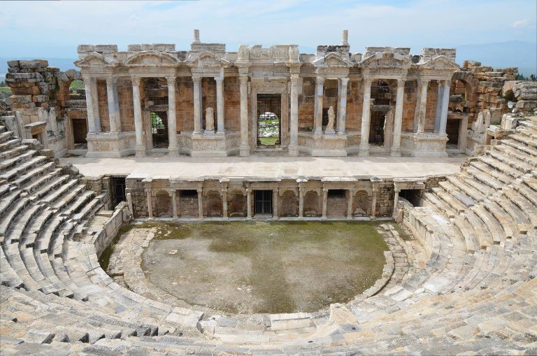
The theater occupied a natural hill slope inclined at approximately 50 degrees. Its auditorium could accommodate an estimated 8,000 spectators. Research places its construction in the second century AD, while much of the structure remains under excavation.
Stadium
A stadium stood northwest of the city beyond the defensive walls and hosted athletic and cultural events. Its running track lies beneath approximately 3 meters of earth. Seats on the western stand remain visible, and the eastern seating has been damaged.
Defenses
Eastern City Wall
The eastern section of the Byzantine city wall was built around the transition from the fourth to the fifth century AD. Its circuit originally extended for more than 1,800 meters. Surviving above-ground stretches reach more than 6 meters in height and approximately 2.5 meters in width. Stone blocks, bricks, and elements reused from earlier buildings, including columns, capitals, friezes, and statue bases, formed the wall. A frieze is a decorated horizontal architectural band.
Western Defensive Line and Fortress
The later Byzantine western wall extended for approximately 1,200 meters in surviving form. A fortress with a round tower rises above the city and belongs to the same broad defensive phase. Together, these structures formed part of the later defense of Tripolis against Turkish attacks.
Burial Grounds and Churches
Necropolises
Cemeteries occupied three sides of Tripolis. Burial practices followed the local terrain. In the northern necropolis, many tombs were cut into bedrock. Sarcophagi, stone coffins or coffin-like burial containers, predominated in the northeastern necropolis, while the southeastern necropolis contained Early Byzantine tombs with barrel vaults.
Early Byzantine Churches
Four Early Byzantine churches with polychrome frescoes have been identified. One church on Theater Hill was investigated during the 2023 excavation program, and another church was uncovered in 2013. Their remains reflect the city’s Christian development during late antiquity and the Early Byzantine period.