Ardoch Roman Fort: A Cohort Fort on the Gask Ridge
Site at a Glance
- Popularity
- Medium
- Country
- United Kingdom
- Primary era
- Classical
- Eras represented
- Classical, Medieval
- Civilizations
- Roman
- Site type
- Military
- Remains
- Fort
On this page13 sections
History
Ardoch Roman Fort is a Roman fort for a cohort, a military unit, near Braco in Perthshire, United Kingdom. Built in the later first century AD, it formed part of the Gask Ridge frontier system, a chain of forts and watchtowers monitoring the transition between the Scottish Lowlands and Highlands.
The frontier and first fort
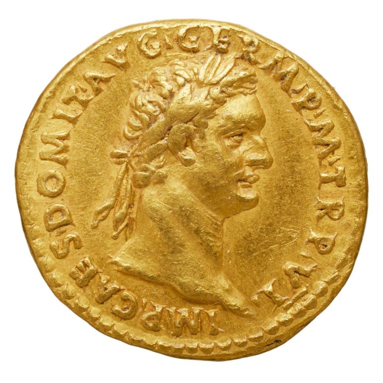
The earliest fort belongs to the Flavian period, the era of the Flavian emperors, and is linked to the campaigns of Agricola, the Roman general and governor of Britain. Construction may have begun under Agricola, but a later start under his successor during Emperor Domitian’s reign is considered more likely. Its listed garrison was Cohors I Aelia Hispanorum, a Roman auxiliary unit that served alongside the legions.
Roman forces advanced into what is now Aberdeenshire by AD 83–84. A battle traditionally identified as Mons Graupius is associated with this campaign. Tacitus, Agricola’s son-in-law and a Roman historian, reported that 10,000 Caledonians, peoples of northern Britain, were killed. Agricola then withdrew toward the southern Highlands, in the area of modern Perth and Kinross, and was recalled soon afterward.
Ardoch stood within a chain of Roman military sites generally arranged from north to south, often about a day’s march apart. The Gask Ridge section extended roughly 37 kilometres from Glenbank toward Bertha, while the wider network ran from Loch Lomond to the North Esk. Later interpretations have proposed that the system may have continued north along the River Isla and perhaps south beyond Glenbank.
Ardoch has sometimes been identified with Alauna, a place listed by Ptolemy, a Greco-Roman geographer, in territory associated with the Damnonii, a people of parts of what is now southern Scotland. The identification is uncertain. The name Alauna may be connected to the River Allan, about 1.5 kilometres south of the fort.
Rebuilding and later occupation
The fort passed through several phases of occupation and rebuilding, including a brief abandonment followed by renewed use and reconstruction. During the Antonine period, associated with Emperor Antoninus Pius, its defences were repeatedly altered. A further short-lived return in the late Antonine period is possible. The latest traces of Roman occupation belong to the Severan period, the era of the Severan emperors, in the early third century AD, perhaps during AD 208–211.
Recognition and archaeological work
In the early 1670s, James Drummond, 4th Earl of Perth, described the earthworks and wrote that their ditches could conceal a man on horseback. His physician Robert Sibbald made an early drawing in 1678. Early descriptions and illustrations sometimes mistook the medieval chapel for the Roman commander’s residence. John Scott, parish minister at Muthill, published the first accurate description in 1793.
The Society of Antiquaries of Scotland conducted the first systematic excavations in 1896–97. The work identified timber buildings, postholes and stone features, and produced a plan that remained useful in later investigations. Postwar aerial archaeology, studies by David J. Woolliscroft and Birgitta Hoffmann, and geophysical surveys from the 1990s onward further developed understanding of the fort and its wider frontier system. In 2016, a team led by Manuel Fernández-Götz and Felix Teichner used non-invasive measurements to map buried features, along with drone-based terrain modelling and aerial images, to add to earlier work and record the site’s condition for monitoring. Ardoch has been protected as a Scheduled Monument, a site protected under heritage law, since 1936.
Remains
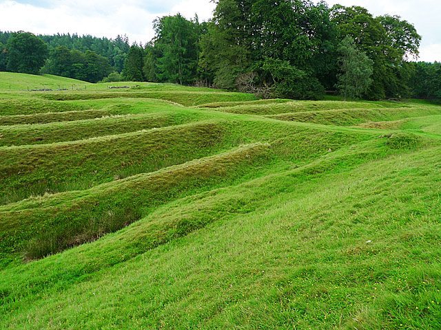
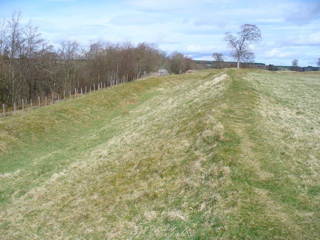
Ardoch survives mainly as grass-covered earthworks. The fort occupies rising ground beside the River Knaik, northeast of Braco and about eight kilometres from the first foothills of the Highlands. The land slopes south toward an artificial lake, and a modern road passes west of the archaeological site. Within this setting, the remains include overlapping forts, adjoining military areas, marching camps and a Roman road with associated watchtowers.
The fort
Defences and gates
The fort complex comprises two intersecting forts. Its roughly square interior lay within defences forming a rectangular enclosure with rounded corners. The Flavian fort covered about 3.5 hectares; during later Antonine phases, the enclosed area contracted first to about 2.5 hectares and then to roughly 2.25 hectares. The later fort was apparently rebuilt inside two outer ditches. Across successive phases, as many as five ditches defended the north and east sides, although they were not all in use at the same time. The north and east gates remain visible in the ground.
Buildings and heating
Most buildings within the fort were made of timber. The central area contained the headquarters, the commander’s residence and granaries. Barracks or stables were identified in the northern and southern parts of the fort. The barracks show as many as three building phases, while the headquarters and commander’s residence have at least two; some later buildings were partly constructed of stone. Underfloor heating systems were identified in three buildings, and debris from lead casting indicates metalworking.
Medieval chapel
Near the fort’s centre are the foundations of a medieval chapel and the remains of its graveyard enclosure. An access path entered the enclosure from the south, and its edges may have been raised.
Associated military landscape
Annexe
A large annexe, an area adjoining the fort, survives in the field to its north.
Marching camps
At least six overlapping Roman marching camps, temporary fortified camps used by troops on campaign, lie north and northeast of the fort. Five irregularly rectangular camps in the area to the north and east cover about 52 hectares altogether; another lies directly north of the fort. Most entrances were open gaps in the ditches, protected by an additional ditch positioned several metres in front.
Road and watchtowers
A Roman road west of the fort can be traced for at least two to three kilometres. It passes the watchtowers at Blackwood Hill, Shielhill South and Shielhill North, spaced roughly 900 metres apart. The towers had square plans and two or three storeys. They were built of timber, since stone was scarce, and each stood within one or two ditches. Their height may have reached seven to ten metres.