Anundshög: A Swedish Burial Complex and Regional Assembly Site
Site at a Glance
- Popularity
- High
- Country
- Sweden
- Primary era
- Medieval
- Eras represented
- Bronze Age, Iron Age, Classical, Medieval
- Civilizations
- Norse, Swedish
- Site type
- Burial
- Remains
- Necropolis
On this page15 sections
History
Anundshög is a burial complex and former regional assembly site near Västerås, Sweden. Its main cemetery was used from the Migration Period, a northern European period before the Viking Age, into the Viking Age, approximately AD 500-1050. Graves in the wider complex span from the Early Bronze Age to the Viking Age.
Burial and regional power
Charcoal from a hearth at the base of the great mound was radiocarbon-dated to AD 210-540. This result has been interpreted as suggesting that the mound was built sometime between the Migration Period and the Viking Age, rather than providing an exact construction date.
A prosperous large farm at Badelunda appears to have ended abruptly, and later settlement did not follow its former property boundaries. One interpretation links this change to a struggle for regional power as Christianity spread. Under this proposal, Badelunda was a secondary center defeated by a stronger rival, possibly Uppsala.
Assembly place and later traditions
Anundshög served as a regional thing-place. A thing was a Scandinavian assembly for legal, political and community affairs. Six preserved letters attest to meetings there in the fourteenth century: two date to 1355, with others from 1358, 1391, 1393 and 1437. The site may also have served as an assembly place during the Viking Age.
Medieval documents give the mound’s name as Anunda Högh. In the seventeenth century, pastor Jonas Holstenius cited the letters as evidence of earlier assemblies. Pastor Hans Spaak recorded a local belief that a king or giant lay buried in the mound. The Swedish antiquarian Johan Peringskiöld identified it as the grave of the legendary king Bröt-Anund, a figure in the medieval Ynglinga saga, a narrative about early Scandinavian rulers. That identification is conjectural. The name may instead refer to Anund, who appears in the runestone inscription.
Damage, restoration and modern disturbance
In 1788, distillery workers from Västerås attempted to plunder the great mound. They probably dug into its summit at night and hid the excavated earth among trees on the mound. The two largest stone-ship settings were restored in 1932 after their stones had been overturned. This may have happened in the early Middle Ages, in an attempt to destroy a pagan monument after the region’s conversion to Christianity. Damage to the mound was repaired in 1970. Surface looting with metal detectors affected the area in 2025 and 2026.
Remains
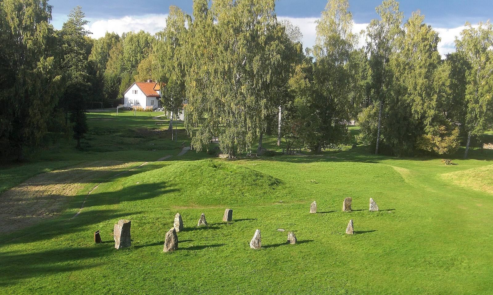
The archaeological area covers approximately 215 by 205 metres and contains 42 remains: 12 burial mounds, 10 circular stone settings, five stone-ship settings, 14 standing stones and one runestone. A stone-ship setting is a group of stones arranged in a ship outline, often associated with burial.
Burial mounds
The great mound
At the western edge of the area, the great mound measures about 64 to 68 metres across and approximately 9 metres high. It is regarded as Sweden’s largest burial mound. Cremations took place on its clay base, which was then covered with a stone-built mound and earth. The summit is flattened, and a wooden staircase leads to the top. Stones beside the stairs are thought to be remnants of the 1788 digging.
Other mounds
The second-largest mound is about 30 metres in diameter and 4 metres high. The remaining burial mounds form part of the broader cemetery landscape.
Stone settings and standing stones
Stone ships
The five stone ships lie in the northern part of the site. The two largest face one another, with their prows oriented toward the great mound, and measure approximately 53 by 16 metres and 51 by 25 metres. Each is outlined by roughly two dozen boulders, some taller than a person. A grave lies beneath the relatively small central stone, called the mast stone, in each setting. The other three stone ships measure 35, 28 and 23 metres long. The proportions of the settings have been compared with estimates for Viking ships.
Standing-stone line
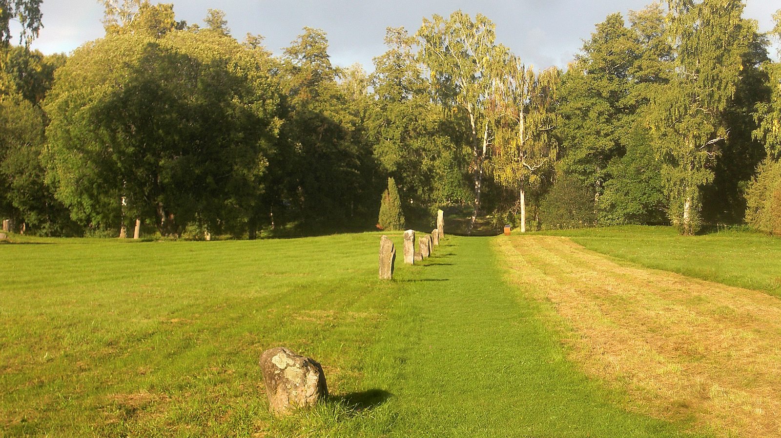
Fourteen widely spaced standing stones form a straight line from the southern end of the area toward its eastern edge. The alignment has been interpreted as the surviving part of a Viking-Age road monument, sometimes called a runestone bridge, a line of stones incorporating a runestone.
Runestone
The runestone stands between the second and third standing stones, counted from the southwestern end. Dated to the first half of the eleventh century, it bears an image interpreted as a man and woman embracing. Its inscription reads: “Folkvid raised all these stones in memory of his son Heden, Anund’s brother. Vred carved the runes.”
Landscape and other archaeological features
Labyrinth, routes and surrounding burial grounds
A large, well-preserved labyrinth lies around the burial field. An old route along the Badelunda ridge ran eastward and may have coincided with the Eriksgata, the customary route associated with a Swedish king’s journey after election. The line of standing stones has also been interpreted as marking an old road that may have followed this route.
The wider Badelunda landscape includes more than 200 graves along the ridge and about 50 circular stone settings in woodland west of Anundshög. To the south, a separate burial field once contained about 15 to 20 remains before gravel extraction. Three mounds and seven circular stone settings survive there; another mound, called Gullhögen, formerly stood in the field.
Radar line and assembly house
A 2008 ground-penetrating radar survey detected a diagonal line of filled holes running about 200 metres from an old ford toward the mound. Each hole was approximately two metres deep and two metres wide. The researchers considered that the line may have held about 30 large stones or posts. Archaeological investigations in 2017-2018 revealed remains of a medieval assembly house established no later than the fourteenth century.