Altrathen Castle: A Medieval Hilltop Fortress in Germany


Site at a Glance
- Rating
- 3.2
- Popularity
- Very Low
- Country
- Germany
- Primary era
- Medieval
- External website
- Open
- Eras represented
- Medieval
- Civilizations
- Holy Roman Empire, Kingdom of Bohemia
- Site type
- Military
- Remains
- Castle
On this page16 sections
History
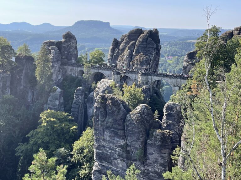
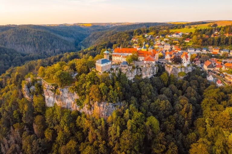
Altrathen Castle is a medieval hilltop fortress in Germany, at Rathen in Saxon Switzerland on the right bank of the Elbe. The site occupies a rocky outcrop associated with the Bastei and formed part of a fortified frontier between the Margraviate of Meissen and Bohemia. A traditional account places its origins around 1100, but neither written nor archaeological evidence confirms an eleventh-century foundation. More recent research connects the Rathen fortifications with frontier strengthening around the middle of the thirteenth century, possibly under Heinrich the Illustrious.
The Two Castles at Rathen
Altrathen and Neurathen, the names used today, formed a double castle with Neurathen approximately 500 metres to the northwest among the Bastei rocks. Medieval documents generally refer only to Rathen and do not usually identify which section they mean. Contrary to the modern naming, current research regards the higher Neurathen complex as the older one. The division of functions between the two castles remains uncertain. Interpretations of Neurathen as an outer defended section, an independent castle, or a refuge castle are conjectural.
Rathen was indirectly mentioned on 29 November 1261 in a papal document concerning a dispute involving the bishop of Meissen and Bohemian vassals, including Teodoricus de Raten. On 6 February 1289, a document explicitly referred to a castle at Rathen. This is the first clear documentary evidence for the stronghold, which was then held as a Bohemian fief, meaning a lordship granted by the king of Bohemia in return for feudal obligations.
Bohemian Lordship and Wettin Expansion
In 1361, Emperor Charles IV referred for the first time to two castles at Rathen. Peter of Michelsberg symbolically submitted to the emperor by opening the gates of both strongholds. Two years later, Charles IV, then king of Bohemia, permitted the Michelsbergs to hold their two Rathen castles together with their possessions at Auscha under common ownership.
Rathen was sold in 1406 to Hinko Berka of Duba the Elder. When his possessions were divided among his sons in 1410, Rathen went to Benesch Berka of Duba, who took possession after his father’s death in 1419. The castle remained a Bohemian fief while ownership moved among Bohemian noble families and the Wettins, a German ruling dynasty whose Meissen and Saxon branches were expanding their territorial authority.
The Berkas of Duba became involved in a prolonged feud with the Meissen margraves of the Wettin dynasty. In 1426, Friedrich of Oelsnitz, bailiff of Königstein and vassal of Friedrich I of Saxony, captured Rathen on Friedrich’s behalf. He was recorded as its lord in 1428. Albrecht Berka of Duba recaptured the castle in 1438, but Friedrich of Oelsnitz regained it in 1439, probably with the support of Friedrich II. A reconciliation treaty dated 10 March 1441 ended the dispute and left Rathen with Friedrich of Oelsnitz, while the Berkas renounced their claims.
Under the Treaty of Eger in 1459, Rathen passed permanently to the Wettins, although it remained subject in feudal law to Bohemian overlordship. By at least 1450, it also served as a customs station for shipping on the Elbe, adding an administrative and economic role to its defensive position.
Destruction in 1469
Hans of Oelsnitz, recorded as the owner in 1466, was described by the chronicler Johannes Lindner as having turned Rathen into a robber-knight castle. From 1467, Elector Ernst and his brother, Duke Albrecht, besieged both Rathen castles. Hans attempted mediation through ecclesiastical intermediaries, but these efforts failed. After more than a year, margravial troops captured and burned the castles in May 1469.
Hans of Oelsnitz escaped and tried unsuccessfully to recover Rathen through the intervention of King Matthias Corvinus. The elector nevertheless allowed him to resettle in Saxony and paid him compensation. Rathen was confiscated as a forfeited fief and assigned to the Pirna office. In the Leipzig Partition of 1485, it passed to Duke Albrecht. Both castles had fallen into ruin approximately sixty years after their capture.
Rebuilding and Later Ownership
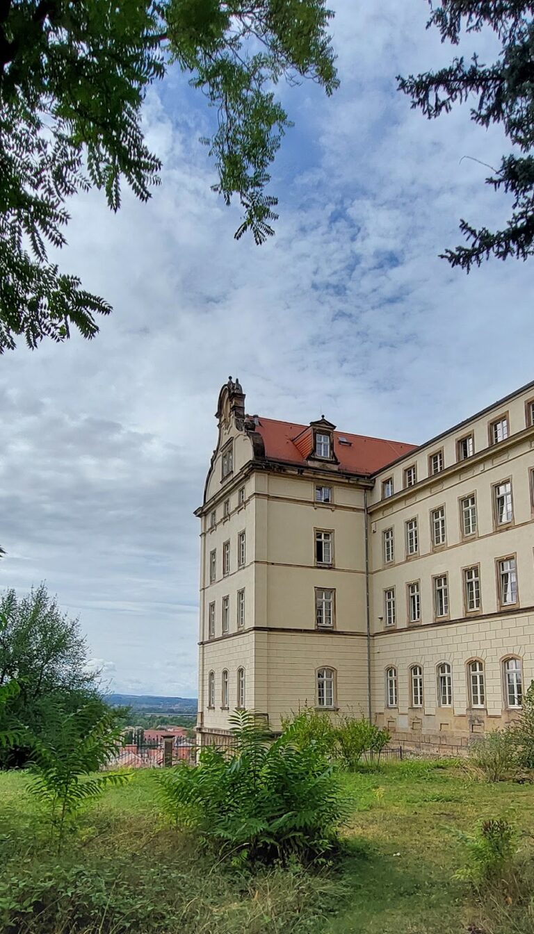
The ruins remained largely unattended for centuries. Their poor condition and increasingly difficult access were already noted in the eighteenth century. In 1888, the industrialist Eduard Seifert acquired the remains and incorporated them into a Neo-Gothic building project completed in 1893.
A residential building on the castle grounds burned in 1902. Carl Schümichen of Dresden designed a replacement in combined Neo-Romanesque and Neo-Gothic forms, based respectively on medieval Romanesque and Gothic architecture. Constructed in 1902 and 1903, it incorporated surviving medieval walls, a vaulted passage, cellar rooms, and the enclosed courtyard. Herbert Beschorner produced a detailed description and survey of the medieval remains in 1907, which remains the most extensive documentation of the site.
After 1945, the building first served as a works holiday home for VEB Brau und Malz Dresden and later as accommodation for the state bank of the German Democratic Republic. After German reunification, the Treuhandanstalt, the institution responsible for administering and privatizing state-owned property in the former East Germany, sold the property to private owners in 1995.
The site was subsequently operated as a hotel and restaurant. The walled courtyard became a restaurant garden known as the Burggarten. The property changed hands again in 2018, and public use as a restaurant and guesthouse ended in November of that year. The grounds were fenced in 2019, interrupting the marked mountain path between Altrathen and the Bastei. After an unsuccessful discussion between the National Park administration and the owner, the trail marking was removed and the route was deleted from the National Park network. Altrathen is protected as both a cultural monument and an archaeological monument. Since 2018 it has been privately owned and is not open to the public.
Remains
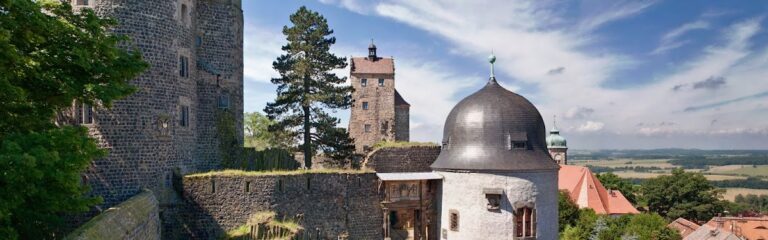
Altrathen occupies a prominent hill and rock outcrop forming the last outcrop of the Bastei, a sandstone formation in Saxon Switzerland. The castle stands approximately 60 metres above the Elbe. Only parts of the medieval complex survive, and these remains are physically integrated with the 1902 and 1903 residential building and its courtyard. The surviving layout includes defensive walls, the Burggarten area, vaulted internal passages, cellar rooms, and traces of additional structures adapted to the natural rock.
Defences and Outer Walls
Castle Ditch and Ridge Defences
On the Elbe-facing side, a rock-cut ditch approximately 20 metres wide and 10 metres deep protected the castle. Rubble partly filled sections of it in the early twentieth century, while other parts were covered by a path. Its historical line remains traceable as a regular break in the slope extending from the Elbe toward the Horn. Near the Horn, the rock lies about one metre below the surface and becomes visible.
Additional outworks occupied a ridge about 70 metres away, descending steeply toward the Amselgrund. Because this higher ground allowed attackers to overlook the castle, it required a separate defensive line. Wall remains along the ridge were laid without mortar and incorporated the natural rock. The steep southern slope toward the Elbe supplied natural protection.
Wall 4
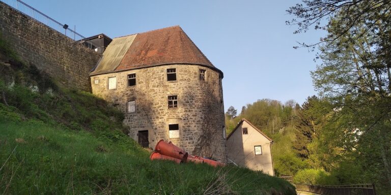
The surviving complex can be divided into three areas, including the Burggarten between wall sections 4, 6, 5, and 10 and the later residence. Wall 4 faces the Rathen valley and rises approximately nine metres. It is partly anchored in the underlying rock, with some foundations extending below ground level. A ledge about 4.5 metres above the ground suggests that a second storey once rested on it.
The wall was originally windowless. Later openings provided light and ventilation to the present Burgkeller, the vaulted cellar and passage area. At its rounded corner facing the Elbe, irregular rebates and uneven masonry suggest that another wall once joined it at a right angle. Stepped traces in the wall and the rock below indicate a former connection between an upper storey and the lower area identified as space 2.
Walls 6 and 5
Wall 6 faces the Elbe and has suffered substantial collapse in its upper section. The Burggarten plateau therefore no longer reaches the wall’s outer edge. Here the rock rises higher, reducing the masonry needed to adapt the structure to the terrain. Masonry blocks in area 9 suggest that another wall once stood there at a right angle. The end of wall 6 is now concealed beneath a stone pile and dense beech growth.
Wall 5 faces the Horn and meets wall 4 at a right angle. Its upper section consists of smooth, carefully laid masonry. Near its beginning, at point 20, the wall projects approximately three metres, apparently extending the horizontal ledge. Below it, stepped masonry with pier-like elements seems to have provided support. One pier was removed in the early twentieth century to improve access, and the roots of an old lime tree later helped support this section.
A major collapse near the lime tree illustrates the deterioration of the wall, although the remaining section continues toward the modern residence and reaches 13 metres in height. It is approximately 2.50 metres thick at the top and 2.70 metres at the bottom. Later ground-raising makes its apparent total height greater.
Wall 10 and the Former Entrance
On the Elbe side, wall 10 runs for approximately 16 metres and rises more than 12 metres externally. Built directly on the rock, it curves outward toward the Elbe valley and begins about 1.5 metres from the modern residence. An indistinct horizontal rebate appears on its outer face, while several rebates at the same level occur inside. Its lower part is buried, so only portions of its original construction can be reconstructed.
At its free end, in area 14, the upper masonry curves inward. This suggests that a right-angled wall once stood in line with the wall enclosing passage 17. A gap between walls 10 and 6 contains arched cut stones, a sill, and fragments of door frames, indicating a former entrance gate. The lower part of wall 10 continues in a straight line and probably served as a retaining wall for the approach.
In area 15, a rectangular infill in the lower wall conceals a circular opening. The feature has been interpreted as the remnant of a pipe that may have formed part of a sluice system regulating water along the Elbe. Older descriptions also mention a cistern whose remains may lie beneath the cellar of the modern residence in area 11.
Vaults, Cellars, and Interior Spaces
Vaulted Passage and First Cellar
The vaulted passage and adjoining rooms, known collectively as the Burgkeller, preserve a major part of the castle’s internal access area. The passage entered through the second round-arched opening in wall 5 retains most of its original vaulted ceiling. It measures approximately 8.50 metres long, 1.70 metres wide, and 2.90 metres high, with walls 2.70 metres thick. Its floor was raised by about five centimetres. At the far end, the passage meets a rock face that was later incorporated into the structure and enlarged across its full width. A niche about 2.60 metres above the floor measures approximately 40 by 45 by 45 centimetres, although its original purpose is uncertain.
The first cellar room branches from the passage after approximately 3.10 metres. Its entrance, six steps below the passage level, is 1.90 metres high and 1.50 metres wide in a wall 1.50 metres thick. Four of the steps are regarded as original. The room measures approximately seven metres long, 5.70 metres wide, and 3.30 metres high, with a ceiling vault running from west to east.
A later window pierces the east wall, while an older window in the north wall measures 95 by 95 centimetres. Two arched openings in the south wall lead into a small cave. Excavations in the cave uncovered human skulls, bones, and various instruments of torture.
Second Cellar and Passage 12
A second cellar room opens directly from the main passage, with its doorway approximately 1.25 metres from the first cellar entrance. Its vault also runs from west to east. A later window was broken through the north wall, suggesting that a blind passage originally occupied that side. The south and west walls are entirely masonry, while the east wall retains exposed natural rock.
Passage 12 branches from the entrance to passage 17 and follows the inner side of wall 5. It was originally vaulted but was later lowered by approximately 1.40 metres. The original springing, where the vault began to curve, remains visible at about 3.20 metres above the floor. A window in the exterior wall measures 80 by 60 centimetres on the inside and is slightly offset. Several rebates in the inner wall indicate that the space was once divided into multiple storeys.
Arched Openings in Wall 5
Several arched features survive in wall 5. Near the corner buttress, a round-arched vault is approximately 2.50 metres wide, with its crown two metres above ground level. A later doorway cut through it connects with the adjoining cellar. About 3.5 metres above the ground, a smaller round-arched vault approximately one metre wide contains a simple opening measuring about 50 by 70 centimetres.
Another round-arched vault beneath the roots of the old lime tree is also about 2.50 metres wide, with its crown only 1.50 metres above ground. It was blocked and now serves as the entrance to the Burggarten. A small historical window above it measures approximately 40 by 20 centimetres. Near the entrance to the modern residence, a third round-arched vault is about 2.50 metres wide and barely rises above ground level. A circular hole about 30 centimetres across became visible beside the first vault after a supporting element was removed.
Burggarten and Earlier Building Phases
The Burggarten lies between the surviving wall sections and the 1902 and 1903 residence. From the early twentieth century until 2018, it functioned as an enclosed restaurant courtyard. Cellar vaults lie below its level, while the later residence incorporates the medieval fabric around it.
Area 2, in front of wall 4 toward the Rathen valley, is now a sloping surface that has been partly raised. Beneath grass and accumulated rubble are older walls identified as wall 7. They follow the underlying rock closely and preserve the original terrain in this part of the castle. Excavation revealed charred beams, old bricks, large nails, and door hinges, indicating earlier building phases and uses.
Nearby sites