Rocca di Monselice: A Medieval Fortress Complex in Italy


Site at a Glance
- Rating
- 4.1
- Popularity
- Very Low
- Country
- Italy
- Primary era
- Medieval
- Eras represented
- Medieval
- Civilizations
- Byzantine, Holy Roman Empire, Ostrogothic
- Site type
- Military
- Remains
- Castle
On this page17 sections
History
Rocca di Monselice is a fortified hilltop complex in Monselice, Italy, founded as a hilltop settlement in the sixth century AD during the early medieval period. Its origin is uncertain: the fortification may have been established under the Goths during Theodoric I’s strengthening of defenses against the Franks, or under the Byzantines, the eastern Roman authorities that retained territories in Italy, to defend Padua against the Lombards.
Byzantine and Lombard stronghold
The settlement was certainly Byzantine until 601 or 602, when it was conquered by Agilulf, king of the Lombards. The Lombards, a Germanic people who established a kingdom across much of Italy from the sixth century, made Monselice a military and administrative center for the surrounding territory. It also became a frontier stronghold and possessed a royal estate, or curtis regia. Its military and administrative roles continued even after immediate defensive pressures had diminished.
Monselice resisted the first Lombard advance under King Alboin in 568, according to Paul the Deacon’s History of the Lombards, written at the end of the eighth century. The same work records its conquest during Agilulf’s offensive in 601. The settlement also appears in the Cosmographia of the Anonymous of Ravenna, composed in the seventh or eighth century.
Imperial and municipal administration
Under Carolingian rule, Monselice was the seat of a county by 906. Padua had regained the leading administrative role by 970, but Monselice retained autonomy as a smaller district, or iudicaria. From 1013, a public administrative and judicial station known as the mansio publica operated there.
The settlement maintained a direct connection with imperial authority through its fiscal estates and strategic position. The imperial representative Count Pagano issued judgments at Monselice in 1160 and 1161, while Emperor Frederick Barbarossa was present in 1161 and 1184. Local self-government also developed through consuls and podestàs, although imperial officials or the emperor continued to control the community.
Frederick II and the Federician fortress
In 1239, Emperor Frederick II ordered the construction of a new fortress during his conflict with Azzo VII d’Este. Frederick II, Holy Roman Emperor from 1220 to 1250, promoted the construction and strengthening of imperial fortresses in Italy. Building the stronghold at Monselice involved excavating and demolishing the earlier hilltop church of Santa Giustina, whose materials were reused in the new work.
After Frederick II died in 1250 and Ezzelino III da Romano was defeated, Monselice returned to Paduan influence. Ezzelino, a powerful lord of the March of Treviso and an ally of Frederick II, had been an important force in thirteenth-century northern Italian politics. Scaliger forces conquered Monselice in 1317. After prolonged conflict, Marsilio and Ubertino da Carrara captured it in the summer of 1338 from the Scaliger captain Pietro Dal Verme, bringing the settlement under Carrara rule.
Carrara and Venetian control
During the second half of the fourteenth century, the Carrara rulers expanded and strengthened the defenses as a southern outpost of Padua. The castle also became a residence of the lords of Padua. In 1348, Emperor Charles IV of Luxembourg formally granted it to Giacomo II da Carrara. A few years later, Charles IV spent one night in the palace now called Ca’ Marcello.
In 1405, during the conflict between Venice and the Carraresi, Monselice was handed over peacefully to the Venetian commander Carlo Zeno. The castle then passed to the Republic of Venice and to Venetian noble families, including the Marcello and Duodo families. The fortress retained a defensive function during the War of the League of Cambrai, when French forces attacked Venetian territory in July 1510. After this conflict, changing firearms and military strategy reduced the stronghold’s strategic value. It fell into neglect and was abandoned as a military site.
Palaces, gardens, and quarrying
After the war, the Marcello family held the palace known as Palazzo di Ezzelino in the foothills, while the Duodo family acquired land on the eastern side of the Rocca and developed Villa Duodo. The northern slopes of Palazzo di Ezzelino were arranged as approximately two hectares of vineyards and olive groves, and the eastern slopes were terraced as gardens.
Stone quarrying shaped the hill from Roman times through the medieval period and most intensively under the Venetian Republic. Twelve quarries operated on the slopes in the eighteenth century, largely under Venetian noble ownership. By 1875, three active quarries remained: Balbi Valier on the eastern side, Ramina near Santa Giustina, and Giraldi northwest of Ca’ Marcello. Quarrying destroyed almost one-third of the hill and permanently altered its form. Extraction ended around 1930 on the initiative of Count Vittorio Cini, after which the quarry areas were reforested.
Archaeology and conservation
Archaeological research at the Rocca developed through three principal phases. Investigations in 1988–1990 documented sections of the early medieval circuit wall and a tower with Lombard burials outside it. Work in 1995–1996 exposed remains of Santa Giustina, a tower, and a large building predating the Federician mastio, the principal tower of a fortified complex.
Excavations in 2021–2022, directed by Alexandra Chavarría Arnau for the University of Padua, examined structures south and east of the mastio, clarified several phases of Santa Giustina, and revealed a cemetery dating from the early medieval period to the thirteenth century. The investigations produced ceramics, metal objects, elements of the church’s architectural decoration, and numerous human skeletal remains. The Mastio Federiciano has Italian national heritage status, and the Veneto Region acquired the area for conservation. Restoration of the mastio formed part of the wider conservation of the Rocca and enabled the historic and natural complex to function again as a public heritage site.
Remains
Hilltop defenses
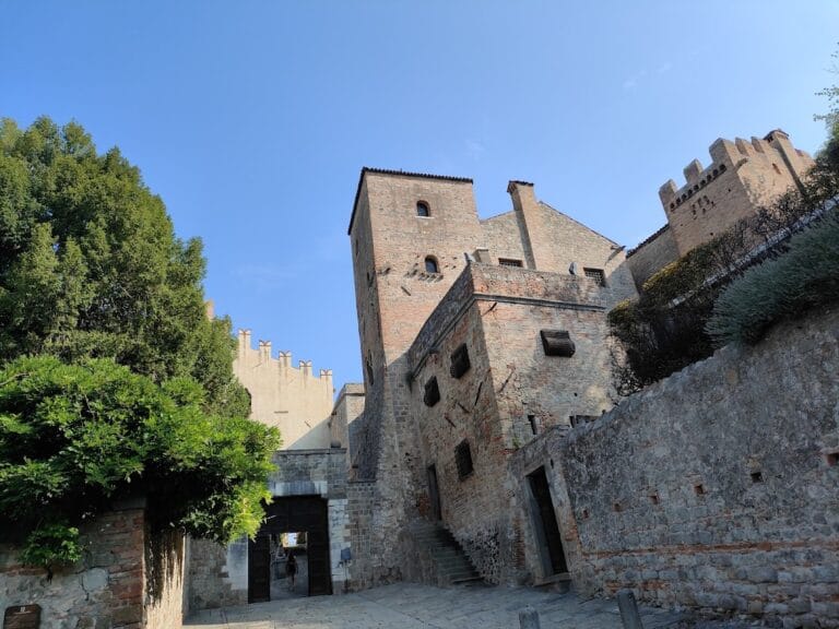
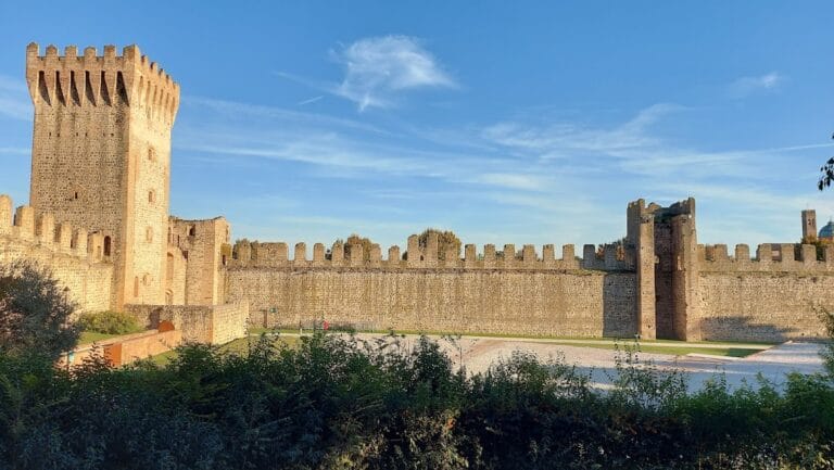
The Rocca occupies a rounded trachyte hill approximately 150 metres above sea level. Its base measures about 500 metres across, while the summit narrows to approximately 80 metres. The defensive complex developed around the top and extended down the western slopes. Its later medieval arrangement included an outer circuit with towers and monumental entrance gates, followed by four inner circuits ascending toward the summit. An elliptical wall approximately 210 metres long enclosed the summit plateau.
Federician mastio
The Federician mastio stands at the summit. Its lower section forms a truncated-pyramidal base with internal dimensions of approximately 8.5 by 9 metres. This base contained a rain-fed cistern and a chamber for draining the latrine. The tower rose through three levels to a height of about 20 metres.
Entry was made from the west through a doorway about 8.8 metres above ground level. A wooden bridge linked the entrance to a double-flight staircase attached to the Romanesque tower in front of it. Inside were two independent living rooms connected by an internal stair, two bathrooms, and a well used to draw water from the cistern.
Summit enclosure and towered residence
The summit enclosure incorporated an earlier towered residence, or domus turrita, which continued to serve a domestic purpose while also combining defensive functions. The original entrance to the fortification was probably at the northeastern corner. The portal now standing there was reconstructed in a medieval style at the beginning of the twentieth century.
Santa Giustina and associated buildings
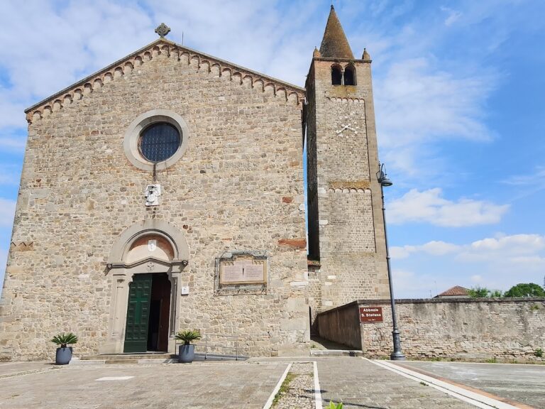
Santa Giustina originally stood on the summit before the mid-thirteenth-century construction of the mastio. It was later rebuilt halfway up the hill, where it became known locally as the Old Cathedral. The church remained a parish church, or rural ecclesiastical center serving surrounding communities, until its demolition, although settlement had already shifted mainly toward the plain.
Church building
The church was a rectangular, three-aisled structure oriented from east to west. It measured approximately 17 metres wide and 32 metres long and ended in a semicircular apse. Its pavement combined square mosaic tesserae in opus tessellatum, a technique using small pieces to form a mosaic, with geometrically cut stone slabs in opus sectile, a surface made from shaped pieces of hard material.
Crypt and cemetery
The crypt was entered from within the church through three arches supported by two central columns. Construction differences at the southwest corner indicate two building phases, an early medieval phase followed by an enlargement in the late eleventh or early twelfth century. Tombs beneath the crypt’s mortar floor point to an earlier church at the location. Outside the southern wall, a furnace was used to melt and forge iron, probably during construction of the later Romanesque church.
A cemetery occupied the area outside Santa Giustina, with burials associated with the church’s successive construction phases. Anthropological analysis examined skeletal material from approximately 80 individuals, including 20 men, four women, and seven children.
Western tower and semisubterranean building
West of Santa Giustina stood a square tower measuring 8 by 8 metres. Its exterior was built from small trachyte blocks, while the inner parts of its walls contained stone fragments set in abundant mortar. The tower dates from before Frederick II’s reorganization of the defenses.
Attached to the tower was a large rectangular building set partly below ground level. An internal wall divided it into two rooms of unequal size. Its construction technique places it in the eleventh or twelfth century, and its probable function was to house the priests and clerics who served Santa Giustina.
Lombard burials and objects
Five excavated Lombard graves were associated with four adult males and three children. The burials contained combs, knives, weapons for offense and defense, and high-quality grave goods. The assemblage indicates that some of the adult men were warriors and reflects interaction between Christian-Byzantine and Lombard traditions.
Among the objects were a small gold-sheet cross and a silver belt fitting engraved with Latin monograms. Other grave goods included swords, spears, shields, and large single-edged knives known as scramasaxes. Leather or textile belts carried the weapons and were decorated with iron or bronze buckles, belt tips, reinforcing plates, and abstract animal patterns resembling dragons or serpents.
Terraces, vegetation, and stone
The eastern slopes retain dry-stone terrace walls made from trachyte flakes. These terraces belonged to the gardens associated with Villa Duodo. The southern and southeastern terraces continue to support olive trees. The wider vegetation includes pomegranate, fig, jujube, poppy, oak, hackberry, manna ash, black locust, paper mulberry, and tree of heaven, with more than 300 flowering plant species recorded on the hill.
Rocca di Monselice is formed from trachyte, a durable volcanic stone valued for its resistance and appearance. Its resistance to water and salt, ease of extraction and working, and relatively low transport cost made it useful in buildings, roads, lagoon defenses, paving, river embankments, and railway foundations. The reforested quarry zones and altered slopes preserve the physical effects of this long history of extraction.