Fort of Beauregard: A Polygonal Fortification in Besançon, France


Site at a Glance
- Rating
- 4.4
- Popularity
- Very Low
- Country
- France
- Primary era
- Modern
- Eras represented
- Early Modern, Modern
- Civilizations
- French
- Site type
- Military
- Remains
- Fort
On this page14 sections
History
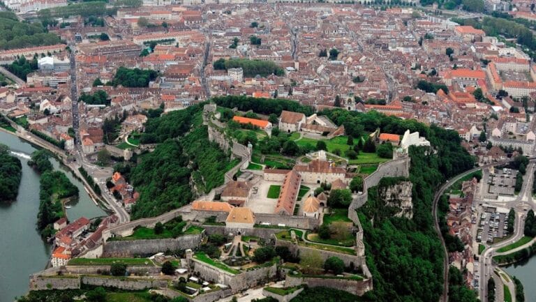
Fort of Beauregard is a fortification in Besançon, France, built in successive phases from 1791 to 1870 as a polygonal military work. It occupies a secondary summit of Mount Bregille, formerly called Mandelier and later Beauregard, above the Saint-Etienne hill and the Citadel of Besançon. From this position, artillery could threaten both the city and its principal fortress.
Strategic importance before 1814
The military value of Bregille had already been demonstrated during the siege of 1674. French forces occupied the heights, established artillery batteries, and bombarded Besançon during Louis XIV’s reconquest of Franche-Comte from Spanish Habsburg rule. The episode showed how control of Bregille could influence the defence of the city and its citadel.
Plans from 1791 show an earthen work on the site, where a small lunette à arçon, a detached defensive work, was intended to be built. The position became more urgently important during the French campaign of 1814, when Austria and other coalition forces opposed Napoleon I. On 1 January 1814, General Jacob François Marulaz was placed in charge of Besançon’s defence. He ordered buildings and fruit trees within 700 metres of the old city to be destroyed, seeking to prevent enemy ambushes. Austrian artillery nevertheless reached Bregille and threatened the citadel, and Austrian forces captured the position rapidly on 31 January.
Permanent fortification
After the conflict, Marulaz supported the completion of a permanent work at Beauregard and the strengthening of the Bregille heights. The fort was intended to support and protect Fort Bregille, which served as Besançon’s central magazine, while also defending the eastern line of the old-city fortifications between the Bregille and Saint-Pierre towers. Its responsibilities extended to the eastern front of the Battant bridgehead.
Construction resumed during the Restoration under projects developed between 1817 and 1834, and the work was completed in 1831. Land acquired next to the fort in 1841 made possible a substantial extension and modification campaign from 1845 to 1870. These successive interventions produced the fort largely in the form known today. Its restricted site encouraged the adoption of a polygonal plan, an irregular, multi-sided arrangement that could be adjusted to limited ground. The fort was regarded as the first, or one of the first, French fortifications to use this system.
Obsolescence and rehabilitation
Fort of Beauregard was completed as the Franco-Prussian War began in 1870, but it was not used in that conflict or in the First World War. No established evidence connects it with use during the Second World War. It later became obsolete and was abandoned at an unknown date after 1870.
Before the property passed to the City of Besançon, weathering and the loss of many architectural elements had left the abandoned fort deteriorated. During the 2010s, the city rehabilitated it as a public square and incorporated it into the urban landscape. The fort has no stated individual historic-monument classification. Mount Bregille is, however, within the registered historic site covering Besançon’s old centre and surroundings; the Citadel and Fort Griffon hold separate higher-level heritage designations.
A later architectural reuse study explored the fort’s integration into a contemporary thermal, health, and hotel complex of about 30 rooms. The partnership involved the Paris-Belleville National School of Architecture, the Vauban Major Sites network, and the City of Besançon. Coordinated by Philippe Prost and Jean-Marc Weil, the student proposals were exhibited at the Musée du Temps from 16 September to 31 October 2010.
Remains
Fort of Beauregard stands at approximately 314 metres above sea level on a small eminence of Mount Bregille. The hill’s terrain developed through Pliocene acid-rain processes that fractured the rock and formed underground water networks, from which the Douin and Le Moine springs originate. The fort’s compact ground plan reflects the limited summit available for construction. Its rehabilitated garden and surviving structures provide a panorama over Besançon’s old city, especially the Saint-Jean area and the La Boucle district.
Polygonal defenses
Walls, ditch, and traverse
The original fort followed a polygonal layout organized around a central traverse, a protective cross-wall or earthwork. A semi-detached escarp, the inner wall of the ditch, carried loopholes at foot level and a wall walk protected by a parapet with vertical loopholes. The ditch was paired with an earthen counterscarp, the opposing outer slope. Because the caponier, a covered structure used to fire along a ditch, was not yet employed in France when the fort was designed, the engineers addressed flanking defence through the semi-detached escarp. A strong metal grille at the bottom of its slope formed a foot-level crenel intended to obstruct attackers.
Carriage entrance and bridge
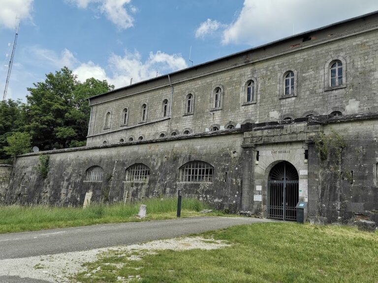
The south wall contains a carriage entrance with the inscription “Fort Beauregard — 1848” on its exterior. A small bridge once crossed the ditch at this point. Two former bridge piers survive, while the crossing has been remodelled as a small footbridge.
Buildings and circulation
Barracks
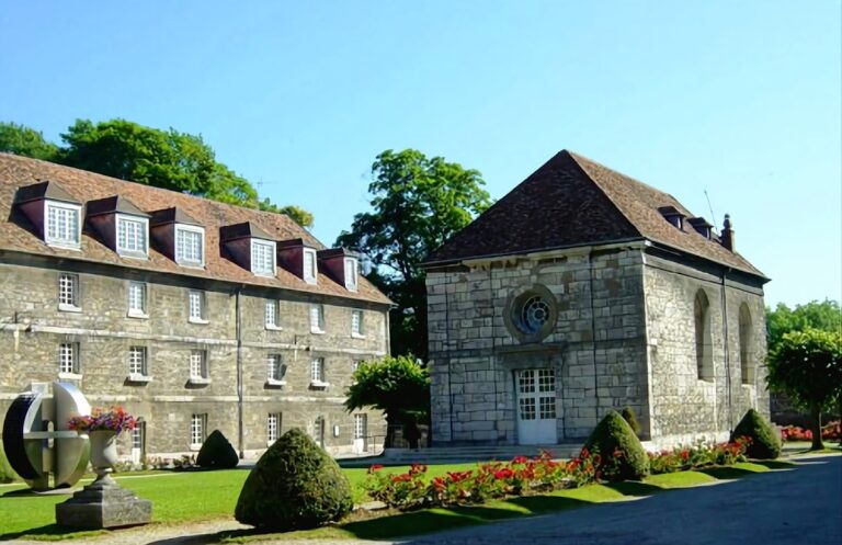
The two-storey barracks faced the city, helped close the fort, and overlooked the Doubs River. Loopholes opened along the lower level, while the upper storey had high rectangular windows and a doorway leading into the interior courtyard. The roof formed a terrace protected by a crenellated parapet.
Postern and stairways
A projecting medieval-style bretèche dominated the entrance. A postern, or small secondary entrance, reached natural ground level by a curved flight of stairs. A separate straight staircase descended towards the Doubs, providing another connection between the fort and the surrounding terrain.
Rehabilitated interior
Garden and altered defenses
The front ditch and the interior courtyard were filled up to the level of the upper parapet to create a garden. This rehabilitation removed the former wall walk, traverses, and infantry banquettes, which were raised firing steps for soldiers. The surviving arrangement therefore combines the original defensive shell with substantial changes made during the site’s later adaptation.
Rear section and casemate
The rear section includes the lateral ditches, counterscarp, entrance, courtyard, barracks, and escarp wall. A casemate, a fortified vaulted chamber, is now used as a raised viewpoint. This rear portion has been assessed as being in good condition, preserving the relationship between the fort’s defensive enclosure and its principal internal structures.
Nearby sites