Fort of Bregille: Besançon’s Nineteenth-Century Military Fortification


Site at a Glance
- Rating
- 4.5
- Popularity
- Low
- Country
- France
- Primary era
- Modern
- External website
- Open
- Eras represented
- Modern
- Civilizations
- French
- Site type
- Military
- Remains
- Fort
On this page16 sections
History
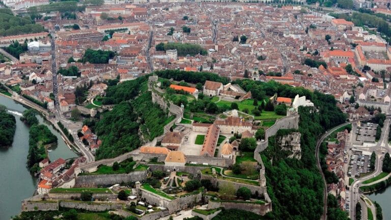
The Fort of Bregille is a military fortification in Besançon, France, built between 1820 and 1832 on the summit of Bregille Hill. At an elevation of 446 metres, it occupied a height overlooking the old city and the Citadel of Besançon, forming part of the city’s fortified network. Its design belongs to a period of transition between the bastioned principles associated with Vauban and newer nineteenth-century military techniques.
An Earlier Strategic Position
Bregille had strategic value because it dominated Besançon and the hill of Saint-Étienne, where the citadel was constructed from 1668. During Louis XIV’s conquest of Franche-Comté from Spanish rule in 1674, French troops occupied the summit and placed artillery batteries there before bombarding Besançon.
An earthwork occupied the same site near the end of the eighteenth century. Plans from 1791 show this earlier defense. During the siege of 1814, enemy forces rapidly captured the position, after which it was judged obsolete. The events confirmed the danger posed by the height to the city and encouraged the construction of a permanent fort.
The Fortification of Bregille
During the 1814 campaign, General Marulaz defended Besançon against Austrian forces positioned at Bregille and Chaprais. Austrian artillery was established on Bregille on 31 January 1814, apparently within a small earlier earthwork, and threatened the citadel. The position remained contested until 2 May 1814.
After the campaign, plans were made for a permanent fort on Bregille. Construction continued from 1820 to 1832, creating a masonry stronghold with a bastioned outline. A bastion is a projecting section of a fortification from which defenders could fire along adjoining walls. The fort’s narrower ditches, simplified outer defenses, and better-protected parapets reflected changing military practice.
King Louis-Philippe I visited Besançon from 25 to 27 June 1831 and inspected the work. During the visit, he remarked that an enemy might dig approach trenches from the Chalezeule wood. Engineers replied that their plans called for removing the limited soil cover to expose the rock beneath the fort.
Later Military Use
The fort was officially renamed Fort Morand in 1887, commemorating Charles Antoine Morand, a general of the Empire born in the region. The new name remained little used, and the site continued to be known principally as the Fort of Bregille.
Its large powder capacity gave the fort a central magazine role for Besançon. Military use otherwise remained limited. The fort did not take part in the Franco-Prussian War or the First World War because Besançon was not involved in those conflicts. Before the Second World War, anti-aircraft batteries were installed there, and during the war the fort’s military function was limited to this purpose.
Transfer to the City
After the Second World War, the army ceded the fort to the city of Besançon. Associations and children’s activity centres subsequently used parts of the complex, particularly during July and August. In 1973, during the Lip affair, striking workers from the Lip factory used the fort for meals in a temporary restaurant.
The city of Besançon owns the fort. Parts of the complex are used by an animal pound operated for the French animal-protection society and by the municipal police, while other rooms accommodate children’s activities and meetings of local associations. Interior access requires authorization from the city. The fort has not been classified as a historic monument, but it remains part of Besançon’s local heritage and its surrounding recreational landscape, which includes the natural area known as the Grand Desert and views over the city.
The Fort of Bregille belongs to the wider fortified camp of Besançon, in which at least 25 defensive works were built within a radius of about 50 kilometres. This defensive reorganization followed the development of the Séré de Rivières system after the Franco-Prussian War. The system was a late nineteenth-century French network of forts and fortified positions intended to control invasion routes and strategic passages, especially along the eastern frontier.
Remains
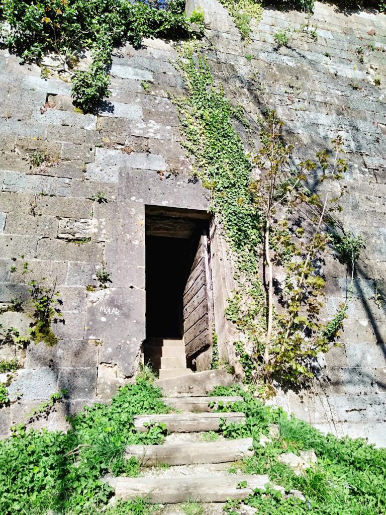
The fort occupies the summit of Bregille Hill and is constructed in masonry around an interior courtyard of about one hectare. Its defenses retain a bastioned plan with five bastions of unequal size, curtain walls, approximately 900 metres of ditches, and outer defensive positions. The arrangement of the ditches, traverses, casemates, firing positions, and covered routes reflects both the defense of the strategic height and the fort’s role as Besançon’s central powder magazine.
Defensive Fronts and Ditches
South and North Defenses
The south flank consists of three bastions joined by a curtain wall. The north flank, which formed the attack front, has two bastions linked by another curtain wall and protected by a tenaille, a low angular defensive work placed before a curtain wall or between defensive positions. This side also protected the covered way, a defended passage along the outer edge of the ditch, and a recessed place of arms at its centre, where troops could assemble.
The counterscarp, the outer wall or slope of a ditch, includes an infantry position facing Bastions II and III and a smaller position facing Bastion I. On the northern side, the ditch continues to Bastion III and reaches a large tenaille. A separate defensive sector beside the shallower ditch contains another tenaille divided by a narrow sunken passage running from the inner ditch wall to the counterscarp. A postern, or concealed passage through a fortification, blocks this route, while the remains of two stairways lead toward a former recessed place of arms.
Eastern Ditch and Bastion II
The eastern ditch has two levels. Along the right half of Bastion II, it includes a deeply cut diamond ditch, an arrangement also found at the forts of Montfaucon and Pugey. The form of this sector reflects the particular exposure assigned to Bastion II in the fort’s defensive design.
Bastion II retains embrasures, openings through a parapet for weapons, on its left flank and two rows of loopholes in the escarp wall. An escarp is the inner wall or slope of a ditch. At the end of the left flank, a gallery contains some of the fort’s finest masonry and serves eleven infantry casemates, which are protected chambers for troops. The soldiers in these rooms fired through the loopholes.
Traverses, Sortie Route, and Southern Edge
Large traverses stand between Bastions II and III. These raised shelters protected troops and equipment from artillery fire, while also serving as firing steps and marking the beginning of a postern descending toward the ditch. Bastion IV has a partly detached escarp wall on both fronts forming its right flank, and Bastion V was arranged to allow mortars to be moved and operated comfortably.
The defensive layout included a discreet sortie route from the inner courtyard into the ditch and then toward the open countryside in the direction of the Glacis near Battant. A glacis is a gently sloping area outside a fortification where attackers could be exposed to defensive fire. On the southern side, the counterscarp opens sharply toward the exterior and overlooks the Doubs. Near Bastion I, a stairway in the counterscarp ends above the drop through a timber-supported ha-ha, a concealed drop or barrier within the defensive landscape.
Gorge Front and Barracks
Entrance and Barracks
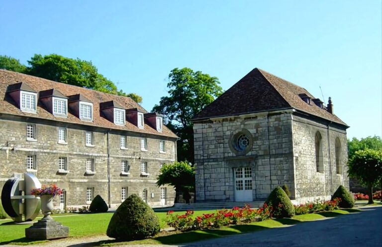
The west gorge front contains the main entrance and a substantial two-storey barracks flanked by two massive bastions. An access road reaches an esplanade before the barracks. The barracks occupies the gorge curtain several metres behind the escarp wall and has a carefully built rectangular form. Its roof was designed to collect rainwater and supply the fort’s cisterns.
The projecting wings were set perpendicular to the central sections to improve resistance to bombardment. The entrance passage has crenellated sides and a notable vault keystone across the setback between the barracks and the escarp wall. Two pulley wheels high on the facade, above the ceiling of the carriage entrance, show that the entrance was designed for a drawbridge.
Beyond a row of five loopholes, the ceiling rises abruptly by two storeys, creating a monumental porch. A wrought-iron grille and glazed openings give the entrance a restrained but imposing character. Dates carved into the fort include 1829 on Curtain IV, 1830 on the entrance porch, and 1869 on the shelter at the left side of the main central courtyard.
Courtyard Shelters
The interior courtyard covers about one hectare. Former artillery positions survive at its far end, while three traverses or shelters stand behind the fronts of Bastions II and III. The central traverse is larger than the two lateral examples, each of which contains a secondary room.
Powder Magazines
Main Magazine and Ventilation Passage
A former magazine measuring 177 square metres is isolated behind and between Curtains I and II. An earth mound behind Curtains IV and V may indicate another former powder magazine. Elsewhere, two corridors lead to a room with five squat toilets and then to a magazine designed to hold up to 40 tonnes of powder.
The 40-tonne magazine has a storage room 5.60 metres wide and approximately 15 metres long, with three ventilation openings on its left side. A ventilation passage added against the magazine contains a central passage one metre wide and five successive pairs of facing alcoves. Each alcove is 2.70 metres wide and separated from the passage by one metre. A lamp room with a single loophole and a vestibule topped by a light well reflect later modifications. A lamp room was a separate space used to illuminate a magazine without exposing gunpowder to an open flame.
The storage chamber has an ogival vault and a pronounced longitudinal return near the lamp loophole. These details belong to a carefully adapted magazine complex whose circulation and lighting arrangements were repeatedly modified.
Additional Magazines
A second magazine behind Bastion IV has an earth-covered form. Its side walls and segmental-arched storage vault are built of fired brick. A later partition with three aligned lamp loopholes reduced its capacity to 24 tonnes. A corridor connects this magazine with the lateral ventilation passages and leads centrally to its parallel lamp room.
A third magazine beneath Bastion I held 75 tonnes of powder. A fourth beneath Bastion III held 36 tonnes and is now used by the animal pound and municipal police. A fifth, simply shaped magazine near Bastion II forms part of the fort’s powder-storage system. Taken together, the magazines provided a minimum total capacity of 175 tonnes, explaining the fort’s role as Besançon’s central store of gunpowder.
Nearby sites