Nowy Dwór Castle in Wałbrzych: A Piast Frontier Stronghold


Site at a Glance
- Rating
- 4.7
- Popularity
- Very Low
- Country
- Poland
- Primary era
- Medieval
- Eras represented
- Medieval, Early Modern
- Civilizations
- Holy Roman Empire
- Site type
- Military
- Remains
- Castle
On this page10 sections
History
Nowy Dwór Castle in Wałbrzych, Poland, is a ruined medieval stronghold built under the Piast dukes of Świdnica-Jawor around the turn of the thirteenth and fourteenth centuries. It occupied the site of an earlier fortified settlement and is associated especially with Bolko I the Strict, although another attribution connects its construction with Bolko II the Small. The castle was also known as Ogorzelec, Neuhaus, and Waldenburg.
A Piast frontier stronghold
The earliest surviving reference to the castle dates from 1364–1365. It formed part of an inner chain of strongholds protecting the Silesian-Bohemian frontier and the southern boundary of the Świdnica-Jawor duchy. The fortress guarded a medieval trade route through the Pełcznica valley and helped strengthen ducal authority in a sparsely settled mountain region. It also encouraged the development of the settlement of Podgórze and served as the titular administrative seat of an estate.
After Bolko II died, the castle passed to his wife, Agnes of Habsburg. The duchy came under the Bohemian Crown in 1392, when the Bohemian monarchy assumed authority over the Świdnica-Jawor territories. By 1372, however, the castle and its district had entered the hereditary possession of the Schoff burgraves. Minor building works followed between 1402 and 1417.
Changes of ownership and military use
The Liebenthal family held Nowy Dwór from 1426, and Herman the Younger of Czettritz acquired it in 1434. The Czettritz family retained the castle, with brief interruptions, until its abandonment in the seventeenth century. The Zedlitz family possessed it approximately from 1450 to 1462, after which it returned to the Czettritz family.
The castle survived the conflicts of Bolko II’s reign, the Hussite Wars of 1419–1436, and the wars between Matthias Corvinus of Hungary and Władysław Jagiellończyk. During the 1471 conflict between Matthias and Władysław, it served as an important defensive position and already had artillery. After the death of the Bohemian king George of Poděbrady, the Czettritz party lost Neuhaus to Matthias Corvinus in 1475. Georg of Stein administered it as a royal pledge, meaning that he held the estate as security for an obligation.
Neuhaus returned to Hans von Czettritz in 1488. In 1490, the Bohemian king Vladislav II withdrew the pledge and granted the estate to Fabian von Tschirnhaus as an hereditary fief, a grant carrying inheritable rights. The property had returned to the Czettritz family by 1492.
Rebuilding, abandonment, and later estate history
A major rebuilding campaign took place at the end of the sixteenth century, but a lightning-caused fire destroyed the castle in 1581, and it was not rebuilt. Its functions were transferred to a palace erected by the Czettritz family at the foot of the hill. A Renaissance palace at Upper Waldenburg was constructed between 1606 and 1628.
During the Thirty Years’ War, the abandoned castle received bastion fortifications, which were projecting defensive works designed to support fire against attackers. These additions allowed the palace’s owners to defend themselves against armed bands during the disorder of the war, which lasted from 1618 to 1648. The castle was not used afterward and gradually became a complete ruin.
From the beginning of the seventeenth century, the owners lived in Upper Waldenburg or in a smaller palace below the castle hill. The latter building was demolished in 1882. The Czettritz family and its Dyherrn-Czettritz branch retained the estate until 1866, when Amalie Friederike Wilhelmine von Dyherrn-Czettritz inherited it. The estate then passed to the pastor Franz Gyrdt, from whom Hans Heinrich XI von Hochberg, Prince of Pless and Count of Hochberg of Fürstenstein, acquired it in 1871.
In the fourteenth century, the castle district included Hermsdorf, Waldenburg, and Weißstein. By 1682, it comprised Neuhaus, Dittersbach, Hermsdorf, Althain, and part of Bärengrund. The district and its estate farm were incorporated into Dittersbach in 1928, and Dittersbach became part of the city of Waldenburg in 1934. The ruins entered Poland’s register of historic monuments on 19 March 1960 under registration number A/684/660.
Remains
The ruins occupy the steep, rocky, conical summit of Castle Mountain at approximately 618–620 metres above sea level, south of Podgórze and within the Wałbrzych Landscape Park. The summit is formed from Permian melaphyre, a dark volcanic rock. Lower-montane beech forest covers the hill and the ground around the ruins, while small but deep valleys partly enclose the steep slopes.
Upper castle and defensive circuit
The fortress occupied a rocky ridge about 140 metres long. Its elongated, irregular quadrilateral plan followed the shape of the terrain, and the walls were built from unworked split stone. The fourteenth-century upper castle formed the main part of the complex, together with perimeter defenses and two buildings inside the walls.
Gothic gate and western defenses
The distinctive Gothic gate portal survives with two bastions. The more accessible western side was protected by a dry ditch cut into the rock. The entrance was probably positioned in the western part of the defensive circuit, and a water reservoir occupied part of the ditch.
Residential and garrison buildings
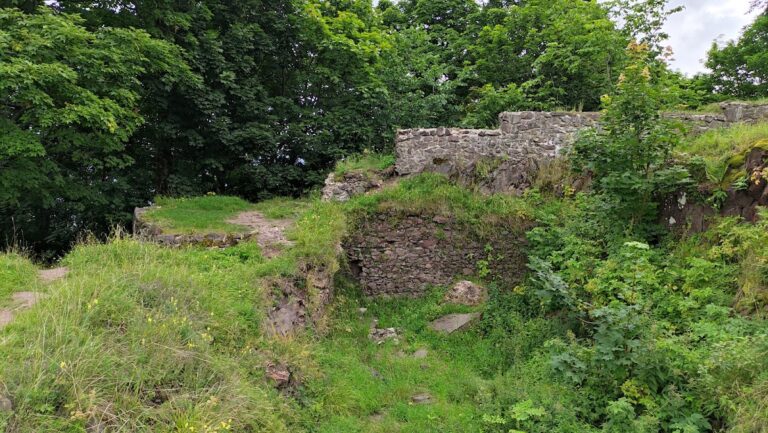
One internal building stood in the northwestern corner and measured approximately 10 by 5 metres. The other was an elongated structure along the northern wall. Together, these buildings contained stables, service facilities, and quarters for the garrison. Foundations of the residential buildings remain, along with fragments of the walls surrounding the courtyard and upper castle.
Outer tower
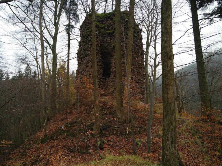
A tower stood outside the main circuit of the walls. Remnants of this structure survive among the foundations and defensive fragments of the complex.
Lower bailey and later fortifications
A lower bailey, an enclosed outer part of a castle, was added to the west during the sixteenth century. It had a roughly trapezoidal plan, with a courtyard approximately 50 metres long. The longer wall sections were strengthened at their centres. A projecting spur reinforced the southern side, while a semicylindrical bastion stood on the north.
Additional bastion fortifications were inserted during the Thirty Years’ War. The surviving remains include fragments of these defenses as well as the walls of the earlier upper castle and courtyard. Sparse beech forest now covers the sixteenth-century courtyard.
Nearby sites