Schloss Putzar: Ruined Renaissance Manor Houses in Germany


Site at a Glance
- Rating
- 4.5
- Popularity
- Very Low
- Country
- Germany
- Primary era
- Early Modern
- Eras represented
- Early Modern, Modern
- Civilizations
- Duchy of Pomerania, German, Holy Roman Empire, Kingdom of Prussia
- Site type
- Domestic
- Remains
- Manor House
On this page9 sections
History
Schloss Putzar is a ruined manor-house complex in Putzar, Germany, formed by two Renaissance buildings associated with the Schwerin family. The older Ulrichsbau began around 1545 or 1550, while the Joachimsbau was built between 1577 and 1580. Together, they reflect the development of a fortified noble residence at a former border settlement between Pomerania and Mecklenburg.
Border settlement and the Ulrichsbau
In 1306, Duke Otto I of Pomerania and Duke Henry II of Mecklenburg agreed that Putzar, a village on the Landgraben border, should receive a fortified house rather than a castle. A fortified house was a smaller protected noble residence, designed primarily as a dwelling with defensive features. It remains uncertain whether Ulrich von Schwerin built the later Ulrichsbau on the walls of that earlier structure. Ulrich von Schwerin was a Pomeranian grand court master and noble builder linked with the sixteenth-century building.
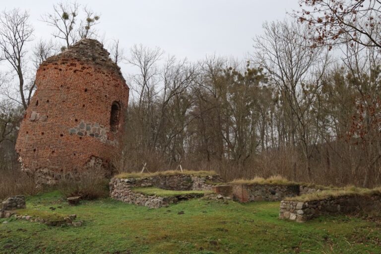
The Ulrichsbau was originally a three-storey building with a north-south axis. It began to deteriorate during the eighteenth century. In 1785, the tenant Heinrich Christoph Schröder ordered the upper storey demolished, probably so that its materials could be reused for construction.
The Joachimsbau and the Schwerin estate
After Ulrich von Schwerin died, his sons Joachim and Ludolf inherited the Putzar estate. While Ludolf was away for two years, Joachim von Schwerin commissioned a second manor house immediately beside the Ulrichsbau. The two-storey Joachimsbau was built between 1577 and 1580 in the Renaissance style. After Ludolf’s line died out, it became the only inhabited house of the pair and underwent several alterations, including the addition of a third storey in 1753.
The estate remained a residence of the counts until 1945. Christoph, Count von Schwerin, who lived from 1868 to 1923, was a lawyer and a patron of regional institutions and charitable foundations. He had no male heir, so a nephew inherited the estate. In 1939, the combined Putzar and Glien estate covered 1,133 hectares. Its agricultural operations included sheep farming with 1,027 animals, pig breeding with 517 animals, and 50 hectares of woodland.
Joachim, Count von Schwerin, who lived from 1910 to 1952, was the last owner. He was a reserve lieutenant around 1942. After the postwar land reform, which redistributed large estates in the Soviet occupation zone and ended aristocratic ownership of many such properties, he lived in Württemberg and established a family there.
Nineteenth-century transformation
Work near the manor houses began in 1815 under district administrator Heinrich von Schwerin, including the drainage of marshy ground. The programme intensified in 1840 under Maximilian von Schwerin-Putzar, a liberal politician. He created the park and inserted an agricultural building into the ruins of the Ulrichsbau.
The same period brought major changes to the Joachimsbau’s surroundings. Stables and agricultural buildings on its south side were demolished and replaced by a terrace with steps leading toward the park. Until these nineteenth-century alterations, the buildings were surrounded by a water moat crossed by a drawbridge, a bridge that could be raised or lowered across the moat.
War, postwar use, and preservation
After the Second World War, refugees and resettled people were housed in the Joachimsbau. The building was later used for storage, and its roof structure collapsed during the 1970s. The Ulrichsbau had already been deteriorating for much longer, leaving the complex as ruins of two related manor houses rather than an intact residence.
Since 1990, efforts to preserve and restore the Schloss Putzar monument ensemble and park have increased. The overgrown park was cleared, and a protective roof was erected over the Joachimsbau ruins in recent years to slow further deterioration.
Remains
The surviving site consists of the Ulrichsbau and Joachimsbau ruins within a landscape park extending from the village street toward the low-lying ground beside Lake Putzar. The two houses stand as separate but closely related Renaissance structures, while later terraces, park features, remnants of water management, and nineteenth-century agricultural alterations reveal the estate’s changing functions.
Ulrichsbau
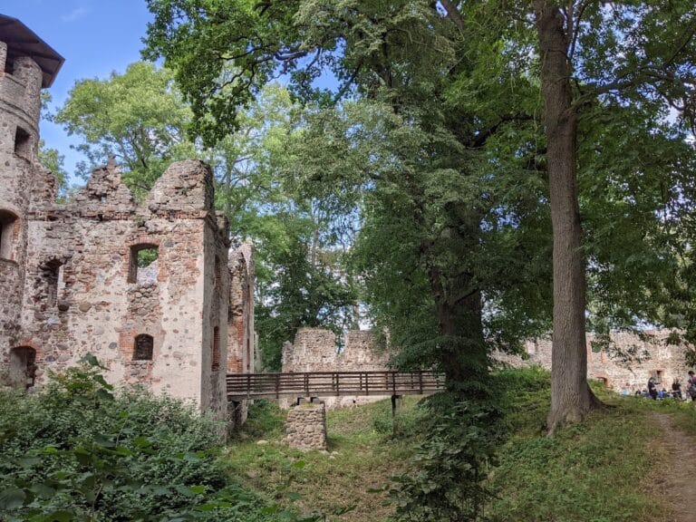
The Ulrichsbau was built mainly from fieldstone, roughly shaped natural stone used in masonry. Fired brick surrounds its doors and windows and forms levelling courses within the walls. Its north-south alignment belongs to the original three-storey building, although the upper storey was demolished in 1785 and an agricultural building was later inserted into the ruins.
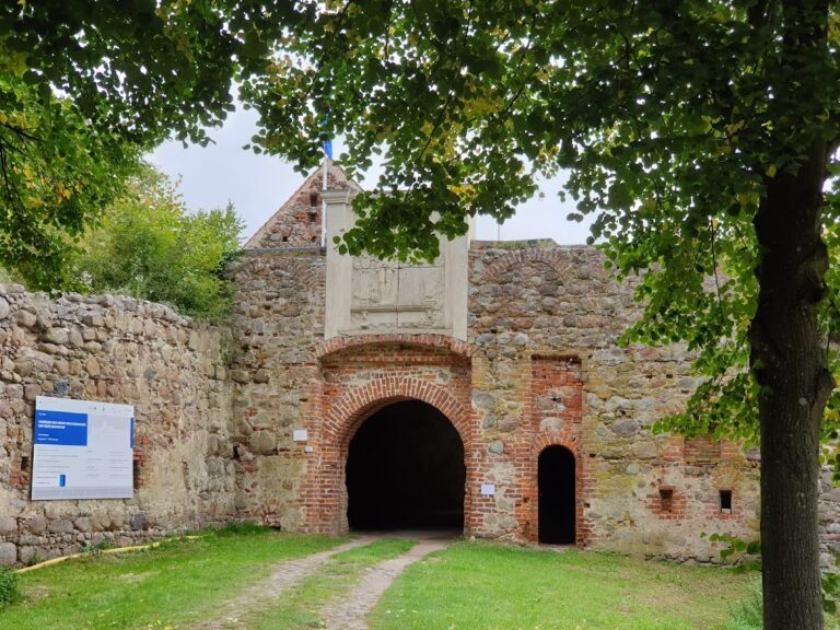
A Renaissance round-arched portal survives on the east side. Its decoration includes bar tracery, a framework of slender intersecting members, and an empty field above that probably held a heraldic or image stone. The stone may have resembled work at Spantekow Fortress, which was also built by Ulrich von Schwerin. The east facade retains curtain-arch windows and traces of corner rustication, a treatment that visually emphasizes the corners with projecting or articulated masonry blocks.
Joachimsbau
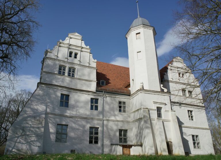
The Joachimsbau was built on an east-west axis, primarily from brick that was later covered with plaster. It originally had two storeys, with a third added in 1753. A projection on the north side resembles a stair tower and contains several small rooms, including vaulted tower rooms. In the narrow angle between the projection and the western half of the house, a spiral staircase, a stair arranged around a central axis, was partly built into the wall.
From 1753, the upper floors were reached by an oak staircase inside the building. The former southern stables and agricultural buildings were replaced during the nineteenth century by a terrace and steps leading into the park. The roof structure collapsed in the 1970s after the building’s postwar use for housing and storage. A protective roof now covers the ruins to reduce further deterioration.
Park and landscape features
The park acquired its present character mainly after 1840. It includes a lime avenue and a southern area dominated by old ash trees. The forecourt and carriage approach were laid out in 1862 according to plans by garden director Ferdinand Jühlke, and chestnut trees were planted at the entrance to the castle area in 1870. The entire park was renewed in 1872 under plans by the Kolberg garden inspector Bauck, followed by construction of a park wall in 1874.
Individual trees include numerous lime trees, a two-stemmed ash in the southern park with a trunk diameter of 2.5 metres, and a pedunculate oak on the eastern edge whose trunk reaches two metres in diameter. The oak stands on a feature known as Engagement Hill. Along the park wall, a ditch or pond extends toward the eastern part of the grounds. It no longer carries water, while a filled crossing at this location probably once carried a bridge.
Nearby sites