Neurathen Castle: A Medieval Rock Castle in Saxony, Germany


Site at a Glance
- Rating
- 4.7
- Popularity
- Medium
- Country
- Germany
- Primary era
- Medieval
- External website
- Open
- Eras represented
- Medieval, Modern
- Civilizations
- Holy Roman Empire, Kingdom of Bohemia, Margraviate of Meissen
- Site type
- Military
- Remains
- Castle
On this page18 sections
History
Neurathen Castle is a medieval rock castle in Germany, above Rathen on the northern bank of the Elbe in Saxony. Occupying the Elbe Sandstone Mountains, it is associated with the Meissen border defenses against Bohemia around 1245 under Henry the Illustrious, Margrave of Meissen. Archaeological finds point to occupation of the rocks as early as the Bronze Age, but a proposed eleventh-century foundation has no supporting written or archaeological evidence.
Origins and Bohemian rule
The castle was indirectly mentioned on 29 November 1261 in a document concerning a dispute between the Bishop of Meissen and Bohemian vassals. One of those named was Teodoricus de Raten. A 1289 agreement between King Wenceslaus II of Bohemia and Friedrich Clem, Lord of Dresden, explicitly referred to a castrum, or castle, at Rathen. Rathen remained a Bohemian fief until 1426.
Neurathen formed a double castle with lower Altrathen Castle. The names Neurathen and Altrathen are modern, and medieval documents usually do not identify which part of the paired site they describe. Neurathen is nevertheless regarded as the older castle. The name Rathen probably comes from the Old Sorbian personal name Raten or Ratan, itself a shortened form of Ratibor. A proposed connection with the Czech word for castle is considered unlikely.
Documents issued under Emperor Charles IV in 1361 referred to two castles at Rathen. Neurathen was then a free lordship held by the Lords of Michelsberg. Peter of Michelsberg symbolically submitted to the emperor by opening the gates of both castles. In 1363, Charles, acting as King of Bohemia, allowed the Michelsbergs to hold the two castles jointly with their possession at Auscha.
The Berkas and the Saxon conflict
Hinko Berka of the Duba purchased Rathen in 1406. After dividing his possessions among his five sons in 1410, he left Rathen under the control of Benesch Berka of the Duba following his death in 1419. The Berka family expanded the area’s network of rock castles and fortified watch stations while remaining in prolonged conflict with the Wettin rulers of Meissen. The Wettins were a German ruling dynasty that increased its territorial authority in Saxony during the late medieval period.
Friedrich of Oelsnitz, bailiff of Königstein and a vassal of Frederick I of Saxony, captured Rathen in 1426. Albrecht Berka of the Duba recovered it in 1438, but Friedrich of Oelsnitz took it again in 1439, probably with the support of Elector Frederick II of Saxony. A reconciliation treaty dated 10 March 1441 ended the conflict, leaving Rathen with Friedrich of Oelsnitz.
Under the Treaty of Eger, Rathen eventually passed to the Wettins, although it remained a Bohemian fief in feudal law until the Holy Roman Empire was dissolved in 1806. From at least 1450, the settlement also functioned as a customs station for shipping on the Elbe.
Destruction and later memory
Under Friedrich of Oelsnitz’s son Hans, recorded as the owner in 1466, Rathen became a robber-knight castle. Elector Ernest of Saxony and his brother, Duke Albert, besieged both castles from 1467. After more than a year, Saxon troops set the castles on fire and captured them in May 1469. Hans of Oelsnitz escaped, and his attempts to regain the castles through King Matthias Corvinus failed. Rathen was confiscated as a forfeited fief and assigned to the Pirna district. The Leipzig Partition of 1485 then gave it to Duke Albert of Saxony.
Both castles had fallen into decay within about sixty years of the capture. Neurathen was described as a ruin by 1530, although a map made by Matthias Oeder in 1593 marked “New Raden” and a watch house near Rathen. During later wars, local people used the ruined rocks as a refuge. In 1639, during the Thirty Years’ War, many residents of Pirna reportedly sheltered there from Swedish troops. A rock inscription made in 1706 during the Great Northern War records local fear of Swedish forces.
Stone pillars from the earlier western access bridge still stood in 1755, and the southeastern landward gate retained a vaulted top. Wilhelm Leberecht Götzinger recorded the gate in 1804. A tradition that the castle was destroyed during the Hussite Wars is contradicted by the documentary evidence. Legends published by Alfred Meiche around 1900 attribute its construction to the Sorbs and its destruction to conquest under Emperor Henry IV, but these traditions are historically unverified. Another later story links the nearby Honigsteine rocks with wild bees and a supposedly cruel lord of Rathen.
Access, excavation, and protection
The first major tourist access works appeared in the nineteenth century. In 1814, Auerswald arranged a 487-step stairway from Rathen to the Bastei through the Vogeltelle gorge. Around 1821, two wooden bridges connected the Neurathen Rock Gate with the rock tower called Steinschleuder. Ludwig Richter depicted them in an 1823 etching. The rock group and castle area passed from the Rathen hereditary court to the Kingdom of Saxony in 1826. That year, a wooden bridge over the Mardertelle reconnected the Bastei and the castle. Construction problems led to its replacement by the present stone bridge in 1851.
Archaeological investigation began with Herbert Beschorner in 1906. Alfred Neugebauer’s excavations from 1932 to 1934 exposed the previously buried defensive passage and recovered ceramics, tiles, and other material. Part of the passage was reconstructed to a length of 120 metres in 1934. It deteriorated during the Second World War and was repaired in 1953. Excavations from 1982 to 1984 focused on the cistern and water-supply system, while the defensive passages were reconstructed again in metal. The site subsequently became an open-air museum, including a reconstructed medieval stone-throwing engine installed in 1986 and a model of the castle before its destruction in 1469.
The castle rocks became part of the Bastei nature reserve in 1938, and protection was strengthened in 1956 through the Saxon Switzerland landscape-protection area. Since 1990, the castle has stood within the core zone of Saxon Switzerland National Park, where access is restricted to marked paths and routes. The Free State of Saxony owns the site, which Lohmen Municipality leased from 1996. Unstable rock led to its closure for safety reasons in September 2023. Lohmen ended its lease in April 2025 after no clear prospect of repairing a bridge had emerged, and the reopening date remained uncertain in December 2025.
Remains
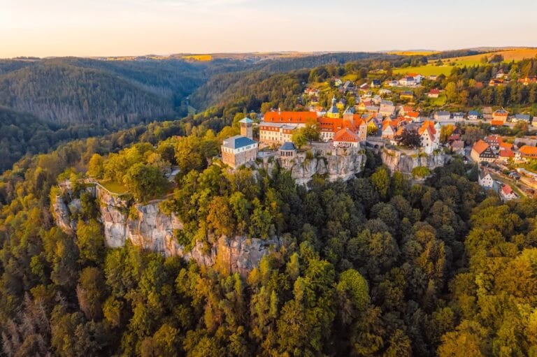
Neurathen occupies a rocky ridge known as the Bastei Reef, which extends eastward from the Bastei toward Rathen along the Elbe. The ridge reaches about 100 metres in width, while the rocks fall almost vertically for 50 to 60 metres on most sides. The eastern slope toward Rathen is less steep. The wider castle area, stretching from the Bastei to Altrathen, is about 700 metres long, while the core Neurathen castle covers approximately 220 by 100 metres.
The rocks are quartz sandstones with siliceous cement, deposited in a shallow Cretaceous sea during the Turonian and Coniacian stages of the Late Cretaceous. They belong to the large-bedded sandstone of the Schrammstein Formation, which reaches 50 to 80 metres in thickness. Natural rock platforms and narrow clefts supplied the main defensive framework. Most buildings were either carved into the stone or made as timber-framed structures, so the surviving evidence consists chiefly of masonry fragments, rock-cut rooms, beam holes, slots, and bearing surfaces for lost wooden elements.
Approaches and outer defenses
Western approach and Rock Gate
The principal western approach crossed the roughly 50-metre-deep Mardertelle gorge from the Bastei to the former castle gate. The present stone Bastei Bridge, built in 1851, follows the medieval line but stands somewhat higher. Before the nineteenth-century bridges, a steep route through the forest below the rocks also connected the castle with Rathen.
The Bastei and its approaches contained outer defensive works. Weathered slots in the rock probably held a wooden tower, and a rocky ridge near Ferdinandstein may have served as another fortified position. The Neurathen Rock Gate, now a climbing summit, was the main entrance. Its final approach included a drawbridge, and the opening was broad enough for wagons. Scrape marks left by wagon axles survive on the sides of the rock passage.
Steinschleuder and watch posts
Steinschleuder stood as an outpost near the middle of the present Bastei Bridge. Steps cut into its northern side provided access. Stone balls and floor slots were found there, but the tower probably did not contain a stone-throwing engine because there was too little room for loading and the anchoring arrangements were too small. The stone balls inside the castle are instead associated with ammunition fired by attackers during the sieges. A stone-throwing engine was a medieval siege weapon used to hurl stones.
Several surrounding rocks carried additional watch posts. On the eastern summit called Mönch, a niche known as the Mönchsloch was cut into the rock head. It is about 1.75 metres high and 1.3 metres deep, and it was probably reached by ladders and wooden walkways. Another post stood on the rocky spur called Kanapee, with views toward the Elbe valley and the Bastei.
Landward gate and outer ledge
Above the present viewpoint at Tiedgestein, another watch room was cut into the rock. Beside it stood a landward gate at the beginning of a rock cleft. Part of the gate’s masonry survives, while the arched top recorded in 1755 has disappeared. Cuttings for the gate and further barriers remain in the cleft. The narrow exposed ledge called Rahmhanke probably formed part of the outer works, running from Tiedgestein at roughly mid-height beneath the castle rocks toward the area behind the Bastei.
Defensive passage and courtyards
Defensive passage and Brückenturm
The core castle was organized around a small courtyard and a larger courtyard. A defensive passage, meaning a protected route for moving defenders and guarding approaches, ran mainly along the northwestern and northeastern sides. Near the gate leading toward the Mardertelle, it was partly doubled to strengthen the most vulnerable section. Only short blocking structures have been found in clefts toward the Elbe valley.
The present steel walkways largely follow the medieval passage. Small buildings stood alongside it, some probably serving as living quarters; pottery used in domestic life and traces of fireplaces were found there. At the northernmost point, above the Wehlgrund, stood a developed lookout. Farther east, the passage crossed several rock towers, including the Brückenturm. An approximately 11-metre-long wooden bridge once crossed that tower, and a steel bridge now occupies the same passage. Brick fragments and pottery indicate a living room on the Brückenturm.
Signal tower and castle tower
At the southwestern end of the defensive passage, facing the watch post on Mönch, archaeologists found an irregular outer masonry ring on a rock head. A second ring of clay and granite rubble stood inside it. The structure was probably the base of a timber-framed signal or watchtower. The steps leading to the rock head were added only in 1934.
A castle tower stood on a rock above the present museum ticket building. Its masonry foundation supported a timber-framed structure probably two or three storeys high. Window glass, traces of a fireplace or stove, pottery, and glass sherds point to a comparatively representative interior. A small log hut now occupies the rock. Another building stood west of the tower beside the defensive passage, where masonry remains and pottery have survived.
Hall and residential chambers
The large courtyard contained a hall of approximately 50 square metres, originally two storeys high. Excavations in the early 1930s exposed its cellar, which held a roughly two-metre-thick layer of fire debris. Wood remains, nails, and fired clay show that the upper hall was timber-framed over the cellar. Reconstructed ceiling beams and fittings indicate its approximate proportions.
A second chamber adjoined the hall. A stove and fragments of window glass suggest another representative living space. Farther southeast were the room called the Swedish Room, named after the 1706 rock inscription, and a chamber formerly interpreted as a castle chapel. A cross carved above its stairway and a wall niche suitable for sacred objects support that interpretation, but stove tiles and a stove foundation make another heated residential room more likely.
Kitchen and small courtyard
The probable kitchen occupied the highest point between the hall and the defensive passage, east of the hall. It consisted of a rock-cut room about 6 by 5.6 metres across, with its open sides enclosed by timber framing. Excavations in the gorge below recovered pig, deer, and cattle bones together with broken tableware. The small courtyard north of the kitchen and south of the Brückenturm has not been satisfactorily reconstructed and can be viewed only from the defensive passage.
Water supply
Cistern
The cistern lies in the large courtyard below the castle tower. Since the sandstone rocks had no natural spring and the small elevated platform could not support a practical well, the castle collected roof runoff in a constructed reservoir. Water passed through a gravel bed before reaching the drawing point, a filtration arrangement considered unique among the rock castles of Saxon and Bohemian Switzerland.
A funnel cut into the sandstone floor is 0.78 metres deep and 2.40 metres wide at the top, with a volume of about 1.18 cubic metres. The lower part measures 4.10 by 2.4 metres, while at two metres above the lowest floor it measures 3.75 by 5.60 metres. The cistern is 6.87 metres deep on the west side and 6.32 metres on the east. Its maximum capacity was about 135,000 litres, making it the largest water-collection basin in a rock castle in Saxon Switzerland.
The funnel probably collected the final reserves of water while separating sediment and other impurities. Grooves leading toward it show that the basin was cut directly into the rock. Sandstone masonry on the north and south sides increased its capacity, and a roof protected the stored water from contamination. Water was apparently drawn through a lower opening into a gravel channel, where it was filtered before reaching the outlet. A wooden tap or stopper was probably fitted at both the cistern opening and the outlet.
Archaeological finds and conservation
Excavations have produced material from the Bronze Age through the late medieval period. Bronze Age finds include scattered pottery and a granite millstone, with further pottery recovered at the northern foot of the rocks toward the Wehlgrund. Thirteenth- to fifteenth-century material includes pottery from Bohemia, especially northern Bohemian workshops, including fragments of Lewin ware. Later medieval finds include stove tiles and glazed vessels in several colours, as well as bricks, roof tiles, fired clay, charcoal, nails, door fittings, and other building materials.
Fire debris from the destruction in 1469 contained weapon fragments, including stone balls and arrowheads. Two swords found in the nineteenth century and two small medieval clay figures excavated in 1934 are among the most notable discoveries. The figures, a Madonna and a cradle with a child, were probably fourteenth- or fifteenth-century votive offerings. A spindle whorl was found in the courtyard in 1982.
The open-air museum route presents the surviving beam slots, rock-cut chambers, masonry, reconstructed and roofed cistern, and stone balls associated with medieval siege engines. A model shows the probable appearance of the castle before 1469. The reconstructed walkways, renewed in 1953 and 1984, are made of steel, and existing medieval steps were generally covered with steel steps for protection. The rock-cut rooms and passages, rather than the lost wooden buildings, provide the principal surviving physical evidence.
Sandstone weathering remains a major conservation problem. In 1936, a fallen rock bearing beam-slot traces had to be blasted away. On the northern side, the original cistern outlet contributed to erosion and undermined the cleft wall built toward the Wehlgrund. Endangered areas are closed to foot traffic, while the wider castle remains subject to protection and safety restrictions.
Nearby sites