Château de Rochebaron: A Gothic Feudal Castle in France


Site at a Glance
- Rating
- 4.5
- Popularity
- Low
- Country
- France
- Primary era
- Medieval
- External website
- Open
- Eras represented
- Medieval
- Civilizations
- Unclassified
- Site type
- Military
- Remains
- Castle
On this page10 sections
History
Château de Rochebaron is a ruined medieval castle in France, above Bas-en-Basset, whose surviving Gothic ensemble largely reflects rebuilding in the early fifteenth century. It stands on a rocky spur between the historic territories of Velay and the former County of Forez. During the feudal period, the castle administered a seigneurial district known as a mandement, a territory governed from a castle, that covered most of the former parish of Bas and extended into parts of Monistrol and Merle.
Early lordship and contested allegiance
The castle is first recorded in 1173, when it was also identified as the seat of the district. The Rochebaron family was associated with the site by at least 1163 through Pons de Rochebaron, the earliest securely documented member of the lineage. Bas and its surroundings had earlier belonged to the Carolingian County of Velay, and the village served as the center of a local administrative district.
Rochebaron’s feudal position remained uncertain for centuries. From the fourteenth century, authority over its dependencies was divided between the Counts of Forez and the count-bishops of Le Puy, whose jurisdiction included the parish of Bas. This contested arrangement followed the disappearance of the first feudal County of Velay around 1163, after royal intervention against rebellious regional lords. The district gradually moved from the fiscal and judicial sphere of Velay into that of Forez, although an intermediate jurisdiction continued to be known as the ressorts of Forez or Velay. By the fifteenth century, the arrangement had been established within Forez.
In 1214, King Philip II Augustus granted possession of the castle to Robert de Mehun, bishop of Le Puy from 1213 to 1219, with the obligation that he acquire it. The grant probably followed a revolt by local lords after Brocard de Rochebaron was removed from the episcopal office to which he had been elected in 1213. Pope Clement IV supported the grant with a papal bull in 1264.
The Rochebaron lords first rendered homage, the formal act by which a vassal acknowledged dependence on a superior lord for a fief, for part of the district in 1248. Under Pons de Rochebaron, this portion included Bas and Basset. From 1325, the remainder was rendered to the Counts of Forez. In that year, Érail I de Rochebaron paid homage to Count Jean I de Forez for the castle and a substantial part of its district, including Ranchevoux and Chanteloube. Lands such as Naves and Crémerolles appear to have been held as allods, meaning property held without that feudal dependence.
Fifteenth-century reconstruction
During the 1320s and 1330s, the lords of Rochebaron faced accusations of felony, disputes over jurisdiction, renewed demands for homage, and proceedings involving Érail I. The castle’s political importance was therefore tied not only to its defensive position but also to the competing jurisdictions of Velay, Forez, and the bishopric of Le Puy.
The fortress was probably reconstructed and modernized at the beginning of the fifteenth century on the foundations of an earlier castle. The initiative is most likely associated with Érail II de Rochebaron, whose lands had expanded into Gévaudan. During the Hundred Years’ War, the prolonged conflict between the English and French crowns, he became councillor and chamberlain to John the Fearless, Duke of Burgundy. His political ambitions and conflicts with Armand X de Polignac weakened his allegiance to the Counts of Forez and Velay and to the count-bishop of Mende, for his possessions in Gévaudan.
A document from 1402 mentions a square master tower, probably represented by the surviving triangular tower. A second major tower, probably the present large circular tower, was newly built shortly before 1419. The reconstruction may not have continued beyond that date. Érail II’s son, Guigues or Guyon II de Rochebaron, died at the Battle of Verneuil in 1424, bringing the senior Rochebaron line to an end.
Guigues or Guyon II’s only descendant was Antoinette, who married Louis de Chalencon ten years after her father’s death. Their marriage founded the Chalencon-Rochebaron branch. The first charter to designate Louis de Chalencon as lord of Rochebaron dates from the 1460s.
Settlement, decline, and preservation
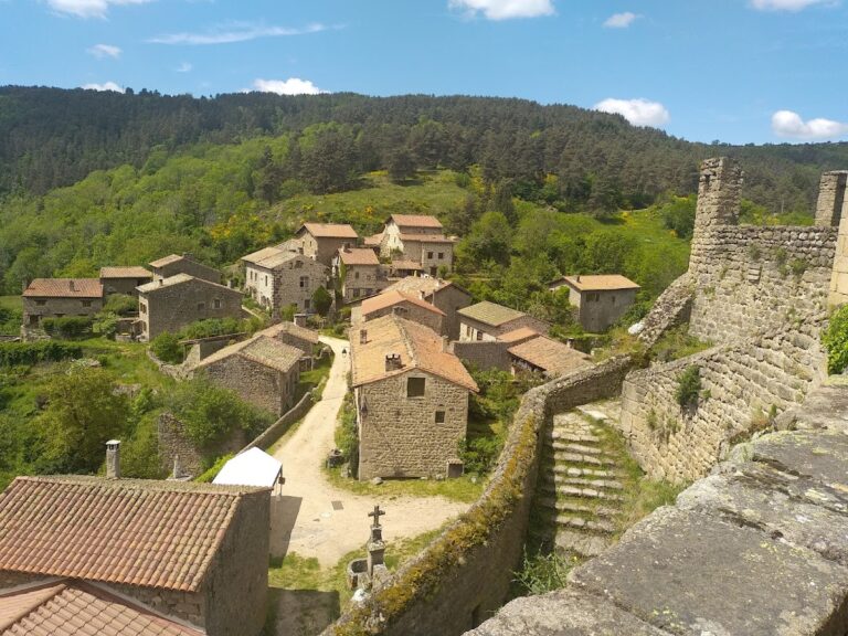
During the early modern period and into the early twentieth century, Rochebaron remained the center of its district and supported a modest settlement. Houses in the lower bailey, the outer fortified area, were used by servants, minor local nobles, and castle officers, and also as refuges for inhabitants of the district. Some of these houses are documented from 1457, and they gradually formed a hamlet.
Around the middle of the seventeenth century, the La Rochefoucauld family acquired the lordship through its alliance with the d’Isserpens, or des Serpents, who had inherited it from the Chalencon-Rochebaron branch. The La Rochefoucauld rarely occupied the castle thereafter, and the owners largely abandoned it. Even so, an eighteenth-century account by Louis de La Rochefoucauld described two large towers, apartments, service rooms, strong walls, and inhabitants living within the enclosure.
The chapel and two towers continued to receive minimal maintenance, probably because they retained a prison function. In 1743, Pierre-François de Giry described the castle as already ruined, while also noting a farmer’s house, a hay barn, granaries, cellars, a chapel with its old ornaments, and two prison towers. The castle had therefore entered a partial ruinous state by the first half of the eighteenth century.
During the French Revolution, the chapel dedicated to Saint Anthony was systematically pillaged by two workers sent there by members of the district. After the Revolution, and continuing until the middle of the nineteenth century, major deliberate demolitions took place to recover building materials. A volunteer association has worked to preserve and present the castle since 1972. Château de Rochebaron has been protected as a French historic monument since December 1951.
Remains
The ruined castle crowns a rocky spur approximately 1.5 kilometres northwest of and above Bas-en-Basset, at the northern edge of the Haute-Loire department. Its surviving complex is generally Gothic in character and forms a large early-fifteenth-century ensemble built on the foundations of an older fortress. An elongated outer enclosure, roughly rectangular and measuring about 200 by 50 metres, follows an east-west axis. Within it, the lower bailey occupied much of the western area, while the castle proper stood on the rounded summit at the eastern end.
Outer enclosure and lower bailey
The outer perimeter is entered through a fortified gateway flanked by two small towers. The western three-fifths formerly contained most of the lower bailey and later the castle hamlet. Few traces survive there, and the western wall has not yet been uncovered, cleared, or developed for presentation.
The eastern two-fifths are enclosed separately. Their southern part contained the remainder of the lower bailey, including additional houses and the seigneurial barn. One of the houses has been restored and serves as a reception building. The northern part contains the castle proper, which occupies the highest portion of the spur within another set of enclosing walls.
Central castle and terrace
The central castle formed a densely built residential and defensive core at the summit. A raised terrace lies 3 to 5 metres below it and surrounds the core on the north, south, and east, where the natural slope provided greater protection. Fairly straight curtain walls enclose the terrace, including a long surviving section on the southern side.
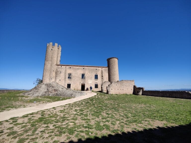
On the more exposed western side, the enclosing wall joins the triangular tower and two circular corner towers. The circular tower overlooking the access path is taller and more strongly built than the other. It was maintained until the end of the eighteenth century and remains the better preserved of the pair.
Gatehouse and chapel
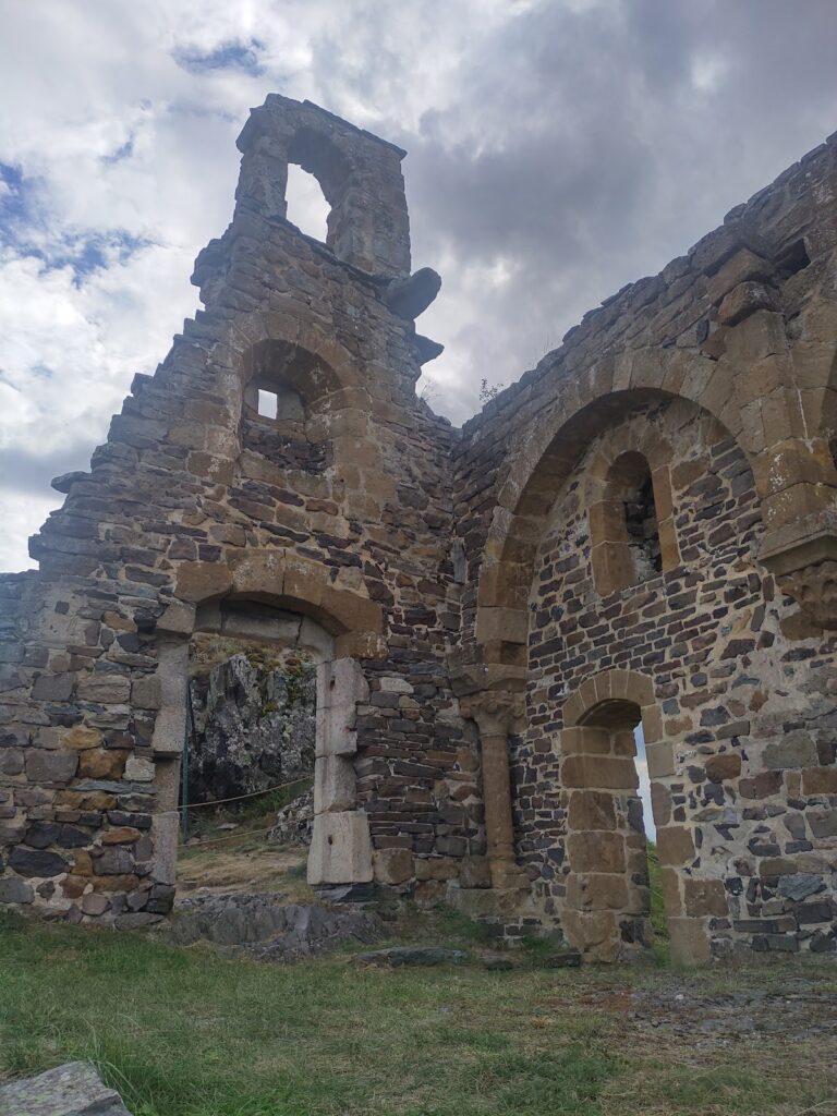
The southern side of the central core retains a two-towered gatehouse together with the southern and western sides of the castle chapel. The foundations of the chapel and the adjoining turreted gateway may predate the Hundred Years’ War and may extend back to the thirteenth century. Their masonry blocks are almost twice the size of those used in the rest of the elevations, supporting this earlier attribution.
The facade joining the gatehouse and chapel appears to have been built in several closely spaced stages. Its architectural characteristics place it in the fifteenth century, approximately contemporary with the large circular tower. The general plan of the central core was inherited from the earlier castle and retained during the Gothic rebuilding.
Triangular and circular towers
The triangular tower incorporates an older collapsed tower. Its northeastern corner consists of the surviving remnant of that earlier structure, preserved over its full height. The tower probably represents the square master tower mentioned in the document of 1402.
The large circular tower is connected directly to the triangular tower by a straight section of curtain wall. Its height and relationship to the central core indicate that it functioned as a second master tower rather than simply as a corner tower. It is sometimes described as a keep, the principal fortified tower of a castle, and its former prison use explains the name “Prisoners’ Tower.”
Surviving fabric and later loss
The visible ruins include the chapel’s southern facade, the adjoining turreted gatehouse, and the two high towers known as the circular and triangular towers. Most of the other walls survive as scattered foundations or low wall bases. The chapel was already visibly ruined by about 1850, although a view from that period still showed roof structures on the gatehouse turrets and upper structures above the machicolations, projecting defensive features with openings through which defenders could act against people below, on the large circular tower.
The 1841 cadastral plan depicted the chapel, the two gatehouse turrets, the two large towers, and a third northern corner tower as roofed buildings. It preserves a record of the complex before the later loss of additional fabric and helps establish the changing physical condition of the surviving castle.