Clavering Castle: A Medieval Fortified Manor Centre in Essex
Site at a Glance
- Rating
- 4.1
- Popularity
- Very Low
- Country
- United Kingdom
- Primary era
- Medieval
- Eras represented
- Medieval
- Civilizations
- Anglo-Saxon, Norman
- Site type
- Military
- Remains
- Castle
On this page16 sections
History
Clavering Castle is a medieval fortified site in Clavering, Essex, United Kingdom, built no later than 1052 and associated with Anglo-Saxon and Norman fortification. Its surviving ringwork and earthworks stand on a defensive site that had earlier been occupied by a British Iron Age fort and a pre-Conquest settlement. The date of the surviving artificial works remains uncertain, with some features possibly belonging to the twelfth century or slightly later.
Iron Age and Pre-Conquest Occupation
The site first served as a defended settlement during the British Iron Age, the period before the Roman conquest when communities in Britain widely used iron tools and weapons. Anglo-Saxon occupation later built over the earlier fort, followed by the Norman development of the castle. Archaeological evidence also identifies a settlement at the site before the Norman Conquest, William the Conqueror’s conquest of England beginning in 1066.
The Castle of Robert FitzWimarc
Clavering Castle has been identified as one of the strongholds to which the French faction at the court of Edward the Confessor fled in 1052. Edward was the English king who ruled until 1066. The association connects the site with Robert FitzWimarc, a French courtier and close supporter of the king who became the first known Lord of Clavering named in the Domesday Book of 1086, the survey of land and property made for William the Conqueror’s government.
The “Robert’s Castle” listed in the Domesday Book is thought to refer to Clavering Castle. During the medieval period, the site became the centre of the local manor, a landed estate and its administrative and economic centre. People lived within the castle complex, and pottery production took place there. Animal bones and skeletons further indicate domestic occupation.
Water Management and Later Use
The River Stort was regulated around the castle through channels, artificial ponds, and other earthworks. The water system fed the moat and was connected with a former mill, although the date of the mill-related works has not been established. These features formed part of the wider medieval complex associated with the castle.
After the fourteenth century, the manor moved elsewhere and the castle site was probably used only for agriculture. Traces of its walls remained visible in the eighteenth century. Clavering’s first map, made in 1783, marks an orchard on the site.
Investigation and Protection
A sandstone coffin discovered in the churchyard in 1923 was believed to have held the remains of one of the Lords of Clavering. It was found in a trench about 60 centimetres deep near the former castle moat, probably close to the site of a chapel attached to the castle. After examination, the coffin was reburied.
Aerial photography and archaeological survey later clarified the extent of the castle and its surrounding buried structures. In 2005, volunteers from the Clavering Landscape History Group worked with archaeologists to produce a detailed survey. The castle is now a legally protected monument.
Remains
Enclosure and Ringwork
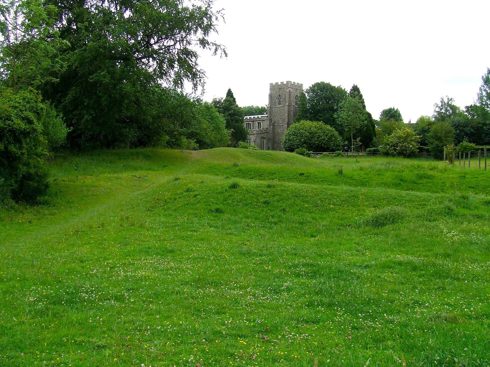
The surviving earthwork has a roughly rectangular plan measuring about 150 by 100 metres. It formed an enclosed interior courtyard at the same level as the surrounding ground. The principal entrance lay at the southeastern corner. Uneven ground inside the enclosure indicates buried structures, probably the foundations of buildings that once occupied the protected area.
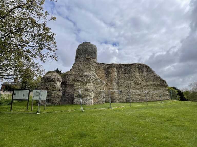
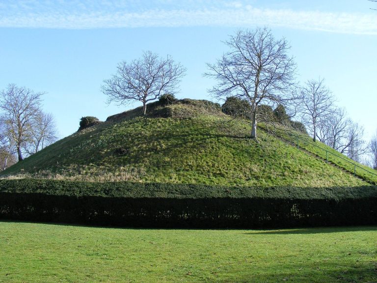
The castle was probably a ringwork, a small fortified enclosure formed by a bank and ditch, usually with a timber palisade and buildings inside. The surviving bank and earthworks belong to an unusual group of Anglo-Saxon and Norman fortifications of this kind. The mound, enclosure earthworks, and buried structural traces remain identifiable within the site.
Moat and River Setting
Moat
A ditch or moat about 26 metres long and 5 metres deep is the main surviving defensive feature. It remains partly filled with water and forms part of the enclosing earthworks. The River Stort was diverted to supply it, linking the defensive boundary with the wider water system.
River Stort
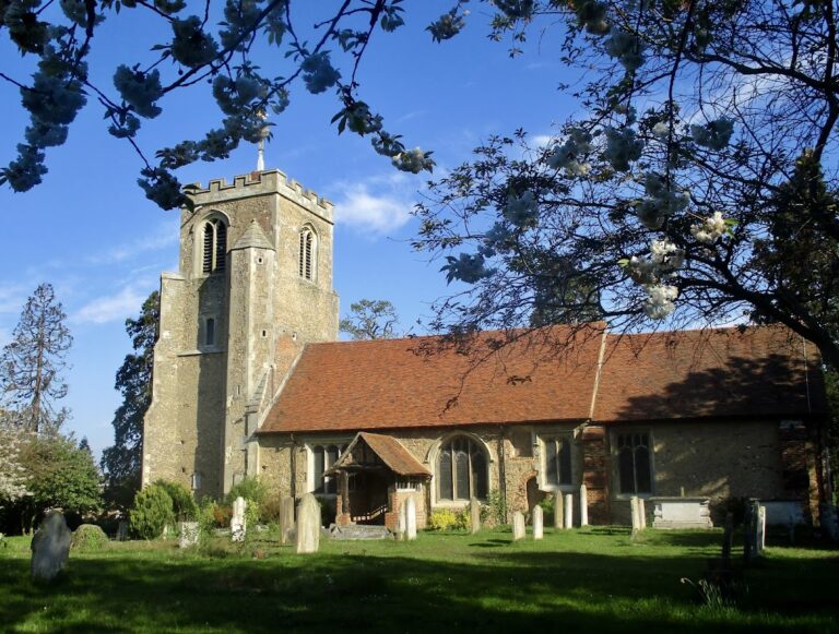
The castle stands on the southern bank of the River Stort, which flows around its northern side. The site is approximately 50 metres north of St Mary and St Clement’s Church. Channels, pond bays, and artificial banks extend the water-management landscape beyond the enclosure.
Waterworks and Mill Features
Artificial Banks and Ponds
Additional earth banks, channels, pond bays, a dam, and a pond extend for about 200 metres west of the castle along the riverbanks. Further artificial banks, channels, and water-collection features occur to the north. Together, these works show how the castle’s surroundings were shaped to control and retain water.
Watermill
The wider complex includes the remains or site of a watermill associated with the regulated river system. The castle, moat, bridge, buildings, earthworks, dam, pond, and watermill belong broadly to the period from 1066 to 1539.
Archaeological Finds
Pottery Production
Archaeological evidence places a pottery workshop within the site. Its presence, together with animal bones and human occupation evidence, helps define the castle as a lived-in manor centre rather than only a defensive enclosure.
Sandstone Coffin
The coffin found in 1923 was carved from solid sandstone. Its cover measured approximately 2.1 metres long and 0.6 metres wide, while the cover, sides, and base were each about 152 millimetres thick. It contained a well-preserved human skeleton. The skull was described as belonging to an intellectually developed individual, and the teeth were in excellent condition. A broken end of the lid indicates that the coffin had previously been opened and the burial disturbed.