Burg Mark: The Medieval Seat of the Counts of Mark in Germany



Site at a Glance
- Rating
- 4.5
- Popularity
- Very Low
- Country
- Germany
- Primary era
- Medieval
- Eras represented
- Medieval
- Civilizations
- Holy Roman Empire
- Site type
- Military
- Remains
- Castle
On this page17 sections
History
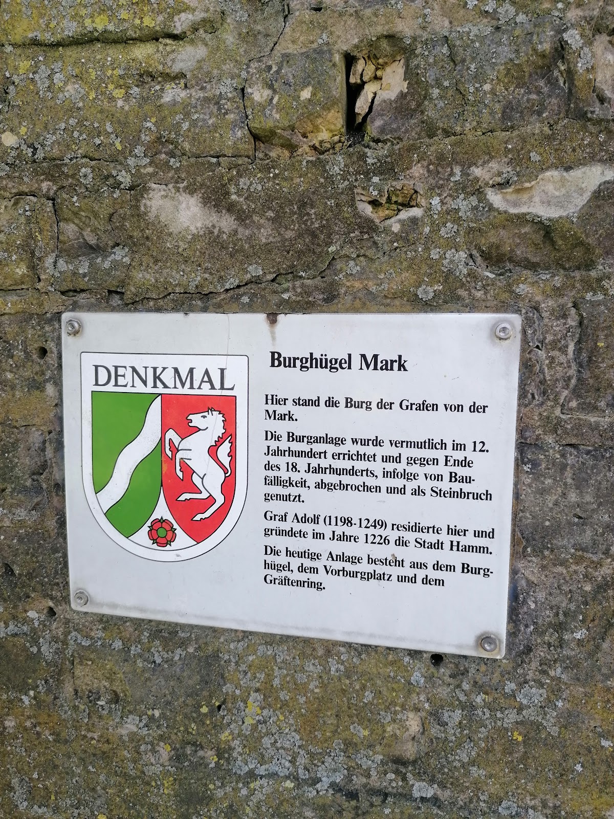
Burg Mark, also called Haus Mark, is a medieval lowland castle in Hamm, Germany, established around 1200 as a territorial lord’s residence and seat of the Counts of Mark. Its remains, known as Burghügel Mark, preserve the earthworks of a major castle complex associated with the formation of the County of Mark in Westphalia.
Origins and the Counts of Berg-Altena
The beginnings of Burg Mark are uncertain. The future castle hill belonged to the Oberhof Mark, also called the Schultenhof, whose lands included the site of the later Pankratius Church. The Oberhof itself stood near the church rather than on the hill. If an earlier structure occupied the mound, it was probably only a small farmstead, perhaps surrounded by a moat. Archaeological evidence does not support the presence of a large twelfth-century motte.
Friedrich of Berg-Altena acquired the Oberhof, the church, and their associated possessions between 1170 and 1198. These possessions included the land on which Burg Mark was later built. One plausible reconstruction identifies an earlier holder, Rabodo of Mark, with the nobleman Rabodo of Rüdenberg. In 1169 or around 1170, Rabodo sold the estate to Philipp of Heinsberg, Archbishop of Cologne, for 400 marks and received it back as a fief. Papal confirmations in 1178 and 1184 listed Burg Mark and Rabodo’s freehold possessions among the property of the Cologne Church.
The precise transfer of the estate from Rabodo or the archbishop to Friedrich remains uncertain. It may have resulted from an archiepiscopal grant, an approved transfer of feudal rights, or a later acquisition connected with the Cologne archbishop or Friedrich’s steward. The evidence does not establish that Friedrich simply enlarged an earlier castle belonging to Rabodo.
Friedrich’s position at Mark was connected with the territorial ambitions of Philipp of Heinsberg, whose ecclesiastical principality was also a major power in Westphalia. Friedrich supported Emperor Frederick Barbarossa during the conflict with Henry the Lion, the powerful Duke of Saxony who opposed the emperor. After Henry’s defeat, Philipp received the Duchy of Westphalia, and Friedrich’s possession of the Mark estate may have been a reward for his loyalty.
Friedrich also had a personal reason to establish a residence on land under his sole control. His inheritance dispute with his brother Arnold began after their father Eberhard I divided the family inheritance in 1173 and continued until shortly before Friedrich’s death in 1198 or 1199. Arnold controlled part of Altena Castle and later sold his share to the Cologne archbishop. Burg Mark was probably established shortly after 1198, before 1200 in the most plausible reconstruction, and may have been intended for Friedrich’s son Adolf.
Adolf I and the formation of the County of Mark
Adolf I of the Mark was the first count to make Burg Mark his seat. By 1202 he styled himself Count of the Mark, and the castle became one of the bases from which the family consolidated its territorial power. Although the construction is sometimes attributed to Adolf, the most plausible interpretation places the foundation under his father Friedrich. Adolf was probably born considerably earlier than the traditionally cited date of 1194, possibly around 1181 or 1182.
The nearby Pankratius Church became associated with the family after the Counts of Berg-Altena-Mark established the cult of Saint Pancras in the region. It later served as the family church of the Counts of Mark and their castle. In 1251, during conflict with the bishops of Münster, Count Engelbert I of the Mark ordered the church tower demolished and replaced by a lower structure. A tall tower might have been occupied by attackers and used to fire on Burg Mark.
Adolf founded the town of Hamm in 1226 and established a fortified residence there, the city castle of Hamm. Burg Mark, Hamm, Adolf’s Altena possessions, and the newly built Blankenstein fortress formed the territorial framework of the later County of Mark. Twelve castle-men were stationed at Burg Mark, a larger number than at Altena or Blankenstein. These mounted military retainers also held citizenship in Hamm and had the right to participate in the town council.
The conflict between Adolf I and Dietrich of Altena-Isenberg ended in 1243. Dietrich retained possessions north of the Lippe and founded the County of Limburg, while Adolf consolidated the County of Mark. Burg Mark is explicitly described as a castrum, meaning a castle or fortified stronghold, in documents of 1256 and 1265 issued in connection with Welver Abbey.
During the thirteenth century, the castle normally housed about ten to fifteen castle-men under the command of the count or his steward. They formed a legally organized association with their own seal and enjoyed jurisdictional privileges. Disputes involving them were heard in the castle court. The estate also included the Oberhof Mark and dependent farms. Its lord held ownership rights in the common Mark, grazing rights for animals kept at the castle, fishing rights in the Geithe stream and the Lippe, the exclusive right to hunt ducks in those waters, the right to keep pigeons, and hunting rights throughout the Amt Hamm, a territorial administrative district.
Decline, destruction, and archaeological investigation
Burg Mark remained the principal residence of the Counts of Mark until 1391. The union with the County of Cleves then shifted the family residence to the Lower Rhine. No major new construction followed, and maintenance declined. Hamm briefly became a residence again from 1437 to 1461, but its count used the city castle rather than Haus Mark. The castle-men finally left in 1507.
From 1450 until the end of the sixteenth century, the Dukes of Cleves repeatedly pledged Haus Mark to creditors. The pledge holders were formally expected to maintain the property, but generally concentrated on leasing its lands and allowed the buildings to deteriorate. In 1464, Duke John I of Cleves and Count of the Mark commissioned Lubert Torck to keep eight armed men at the castle. By the sixteenth century, however, Burg Mark no longer had a permanent garrison. Troops were to be brought in only during wartime.
An inspection in 1595 found the buildings, bridges, gates, chapel, walls, and wall walks in serious disrepair. The long stable had collapsed, the chapel walls were bulging, and the principal residential building leaked badly. Its wooden stair was unusable, while the wall walk had fallen into ruin.
Around 1600, the last Count of the Mark transferred the castle to the Reck family for 1,500 Reichstalers to settle unpaid salary, clothing, and other debts. In 1601 the pledge passed to Margarete Ovelacker and later to the Landsberg family. The Landsbergs held Haus Mark without living there and undertook some repairs, but repeated military occupations after 1609 interrupted the work.
After the death of the last Count of the Mark in 1609, Burg Mark came under Brandenburg rule. From 1616, probably in a vaulted room of the palas, it served as a prison. During the Thirty Years’ War, the castle was repeatedly occupied and plundered by rival forces. Occupations between 1622 and 1624 destroyed earlier repairs. By 1631, rooms, stairs, doors, windows, timber, roofs, the gatehouse, chapel, stable, fences, and sections of the walls had been destroyed. Further military activity in 1632 burned the remaining wooden parts.
The outer bailey continued for some time as an agricultural enterprise. Brandenburg authorities eventually took over the estate and leased it out. In 1688 it still comprised 369.5 Morgen, 23 Ruten, and 180 Schuh according to local measures of land area and length. The chapel, built under Adolf I and dedicated to Saint Anthony, continued to serve Reformed Christians as an emergency church during the seventeenth century.
The ruined castle was increasingly used as a quarry. In 1772, General Karl Friedrich von Wolffersdorff ordered the remaining buildings demolished, and 130 wagonloads of stone were removed for barracks at Hamm’s Westentor, completed in 1774. The estate became a hereditary leasehold domain in 1777. Some vaults still survived in 1803 and had apparently been used during the first half of the eighteenth century as a workshop for counterfeit local three-penny coins. In 1803 the vaults and almost all remaining foundations were broken out.
The state sold the property in 1819 to Johann Vorster, a major and domain rentmaster. He also acquired the neighboring Kentrop estate in 1824. The property remained privately owned from 1819 until 1935, or possibly 1938, passing among the Vorster, Graevemeyer, Loeb, and Brockmann families. Agricultural buildings occupied part of the outer bailey into the 1930s.
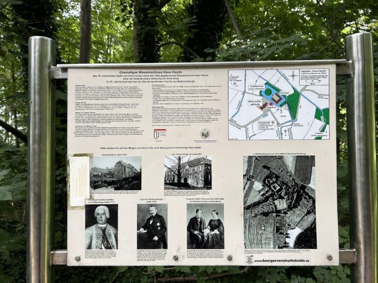
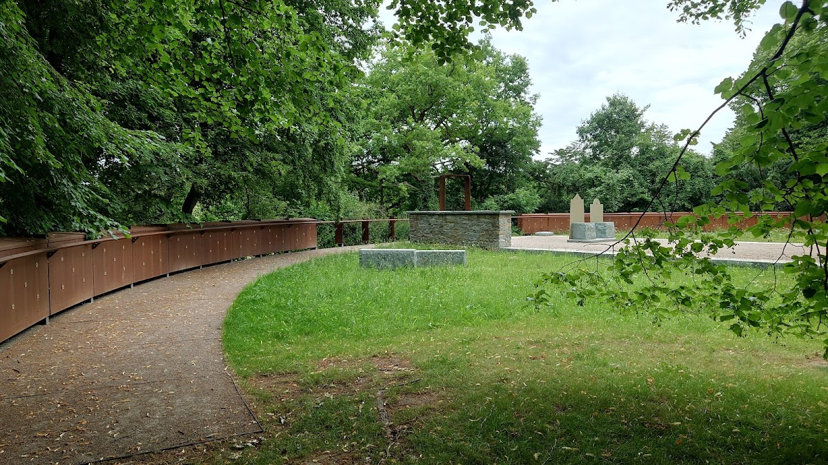
Excavations in the 1930s recovered a bronze spur from the main castle. Extensive excavations directed by the medieval archaeologist Uwe Lobbedey in 1973 and 1975 showed that almost all of the castle’s building fabric had been removed. Deep modern earthmoving had also destroyed much of the evidence for construction phases and occupation horizons. Since 3 April 1990, the castle hill has been protected as an archaeological monument. In 1976, masonry marking the approximate position of the palas was laid out on the ground beside a memorial stone and commemorative plaque. The entrance area and stairway to the motte were redesigned in 2009, when new historical information panels were installed.
Remains
Castle layout and water defenses
Burg Mark was a large two-part motte castle in the flat Ahse lowland, north of the former confluence of the Geithe and Ahse. The main castle and outer bailey together extended about 200 metres and could be approached only from the northeast along a causeway about 200 metres long. The outer bailey occupied an irregular oval platform approximately 140 by 100 metres and stood about 2 metres above the surrounding ground. Northeast of it, the main castle rose on a roughly circular, truncated-conical mound about 7 metres high and 50 to 60 metres in diameter.
Interconnected moats and earthworks surrounded both sections. Water entered the outer moat from the Ahse and Geithe, while an internal moat separated the main castle from the outer bailey. Walls with wall walks enclosed both areas. A broad ring ditch and two high banks surrounded the complex, with another narrow, often double ditch around the outer bank. That outer ditch may have served mainly to drain the land rather than to strengthen the defenses.
Approach and gates
The causeway reached the outer moat, where a barrier controlled the approach. A bridge then led to the outer bank and a first gate. A second bridge crossed the inner moat to a substantial stone main gate, and both gates were protected by drawbridges. The causeway, barrier, bridges, and stone gate still appeared on the plan of 1688, but had disappeared by 1751.
Main castle mound
The main castle was a ring-mantle castle, meaning that a defensive wall followed the edge of the mound while the buildings stood against its inner face. The circular wall was approximately 1.5 to 2 metres thick and was built into the mound fill, which was partly banked against it from the outside. The mound consisted mainly of yellow or yellow-brown sand brought from elsewhere, with charcoal-rich layers and humic horizons over natural silty alluvial clay. The moat held a grey, peat-like deposit followed by later infill of clay, sand, and building rubble.
A large robbing trench marks the position of the eastern tower, which incorporated the gatehouse and measured about 12 by 9.5 metres. Plans also show a second tower in the ring wall, although this may have been an inaccurate representation of the palas rather than a separate structure. No remains of palisades or other additional fortifications were identified.
Residential and service buildings
The main castle was relatively sparsely built for a residence. Much of its economic and service accommodation probably lay in the outer bailey, where most buildings were likely wooden. The principal building on the mound was a two-storey, tower-like palas, or main residential and representative building, in the southwest of the castle. It measured approximately 18.2 by 9.7 metres, or 58 by 31 feet, and was described in 1595 as the long saddle or the lord’s residence.
Palas
The palas had a high vaulted basement or lower storey. Renewing its vaulting may have required about 10,000 bricks, and external wooden stairs and galleries connected the two upper levels. Stone robbing removed most of the building. Excavation revealed deep robbing trenches and a surviving right-angled section of one-faced masonry built against the mound fill from green marlstone, limestone, and red and yellow brick. The wall was about 35 to 60 centimetres thick and probably formed the side of a cellar entrance.
The age of the palas cannot be securely established from the surviving archaeological evidence. Its apparently old-fashioned arrangement, including the absence of internal stairs in the 1595 description, suggests that its main form may have belonged to the castle’s late twelfth- or early thirteenth-century construction phase. The brickwork at the cellar entrance was probably added later. The castle itself was probably built as one major project and in stone from the beginning, although an earlier structure on the mound cannot be entirely excluded.
Outer bailey buildings
The outer bailey contained a gate with a drawbridge, a long brick-built stable, the Saint Anthony Chapel, and agricultural and residential buildings. The stable measured about 102 by 24 feet, used the southern enclosure wall as one of its own walls, and had collapsed by 1595. Other buildings included the tenant’s house, barns, additional stables, and the dwellings of the castle-men, whose accommodation developed over time. By 1751, the long stable and two other economic buildings were still shown on the plan.
The chapel was probably founded in 1442 and measured about 47 to 49 feet in length and 24 feet in height. An earlier chapel had allowed defenders to worship without risking capture at the nearby parish church. The Saint Anthony Chapel remained on the plan of 1688 but was no longer shown in 1751. A route south of a tower crossed the dividing moat toward the elevated main castle, also called the upper bailey. Another tower was incorporated into the outer-bailey ring wall.
Garden and well
A medieval kitchen garden probably occupied the area later called the old garden northwest of the outer bailey. A larger garden lay farther north, and the 1688 plan describes the older garden as cultivated. A stone-lined well in the outer bailey measures 1.13 metres in diameter. Its upper section was rebuilt in newer brick and covered by a large round sandstone slab. The well was still in use in the nineteenth century. Its original construction may have been medieval, while the present shaft was reconstructed from remains of another well found in Hamm.
Bridges and archaeological finds
Bridge between the castle sections
A wooden bridge connected the outer and main castles. Excavation found two rows of sharpened oak piles, generally 20 to 35 centimetres across and usually spaced about 2.5 metres apart, corresponding to the bridge’s width. One pier rested on a timber grillage of oak beams about 23 centimetres wide and 15 to 21 centimetres thick. The surviving grillage measured 1.36 by 1.70 metres.
The pier was built of green marlstone set in hard, probably water-resistant mortar below the waterline and in ochre, sandy mortar above it. It measured about 1.2 metres wide at its base and narrowed upward. Because it was inserted into as much as 40 centimetres of earlier moat silt, it was not part of the castle’s original construction. Additional paired piles may have supported a smaller walkway beside the eastern tower, although their relationship to the walkway shown on the 1688 plan remains uncertain.
Moat structure
A smaller timber structure in the southwest part of the outer-bailey moat consisted of three oak piles, 20 to 24 centimetres thick, together with burned or collapsed beams. It may have been a small bridge or a platform extending into the moat for everyday economic work such as washing vessels. The surviving evidence does not determine which interpretation is correct.
Objects and building fragments
The excavated pottery includes locally made grey hand-built vessels, often with wheel-finished rims, as well as imported Rhineland fast stoneware and Siegburg stoneware dating from the thirteenth to fifteenth centuries. Later glazed earthenware and stoneware continue from the sixteenth century onward. Most of the pottery dates from about 1200 to 1300, reflecting substantial thirteenth-century use. The forms include cooking pots, jugs, bowls, tripod vessels, a small handled tripod pot, a three-part vessel, spouted vessels, and a possible glazed fish-frying pan.
Deposits in the lower outer moat produced a closely dated assemblage from the middle to late thirteenth century. It included Siegburg fast stoneware, imported earthenware with red-brown slip, and abundant thin-walled grey globular pottery made largely by hand. Siegburg jugs, cups, and other vessels were also present. The uniformity of the local globular pottery suggests production in a single nearby workshop. Building rubble, charcoal, and burned material indicate that one or more outer-bailey buildings had burned or been demolished before later infilling of the moat.
Moat deposits also contained a wooden bowl, fragments of a trough or hand mill for producing flour, animal bones, shoe leather, harness fittings, and a nearly complete tongue-shaped roof-slate fragment with its original nail holes and a repair hole. Two sandstone hand-mill fragments came from the outer-bailey deposits, including part of a lower stone and half of a runner stone. A larger lower-stone fragment was found in excavated spoil.
Metal finds include an iron arrowhead, an iron crossbow-bolt head, large forged nails, a chest fitting, door fittings, a boat hook, and part of a chain caught in a driven pile. A heavily corroded iron spur came from the early castle phase and from the mound fill at the outer foot of the ring wall. A bronze prick spur from the thirteenth century, probably belonging to a knight, reflects the wealth and social position of the castle’s inhabitants. A disc-pommel sword of the thirteenth or fourteenth century in the Gustav Lübcke Museum may also have come from Burg Mark.
Other finds include a small white sandstone fragment shaped like a three-lobed crocketed form, perhaps part of a mortar or another implement, and a slate fragment from a sundial whose numeral style dates it to the sixteenth or seventeenth century. Two architectural fragments, probably from the first construction phase, consist of part of a window mullion and two matching pieces of a jamb. One jamb fragment had been reddened by fire. A glazed imported medieval jug base from the bridge area may date from the thirteenth or fourteenth century, as may a fragment of a turned wooden bowl. A late Gothic engraved tin fitting plate and a truncated-pyramidal lead weight weighing 118.5 grams were also recovered. The weight is approximately half a Cologne mark.
Surviving landscape and interpretation
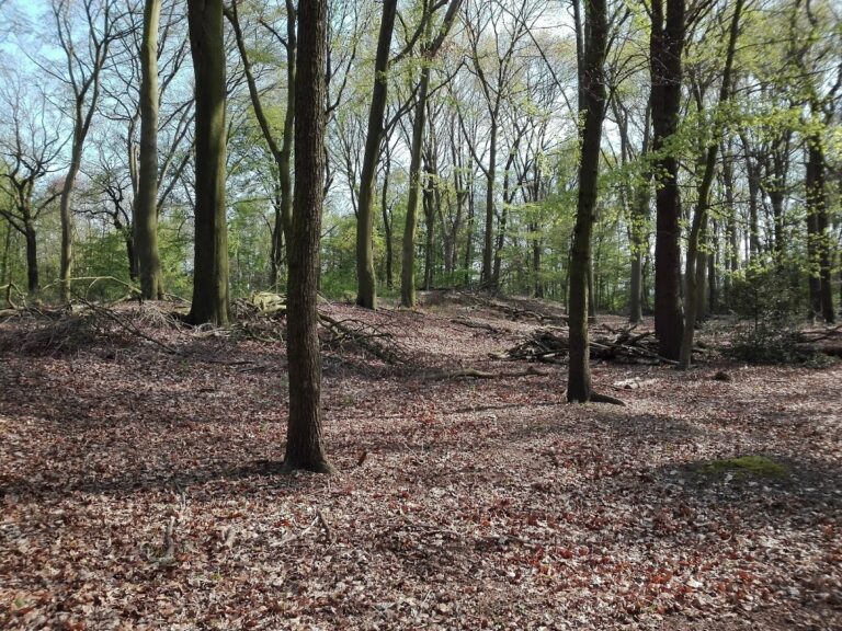
The principal surviving features are the earthworks, filled moats, elevated outer-bailey platform, and circular main-castle mound. The present park retains an approximately oval moat around both castle sections and a smaller, partly filled circular ditch separating the main mound. An eroded bank remains around the oval moat, rising about half a metre above the surrounding ground.
A wooden bridge and stairway now lead to the former main-castle courtyard. The circular line of the ring wall and a tower are marked there, while trees cover the area between the walls. Almost none of the medieval buildings survives above ground. The building materials used at Burg Mark included green marlstone from the Haar ridge, limestone, sandstone, brick, timber, roof slate, and monk-and-nun roof tiles. The walls were probably whitewashed. The surviving northern foundation fragment consists of one or two courses of flat green marlstone rubble bonded with hard, whitish lime mortar mixed with fine sand.
Deep modern disturbances, extensive stone robbing, and the removal of foundations prevent a secure reconstruction of every building phase and later alteration. The surviving earthworks and archaeological evidence nevertheless identify a large ring-mantle motte with a peripheral gate tower, a palas, an outer bailey, and substantial water defenses. Together, these remains preserve the physical setting of the castle that served as a political and residential center of the Counts of Mark before its decline and destruction.