Bumannsburg: An Early Medieval Ringwork Fortification in Germany


Site at a Glance
- Rating
- 3.4
- Popularity
- Very Low
- Country
- Germany
- Primary era
- Medieval
- Eras represented
- Medieval
- Civilizations
- Carolingian
- Site type
- Military
- Remains
- Fort
On this page10 sections
History
Bumannsburg is the remnant of an early fortified earthwork in Germany, located at Rünthe in Bergkamen, on the southern bank of the Lippe. It is generally identified as a Carolingian–Ottonian ringwork, a fortification made chiefly from an earthen bank and ditch, although its construction date remains uncertain. Its origins have been tentatively linked with Charlemagne’s Saxon Wars, fought between 772 and 802, while pollen evidence and associated changes in the surrounding landscape point instead to the second half of the tenth century. The site is also described as probably dating to around the eighth century.
Landscape before the fortification
Pollen analysis carried out in 2006 reconstructed several phases of land use around Bumannsburg. During the Roman Imperial period, the landscape first showed forms of cultivation associated more closely with Roman practice and later patterns linked with Rhine–Weser Germanic communities. Walnut and coriander, together with the wild plants cocklebur and sea holly, occur among the pollen. These plants are associated with Roman-period activity in North Rhine-Westphalia, although the cereals and weeds of cultivated fields cannot establish whether Roman farmers or local communities adopting Roman methods were responsible.
Around AD 100, livestock raising and oak-rich managed woodland predominated, while evidence for cultivated fields declined. From the fourth and fifth centuries, signs of economic activity gradually faded as beech and oak-hornbeam forests, along with ash and elm, expanded. These woods reached their greatest extent around 650. Land development resumed from about 700, initially through livestock grazing in woodland. Around 800, nearly pure oak woodland predominated, while the Lippe floodplain in front of the fortification remained largely undisturbed.
Early medieval development and use
Extensive clearance of the floodplain forests began around 850. Wet grassland containing grasses and sedges increasingly occupied the floodplain and reached its greatest extent around 950. Cornflowers associated with winter grain point to the introduction of a three-field farming system, while the floodplain below the fortification was used for livestock raising. These environmental changes provide important evidence for the chronology of the earthworks, but they do not resolve the disagreement between an eighth-century origin and construction during the later tenth century.
During the ninth and tenth centuries, Bumannsburg served civil and military purposes for the surrounding countryside. Finds also indicate that it functioned as a refuge fortress for the local population in the thirteenth century. The name comes from an old farm within the rampart, which remained there until 1847. In the nineteenth century, the Prussian officer, historian, and numismatist Ludwig Hölzermann argued that the site had been a Roman camp. Searches for Roman artefacts did not confirm that interpretation, although the later pollen study identified plants that may have entered the region through Roman influence.
Excavation and protection
Archaeological investigation began with excavations directed by Carl Schuchhardt in 1898 and continued in 1978. The earlier work exposed two wells in the southern part of the outer bailey, while the later excavation revealed a well-preserved timber framework beneath a rampart. Bumannsburg was entered in the monument list of the city of Bergkamen as an archaeological monument on 5 July 1990.
Remains
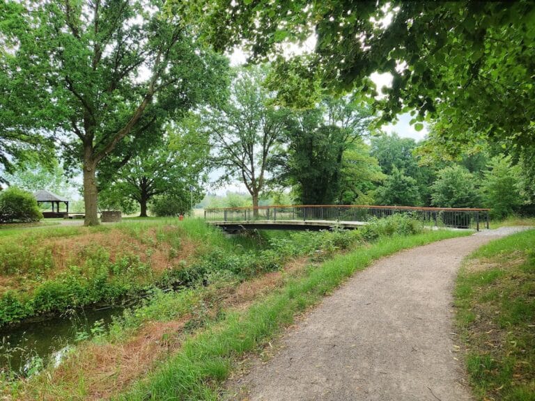
Bumannsburg is a two-part ringwall fortification built in relatively flat, wet terrain. A roughly rectangular core enclosure lies to the north, while a substantially larger outer bailey extends to the northwest. The earthworks use ramparts and external ditches rather than masonry walls, and surviving watercourses helped shape parts of the defensive layout.
Core enclosure and outer bailey
Core enclosure
The core enclosure measures about 120 by 80 metres. Its eastern side retains an earthen rampart rising to approximately three metres. This surviving bank forms the clearest remaining part of the principal enclosure and represents the earthwork construction of the fortification.
Outer bailey
The outer bailey covers approximately 4.9 hectares. A main rampart and two additional ramparts protected it, with each bank accompanied by an external ditch. The eastern main rampart continues northward before ending at the steep cut bank of a former arm of the Lippe. A gate complex probably stood in the northeast, while the southeastern part contained a passage for a stream.
Watercourses, wells, and timber reinforcement
A stream that is now canalized enters the enclosure in the southeast, where the original form of the fortification remains unclear. At the point where the watercourse crosses the rampart line, well-preserved timbers were found in 1936 within a peat layer about 2.5 metres thick. Two wells occupied the southern section of the outer bailey. Their excavation in 1898 adds evidence for activity within this enclosed area.
The 1978 excavation exposed a timber boxwork beneath one of the ramparts. This was a framework of wooden beams used to reinforce or retain the earthen bank, and it survives as an important example of the construction methods used at Bumannsburg.
Pottery finds
Pottery from the site includes fragments of Rhenish Pingsdorf vessels dating to around 900. Numerous sherds from rounded vessels known as globular pots date from the tenth to the twelfth centuries. Together, these finds provide material evidence for activity at the fortification across the early and high medieval periods.
Nearby sites