Aghinolfi Castle: A Lombard Fortress in Montignoso, Italy



Site at a Glance
- Rating
- 4.5
- Popularity
- Low
- Country
- Italy
- Primary era
- Medieval
- External website
- Open
- Eras represented
- Classical, Medieval
- Civilizations
- Lombard, Republic of Lucca, Roman
- Site type
- Military
- Remains
- Castle
On this page15 sections
History
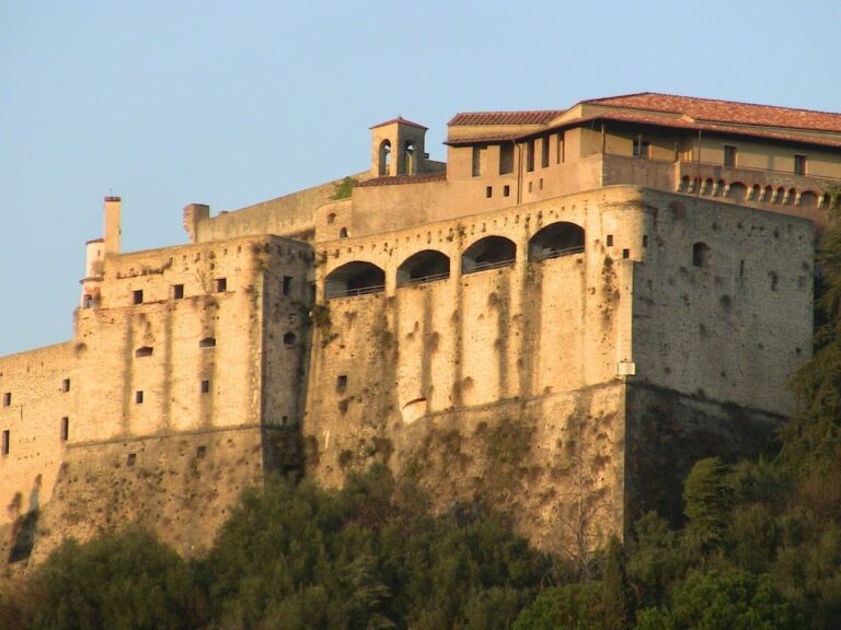
Aghinolfi Castle is a historic fortress in Italy above Montignoso, about 5 kilometres south of Massa. Its development is associated with Lombard rule, especially the transformation of the site into a Lombard stronghold in 590, although the origins of the earliest fortification remain uncertain. The castle occupied a strategic height above routes leading toward Rome and Lunigiana, and later controlled the Via Francigena, the major medieval pilgrimage and travel road connecting western Europe with Rome.
Lombard origins
In 590, Lombard forces associated with Queen Theodelinda occupied the Garfagnana and transformed the Castrum Aghinolfi into a fortress. The Lombards were a Germanic kingdom that ruled much of Italy from the sixth to the eighth century. The castle was still in Lombard possession in 753, when King Aistulf donated land in the area to his brother-in-law. An eighth-century document refers to a Lombard castle of Aginulfo, possibly named for a senior official of the Lombard court at Lucca.
The site may also have possessed a strategic role before the Lombard transformation. Its position controlled a route toward Rome and another toward Lunigiana and northern Italy. The height offered observation across the Ligurian coast, from the Gulf of La Spezia to Livorno, and in especially clear conditions toward the Maritime Alps. The fortress also served as a refuge for much of the surrounding population and was regarded as the most important stronghold in the valley.
Feudal and Luccan control
From the eleventh century, Aghinolfi Castle belonged to several feudal lordships of Lombard origin. These included a branch of the Nobili di Corvaia and the Cunimondinghi. After the struggles between Lucca and Pisa, the fortress passed to the Republic of Lucca in 1376. Lucca strengthened its military defenses, adapting the complex to the political and military conditions of the later Middle Ages.
In 1494, the fortification was transferred to Charles VIII of France, who was king from 1483 to 1498. This transfer placed the castle within the territorial conflicts and ambitions of late-fifteenth-century France. At the time, the site consisted of three walled enclosures spread across approximately one hectare. The first contained 43 buildings, the second contained 87 houses, and the highest enclosure held the principal castle.
Abandonment and material loss
The Republic of Lucca abandoned the castle after 1799, following the Jacobin Revolution, a political upheaval associated with revolutionary French influence. Local inhabitants then dismantled parts of the complex for building materials. Between 1808 and 1812, Elisa Bonaparte Baciocchi, Napoleon Bonaparte’s sister and ruler of the Principality of Lucca, ordered material from houses within the castle’s surrounding walls to be taken for sluice works at Cinquale. These actions caused further losses to the historic complex.
Wartime destruction and restoration
During the Second World War, German forces occupied Aghinolfi Castle and used it as a strongpoint in the Tyrrhenian sector of the Gothic Line. The Gothic Line was a German defensive system across northern and central Italy, and its Tyrrhenian sector covered the western coastal area. Allied bombardment during the conflict caused the almost total destruction of the castle.
The ruins remained abandoned and overgrown until 1997, although local residents continued to use parts of the site. Archaeological research and restoration between 1997 and 2001 recovered and interpreted the surviving structures. The octagonal keep now houses a museum presenting the history of the monumental complex. Aghinolfi Castle is owned by the Municipality of Montignoso, has been restored, and is recognized as Italian national heritage.
Remains
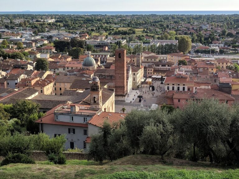
The castle occupies a limestone rocky spur at the summit of a hill. Its high position provides extensive views over the Ligurian coast, while the surrounding landscape includes the former marshy plain below. Views from the rock may extend toward Corsica and the islands of Gorgona and Capraia. The surviving arrangement reflects the adaptation of the rocky summit into a layered defensive complex, with an upper fortified area, enclosing walls, towers, and lower spaces that once contained houses and other structures.
Early tower and octagonal keep
Quadrangular tower
Archaeological research identified the remains of a primitive quadrangular tower. A small charcoal fragment preserved in the mortar of the surviving walls produced a radiocarbon date between AD 775 and 980. During the medieval period, the rocky spur and the early medieval tower were incorporated into a more powerful octagonal fortification, while the lower part of the quadrangular structure continued in use.
Octagonal keep
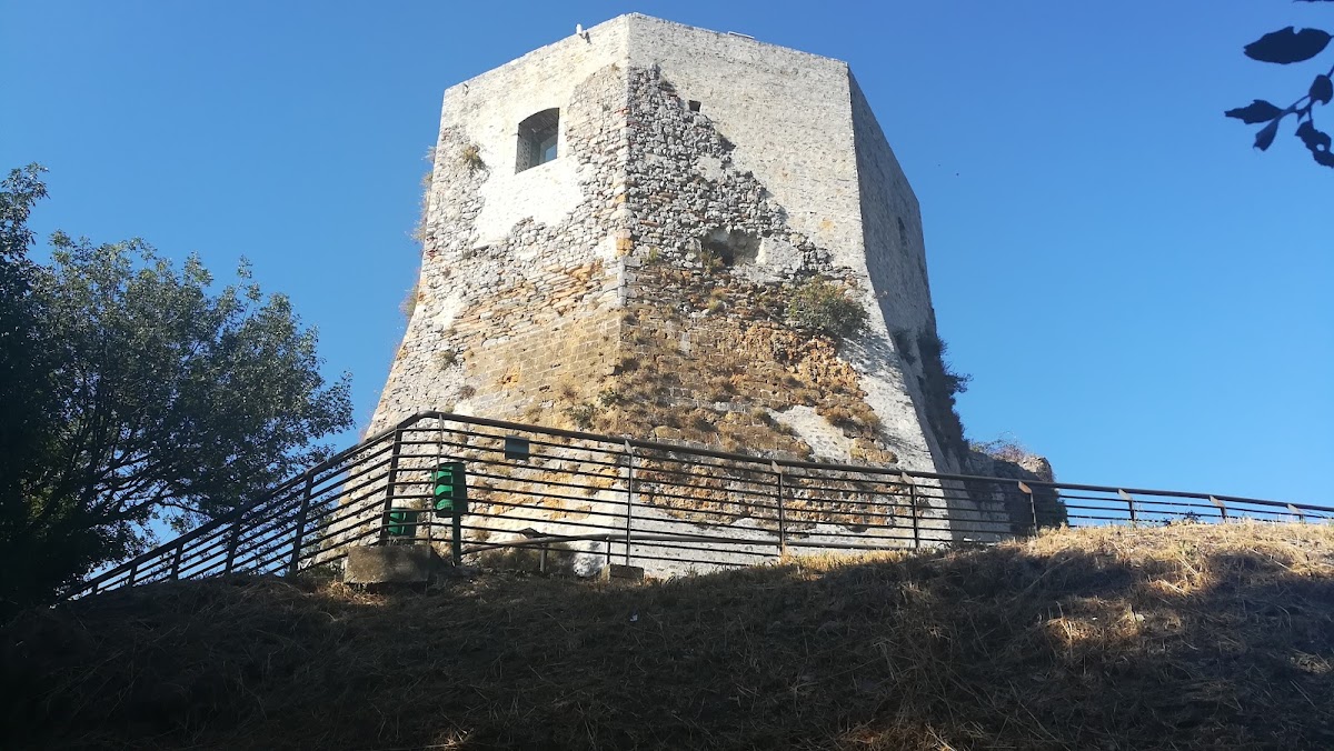
The octagonal keep stands at the highest point of the hill and is probably the oldest surviving element of the complex. Its polygonal form and distinctive foundation have been attributed to the early centuries of the late medieval period. The keep contains broad interior spaces and walls marked by horizontal bands of two colors, features interpreted as possibly indicating a residential function. An internal circular tower rises above it and served both as a structural support and as a watchtower.
In the fifteenth-century arrangement, the large octagonal keep was connected by curtain walls, defensive walls linking fortified structures, to a tower with a circular base. The principal castle also contained a mill, a large cistern for collecting rainwater, and a secret escape passage. Later work raised the interior floor and added a terracotta surface. A wooden stairway that had formerly run around the keep was removed, and access was provided from the embankment.
Towers and later alterations
Ruined tower and projecting structure
A large tower was ruined during a battle in the early thirteenth century. By the late fourteenth century, its remains had been reused as the foundation of a new tower with a distinctive beak-like projection. A modest building with a slate-slab roof stood beside it. Probably in the second half of the fifteenth century, that building was destroyed, while the octagonal structure was repaired. Earlier gaps in the masonry were filled, the octagonal tower was raised by several metres, and it received a ring-shaped masonry vault.
San Paolino Bastion
The higher fortified space formed the parade ground and included the octagonal keep and the circular San Paolino Bastion, a projecting fortified structure designed to help defend a wall or enclosure. The bastion dates to the fifteenth century. Later structural demolitions continued after the mid-eighteenth century, including the collapse of part of the ring-shaped vault.
Enclosures and archaeological layers
Fortified enclosures
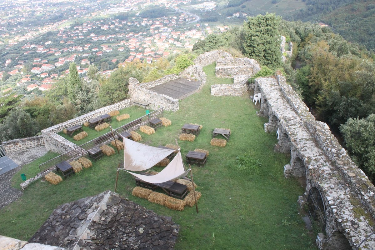
The wider defensive layout comprised three enclosures covering about one hectare. The first held 43 buildings used as refuges or warehouses. A drawbridge provided access to the second enclosure, which contained 87 houses. The highest enclosure contained the principal castle. The later architectural arrangement included a large enclosing wall with flanking towers around two spaces set at different elevations. The outer enclosure covered the larger area, while the upper space concentrated the principal defensive structures.
Foundations beneath the keep
Restoration and archaeological investigation revealed successive floor levels beneath the octagonal tower, including its square foundation. A specially installed glass floor allows these layers to be viewed. The foundation has been described as possessing unmistakably Roman characteristics, although its date remains difficult to determine. Blocks of Volterra tuff placed around the limestone spur have been interpreted, with uncertainty, as evidence of an earlier Roman military construction. Later Lombard builders may also have used basalt from the Val di Vara.
During the German occupation, a trench was cut through the rubble to reach the southern loophole and was then covered provisionally with wooden trunks. This wartime alteration forms part of the physical record of the final military phase before the castle’s archaeological recovery and restoration.