Ashdod-Sea Fortress: An Umayyad Coastal Defense Stronghold in Israel


Site at a Glance
- Rating
- 4.5
- Popularity
- Medium
- Country
- Israel
- Primary era
- Medieval
- External website
- Open
- Eras represented
- Medieval, Modern
- Civilizations
- Crusader, Fatimid, Kingdom of Jerusalem, Umayyad
- Site type
- Military
- Remains
- Fort
On this page11 sections
History
Ashdod-Sea Fortress is a seventh-century coastal fortress in Ashdod, Israel, built by the Umayyad dynasty under Caliph Abd al-Malik. It formed part of a chain of ribats, fortified frontier strongpoints, and signal towers along the southern coast. Together with installations near Ashkelon and Yavneh-Yam, the network warned the provincial capital at Ramla of attacks by Byzantine ships.
Umayyad and Fatimid Fortification
During the tenth century, the Fatimids, a Shi’i Islamic dynasty that ruled Egypt and parts of the eastern Mediterranean, including Palestine, strengthened and enlarged the fortress. It was then known as Qal’at al-Mina. A related signal tower stood in the area of modern Ashdod’s Quarter 15, extending the coastal warning system.
An earthquake in 1033 damaged the fortress. Its later history unfolded during the period of Crusader rule that followed the First Crusade and the establishment of the Kingdom of Jerusalem in 1099. The fortress was fortified again and became known as Castellum Beroart, or Beroardi, a name associated with Nicholas de Brouwer, a knight serving Hugh of Ibelin of Ramla.
Abandonment and Archaeological Work
The fortress was abandoned in 1260 after the fall of the Crusader kingdom and the Mamluk conquest of Palestine. The Mamluks were a military ruling dynasty that controlled Egypt, Syria, and Palestine after defeating the Crusader states. Nomads later used the structure, which has survived as a ruin.
Excavations began in 1968 and continue. A concentrated campaign in the late 1990s fully exposed the remains, with work involving Yaakov Kaplan, Saar Ganor of the Israel Antiquities Authority, and Alexander Fantalkin of Tel Aviv University. In September 2012, an additional excavation of a well investigated the ancient sea level along the coast of Palestine.
A conservation and development plan was approved in May 2011 and completed in 2020. The work was intended to conserve the fortress and develop it as a maritime-archaeological attraction. Local residents and the Emek Shaveh association criticized aspects of the project, arguing that the floating deck damaged the site’s character, a newly built arch and wall were presented as ancient construction techniques, and stones covering the water wells reduced the site’s authenticity. In 2023, further construction began to regulate and expand parking and to create a road and bicycle route. The works closed pedestrian access from the Robert Haim Sports Promenade to the fortress and Yohai Lookout, prompting criticism that the development harmed the site’s natural character and commercialized it.
Remains
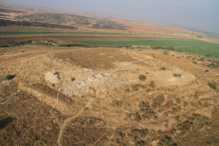
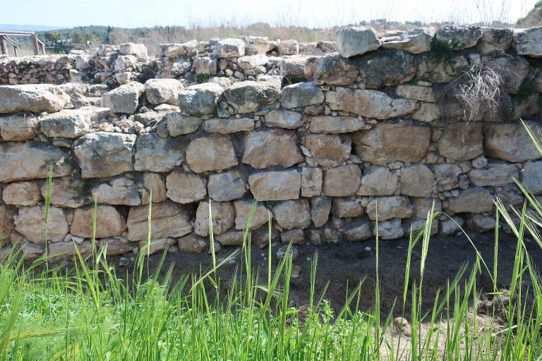
The archaeological ruin occupies an approximately rectangular enclosure measuring about 60 by 45 metres. Its walls are made of quarried kurkar, a coastal sandstone formed from windblown sand and widely used along the eastern Mediterranean shore. The fortress combines a defended perimeter, controlled entrances, and rooms arranged around a central courtyard.
Enclosure and Entrances
Walls and Towers
The enclosure had six round towers, each approximately 8 metres high. Four stood along the western side and two along the eastern side. Two western towers flanked the sea gate, while two eastern towers flanked the land gate. Two additional square towers occupied the eastern corners. Erosion is visible in the entrance towers, attributed to the combined effects of the 1033 earthquake and winds from the sea.
Moat and Bridge
Remains of a moat surround the landward side of the fortress. A bridge crossed the moat and led to the eastern entrance, linking the defended enclosure with its land approach.
Courtyard and Service Areas
Courtyard, Living Quarters, and Wells
Rooms around the central courtyard probably housed soldiers responsible for guarding the coast against invasion. The interior included living quarters, stables, and a mosque. Two wells stood north and south of the courtyard, supplying the fortress’s internal water points.
Bathhouse
A bathhouse north of the courtyard contained plastered tubs and an installation for heating water. Its position within the fortress formed part of the internal facilities associated with the garrison.
Conservation Features
Conservation work strengthened supporting walls, removed and screened sand, laid a floor, and created paths for visitors and people with disabilities. A raised floating deck was constructed above the fortress, providing an elevated position over the site and the adjacent coastline. The fortress remains an archaeological ruin undergoing conservation.