Tel Ashkelon National Park: The Archaeological Remains of an Ancient Port City
Site at a Glance
- Popularity
- Medium
- Country
- Israel
- Primary era
- Medieval
- Eras represented
- Bronze Age, Iron Age, Classical, Medieval
- Civilizations
- Byzantine, Canaanite, Crusader, Fatimid, Kingdom of Jerusalem, Philistine, Roman
- Site type
- City
On this page21 sections
History
Tel Ashkelon National Park is an archaeological park on Israel’s Mediterranean coast, southwest of the modern city of Ashkelon. Settlement at Ashkelon began about 10,000 years ago. During the Middle Canaanite period, a Bronze Age phase, a substantial city grew here. The Canaanites were an ancient people of the eastern Mediterranean, and Ashkelon became their largest port. With an estimated population of about 15,000, it was also one of the region’s largest cities.
Canaanite and Philistine periods
In the Late Canaanite period, Ashkelon was a fortified city under Egyptian rule. During the Middle Iron Age, the era following the Bronze Age, its area expanded to about 600 dunams, each equal to 1,000 square metres. Around 1150 BCE, the Philistines, another ancient people of the eastern Mediterranean, captured the city, and its area contracted. Ashkelon’s king became one of the five Philistine lords, while the city and the Israelites remained in continuing military and political tension.
In 701 BCE, Ashkelon joined Hezekiah, king of Judah, in a revolt against Assyria. Assyrian king Sennacherib attacked the city and replaced its king. In 604 BCE, Babylonian forces captured Ashkelon, burned and destroyed it, and deported its inhabitants. This brought the Philistine period to an end.
Persian, Hellenistic, Roman, and Byzantine rule
Under Persian rule, Ashkelon was protected by Tyre and also had a Phoenician population. The city prospered as a seaport during the Hellenistic period, when Greek-ruled kingdoms held power in the region. It gained autonomy in 104 BCE. Although the Hasmonean kingdom, a Jewish ruling dynasty, came to control the coast under Alexander Jannaeus, Ashkelon remained independent through its alliance with Ptolemaic Egypt, a kingdom based in Egypt.
Herod, who ruled Judea under Roman authority and was known for major building projects, enlarged and strengthened Ashkelon. He is sometimes thought to have been born there. The city continued to prosper under Roman rule, reaching an area of about 600 dunams and serving as an urban centre for a surrounding agricultural hinterland. It flourished again in the Byzantine period, the later eastern Roman Empire, and appears in part on the Madaba Map.
Islamic and Crusader periods
Arab forces captured Ashkelon in 640. From the late 11th century, a tradition that a memorial building in the city contained the head of Husayn ibn Ali, Muhammad’s grandson and a figure especially revered in Shi’a Islam, gave the place special religious standing.
When the Crusaders, Latin Christian forces and rulers active in the eastern Mediterranean, arrived in 1099, Ashkelon was an important Fatimid fortress. The Fatimids were a Muslim caliphate. Despite a Crusader victory in the nearby Battle of Ashkelon, they did not take the city. Around 1150, Ashkelon’s Fatimid ruler strengthened its defenses with 53 watchtowers. Baldwin III of Jerusalem captured it in 1153 after a month-long siege. The city then became part of the Crusader County of Jaffa and Ashkelon, a territory governed by a count, and an important town within it.
In 1187, Saladin, an Ayyubid ruler and military leader, expelled the Crusaders after a two-week siege. He destroyed and burned Ashkelon and filled its harbor. Crusaders returned under Richard the Lionheart in 1192, restoring and fortifying the city, but abandoned it again because of the Muslim threat. They came back and refortified it in 1241. In 1270, the Mamluk sultan Baibars, whose dynasty ruled Egypt and parts of the eastern Mediterranean, destroyed the city and filled its harbor. Ashkelon was abandoned and never resettled.
Excavation and modern history
In 1815, the British aristocrat and traveler Lady Hester Stanhope led an expedition to Ashkelon to search for a supposed cache of gold coins beneath a mosque’s ruins. Ottoman authorities allowed the excavation and ordered Abu Nabbut, the governor of Jaffa, to accompany her. The work ended after two weeks when the treasure was not found. The British School of Archaeology in Jerusalem began excavating at Ashkelon in 1921, exposing a Roman basilica, a large public hall. Harvard University began work at the seaport in 1985 under archaeologist Lawrence Stager, with support from American donor Leon Levy.
From 2007, excavations in Grid 38, an archaeological area, focused on the Late Bronze and Early Iron Age layers. The area’s sequence runs from the Early Bronze Age through the Islamic and Crusader periods and traces Philistine occupation from their arrival in the early 12th century BCE to the Babylonian destruction in 604 BCE. Ground-penetrating radar, which uses radar pulses to detect features underground, revealed Islamic ramparts and a major basilica in the Roman Forum, the city’s civic centre, in 2007. Radar and probes were also used to examine medieval fortifications in 2009.
In 1948, during the Arab-Israeli War, the Palestinian village of Al-Jura, then home to 2,420 people, was ethnically cleansed during Operation Yoav, an Israeli military operation. Its land was later incorporated into the park. In 2021, Israel Antiquities Authority archaeologists led by Rachel Bar Nathan announced the discovery of a Roman basilica complex. During missile barrages associated with the 7 October 2023 attacks, containers holding archaeological finds at the site were hit, destroying some objects. The park’s name changed from Ashkelon National Park to Tel Ashkelon National Park in 2024.
Remains
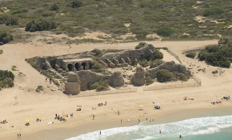
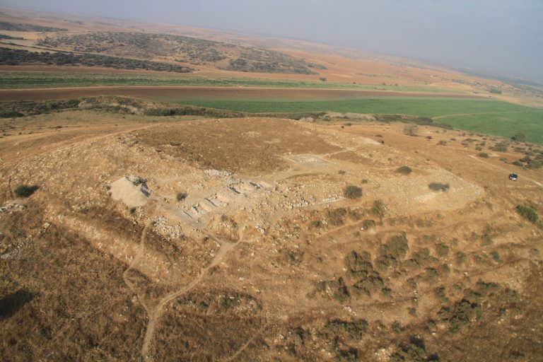
The park covers about 3 square kilometres on a coastal ridge of kurkar, a local sandstone, beside the Mediterranean Sea. Ancient Ashkelon stood on the Way of the Sea, an old coastal trade route, in fertile surroundings with abundant water. Its remains include city defenses, gates, Canaanite and Roman buildings, and later religious structures. Ships anchored offshore, while people and goods travelled to the beach in small boats.
Defenses and entrances
City walls and rampart
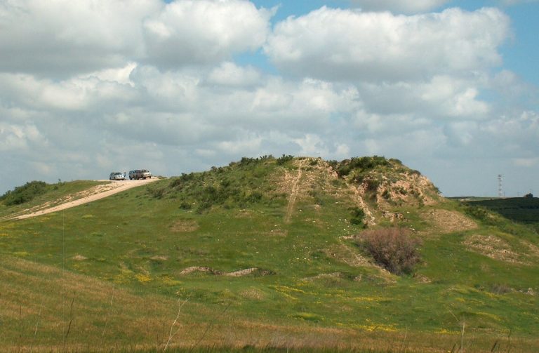
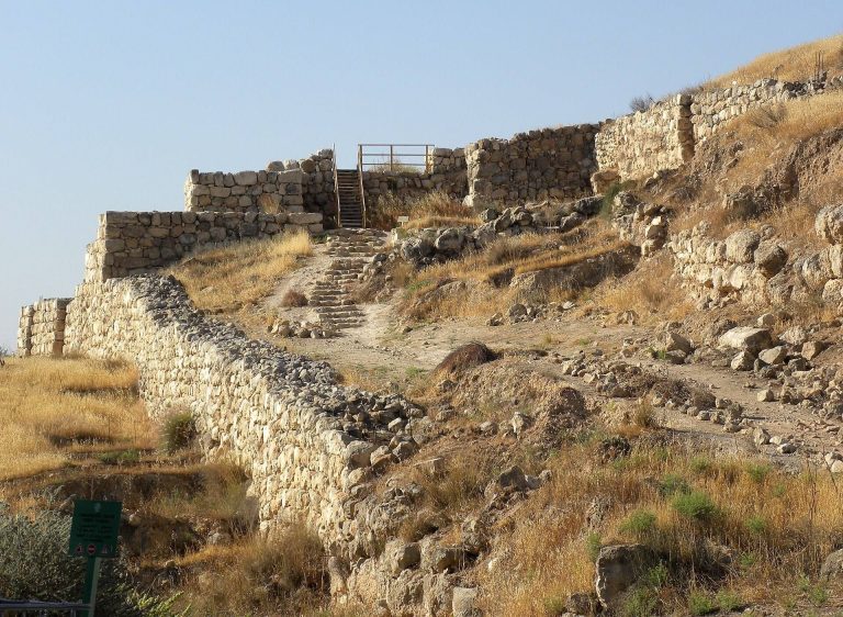
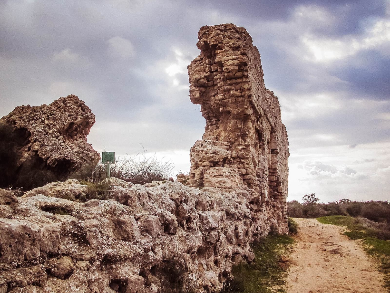
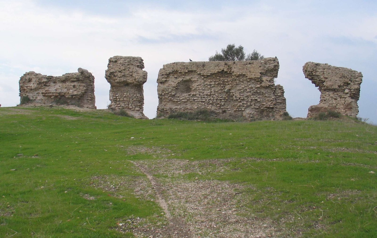
The city’s landward defenses formed a semicircle around its northern, eastern, and southern sides. The western edge used the natural sea cliff. The eastern and southern wall dates to the mid-12th century, when the Fatimids built it on a raised earthen rampart about 2,200 metres long, 50 metres wide, and 15 metres high. This wall followed an older Canaanite line also used by Roman and Byzantine walls. Later Muslim and Crusader rulers built a wall along the seafront, and about 1,200 metres of it survive.
City gates
The city’s four gates originated in the Byzantine period. They are identified by direction as the Sea Gate, Gaza Gate, Jerusalem Gate, and Jaffa Gate.
Canaanite gate and sanctuary
Northern gate
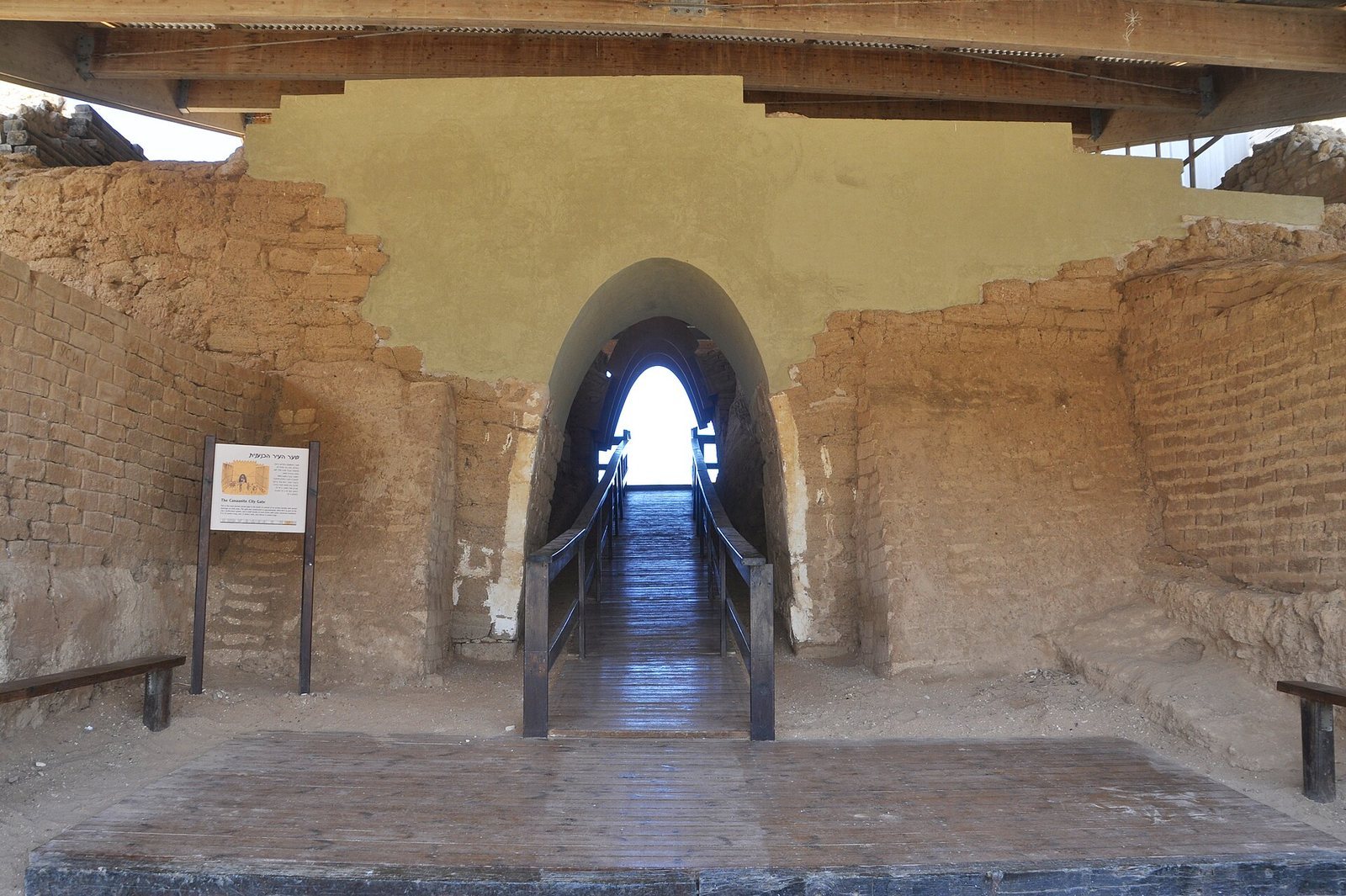
A gate on the northern side of the site dates to about 1850 BCE and is regarded as the world’s earliest known arch. Its construction combines mud brick with local kurkar sandstone.
Temple beside the gate
Outside the wall beside the gate are remains of a Canaanite temple, probably dedicated to Baal, a storm god. Finds include a 10-centimetre bronze bull covered with silver and a pottery vessel thought to have served as its small shrine.
Roman public buildings and finds
Basilica complex
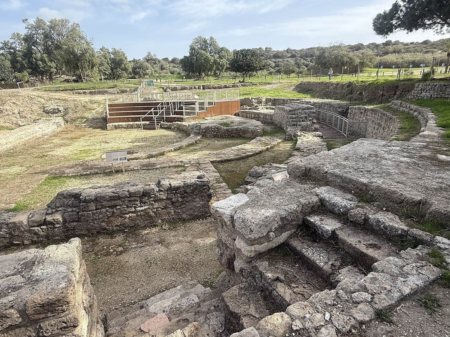
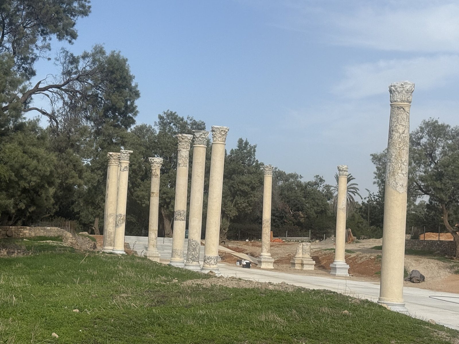
The Roman basilica in the city’s civic centre had a central hall with two side sections. The structure, dated by excavators to Herod’s reign and identified as a municipal council hall, measured about 110 metres long and 35 metres wide. Marble covered its floor and walls. Corinthian columns, with their elaborately decorated upper sections, stood in a row with pedestals; a semicircular hall to the south may have served as a meeting place. Large marble columns and capitals around the main hall were brought by merchant ship from Asia Minor. Some capitals bear plant designs, and some also show an eagle, the symbol of the Roman Empire.
Sculpture and column fragments
Marble and granite columns and capitals found in the excavations are displayed beside the basilica. A statue of Nike, also called Victoria, shows the victory goddess standing on a globe carried by Atlas, a figure from Greek mythology. Another statue portrays Isis, an Egyptian goddess, in the form of Tyche, the Greek goddess associated with Ashkelon’s fortune.
Byzantine remains
Church of Saint Mary the Green
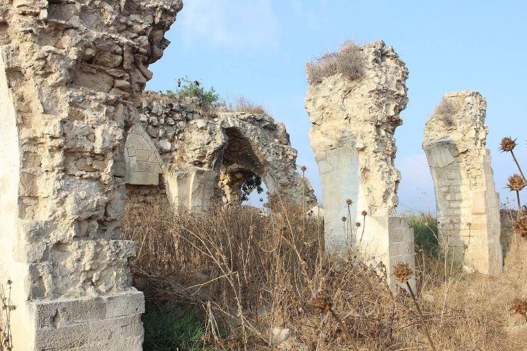
In the eastern part of the park are remains of the fifth-century Church of Saint Mary the Green, built in the form of a long basilica hall. The church was destroyed in 938 and restored by the Crusaders after they captured the city in 1153. Frescoes on its surviving walls show four saints holding scrolls with Greek inscriptions.
Wells
The park contains 67 historic wells, most of them dating to the Byzantine period.
Other excavated remains
Stanhope’s excavation
Stanhope’s dig exposed the lower foundations of a mosque about three to four feet below the ground. The building’s successive uses have been interpreted as a pagan temple, a church, and then a mosque. Finds included marble-column fragments, a Corinthian capital, a glazed faience vessel, and two small pottery vessels. A headless marble statue about seven feet tall was also recovered. It had been broken and thrown into the sea, possibly by local farmers seeking treasure or on Stanhope’s orders amid concern about Ottoman pressure.
Dog cemetery
Excavations also revealed what is described as the largest known dog cemetery in the ancient world.