Tell el-Hesi: An Early Bronze Age Fortified Settlement in Israel
Site at a Glance
- Rating
- 4.3
- Popularity
- Very Low
- Country
- Israel
- Primary era
- Bronze Age
- Eras represented
- Bronze Age
- Civilizations
- Canaanite
- Site type
- City
On this page18 sections
History
Tell el-Hesi is a roughly 10-hectare archaeological settlement in southern Israel, beside the Wadi el-Hesi. Its principal occupation belonged to the Early Bronze Age, when it developed into a fortified city during the third millennium BC. The site was occupied intermittently from the Pre-Pottery Neolithic and Chalcolithic periods through the Hellenistic period, and its excavation helped establish methods for studying successive settlements in the ancient Levant.
Early Bronze Age City
Settlement at Tell el-Hesi probably began at the beginning of Early Bronze IIIA, or earlier. Radiocarbon dates from emmer, an ancient form of wheat, fall at approximately 2890–2590 and 2900–2620 BC. By Early Bronze IIIA, approximately 2750–2500 BC, the settlement had become a fortified city covering about 10 hectares, with an elevated principal area, a lower city, and associated wall systems.
The Early Bronze Age economy combined cattle herding with grain production. Workshops produced incised bone tubes, and the settlement may have served as a trade center. Its occupation was contemporary with Egypt’s Third and Fourth Dynasties, early dynasties of the Old Kingdom. After this period, Tell el-Hesi fell into disuse before being rebuilt during the middle or later part of the second millennium BC.
Late Bronze Age and Later Occupation
Renewed settlement during the Late Bronze Age began after the earlier abandonment, and the site then remained in use for approximately a thousand years. A substantial public building belonged to the fourteenth century BC, while industrial activity represented by a possible blast furnace dates to approximately 1500 BC. Cuneiform writing, a system formed from wedge-shaped impressions, links the site to the administrative and diplomatic world of the Late Bronze Age.
Tell el-Hesi was formerly identified with the biblical city of Lachish. Claude Conder proposed the identification, and Flinders Petrie and Frederick Jones Bliss accepted it. Lachish was later identified with Tell ed-Duweir, so the earlier attribution of Tell el-Hesi is no longer accepted. William F. Albright proposed that the site might instead be biblical Eglon, an interpretation Yohanan Aharoni still supported in the 1970s. That proposal remains unconfirmed, and Tell el-Hesi is now considered unidentified.
Early Exploration and Excavation
Edward Robinson described the mound in the late 1830s. The first major excavations took place from 1890 to 1892 under the Palestine Exploration Fund, a British organization that sponsored archaeological and geographical research in Palestine. Flinders Petrie directed the first season, followed by four seasons under Frederick Jones Bliss. Across five excavation seasons, the project became one of the first systematic archaeological excavations in Palestine.
Petrie developed the systematic use of stratigraphy, the study of superimposed occupation layers, at Tell el-Hesi. He also used ceramic seriation, which establishes relative dates through changes in pottery styles. After training with Petrie at Meydum in Egypt, Bliss applied this pottery sequence and the idea of successive “cities” to create a chronological framework for the mound and for wider Levantine archaeology. The final excavation reports appeared in 1891 and 1894.
Later Archaeological Work
The Joint Archaeological Expedition to Tell el-Hesi began in 1970 under the American Schools of Oriental Research and continued through 1983 for eight summer seasons. Its work examined the acropolis, its walls, and the Early Bronze III wall system of the lower city. The project opened areas west and south of Bliss’s excavation cut and along the southern slope of the acropolis, establishing a settlement sequence from the Chalcolithic period to the Hellenistic period.
A later regional program, the Hesi Regional Survey, was conducted by the Cobb Institute of Archaeology at Mississippi State University from 2004 to 2010. Related investigations at the nearby satellite site of Khirbet Summeily began in 2011 and were most recently conducted in 2023 under the co-direction of James Hardin and Jeffrey Blakely. A military trench system was cut into the summit during the 1948 Arab-Israeli War, and both the trenching and subsequent excavation reduced and damaged the mound.
Remains
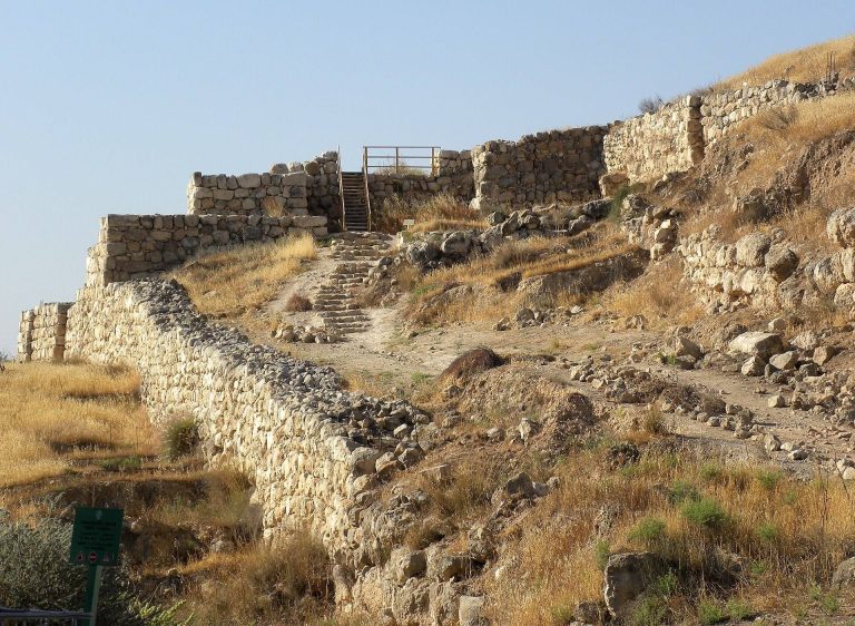
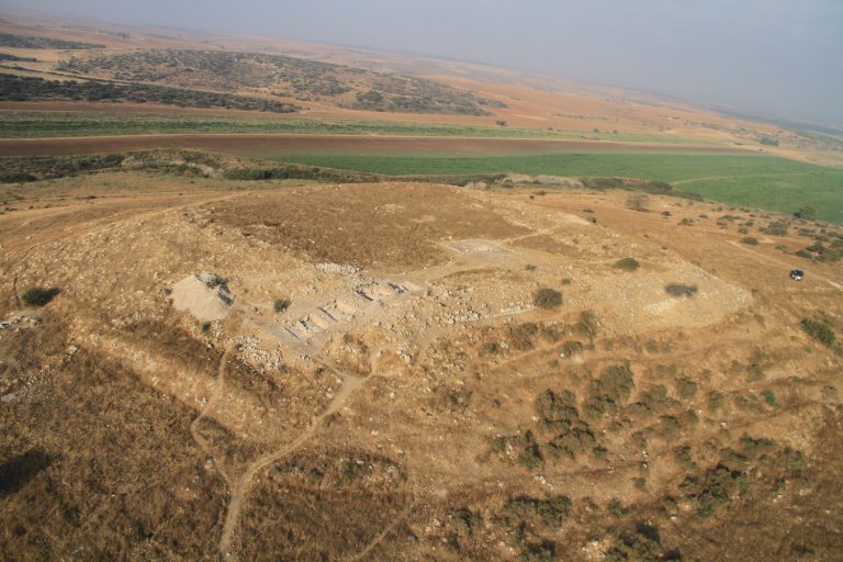
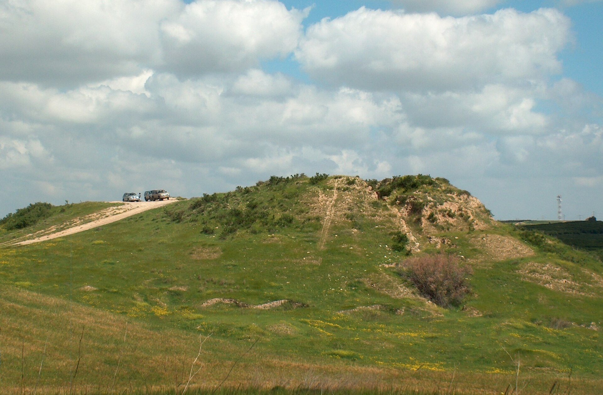
Tell el-Hesi is a tell, an artificial mound formed by accumulated remains of successive settlements. When Robinson described it, the mound was approximately square, measuring about 61 meters on each side. It rose roughly 61 meters above the surrounding land to the east and about 18 meters in the other directions. Excavation and military activity have altered its original form, and the surviving mound is now in ruins. During the Early Bronze Age, the settlement stood beside the Wadi el-Hesi, which was a flowing stream at that time.
Early Bronze Age Defenses
Acropolis
The acropolis occupied the elevated or principal fortified area of the settlement. Its walls were investigated in Fields I and III during the later excavations. Earlier work in the northeastern part of the mound exposed a mud-brick wall and an associated tower. Bliss removed almost one-third of the acropolis while examining its successive occupation layers, leaving a large wedge-shaped excavation trench in the northeastern corner known as Bliss’s Cut.
Lower City Walls
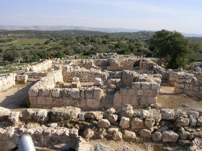
The lower city possessed an Early Bronze III wall system that was investigated in Fields V, VI, and IX. These defenses belonged to the fortified urban settlement that developed by approximately 2750–2500 BC. Their relationship to the acropolis and other wall systems formed a central focus of the 1970–1983 excavations.
Stratified Settlement Layers
Petrie’s Wall
Petrie exposed a very thick mud-brick wall and opened 79 test pits. He attributed the remains he uncovered to the earliest phase of the site and dated them to approximately 1700 BC. His work treated the mound as a sequence of superimposed settlements rather than as a single architectural complex.
Bliss’s Cut and Burial Area
Bliss identified 11 settlement layers and organized them into eight successive “cities.” Bliss’s Cut remains visible as a large wedge through the northeastern corner of the upper mound, allowing the accumulated occupation layers to be examined in section. He also uncovered a cemetery that he initially dated to approximately 200–300 years before his excavation. Later investigations placed the burials in approximately AD 1600–1800, during the Ottoman period, the era of Ottoman imperial rule in the region.
Late Bronze Age Buildings and Industry
Public Building
A well-built and highly symmetrical public building belonged to the fourteenth century BC. Bliss associated it with the tradition of Egyptian-style governor’s houses, buildings also identified at Tell Jemmeh and Tell el-Farah South. The structure stood above an ash layer interpreted as the destruction of the preceding settlement layer. It measured approximately 18 by 18 meters, had walls averaging 1.5 meters in thickness, and was built without foundations. A central hall or courtyard formed part of its plan.
Possible Blast Furnace
Excavations also identified remains interpreted as a blast furnace, together with slag and ashes, dating to approximately 1500 BC. The interpretation depends on technical theories about the installation, including the possibility that hot-air blast technology was used at a very early date. The feature therefore belongs to the industrial evidence of the Late Bronze Age settlement while retaining an uncertain technical interpretation.
Writing and Burials
Cuneiform Texts
Inscribed pottery came from several periods of occupation. One important discovery was a cuneiform tablet closely related to the Amarna Letters, a collection of fourteenth-century BC diplomatic and administrative texts. The tablet mentions a person identified as the governor of Lachish, a high-ranking official who administered a territory or city for a larger political authority. Another fourteenth-century BC cuneiform letter was written on pottery sherds and was described as resembling Proto-Sinaitic writing, an early alphabetic tradition associated with the Sinai and southern Levant.
Ottoman Infant Burials
Excavations on the summit revealed infant burials placed in jars during the Late Ottoman period. These burials are commonly associated with nomadic or itinerant workers of Egyptian origin. They represent a much later use of the mound than the Early Bronze and Late Bronze Age settlements and form part of the varied sequence preserved at Tell el-Hesi.