Heraclea Minoa: An Ancient Greek City in Sicily
Site at a Glance
- Popularity
- High
- Country
- Italy
- Primary era
- Classical
- Eras represented
- Classical, Medieval
- Civilizations
- Ancient Greek, Byzantine, Roman
- Site type
- Settlement
- Remains
- City
On this page15 sections
History
Heraclea Minoa was an ancient Greek city on Capo Bianco near Cattolica Eraclea in Sicily, Italy. Founded in the middle of the sixth century BC as an outpost of the Greek colony of Selinus, it became a contested settlement near the Platani valley and later one of Carthage’s principal naval stations in Sicily.
Origins and early struggles
Two ancient traditions offer mythical explanations for the city’s name. One tells how the Greek hero Heracles defeated the local hero Eryx in a wrestling match, gaining a claim to western Sicily for his descendants. The other says that Minos, the legendary king of Crete, landed near the river mouth while pursuing the craftsman Daedalus and founded Minoa. In another version, Minos’s followers established the settlement after his death. The philosopher Heraclides Ponticus also wrote of an earlier local city called Macara. These stories do not provide a single established account of the city’s origins.
Around 510 BC, Dorieus, a Spartan prince and brother of King Cleomenes I, arrived in Sicily to reclaim land he believed had belonged to Heracles. Carthaginians and Segestans defeated and killed him and almost all his leading companions. Euryleon, the only chief to escape, took control of Minoa. The city probably acquired the name Heraclea at this time; the name Heraclea Minoa was later used to distinguish it from other cities called Heraclea.
Spartan control did not last. During the fifth century BC, Heraclea was governed by Akragas, the Greek city at the site of modern Agrigento, and prospered. Carthage probably destroyed it around 406 BC, though the date is uncertain. A treaty made in 405 BC assigned its territory to Carthage. By then, the city may have disappeared or been greatly reduced.
Shifting control in the fourth century BC
Dionysius I, ruler of Syracuse, recovered Heraclea in 397 BC, but Carthage took it again in 383 BC. In 357 BC, the Syracusan leader Dion landed at Minoa during his campaign against Syracuse. The town lay in Akragan territory but remained under Carthaginian control. Although a treaty set the Halycus, the ancient name of the Platani River, as a boundary, Heraclea on its southeastern bank apparently stayed Carthaginian. A further agreement between Carthage and Agathocles in 314 BC also left the city under Carthaginian rule.
Heraclea later re-emerged as an important city, for reasons that remain unknown. In 309 BC, it joined an independence movement led by Xenodicus of Agrigentum and declared itself free of both Carthage and Agathocles, the ruler of Syracuse. Agathocles returned from Africa and retook the city in 305 BC. Pyrrhus, king of Epirus, captured it in 278 BC as he advanced west from Agrigentum.
Carthaginian naval base and Roman conquest
During the First Punic War, the conflict between Rome and Carthage, Heraclea served as an important Carthaginian naval base. Around 260 BC, the general Hanno occupied the city while moving to relieve Agrigentum, then under Roman siege. In 256 BC, Carthage stationed a fleet of 350 ships at Heraclea to prevent the Romans from crossing to Africa. Roman consuls Regulus and Manlius defeated the fleet. In 249 BC, the Carthaginian admiral Carthalo used the city to watch for a Roman fleet approaching Lilybaeum.
At the end of the First Punic War, Heraclea came under Roman rule. It returned to Carthage during the Second Punic War, another conflict between Rome and Carthage, and was among the last places still resisting the Roman commander Marcus Claudius Marcellus after the fall of Syracuse.
Roman settlement and abandonment
The First Servile War, an uprising of enslaved people in Roman Sicily from 134 to 132 BC, severely damaged Heraclea. The Roman praetor Publius Rupilius, an elected magistrate, settled new colonists there. A municipal law governed relations between the newcomers and the earlier citizens, and remained in force in the time of Cicero. Heraclea was still flourishing then, but later declined along with other towns on Sicily’s southern coast amid the maladministration associated with the Roman official Gaius Verres.
Heraclea was abandoned around the beginning of the first century AD. The first-century geographer Pomponius Mela and the second-century geographer Ptolemy still named the city; Ptolemy is the last known writer to do so. Heraclea subsequently disappeared from Roman itineraries, lists of routes and stopping places. After the city’s abandonment, a villa occupied land outside its walls between the third and seventh centuries AD. A large basilica and an associated cemetery were established there during the Byzantine period, the medieval continuation of the eastern Roman Empire.
Rediscovery and excavation
In the sixteenth century, the historian Tommaso Fazello identified the site and traced the foundations of its walls. He also noted pottery and brick remains across the area. Fazello reported an aqueduct between the city and the river mouth, although the difference in elevation makes such a construction seem unlikely.
A necropolis was discovered in the early twentieth century, and large-scale excavations began in 1950 under archaeologist Ernesto de Miro. The work exposed houses and the theatre, bringing the buried city’s layout and buildings to light.
Remains
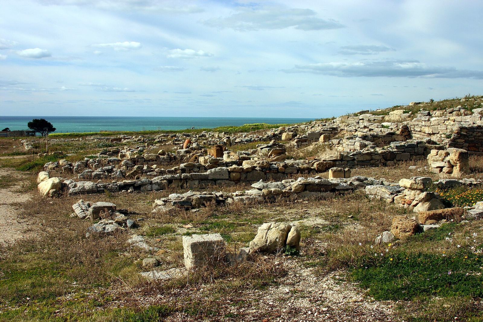
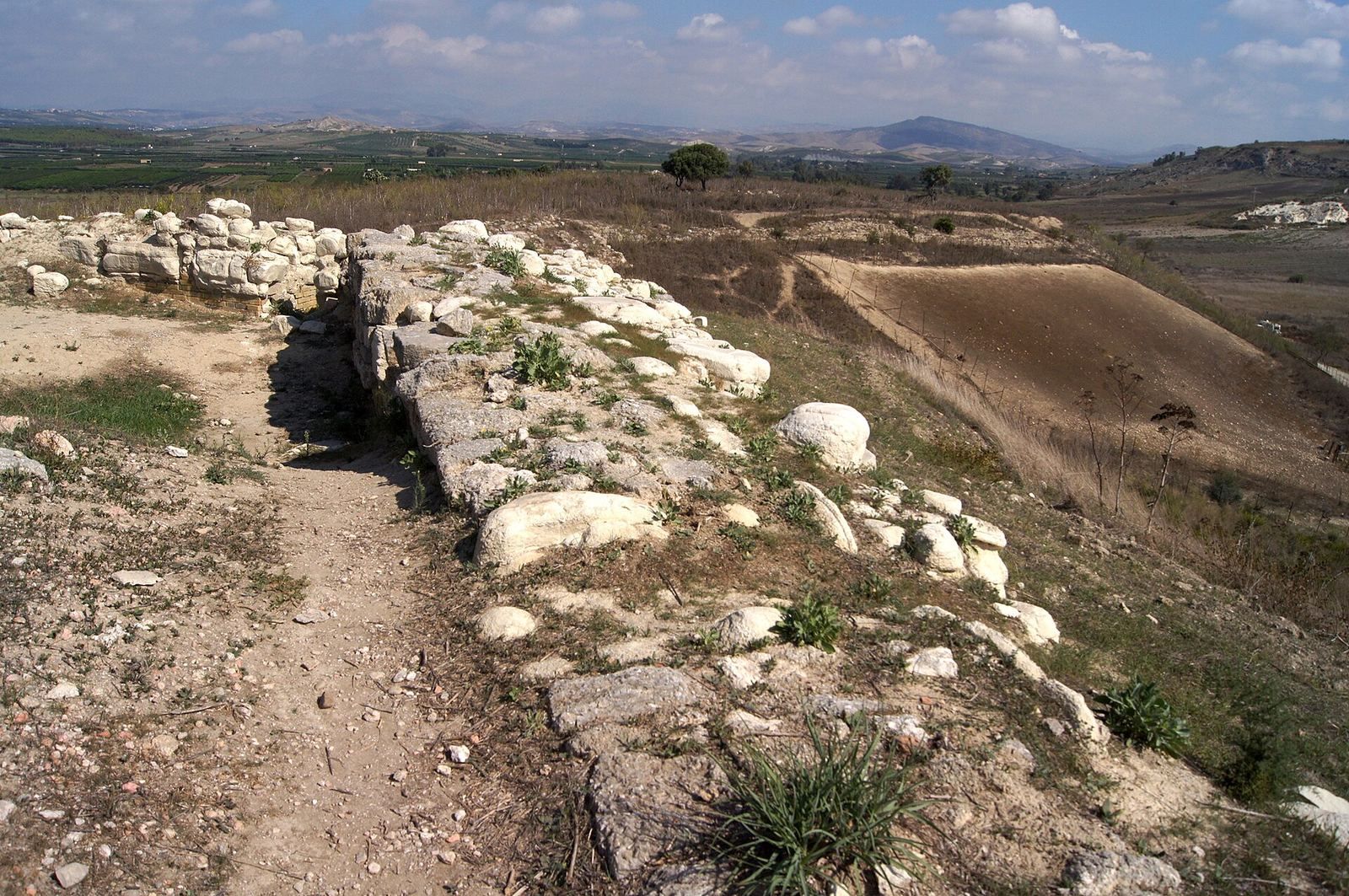
The ruins occupy the summit of the promontory now called Capo Bianco, a few hundred metres southeast of the Platani River’s mouth and about 25 kilometres west of Agrigento. The slopes descend gently north toward the river valley, while white cliffs fall steeply to the sea on the south. The excavated areas include the city’s defensive circuit, residential blocks, theatre, and burial grounds. Surviving construction includes stone foundations and lower courses with mud-brick walls above.
City walls
The city walls remain visible along much of their course. Their construction used a chalky-stone base, mud brick above, and square towers. Four building phases are distinguished: the earliest wall was made of stone, while a later wall was rebuilt twice. In its final form, dated to the third and second centuries BC, the circuit enclosed only the western part of the plateau. It crossed the urban area through House A and reduced the ground protected within the defenses.
Residential blocks
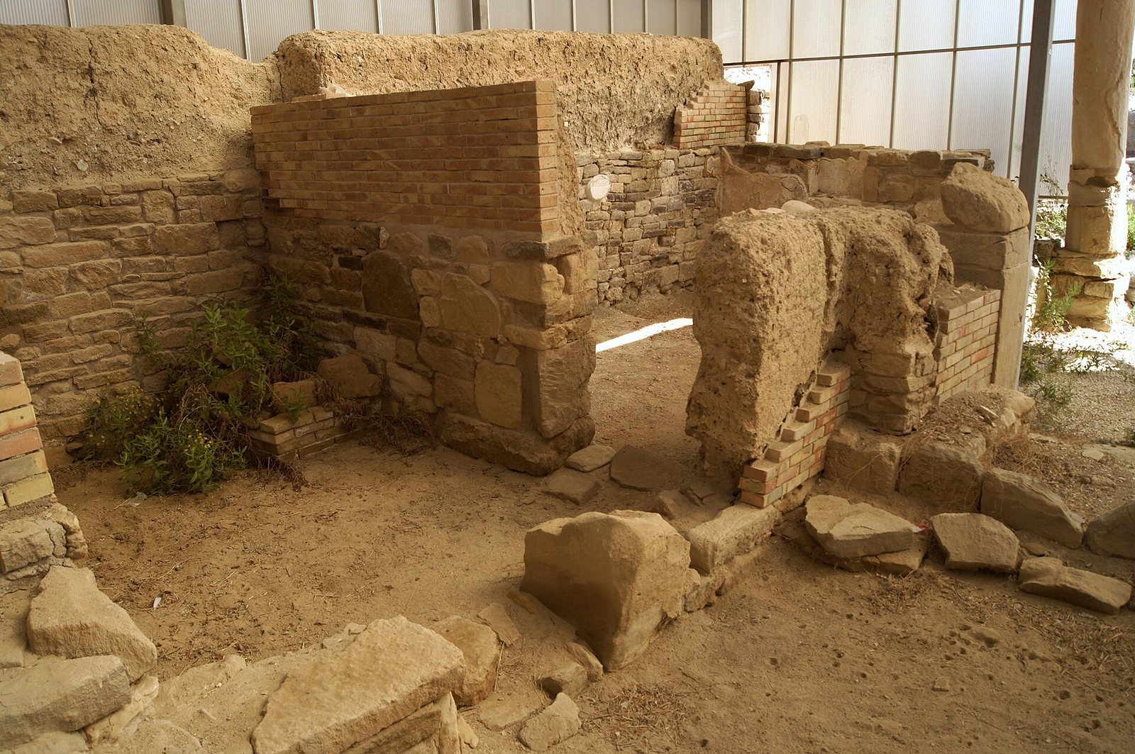
The residential quarter followed a grid of blocks divided by roads running north to south and east to west. This arrangement continued an earlier plan. In the later phase, houses usually had at least two rooms arranged around a courtyard with a hearth. Their walls rested on chalk-stone block foundations and continued upward in mud brick.
House A
House A is a fully excavated example of the older settlement, dated to the fourth and third centuries BC. Its courtyard contained a large cistern that collected rainwater from pitched roofs through an opening in the roof. A domestic shrine occupied the area north of the courtyard. A square altar survives against the northwest corner, while a shrine for household guardian deities was set into the east wall. The room’s floor was made of crushed brick and pottery in mortar, with white pieces in its surface. Remnants of wall decoration in the Pompeian First Style, which imitates masonry, also survive.
House B
House B, another older dwelling, had an upper storey. When it collapsed, its rubble filled the rooms below, preserving unfired bricks, threshold slabs, stucco, plaster, a decorated crushed-brick floor, and a mosaic. The walls are exceptionally well preserved, including their lower stone sections and upper mud-brick work. They were plastered and painted.
Theatre
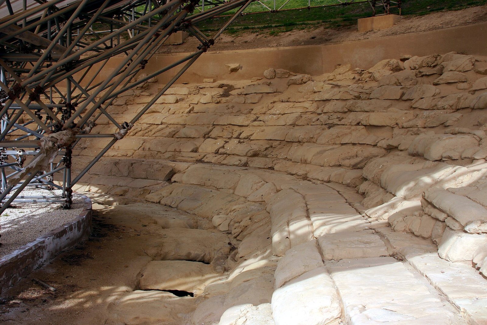
Built in the fourth or third century BC, the theatre was set into the hollow of a small hill. Its seating area faced south, contrary to the advice of Vitruvius, a Roman writer on architecture. One side rested against the city wall, and the sides of the auditorium extended outward, an arrangement also found in some other Greek theatres.
The central performance space had fittings for cables that held a movable wooden platform. The theatre fell out of use in the second or first century BC, when later buildings incorporated the walls of its stairways. Soft stone used in the theatre and elsewhere in the city is vulnerable to erosion, and a modern protective roof covers the structure to limit further wear.
Burial and late antique features
Necropolis and countryside tombs
The necropolis dates from the middle of the sixth to the beginning of the fifth century BC. Tombs and cemeteries have also been excavated in the surrounding countryside. Many of their grave goods are displayed in the site museum.
Villa, basilica, and cemetery
Outside the ancient walls, remains include a late Roman villa, a large basilica, and a cemetery associated with the basilica. The buildings and burial ground represent the later occupation of the area beyond the abandoned Greek and Roman city.