Sawran: A Medieval Walled City in Kazakhstan
Site at a Glance
- Popularity
- High
- Country
- Kazakhstan
- Primary era
- Medieval
- Eras represented
- Medieval, Early Modern
- Civilizations
- Khanate of Bukhara, Mongolian, Timurid
- Site type
- Settlement
- Remains
- City
On this page21 sections
History
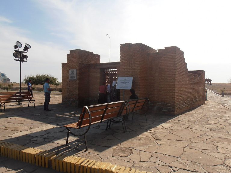
Sawran is the archaeological site of a medieval walled city in Kazakhstan, re-established at its present location after Mongol forces destroyed its predecessor at Qaratöbe in the first half of the 13th century. The later city stood about 3 km north of the earlier settlement and became an important strategic and trading center in the Syr Darya region.
Qaratöbe and the early city
The earlier settlement at Qaratöbe had grown into a city by the 6th century. Sawran appears in 10th-century geographical writings, including works by al-Muqaddasi and Hudud al-Alam, and in a 13th-century travel account by Hetoum I, king of Cilician Armenia. Al-Muqaddasi described a large frontier city with seven walls and a congregational mosque in its inner city, facing the Oghuz and Kipchaks, Turkic peoples of the region.
During the Kara-Khanid period, Sawran was subject to Isfijab, a major Central Asian city later known as Sairam. It became a center for fairs and trade, particularly with the Oghuz, some of whom also lived in the city. In 1065, Sawran submitted to the Seljuq dynasty as the Kara-Khanid state entered a period of Seljuq vassalage. In the mid-12th century, Qaratöbe was drawn into conflicts involving the Khwarazmshahs, the Qara Khitai state, and the Naimans, a Central Asian people and political confederation.
The later Sawran benefited from a caravan route running between the Karatau range and the Syr Darya. At its height, its population may have reached 15,000.
The White Horde and Timur
By the 14th century, Sawran was a center of the White Horde, a Mongol-Tatar polity of the Eurasian steppe, and served at times as its capital. The White Horde ruler Sasy-Buka was buried in the city in 1320. His son Erzen supported extensive building in Sawran and other cities of the realm, including religious and charitable institutions.
In the late 14th century, Timur rebuilt Sawran as a fortress in his struggle against the Golden Horde, another Mongol-Tatar power. During conflicts in the 1370s, Tokhtamysh, a ruler of the Blue Horde backed by Timur, sought control of Sawran and other regional cities while the region was under Urus Khan. Sawran also supplied brick and tile for the Mausoleum of Khoja Ahmed Yasawi, which Timur commissioned in 1389.
Sawran under the Kazakh Khanate
In the 15th century, Sawran maintained diplomatic relations with China’s Ming dynasty. The Shaybanid historian Ruzbihan praised the city, and the writer Zayn al-Din Vasifi lived there in 1514–1515, describing its buildings and water supply. In the 1480s, a son of Janibek, one of the early Kazakh khans, ruled Sawran for several years. His forces defeated a military group led by Muhammad Shaybani.
During the 16th century, Kazakh rulers and the Shaybanids, a Central Asian ruling dynasty, repeatedly contested the city. Bukhara held Sawran in 1515, and Ubaydullah Khan ordered the construction of a madrasa, an Islamic teaching institution. By the end of the century, Sawran had been fully incorporated into the Kazakh Khanate and was one of its principal cities.
In 1598, Shaybanid forces besieged Sawran and inflicted severe damage. Their siege engines destroyed houses and well structures; they also drained water from the moat and dug tunnels beneath the fortress walls. Despite this assault, Sawran remained an important Kazakh Khanate city through much of the 17th century.
Decline and archaeological investigation
Sawran’s decline became pronounced in the 1680s, as other cities along the Syr Darya also diminished. During the Kazakh Years of Great Disaster of 1723–1727, a period of Dzungar attacks, the Dzungars destroyed the city. Sawran had become a small settlement near Turkestan by the second half of the 18th century and was deserted during the first half of the 19th. After abandonment, local residents took building materials from many of its ruins.
P. I. Lerch surveyed the site in 1867. Investigations followed in 1947, 1967, and 1986, with further research from 1998 to 2014 and heritage work beginning in 2004. Excavations uncovered parts of the central square, mosque, madrasa, and khanqah, a Sufi religious lodge. The northern gate, main street, tower, moat, and bridge area were also excavated and restored. Sawran was the first place in Kazakhstan where a qanat, an underground water channel supplied through wells, was discovered. The site is a monument of history and culture of republican significance and forms part of the Azret Sultan State Museum-Reserve.
Remains
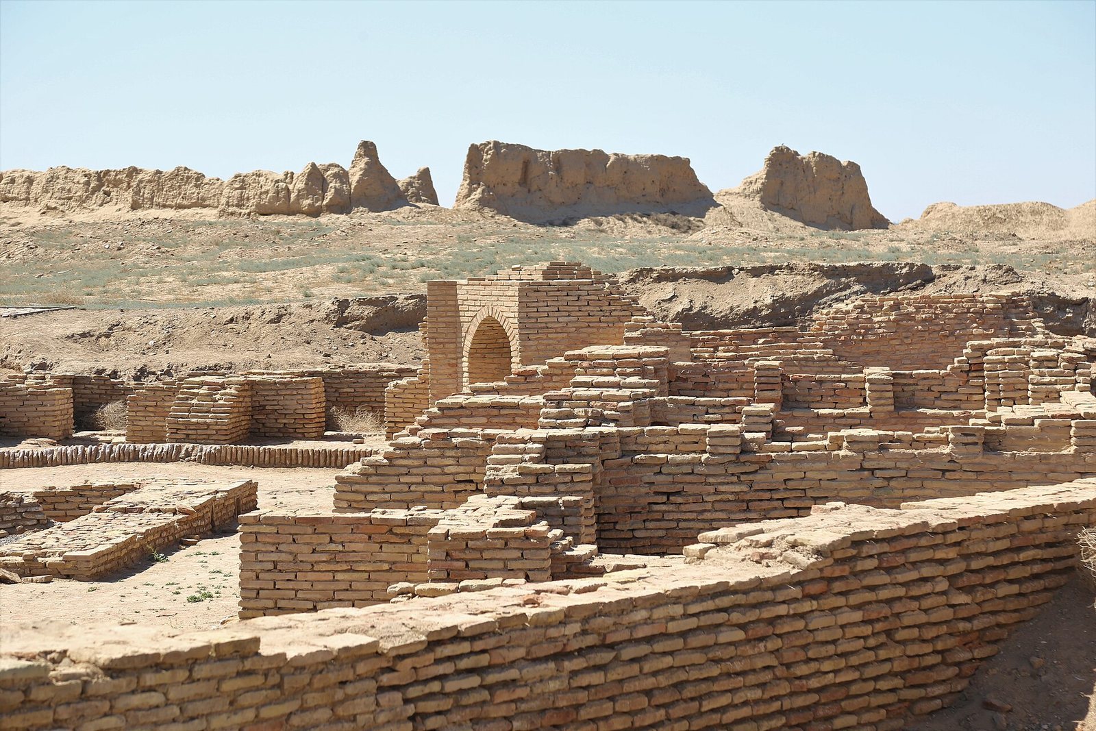
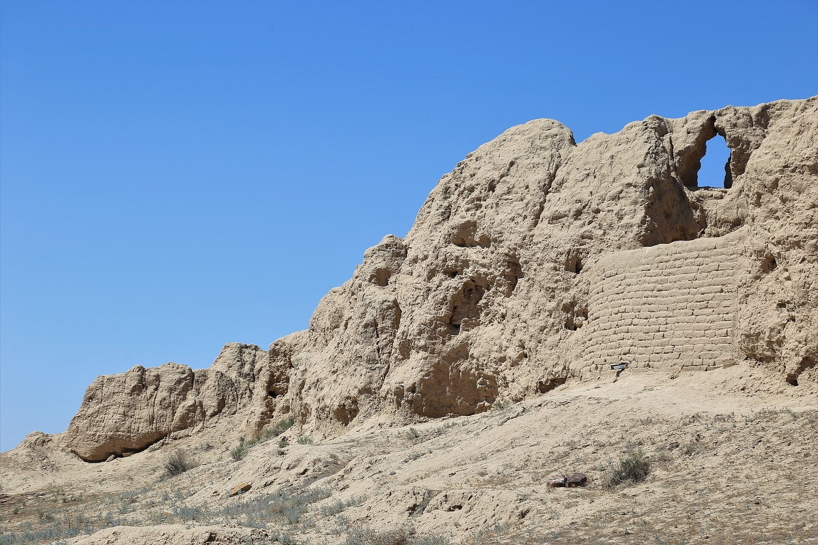
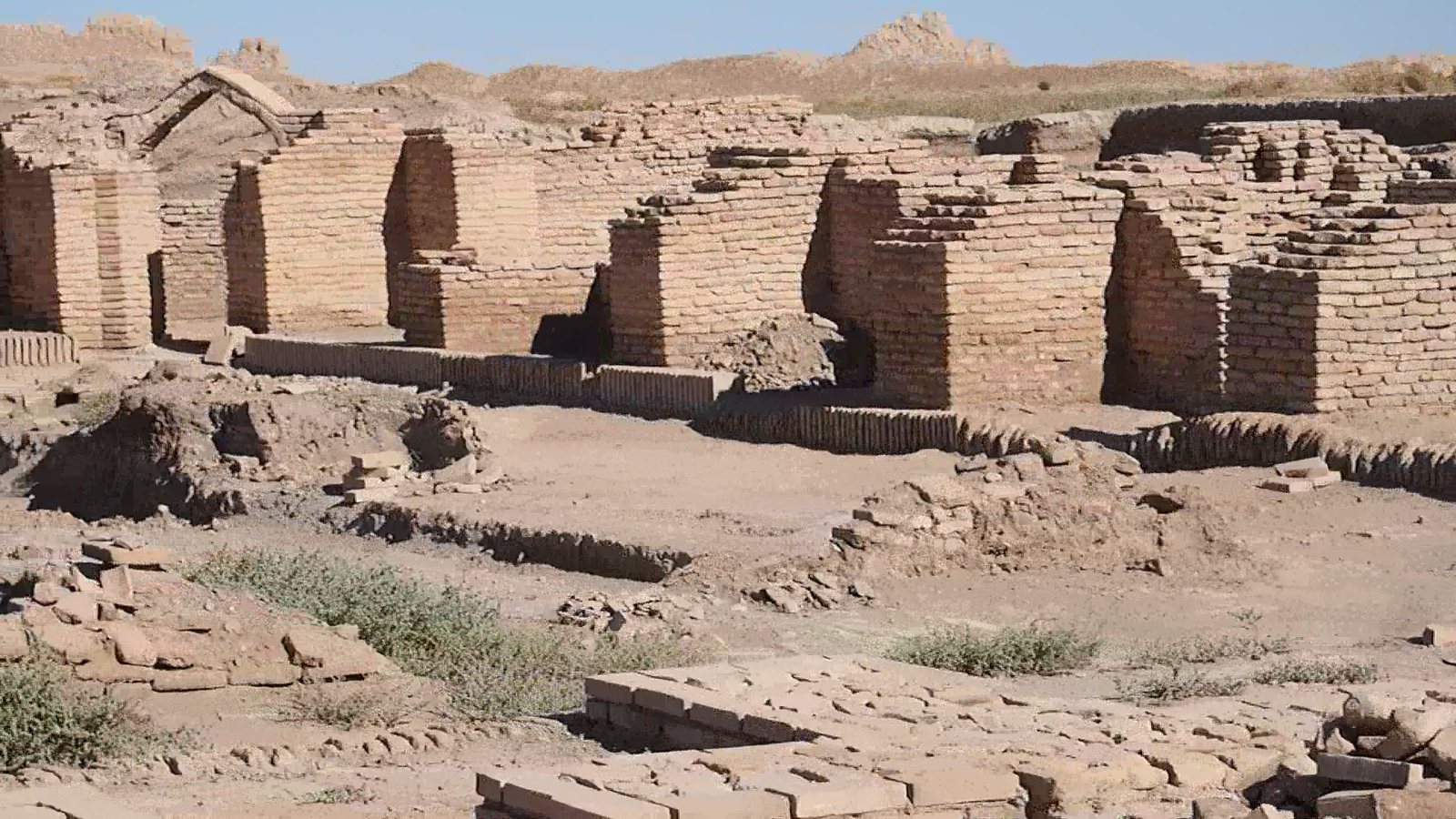
The later city occupies an elevated oval platform about 800–850 m along its longer axis and 500–650 m along its shorter one. It rises approximately 2–2.5 m above the surrounding ground. Its defensive circuit enclosed the urban center, while dense and estate-style suburbs extended beyond the walls. Unfired brick and pakhsa, construction using compacted earth, were used in the defenses; fired brick and colored glazed tiles feature in the principal religious buildings.
Fortifications and street plan
Enclosure and moat
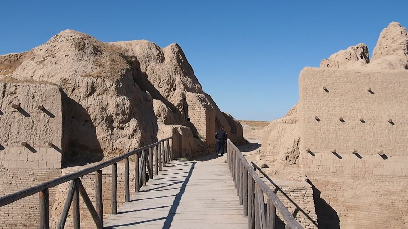
The city wall followed a circuit of about 2,360 m and stood on a base 2–3 m high. Eroded stretches survive at heights of 3–6 m. Seven defensive towers once stood at gates and corners; four two-tiered towers remain. Their domes rested on structures that supported them over the corners, and the northern-corner tower reached about 6 m. Outside the wall, a moat was about 15–20 m wide and several metres deep, exceeding 3 m in excavated sections. One section was reinforced with 48 courses of brick. The water-filled moat was bordered by an earth rampart, up to about 5 m wide and 1–1.5 m high, formed from the excavated soil.
Gates and streets
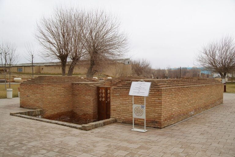
The principal entrance was on the north side, where two towers formed a passage about 20 m long. The second gate, on the southeast, is poorly preserved. Gate passages were about 5–6 m wide; an arched opening in the eastern tower measured about 1.2 m wide and 1.7 m high. Excavated bridge supports mark the main entrance, where a bridge crossed the moat. From this gate, a main street up to 10 m wide ran southwest and divided the city nearly in half. An excavated stretch toward the central square measured 172 m. A cross-street connected the northwest part of the city with the southeast gate, meeting the main street about 150 m from the southwest wall.
Central square and buildings
Central square
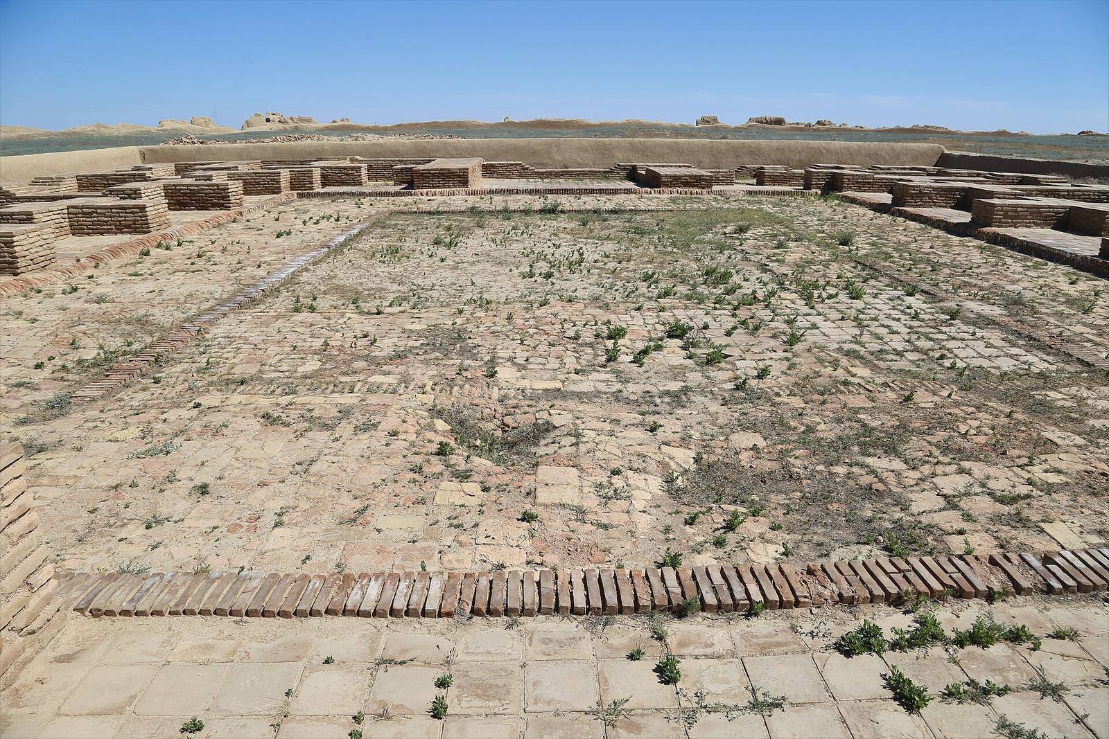
The central square, about 100 by 50 m, lay roughly 210 m inside the northeast gate. The congregational mosque and madrasa faced onto it, and their buildings were made of fired brick and clad in colored glazed tiles. A separate hexagonal Sufi lodge stood near the northeast gate.
Congregational mosque
The mosque occupied the northwest part of the square and measured about 34 by 31 m. It combined Arab and Central Asian architectural traditions. Its central courtyard measured 17.8 by 15.3 m, with colonnaded galleries along two sides and an iwan, a vaulted space open on one side, opposite the mihrab, the niche indicating the direction of prayer. Several domes covered the building. Its foundation used compacted earth, and its brick walls were bonded with alabaster mortar; the exterior walls reached 1.4 m thick.
During a later period of decline, the mosque served as a pottery workshop and temporary dwelling. Excavations revealed remains of temporary kilns and fragments of glazed domestic pottery. Much of its wall masonry had been taken away for reuse.
Two-minaret madrasa
Built in 1515 on Ubaydullah Khan’s orders, the madrasa occupied grounds about 31.5 by 28 m. Its entrance and two minarets faced northwest. The building stood on a plinth 1.2 m high and included several iwans, including an entrance space reached by a 3.3 m-wide stair cut through the plinth. Its inner courtyard measured 11.7 by 8.5 m, and its load-bearing walls were more than 1.5 m thick. The minarets rested on layered foundations designed to resist earthquakes. The best-preserved parts are the hujras, small rooms used as living or study quarters by teachers and students. The minarets remained standing after the city’s decline but collapsed in the second half of the 19th century.
Large building north of the mosque
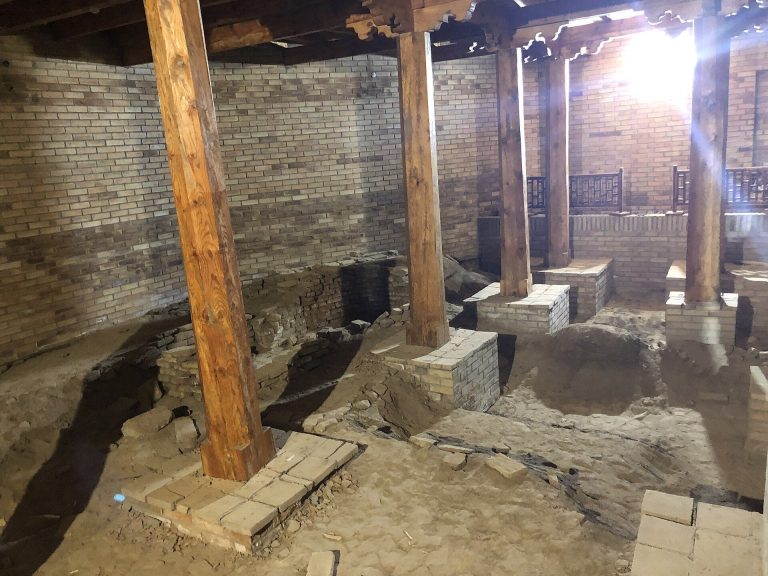
North of the mosque are the remains of a later building whose purpose is uncertain. It may have been an Islamic school, a Sufi lodge, or a caravan inn. The structure covered more than 2,000 m² and had several domes, multiple iwans, and a courtyard about 14.8 by 11.5 m. Its low entrance portal and broad vaulted space were in the southeast wall. Arched niches in the southeast and south walls may have been shops. The northern part is best preserved. Finds point to copper or bronze production and other crafts. Graffiti survives on the interior walls of one room that may have served as a burial chamber.
Suburbs and water system
Estates and gardens
Beyond the walls, suburban development covered roughly 4 km² and extended to a radius of about 1,600 m. It included approximately 350 estates, generally about 1 hectare each. The largest covered about 1.8 hectares and the smallest about 0.5 hectare. Plots beside houses were used for melons and other garden crops, orchards, vineyards, and grain. Residential, commercial, and public-building remains also survive outside the enclosure.
Underground water channels
The qanat system supplied the suburbs through wells linked by underground channels. Lines of ventilation wells survive, each about 5 m in diameter and spaced 12–15 m apart; traces of channels remain outside the city, and the system’s headworks lay about 7 km away. Vasifi attributed the system to the Muslim holy man Mir Arab and said that 200 enslaved Indian laborers built it.
Outlying remains and finds
Necropolis and religious buildings
A necropolis with a mosque lies east of the fortress. Excavations have also exposed remains of a Friday mosque and an Eid prayer mosque outside the walls.
Objects from the city
Finds include Chinese celadon and porcelain dating to the 16th and 17th centuries, along with workshop traces and pottery fragments, many associated with the city’s decline. A 25 kg hoard of copper coins discovered in 2015 contains locally minted pieces and coins struck in the Russian Tsardom under Tsar Alexei Mikhailovich, who ruled from 1645 to 1676. Iron arrowheads, round stone projectiles from wall-breaking machinery, and human skeletal remains have also been found in the moat.
Earlier settlement at Qaratöbe
Several lines of defensive walls survive at Qaratöbe, the earlier settlement associated with Sawran. Excavated material places the end of its occupation after the Mongol invasion.