Atsukashiyama Barrier: A Late-Heian Defense of Hiraizumi
Site at a Glance
- Popularity
- Medium
- Country
- Japan
- Primary era
- Medieval
- Eras represented
- Medieval
- Civilizations
- Unclassified
- Site type
- Military
- Remains
- Wall
On this page7 sections
History
Construction and strategic role
Atsukashiyama Barrier was a defensive earthwork in northern Japan, near the northern end of the Fukushima Basin and the border with Miyagi. It was built in the late Heian period, when Japan’s imperial court was based at Heian-kyō, now Kyoto. The Northern Fujiwara, also called the Ōshū Fujiwara, were a branch of the Fujiwara clan that ruled much of northern Japan from Hiraizumi. They built the barrier before 1189, probably around 1188, to block Minamoto no Yoritomo’s advance into Ōshū and defend Hiraizumi. Construction is credited to Fujiwara no Kunihira, while archaeological interpretation connects the fortification with the defenses of his father, Fujiwara no Yasuhira.
The barrier occupied a narrow passage on the principal route into northern Japan, a corridor that remains an important north-south route. The Northern Fujiwara regarded this area as vital to Hiraizumi’s defense, and it also served as a base for one of their subordinates.
The Battle of Atsukashiyama
In 1189, Yoritomo, the military leader who established the Kamakura shogunate, led the conquest of Hiraizumi. The main fighting took place at the barrier. Its defenses delayed the advancing Minamoto forces only briefly, and Kunihira was killed in the battle.
Investigation and protection
Construction of the Tōhoku Expressway brought the barrier to scholarly attention, and the Fukushima Prefectural Board of Education investigated the site in 1971. A land-improvement plan announced in 1978 threatened major changes to the southern area, prompting the Board to excavate there in 1979. On 14 March 1981, the site became a National Historic Site of Japan. The initial protected area included the mountain summit and land outside the improvement project, with further protection intended to be added in stages.
Remains
The defensive line ran south from the lower slopes of 289-metre Atsukashiyama, across farmland toward a point near the Abukuma River. Its length is estimated at about four kilometres. The defenses comprised three earthen ramparts and two moats, though their arrangement was not uniform along the whole line.
Moats and ramparts
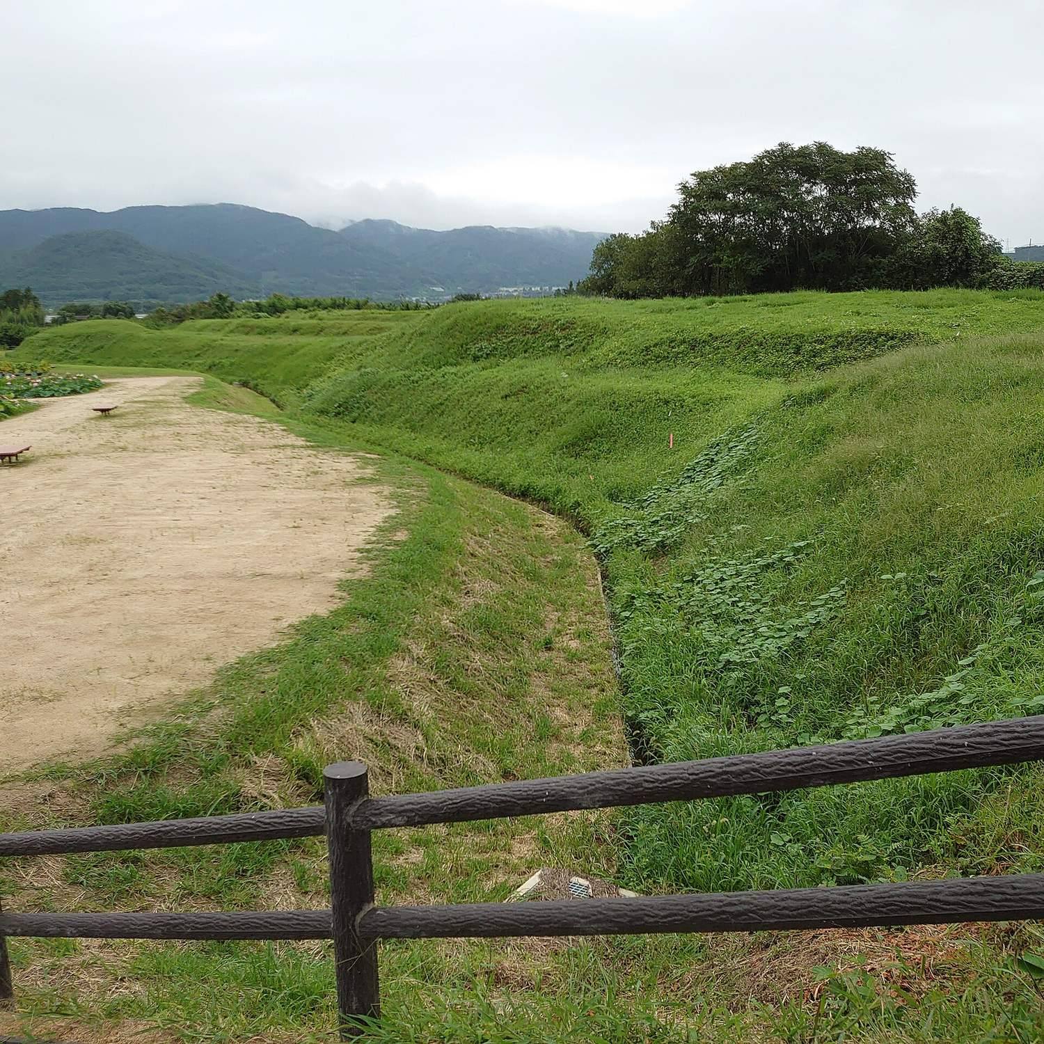
Excavation on the mountain’s middle slope in 1971 uncovered two moats about two metres deep. Soil removed from them formed three ramparts, each about one metre high, and natural stones reinforced the base of the eastern rampart. The distance across the outer edges of the two moats was about 15 metres. Nine trenches dug in 1979 found paired moats in most investigated areas and a single moat in one. The paired system measured about 15 metres across, with V-shaped moats 1.5 to 2.8 metres deep. The medieval Azuma Kagami, a chronicle of the Kamakura shogunate, describes a moat five jō, a traditional Japanese measure, or roughly 15 metres, wide. It also says that Hatakeyama Shigetada, a samurai commander, filled it in. The defenses included dry moats, defensive towers, and siege crossbows, large mechanical bows used in combat.
Surviving traces across the landscape
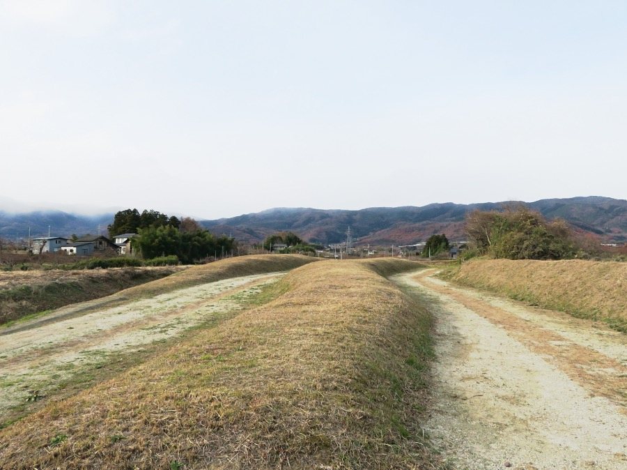
Railways, roads, expressways, farming, and irrigation channels have divided or altered parts of the site. Earthen rises and shifts in ground level remain visible at intervals among paddy-field boundaries, fields, and orchards. Paired moats and three-rampart sections are especially clear in two districts. A north-south sequence of local place-names also preserves associations with former military facilities and strongholds.