Roussolakkos: A Minoan Town and Sanctuary in Crete
Site at a Glance
- Popularity
- Low
- Country
- Greece
- Primary era
- Bronze Age
- Eras represented
- Bronze Age
- Civilizations
- Minoan
- Site type
- City
On this page19 sections
History
Roussolakkos was a Minoan town and later sanctuary near Palekastro on Crete, Greece. Its foundation date is unknown, but it had developed into a planned town by about 2000 BCE. The coastal area had been occupied since the end of the Neolithic period, and scattered Early Minoan buildings appeared at Roussolakkos and on nearby Kastri hill after about 2900 BCE. Early, Middle, and Late Minoan are chronological divisions of Bronze Age Crete.
Growth and repeated destruction
Roussolakkos flourished through much of the Minoan period and was among Crete’s largest settlements in the Late Minoan era, often ranked second or third in size after Knossos and Malia. By around 1900 BCE, it had maritime connections with Asia Minor and Egypt. An earthquake around 1760 BCE damaged the town. It was rebuilt at the beginning of the Neopalatial period, a phase of renewed palace construction and use, with paved streets and drainage channels. Another earthquake struck around 1570 BCE.
Near the end of Late Minoan I A, around 1500 BCE, ash from the Thera eruption covered the region. One or more tsunamis, at least nine metres high, followed and devastated Roussolakkos. In 2006, Jan M. Driessen and J. Alexander MacGillivray proposed that tsunami damage, together with ash deposits in Buildings 2 and 6, explained part of the destruction.
The town was substantially rebuilt during Late Minoan I B, around 1490–1460/1440 BCE. Fires damaged parts of it between about 1460 and 1440 BCE, probably during attacks. Much of Roussolakkos was rebuilt again in Late Minoan II and III A1, around 1440–1400 BCE. Further fires in the early Late Minoan III A2 period, around 1400–1320 BCE, may have coincided with Knossos’s final destruction. After another extensive rebuilding, an earthquake around 1250 BCE destroyed the town, and its inhabitants abandoned it.
During Late Minoan III C, around 1200–1100 BCE, occupation was restricted to a small refuge on Kastri. Its inhabitants may have been people from Roussolakkos, newcomers, or pirates; the refuge’s origins remain uncertain. Roussolakkos itself was probably uninhabited during this period.
The sanctuary and territorial disputes
Linear B records from Knossos, a script used to write an early form of Greek, refer to the worship of Diktaian Zeus at Roussolakkos around 1300 BCE. An open-air sanctuary for a youthful fertility god was established around 900 BCE. Its annual festival celebrated nature’s renewal and included the initiation of young citizens. A temple was built there between about 550 and 150 BCE, and the cult grew from a local observance into a major religious centre in eastern Crete.
An inscription identifies the sanctuary with Diktaian Zeus, an epithet of Zeus, the principal god of ancient Greek religion. The sanctuary was probably the centre of Heleia, also called Eleia, a city or territory associated with the Eteocretans, an ancient population of Crete. Itanos, Praisos, and Hierapytna disputed control of the sanctuary’s administration and the surrounding territory.
After the death of Ptolemy VI of Egypt in 145 BCE, Egyptian troops withdrew from Itanos, and conflict between Itanos and Hierapytna intensified over Leuke and Heleia. Rome intervened after a war ended in 141 BCE, calling for outside arbitration in 140 BCE. The Roman consul C. Laelius Sapiens, one of the Republic’s chief elected magistrates, referred the case to Magnesia on the Maeander. Its judgment in 132 BCE favoured Itanos.
Hierapytna later appears to have gained control of the disputed territory. Fighting around 121 BCE concerned the borderlands, where a Hierapytna settlement was established outside the sanctuary precinct. After another war in 115–114 BCE, the Roman consul L. Calpurnius Piso Caesoninus referred the boundary dispute to Magnesia in 112 BCE. Its ruling again favoured Itanos. Commissioners from Miletus, and possibly Rome, then marked the boundary, and Itanos and Hierapytna made an alliance that extended reciprocal civic rights between their communities.
Decline and archaeological investigation
The settlement beside the temple appears to have been uninhabited by the first century BCE. After Rome conquered Crete in 67 BCE, no large settlement arose at Roussolakkos, though the sanctuary remained in use. Christians apparently looted and destroyed the temple in the late fourth century CE. Local farmers later reused its remains as building stone.
Terracotta objects were noticed near Palekastro in the early 1850s, and two decorated terracotta slabs found by a trader in the early 1880s may have come from Roussolakkos. In 1902, Robert C. Bosanquet found a matching fragment at the site. He initially interpreted the excavated remains as a Mycenaean city, perhaps the capital of eastern Crete; later work established their Minoan identity. The British School at Athens excavated from 1902 to 1906 under Bosanquet and then Richard M. Dawkins. The sanctuary was exposed during the third and fourth seasons, and Dawkins led a further investigation in the surrounding area in 1906.
Excavations by the British School in 1962–1963 focused on House N and the settlement on Kastri. The Greek Archaeological Service excavated parts of the Palekastro area in 1972 and 1978. A new British School campaign began with surveys in 1983, followed by work in the northern sector from 1986. Geophysical surveys in 2001 and 2012 and excavations from 2013 to 2015 formed part of the Palace and Landscape at Palaikastro project. Part of the excavated residential area was destroyed after the Second World War.
Remains
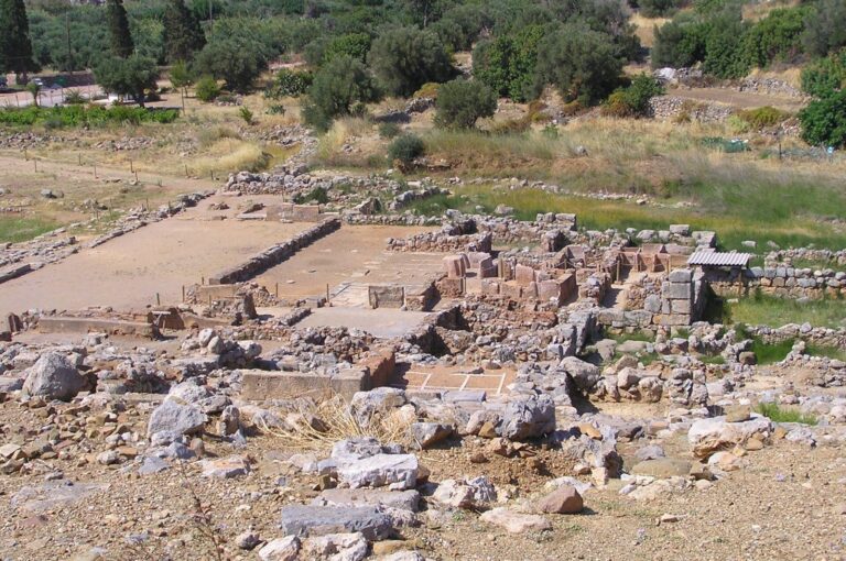
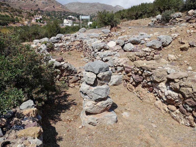
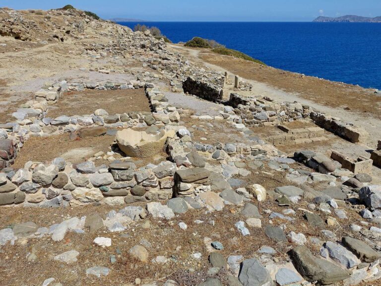
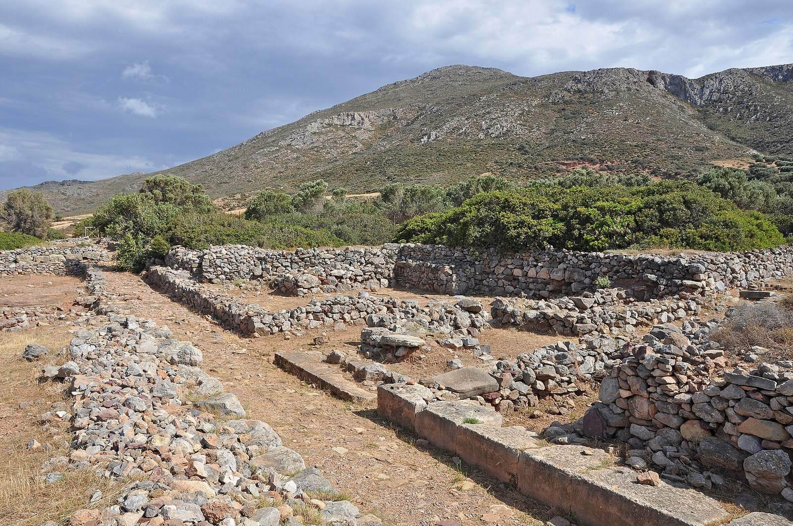
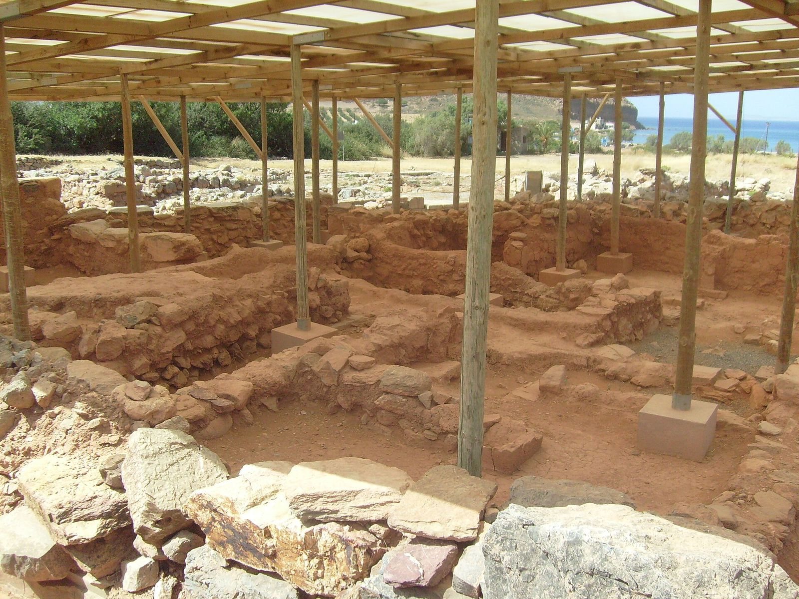
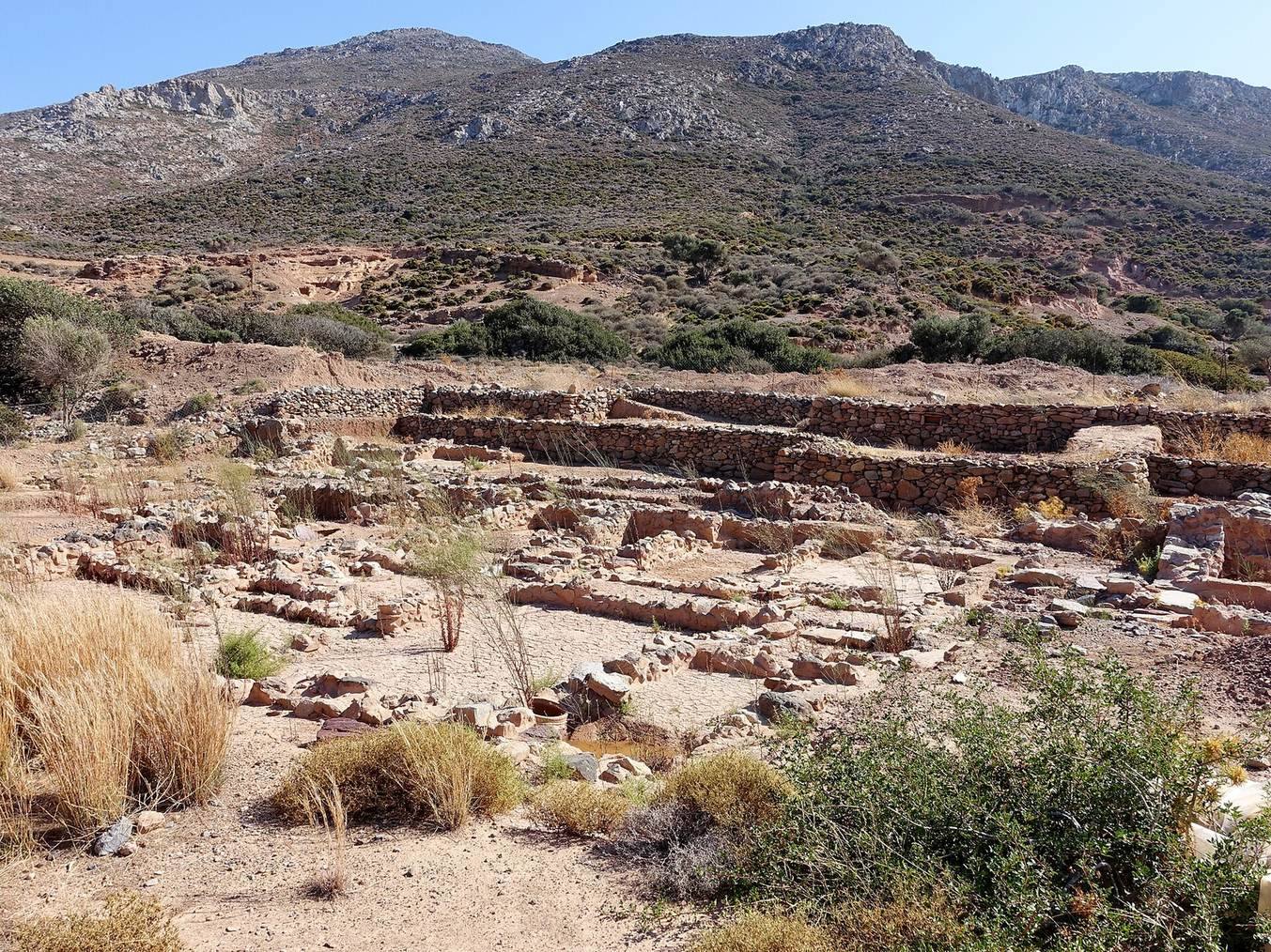
Roussolakkos stands about 10 metres above sea level, roughly 250 metres south-west of Chiona beach and near modern Palekastro. Alluvial deposits, sediments carried and laid down by water, have shifted the shoreline more than 200 metres away; the settlement once stood directly beside the beach. The name Roussolakkos means “red pit,” referring to the reddish, fine-grained, impermeable marl sandstone of the surrounding hollow. Estimates put the town’s area at more than 50,000 square metres, while a wider estimate gives about 30 hectares and an approximate footprint of 600 by 600 metres. About 10,000 square metres have been excavated, with some areas later backfilled.
Town plan and domestic architecture
Streets and building materials
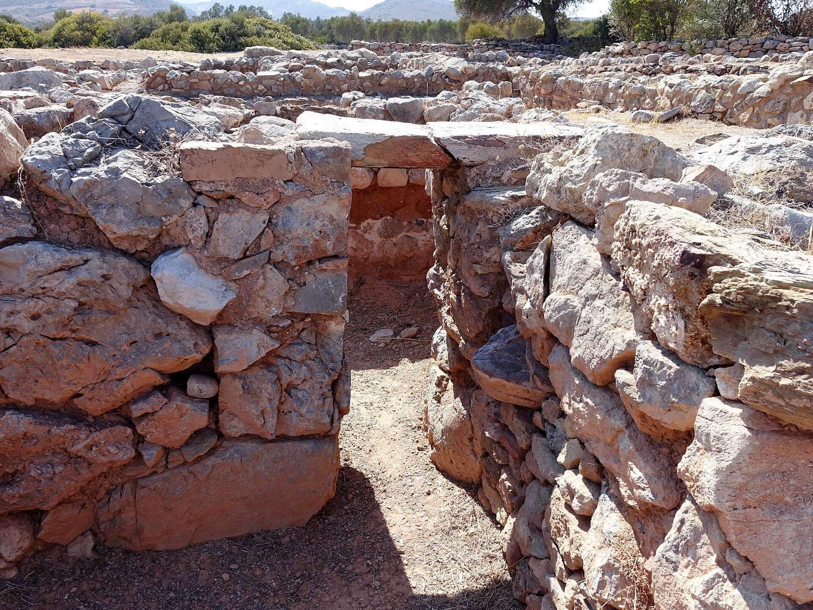
A main road and cross-streets divided the town into nine quarters, connected by a drainage network. Quarter D was the largest, covering about 1,800 square metres; Quarter B held five houses, while Quarter E had at least four. Houses facing the main road had elaborately decorated fronts. The town’s construction commonly used local Sideropetra, a crystalline limestone, and conglomerate. Sandstone served for doorposts and ashlar masonry, which uses carefully squared stone blocks. Purple and blue-green schist paved streets and house floors.
The planned rebuilding of Late Minoan I B included broad roads, large blocks, and façades articulated with projecting and recessed sections. Buildings 1, 2, 4, and 5 in the northern sector illustrate this work. Building 1 was the first at Roussolakkos in Late Minoan I A to have all four exterior walls made of ashlar masonry.
Houses and household installations
Some houses had two storeys, columned courts, large principal rooms, wells, cisterns, and numerous storerooms. Household shrines could contain consecrated alabaster double horns, Minoan religious symbols. One two-storey house in Quarter B opened from the main street onto a courtyard. Its central hall, or megaron, had a light well, and the house also contained kitchens, a ritual-purification basin, a well, a household shrine, an oil store, a bath, and a reception room later divided into storerooms.
Work areas in Quarters B and E
A separate building in Quarter B is identified as an oil press because it contained an oil separator and large storage jars. A building in Quarter E has been identified as a grape press. One house in that quarter also shows occupation continuing for several centuries into the historical period.
The sanctuary
Precinct and altar
The sanctuary occupied much of blocks Pi and Chi and the road between them. It stood on an artificially levelled platform halfway up the south-eastern slope, near the end of the Minoan main road. The surviving enclosure wall measured 36 metres. Votive deposits and a grey layer of wood ash, about three metres long and 0.25 metres thick, identified the altar’s position.
Architectural decoration and offerings
Terracotta remains from the sanctuary include fragments of architectural decoration, a cornice, and a probable pediment fragment. One relief shows warriors on foot and in chariots. Offerings included bronze shields, weapons, vessels, lamps, and a bronze lion; the shields resemble examples from the Idaean Cave, a sacred cave on Mount Ida. Cups, lamps, and torches point to wine consumption during ceremonies held at night.
Inscribed stele
Four fragments of a limestone stele, an upright inscribed slab, were found near block Chi in 1904. Its two-sided text is known as the Hymn to Diktaian Zeus, or the Hymn of the Kouretes, figures in Cretan myth associated with protecting the infant Zeus. The inscription dates to the early third century CE, while its text is thought to derive from the late fourth or early third century BCE.
Sculpture and finds from the settlement
The Palaikastro statuette
The Palaikastro Kouros is a youthful male statuette made of gold and ivory, dated to about 1500 BCE. Pieces of its torso and arms, head, and legs were recovered in and beside House 5 between 1987 and 1990. The figure had been burned and smashed; deliberate destruction during an invasion has been proposed.
Pottery, tablets, and household objects
Settlement finds include Kamares pottery, a distinctive Minoan ceramic style dated here to 2100–1800 BCE, and tripod pottery from 1900–1800 BCE. An octopus-decorated stirrup jar, a vessel with a false neck and a spout between its handles, dates to 1500–1450 BCE. Other finds include a depiction of a Minoan circular dance dated to 1350–1300 BCE and Linear A tablets, written in a Bronze Age script that remains undeciphered.
Objects found in 1903 include spouted jars, two large storage jars probably used in oil production, and an early wine press. Jars held peas, barley, and olive kernels. Other finds include engraved gems, two with three-sided seals; finely granulated amber earrings; the rim of a steatite bowl bearing four Minoan signs; a bone-carved female head; and four stone representations of cult horns. Two double axes differed in size, with the smaller measuring five centimetres from tip to tip. Geometric pottery, bronzes, and a scarab seal found near the south-eastern end of the former main road helped identify an ancient temple in that area. A layer of wood ash indicated a building made mainly of timber.
Nearby archaeological features
Kastri and Petsophas
Kastri hill rises to about 89.79 metres north of Roussolakkos. Its refuge plateau, accessible only from the south, is about 180 metres long and 15–30 metres wide. A settlement there is associated with Late Minoan III C. Immediately south of Roussolakkos, Petsophas has a peak sanctuary, a place of worship on a summit, that may have been linked to the town. Offering tables from the sanctuary bear Linear A inscriptions.
Tombs, buildings, and a kiln
Early Minoan tombs and larnakes, funerary coffins, have been found in the surrounding area. A chamber tomb 275 metres east of Angathia has an eight-metre-long passage leading to the burial chamber, which is 2.30 metres across. Nine finds were recorded there, and the tomb is dated to Late Minoan III A2/B.
At Vlychades, on the coast below Petsophas, two Minoan buildings containing Late Minoan I pottery were investigated. A channel in one bears a double-axe sign. A kiln about 300 metres south-east of Roussolakkos and 400 metres from the sea was cut roughly 1.30 metres into white chalk marl. It is 2.68 metres across, with a 0.40-metre-wide ledge interrupted by an eastern opening. The opening served as a channel for removing fired material and has an arch 0.65 metres high and equally wide externally. It is the easternmost Minoan kiln identified on Crete.
On a hill about 400 metres north-west of Roussolakkos, architectural remains belong to Middle Minoan III, Late Minoan I, and Late Minoan III A. A wall of regular ashlar blocks from Middle Minoan III was incorporated into two later rooms, which contained separate Late Minoan I B destruction and Late Minoan I A layers. The quarries at Ta Skaria on the shore south-east of the town supplied the yellow Aeolianite, a wind-deposited calcareous stone, used for ashlar blocks at Roussolakkos.