Ancient City Itanos: An Ancient Greek Port in Crete


Site at a Glance
- Rating
- 4.6
- Popularity
- Low
- Country
- Greece
- Primary era
- Classical
- Eras represented
- Iron Age, Classical, Medieval
- Civilizations
- Ancient Greek, Byzantine, Roman
- Site type
- City
On this page14 sections
History
Ancient City Itanos is an ancient Greek city and port in Greece, near Sitia on the northeastern coast of Crete. The city developed beside the shore during the Geometric Period in the eighth century BC, at the base of the promontory now called Cape Sidero. Its harbor and position in the eastern Mediterranean supported a trading economy that made Itanos one of the most powerful cities in Crete during the Hellenistic period.
Early settlement and foundation traditions
Human occupation of the promontory began as early as the Final Neolithic, although the earlier Minoan settlement pattern centered on the so-called Villa of Vai rather than on the later city. Farms, dams, and lookout sites extended across the wider area. The eruption of Santorini and its associated tsunami destroyed the earlier civilization on the promontory, while settlement at Vai continued in reduced form into Late Minoan III before disappearing in the Early Iron Age. No Minoan settlement phase is associated with the later city at Itanos.
Ancient tradition gave two possible explanations for the city’s foundation. One attributed it to Itanos, the son of Phoenix, while another connected it with an illegitimate son of the Kouretes, legendary figures associated particularly with Crete. Herodotus linked the city to maritime knowledge through Corobius, a seller of purple dye at Itanos. According to his account, Corobius guided the Therans during the foundation of Cyrene and provided information about the Libyan coast.
Hellenistic power and Ptolemaic intervention
Itanos developed an outward-looking character based largely on trade. As a polis, an ancient Greek city-state with an urban center, political community, and surrounding territory, it controlled land and coast well beyond its built-up area. During the Hellenistic period, the era after Alexander the Great’s conquests when Greek influence spread widely across the eastern Mediterranean and Near East, Itanos governed territory from Cape Samonio, now Cape Sidero, to Cape Erythrae, now Cape Goudouras.
A Hellenistic inscription concerning a territorial settlement defined the city’s territory as approximately 130 square kilometres. It extended south to Karoumes Beach and west toward the mountains of eastern Crete. Itanos issued its own currency and appears to have controlled much of eastern Crete. Its expansion caused conflict with Praesus, Hierapytna, and Dragmos. Praesus remained its principal rival until Hierapytna destroyed that city in the second century BC.
Internal tensions, conflict with Praesus, and close relations with Ptolemaic Egypt led to the installation of a Ptolemaic garrison at Itanos around 265–260 BC. The Ptolemies were the Macedonian-Greek dynasty that ruled Egypt during much of the Hellenistic period. Ptolemy III Euergetes maintained the garrison and continued the policy toward Itanos established by his father, Ptolemy II Philadelphus. The military presence ended after the death of Ptolemy VI Philometor in 145 BC.
Roman arbitration and late occupation
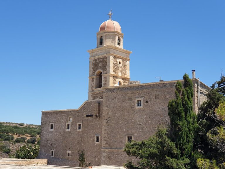
Relations with Hierapytna became increasingly hostile during the second century BC. The dispute eventually reached Rome, whose Senate issued a formal arbitration concerning Itanos, its territory, and its conflicts with Praesus and Hierapytna. A large Greek inscription preserving this decision is now kept at Toplou Monastery.
Itanos continued to prosper under Roman rule and remained an important trading port into the early Byzantine period. Imported early Christian pottery shows that commercial activity continued until at least the seventh century AD. Two early Christian churches were built during this period. After approximately 1,400 years of occupation, the city was abandoned in the seventh century AD for reasons that remain unclear, and its location was subsequently lost.
Rediscovery and archaeological investigation
The ruins at Erimoupolis were identified with ancient Itanos during the nineteenth century. Captain Thomas Abel Brimage Spratt surveyed the coast in 1852 and recorded ruins, churches, tombs, and inscriptions, but he did not find an inscription naming the city. Federico Halbherr established the identification in 1884 through inscriptions found at the site and at Toplou Monastery, and published his conclusion in 1891.
An Italian archaeological mission directed by Halbherr worked at Itanos from 1884 to 1887. Five inscriptions mentioning Itanos or the Itanoi were found among material in situ and objects recently transferred to Toplou Monastery. These discoveries definitively established that Erimoupolis was ancient Itanos. Lucio Mariani later examined the architectural remains.
The French School of Archaeology at Athens excavated the early Christian churches in 1899–1900. French investigations resumed in 1950, revealing part of the North Necropolis, Roman and early Byzantine houses, and Geometric and Archaic pottery from several parts of the city. From 1994 to 2005, the Greek Archaeological Service’s 24th Ephorate of Prehistoric and Classical Antiquities, a regional archaeological office, worked with the French School at Athens, the Institute for Mediterranean Studies at Rethymno, and other international institutions on a multidisciplinary survey of the city and its wider territory.
The survey produced a digital map and database using aerial photographs, maps, surface observations, pottery analysis, and GPS recording. Military aerial photographs from 1945, 1966, 1968, and 1992 were used alongside a further aerial survey in 2004. The work examined visible surface remains and generally excluded concentrations of pottery fragments without another surface feature; the countryside survey itself involved no excavation. It documented a cultural landscape extending from the Neolithic and Bronze Age through the Archaic, Classical, Hellenistic, Roman, and Byzantine periods.
The wider peninsula, formerly owned by Toplou Monastery, became a Natura 2000 protected area in 2000 and part of the Sitia Geopark in 2015 after a development proposal had threatened the landscape. A new research and documentation program for the North Necropolis began in 2011 under Didier Viviers and Athena Tsingarida with the Belgian School at Athens. The Hellenic Republic owns the site, which is managed by the 24th Ephorate of Prehistoric and Classical Antiquities.
Remains
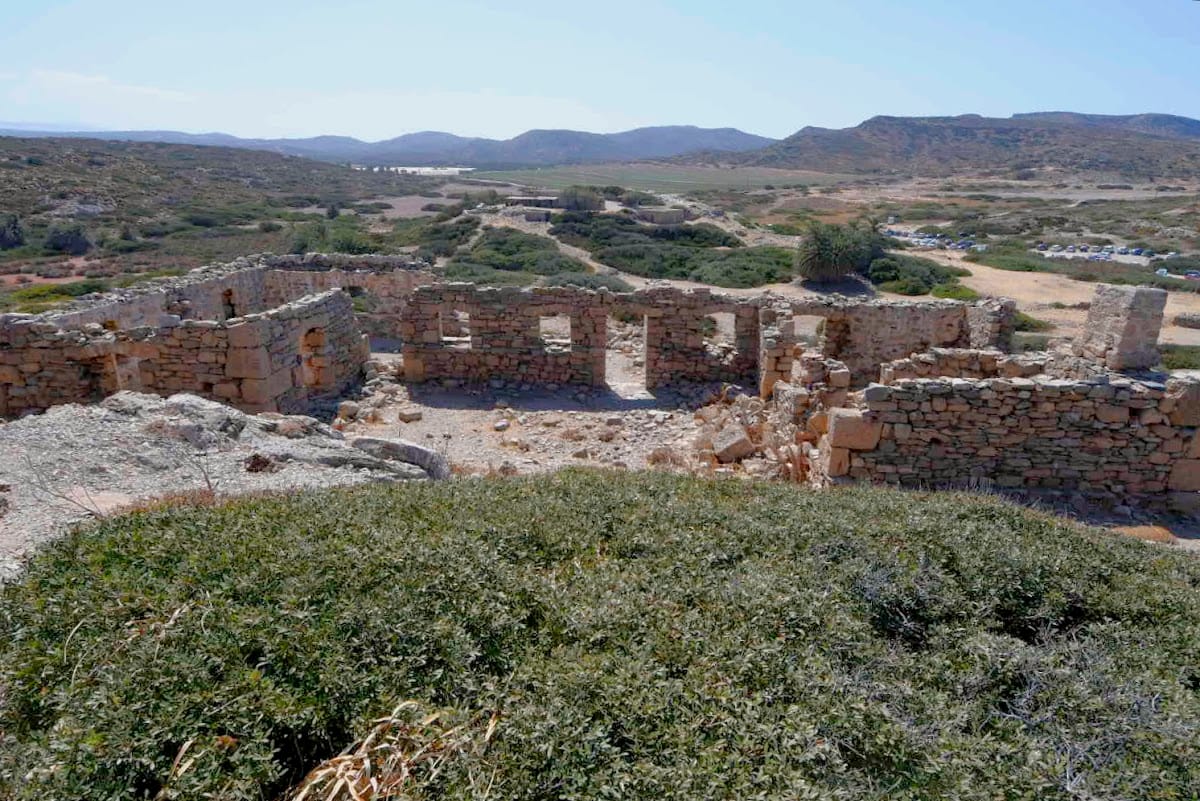
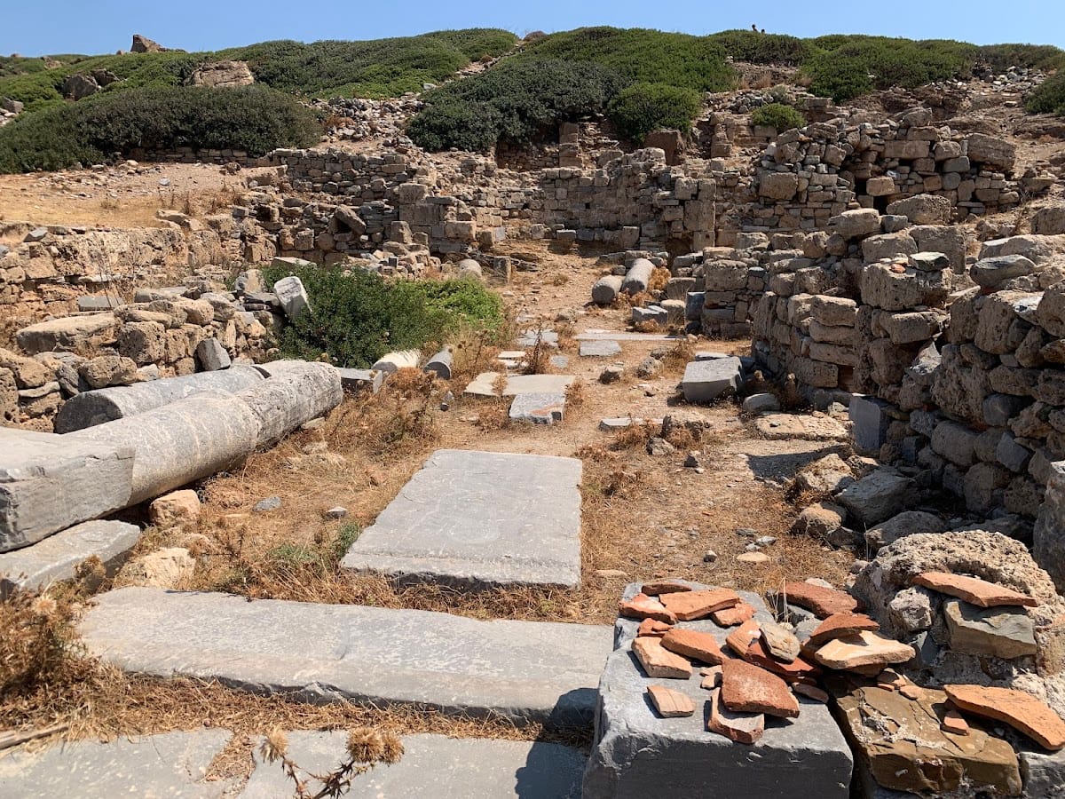
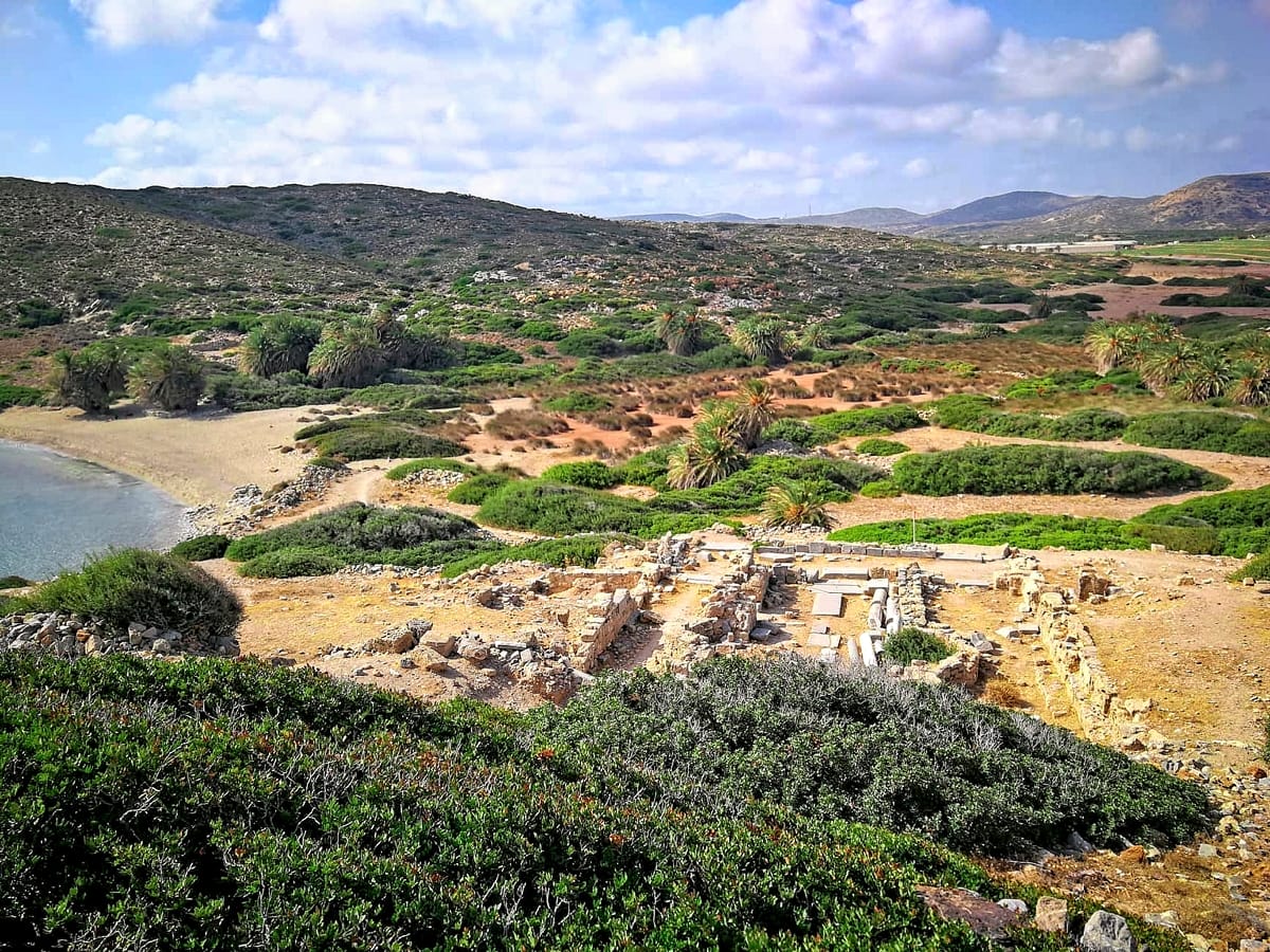
Itanos occupied two neighboring elevated areas, the eastern and western acropoleis, with the principal habitation quarter between them and mainly west of the eastern acropolis. Two additional hills marked the northern and southern limits of the urban area. The eastern acropolis stood on the headland between the two modern beaches, the northern hill held the North Necropolis, and the southern hill contained a fortified enclosure. Fortifications on both acropoleis and separate towers strengthened the landward and seaward defenses. Most of the surviving defensive works date from the Hellenistic period, while other remains include walls, houses, urban buildings, churches, subsurface ruins, and overgrown structural mounds.
Acropoleis, harbor, and urban area
Eastern and western acropoleis
The eastern and western acropoleis were elevated fortified areas and appear to have contained important sanctuaries. The eastern hill is tentatively associated with Apollo Pythios, an aspect of Apollo connected with prophetic worship, while the western hill may have been dedicated to Athena Polias, Athena in her role as a city’s protecting deity. These identifications remain probable rather than certain. Itanos also had temples dedicated to Asclepius, associated with healing, Tyche, associated with fortune, and Zeus, the Greek sky god.
Harbor and lower town
The ancient shoreline differed from the modern coast. Itanos Beach extended approximately 100 yards farther inland in antiquity and formed the deep channel of the harbor. Tectonic changes in late antiquity placed part of the ancient city beneath the sea, while the present shape of Eremoupolis Beach does not necessarily reproduce its ancient appearance. In the lower town, ancient habitation remains lie beneath extensive Christian-period construction. Early Christian remains include Basilica A on the eastern acropolis and another basilica on the southern hill, with Early Byzantine pottery recovered from Basilica A and houses examined in 1994.
North Necropolis
The North Necropolis was probably Itanos’s principal cemetery. The excavated area is divided by a road into western and eastern sectors and was used from at least the Late Geometric period through the Late Hellenistic period. The western sector contained a large Archaic building, part of which appears to have continued in ritual use during the Classical period. Most burials lay in the eastern sector, alongside stepped funerary monuments crowned by stone stelae, mainly dating from the Late Classical period.
During the third century BC, dense burials around the stepped monuments formed groups resembling family funerary enclosures. The cemetery was destroyed during the first half of the second century BC and later reorganized. Stepped monuments with stelae continued to be built after the Ptolemaic garrison departed.
Warrior funerary stele
A marble funerary stele, an upright stone monument commemorating a burial, was found in the sea at Itanos and probably crowned a tomb in the North Necropolis. The complete monument is 0.78 metres high. A projecting dowel secured it to a base. Pilasters frame its rectangular face, while a pedimental top carries three acroteria, ornaments placed at the corners or apex of a pediment.
The relief shows an upright cuirassed warrior facing right. He holds a spear in his right hand and rests his left hand on a Galatian-type shield. The stele dates to the final decades of the second century BC. Its marble is local, and the sculpture was made with certainty by a local workshop. Because it has no inscription, the deceased cannot be identified. The careful execution and unusual subject have been interpreted as indications of a relatively prosperous citizen or family, possibly from the local elite rather than an ordinary soldier.
Inscriptions and architectural fragments
Roman Senate inscription
Numerous Greek stone inscriptions were found at Itanos. The largest and most historically important preserves the Roman Senate’s decision on the city’s territorial disputes and conflicts with Praesus and Hierapytna. The inscription is now kept at Toplou Monastery and provides a direct record of Roman arbitration in the affairs of the Cretan city.
Ionic capital
An Ionic capital, the decorated upper part of a column marked by spiral volutes, was found at Sellia on land belonging to Toplou Monastery. It is preserved in the Archaeological Museum of Agios Nikolaos. Made of ironstone, the capital is 0.33 metres high and 0.285 metres in diameter. It retains the upper drum of an associated unfluted shaft and has small volutes, a low smooth echinus, flattened eyes, moulding, and a flat abacus with a cyma.
Its dimensions indicate that it belonged to a moderately sized building, possibly of the Hellenistic period. The original building cannot presently be identified, although the capital may have belonged to a religious or civic structure.