Seradina-Bedolina Municipal Archaeological Park: Rock Art in Val Camonica
Site at a Glance
- Popularity
- Medium
- Country
- Italy
- Primary era
- Iron Age
- Eras represented
- Stone Age, Bronze Age, Iron Age, Classical
- Civilizations
- Roman
- Site type
- Civic
- Remains
- Rock Art
On this page11 sections
History
The Seradina-Bedolina Municipal Archaeological Park is an archaeological park in Val Camonica, Italy. It preserves more than 170 engraved rock surfaces, most associated with the transition between the Copper and Iron Ages, archaeological periods whose dates vary by region. Together with Naquane, the park forms part of the Val Camonica rock-engraving complex, recognized as a UNESCO World Heritage site in 1979. This was the first such recognition in Italy; the designation identifies places considered to have outstanding importance to humanity.
The park opened in 2005, fifty years after the founding of the National Park of Rock Engravings at Naquane. Engravings and archaeological evidence at Seradina-Bedolina had been studied since the 1930s. Opening the park to the public enabled further analysis and a more systematic phase of research. Miguel Beltrán Llorís fully documented and studied the Bedolina Map, followed by Cristina Turconi of the University of Milan.
Remains
Terrace and route network
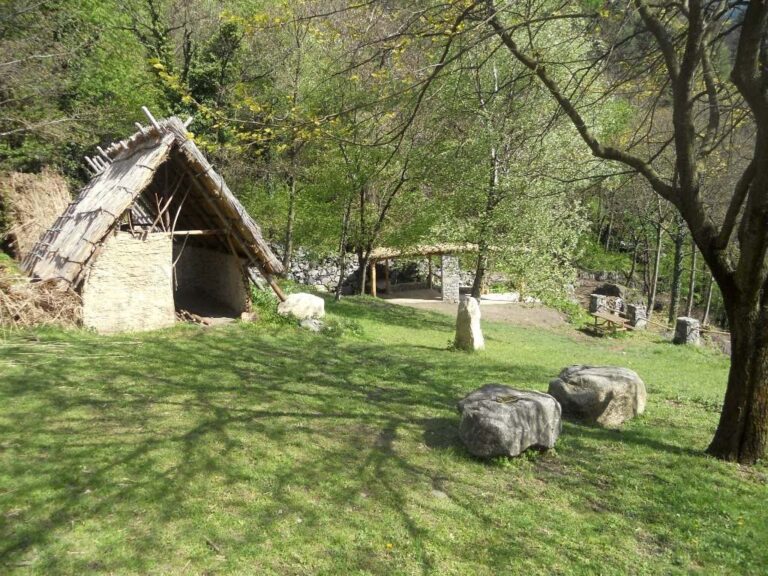
The park covers about six hectares on a terrace at 530 metres above sea level, on the right-hand slope of Val Camonica and the right bank of the Oglio River. Its more than 170 engraved rock surfaces are chiefly associated with the transition between the Copper and Iron Ages. Strong sunlight supports a local ecosystem that includes plants typical of warmer climates, such as the prickly-pear cactus Opuntia compressa. The Strada della Greppa crosses the park from end to end, with other paths branching from it to link the different areas.
Cascina Vecchia collection
A museum collection at Cascina Vecchia contains letters, photographs, and 70 plaster casts of rock engravings made during the first half of the twentieth century.
Seradina II
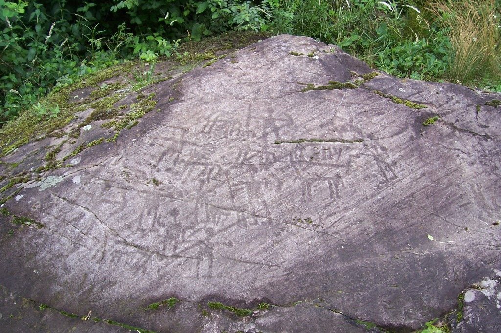
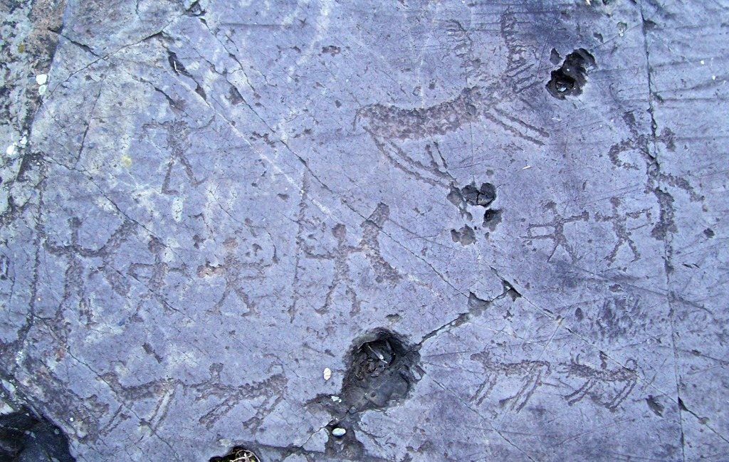
The orange route crosses Seradina II, the park’s southernmost area and one of the richest concentrations of rock art in central Val Camonica. More than 60 engraved rocks bear images dating from the Late Neolithic and Copper Age through the end of the Iron Age. Rock 21 shows warriors and horsemen, a hut, and an inscription in the Roman alphabet. Rock 18 has the area’s greatest concentration of hut images, alongside an inscription and figures shown dueling.
Seradina III
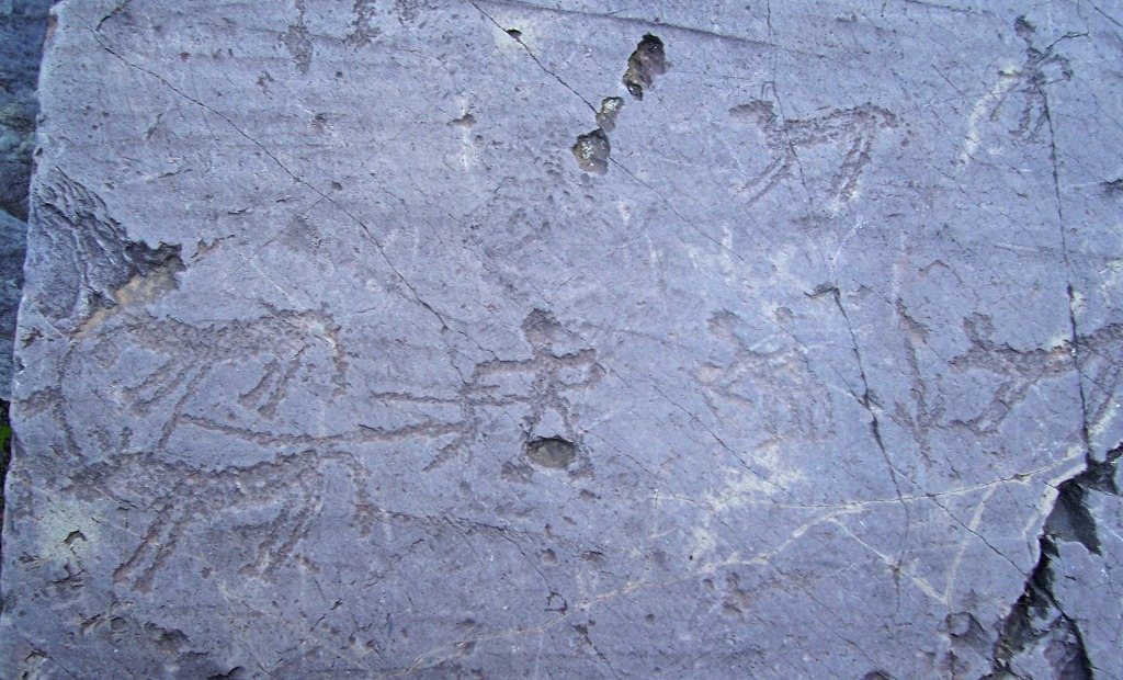
The brown route follows the slope between Seradina and Bedolina and passes the lower-elevation surfaces in Seradina III. More than 60 engraved surfaces carry imagery spanning over 50,000 years. Rock 11 includes designs such as concentric or radiating circles, grids, and ladder-like forms. Rock 9 features numerous combat scenes associated with Iron Age warrior themes.
Seradina I and Ronco Felappi
The green route covers Seradina I and Ronco Felappi, where engraved surfaces are spread across a plateau overlooking lower Seradina I Corno. Rock 29 bears dagger images attributed to the Bronze Age. On Rock 25, large warrior figures cluster in the central band, while depictions of horns date to the Roman period.
Seradina I Corno
The red route, also called the Hunting and Ploughing route, passes through Seradina I Corno. Rock 12 is the park’s largest and most richly engraved surface, with duels, horseback hunts, and symbolic compositions of a religious character. Rock 7 depicts deer with sun-shaped antlers pursued by dogs, as well as warriors and small water birds. Archaeological investigations on the summit of the rise in this area recovered ceramic fragments.
Bedolina
Blue route and surrounding rocks
The blue route crosses Bedolina, the park’s northern area, on a glacial terrace overlooking the valley floor. The area is known for its many map-like depictions. Rock 7 has a composition considered a larger counterpart to the one on Rock 1. Rock 5 carries numerous hut images, a long text combining Latin letters with Camunian characters, an ancient script associated with Val Camonica, and a horse attributed to the Middle Iron Age.
Bedolina Map, Rock 1
Rock 1 bears the Bedolina Map, regarded as one of the oldest topographic maps. Its composition is interpreted as showing cultivated areas, mountain paths, and villages. The flat surface measures 9 by 4 metres and consists of Permian sandstone, a geological formation, smoothed by a glacier during the much later Pleistocene. It carries 109 figures engraved between the end of the Bronze Age and the Iron Age. These include land-pattern designs such as dotted squares and zigzag paths, as well as warriors, animals, wooden huts, cup marks (small cup-shaped depressions), and a Camunian Rose, a geometric symbol. The most notable land-pattern designs are placed in the Iron Age, especially its middle centuries of the first millennium BCE.