Stymphalos: An Ancient Greek City-State in Arcadia
Site at a Glance
- Popularity
- High
- Country
- Greece
- Primary era
- Classical
- Eras represented
- Classical
- Civilizations
- Ancient Greek, Roman
- Site type
- City
On this page20 sections
History
Stymphalos was an ancient Greek city-state in northeastern Arcadia, in present-day Greece. Its position on a route west from Argolis and Corinth gave it strategic importance. The city was refounded in the fourth century BCE, and its territory, known as Stymfalia, is now in Corinthia.
Myth and early traditions
Greek traditions offered more than one account of the city’s beginnings. One linked its name to Stymphalus, son of Elatus and grandson of Arcas; another associated an earlier settlement with Temenus, son of Pelasgus. By the second century CE, when the Greek travel writer Pausanias described the area, that older city had disappeared. He said it had held three sanctuaries of Hera, where the goddess was honored as maiden, wife, and widow.
Myth also told that King Stymphalus was killed by Pelops, who scattered his body. The resulting calamity was said to have afflicted Greece until Aeacus, the mythical king of Aegina, prayed for relief. The nearby lake was famed in another story as the home of the man-eating Stymphalian Birds, which the hero Heracles killed as one of his labors. Stymphalos appears in Homer’s Iliad and in the poetry of Pindar, who called it the ‘mother of Arcadia.’ Pindar celebrated Hagesias, a winner in the Olympic mule-cart race, and urged a chorus to honor Hera as a maiden. That practice has been interpreted as preserving a religious tradition from before the Olympian gods.
Refoundation and Hellenistic conflicts
The refounded city belonged to the Greek world of the fourth century BCE. In 315 BCE, Apollonides, a general serving Cassander during the conflicts that followed Alexander the Great’s death, captured it. Stymphalos later became part of the Achaean League, a confederation of Greek communities.
In 219–218 BCE, Macedonian king Philip V’s forces defeated troops of the Aetolian League, another Greek confederation, near the city. Stymphalos was damaged around the middle of the second century BCE, possibly in connection with Rome’s destruction of Corinth. The city’s history thus included both its role in regional conflicts and periods of recovery.
Roman and early Byzantine periods
Stymphalos was resettled under Roman rule. Five cemeteries dating from the late fourth to the middle of the sixth century CE indicate that a small settlement persisted into the early Byzantine period.
Zaraka and archaeological investigations
Just north of the ancient city, western European Latin Christians known as Franks established the Cistercian monastery of Zaraka in the early thirteenth century, during their occupation of much of Greece. Cistercians were a monastic order in the Western Christian tradition. Monks lived at Zaraka for about half a century, from around 1225 to 1275. After a period without occupation, people resettled the site in the late fourteenth century, and it remained occupied into the sixteenth.
Anastasios Orlandos excavated part of Stymphalos for the Archaeological Society of Athens from 1924 to 1930. The University of British Columbia surveyed the area in 1982–1984, and excavations on the lake’s north shore began in 1982 under Hector Williams. The Canadian Institute in Greece continued that work from 1994. Sheila Campbell of the University of Toronto directed excavations at Zaraka.
Remains
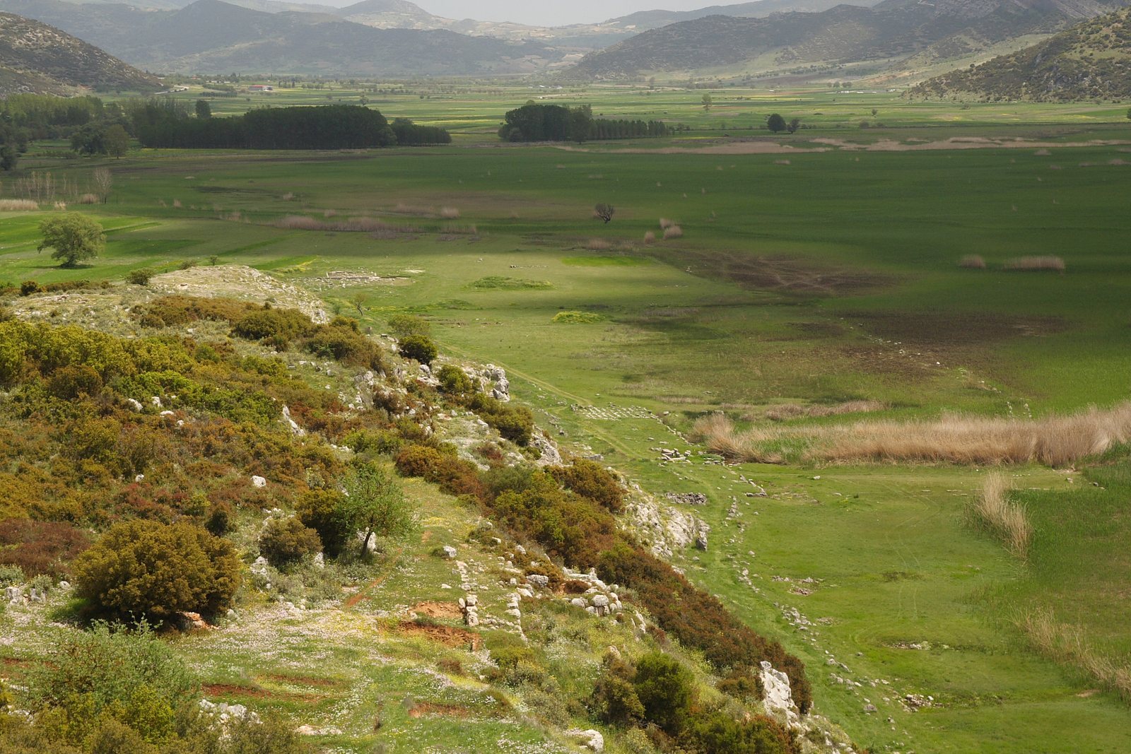
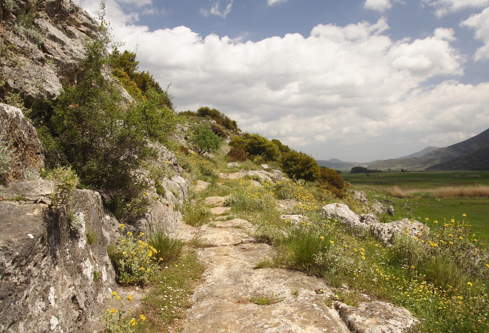
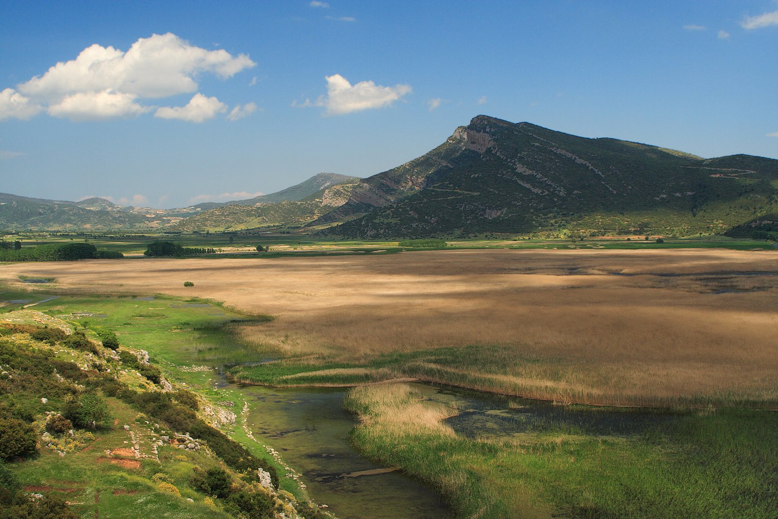
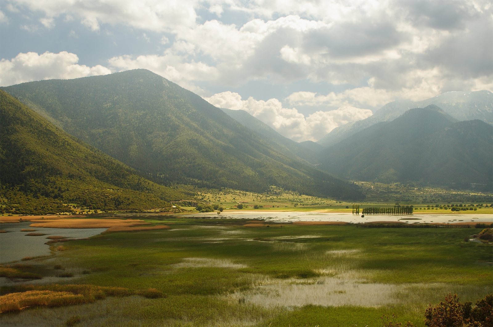
The remains of Stymphalos occupy a plain beside Lake Stymphalos and include a gridded, walled city arranged around an acropolis ridge. Houses, public buildings, temples, and sanctuaries have been identified across the area. The lake, its underground outlet, and the mountains surrounding the plain are part of the site’s physical setting.
Plain and lake
Mountain setting
The plain extends about 9.7 kilometres and was bounded by Achaea to the north, Sicyonia and Phliasia to the east, Mantineia to the south, and Orchomenus and Pheneus to the west. Mountains enclose it. Mount Cyllene rises to the north, with a spur called Mount Stymphalus reaching into the plain; Mount Apelaurum lies at its southern end.
Waterways and flooding
Rain from Mount Cyllene and Mount Apelaurum feeds Lake Stymphalos, along with water from three streams. One descends from Mount Geronteium near Kastania, another rises near Dusa, and the largest issues from a substantial underground spring on the plain’s northern side. This largest stream was called Stymphalus and was also associated with the name Metope. It was believed to run underground for 200 stadia, an ancient unit of distance whose length varied, before emerging in Argolis as the Erasinus River.
The lake’s only outlet is underground. Pausanias described it as drying in summer, while a blockage of its subterranean channel by stones, sand, or other material could cause flooding. He attributed a flood in his time to Artemis’s anger and described its extent as possibly 40 stadia; the figure of 400 is probably a textual error. Strabo reported that the city had once stood at the lake’s edge and was 50 stadia away in his own day. That distance is difficult to reconcile with the lake’s maximum width of less than 20 stadia.
City plan and public spaces
Street grid, walls, and acropolis
The refounded city followed a grid plan. North–south streets, about six metres wide, were spaced roughly 30 metres apart and crossed east–west avenues separated by more than 100 metres. Walls about 2.5 kilometres long enclosed the city, and their course can be traced around it. Towers stood along the walls, with particularly clear remains on the western side. The acropolis, the city’s fortified upper area, occupied a ridge extending west from the lake’s northern shore.
Agora and theatre
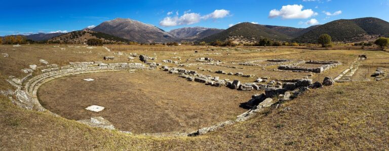
The agora, a public space for civic life and exchange, lay south of the acropolis between the ridge and the lake. Builders cut a rectangular recess into the acropolis’s southern slope to create space for it. Part of a building thought to have been a stoa, a colonnaded hall, is now partly submerged in the lake. Farther east, the theatre’s seating was cut into the acropolis hillside, while its substantial stage building was constructed in two phases.
Sanctuaries
Sanctuary of Athena Polias
At the western end of the acropolis are the remains of a sanctuary for Athena Polias, Athena in her role as a city’s protector. A small temple had a naos, or inner chamber, and a pronaos, or entrance porch. A second building may have served priests or stored supplies. In 1925, Orlandos found an inscription bearing the letters ‘POLIAD…’, apparently referring to Athena Polias.
Finds from the sanctuary include large quantities of gold, silver, and bronze or copper jewelry, as well as terracotta figurines, lamps, and pottery. A pottery graffito names Eileithyia, a goddess associated with childbirth. A partly preserved statue of a child has supported an interpretation of the cult as caring for children. Several dozen loom weights from an annex point to weaving activity and have been taken to suggest Athena’s presence there. The sanctuary was probably destroyed by the Romans in 146 BCE. Pottery lamps from the early to middle Roman period indicate that people later returned to the area.
Sanctuary of Artemis Stymphalia
Pausanias described a temple of Artemis Stymphalia, Artemis being associated with hunting and wilderness. Figures of the Stymphalian Birds decorated the area near its roof. Behind the temple stood white-marble statues of young women with the legs and thighs of birds. The temple appears to have remained in use during Roman times. An inscription from the early second century BCE associated the sanctuary with Brauronian Artemis, a cult title linked to Brauron in Attica. Another inscription commemorated Stymphalian hospitality to the people of Elateia and was intended for display both in Elateia’s agora and at this sanctuary.
Pausanias described the mythical birds as about the size of cranes, resembling ibises but with stronger, less-curved beaks. Some coins from Stymphalos depict birds consistent with that description.
Other religious evidence
Inscriptions attest to cults of Demeter, associated with agriculture, and Hermes, linked with travel and communication. Across the valley are remains of at least five buildings in the Doric style, an ancient Greek architectural form. The ruins of a fifth-century BCE temple lie north of the modern village of Stymfalia.
Other buildings and Roman remains
Lower-city buildings and water supply
Other remains in the lower city include a Hellenistic temple, a palaestra, or place for athletic training, and an exedra, a formal recessed space. A fountain house dating to the fourth century BCE was still functioning in antiquity. Hadrian, a Roman emperor, had an aqueduct built to carry water from the lake to Corinth, and substantial sections of it can still be traced.
Houses and villa
Excavations in other parts of the town uncovered modest remains of Hellenistic houses and an early Roman villa. An earthquake destroyed the villa around 40 CE. Marble furnishings and finely painted wall plaster point to a high standard of living. A cavalry sword and shield found there have prompted the suggestion that the owner may have been a veteran Roman army officer, though they do not establish his identity.
Additional structures and athletic memorial
Identified structures include a monumental gateway and a keyhole-shaped building that may have been a heroon, a shrine associated with a hero or legendary founder. In the Roman period, the urban center appears to have been about 800 metres farther north, around modern Kionia and the ruined monastery of Zaraka. Pausanias also described a statue of Dromeus, a local long-distance runner who won the Dolichos footrace at the Panhellenic Games, major athletic festivals across the Greek world, in 484 and 480 BCE.