Kloster Ihlow: A Cistercian Abbey in East Frisia
Site at a Glance
- Rating
- 4.5
- Popularity
- High
- Country
- Germany
- Primary era
- Medieval
- External website
- Open
- Eras represented
- Medieval, Early Modern, Modern
- Civilizations
- Holy Roman Empire
- Site type
- Religious
- Remains
- Monastery
On this page26 sections
History
Foundation and early development
Kloster Ihlow was a Cistercian abbey dedicated to the Virgin Mary at Ihlow-Ludwigsdorf, Germany. The Cistercians were a Catholic monastic order that developed from Benedictine practice. The abbey’s foundation is dated to 1228, following an institutional process that began in 1216, and its church was built in Romanesque-Gothic style. Ihlow became one of the most influential and economically powerful monasteries in the Dutch and northwestern German region. It belonged to the medieval Archdiocese of Bremen, the church jurisdiction whose bishops held authority in the area.
The foundation grew out of an attempt by the abbot of Meerhusen to join the Cistercian Order. After an inquiry in 1217, the Order agreed on the condition that a new monastery be established elsewhere and that Bishop Gerhard II of Bremen approve. Meerhusen joined the Order in 1218, but its male community had to leave because Cistercian rules did not permit monks and nuns to live together. The monks may have stayed temporarily at a farm in Timmel. Abbot Wigboldus of Aduard received Ihlow into the Order under the name Schola Dei, or School of God, and laid its foundation stone in either 1216 or 1217. Gerhard II confirmed the male community in 1228. In 1230 the abbots of Aduard and Klaarkamp inspected the new house and installed its first abbot.
Ihlow was a daughter house of Aduard and remained legally linked to the women’s community at Meerhusen. Although the two communities lived apart, they formed one institution, and Ihlow conducted its legal business. The abbot of Ihlow also supervised Meerhusen. This combination of religious authority and legal responsibility helped establish the abbey’s wider regional role.
Regional authority and economic reach
Ihlow’s abbots served as mediators in political disputes and took part in water management. In 1233 Pope Gregory IX commissioned the abbot to settle a disagreement between Östringen and Harlingerland. Monastery representatives later joined peace negotiations involving the Bishop of Münster and Frisian communities in 1276, Frisians and people of Groningen in 1338, and Cologne, Harlingerland, and Norderland in 1340. The abbey also acted for the Cistercian Order and the papacy, inspecting religious houses considering admission to the Order and examining other monastic matters.
During the period known as Frisian Freedom, a medieval tradition of Frisian self-government, Ihlow probably served as the archive and chancery of the Upstalsboom association, a gathering linked to political cooperation among Frisians. Its seal and papers may have been kept at the abbey, along with a copy of the Brokmerbrief, a regional law text consulted in disputes. The association’s seal showed Mary with the Christ Child between two Frisian warriors, with monks below them. The image has been associated with Ihlow’s influence, and the seal may have been made there. In the 13th century, Mary replaced James the Greater as the Brookmerland’s patron saint and became the central figure on the seal of the united Brookmer and Aurich communities.
Gifts from wealthy local families helped the abbey build its estate, which eventually comprised 368 hectares of land in use. Farms and agricultural estates, known as granges, supported settlement in southern Aurichland. Ihlow held land or farms at places including Mönnikeborgum, Riepster Hammrich, Leybucht, Simonswolde, Timmel, Victorbur, and Ostergroden near Dornum, as well as scattered property elsewhere. In Emden it maintained a town house and received money and goods from residents.
The monks cultivated crops, raised livestock, managed woodland, cleared land, and created fishponds near the abbey. Through connections with other Cistercian houses, Ihlow helped spread farming, building, craft, and water-management methods in East Frisia, including techniques for reclaiming wetlands and operating mills. Lay brothers, monks whose duties emphasized manual work, and hired laborers carried out much of this work. The abbot also held drainage responsibilities: in 1517 he became an official of the Oberems organization for sluice and water management and one of two drainage judges for the Aurich district. Ihlow also played a major role in recovering land lost to the encroachment of Leybucht.
Political change, reform, and damage
From the 14th century, the Redjeven, local judges, lost influence as regional chieftain families gained power. Ihlow came under the protection of the tom Brok family. On 20 May 1378, Ocko I tom Brok pledged at the abbey’s altar to defend the monastery and deposited a document recording his promise. His successors gave financial support, adding to Ihlow’s resources and standing.
The 14th and 15th centuries brought famine, disease, economic hardship, and political disorder. Disagreements over the direction of religious orders coincided with conflict between groups known as Schieringers and Vetkopers. In 1412 the Cistercian General Chapter sent Johann Boyng, abbot of Menterna, to restore discipline at Ihlow. The community confirmed him as abbot, and he held the office until 1418. Reforms limited women’s access to parts of the church and cemetery, reduced the number of lay brothers, and drew on the devotio moderna, a movement emphasizing disciplined personal devotion. Gifts to the abbey increased in the late 15th and early 16th centuries.
In 1450, during Count Ulrich Cirksena’s conflict with Hamburg, the unfortified abbey suffered structural damage and was repaired by the Cistercians. Countess Theda gave Ihlow 100 Rhenish guilders in 1494 for prayers for her soul. It remained the wealthiest of East Frisia’s 28 monasteries. The Saxon Feud, an early-16th-century conflict over East Frisia, brought further damage in 1514.
Dissolution and conversion to an estate
East Frisian counts Enno II and Johann took possession of Ihlow in 1528, chiefly for economic reasons. The abbey was dissolved the following year. Although a papal ruling assigned the monastic estates to the abbot of Aduard, the counts appropriated them. The archive was dispersed or destroyed, leaving only two documents. The last abbot, Antonius von Senden, left and joined the new faith associated with the Reformation, the 16th-century movement that divided Western Christianity and led to the emergence of Protestant churches. Some members of the community followed him. The counts gave him the parish at Larrelt, paid off the other monks, and supported the oldest among them.
Count Johann ordered the church and parts of the monastic complex demolished, both to reduce upkeep and to make it harder for the Cistercians to reclaim the property. The altar and organ were taken to Aurich. In 1530 Enno II ordered sacred vessels from East Frisian monasteries, including Ihlow, to be handed over for sale. Balthasar von Esens partly destroyed the monastery in 1533–34. Some surviving monastic buildings were reused as guest accommodation for Johann’s hunting house, and the former grounds became a favored hunting area for the counts.
Between 1608 and 1612, Count Enno III built a small Baroque hunting lodge west of the present forest house. The counts and princes used it as a summer residence, and Enno III laid out a lime avenue leading from the Krumme Tief toward the lodge in the style of French formal gardens. After the Cirksena line ended, East Frisia and its princely estates passed to King Frederick II of Prussia in 1744. The Prussian administration sold the estate’s agricultural equipment and sent the lodge’s furnishings to Berlin for auction. Peter Janssen Haneborger bought the lodge in 1756 and demolished it in 1763. A garden house was built on the site, while the former monastic grounds were increasingly used for agriculture.
After East Frisia became part of the Kingdom of Holland in 1806 and the French Empire in 1810, authorities began cutting timber in Ihlow Forest in 1811 for Napoleon’s island fortifications. More than 2,000 oak trees were hauled to Dornumersiel by 45 wagons drawn by 130 horses. A forest house stood at Ihlow by 1804, but it burned in 1828; a replacement was built in 1834 and took on its present appearance after 1931.
Archaeology and renewed religious use
Proposals for archaeological investigation began in 1970, and excavations started in 1973. Later campaigns established the church’s ground plan and examined the conventual buildings, with work continuing through 2008. Surveys also identified traces of building activity across the former clearing and investigated the hunting lodge site. In 1986, bricks were used to mark the church’s wall lines and pier positions at ground level, and a monastic garden was laid out the following year. The Archaeological Park Klosterstätte Ihlow was developed from 2005 to 2009. A new altar was put into use in its devotional space in 2007, and regular devotions continue at the site.
Remains
Setting and early occupation
The abbey occupied a nine-hectare clearing in low, wet ground. A natural rise near its center was built up with fill, and the monks diverted a stream to improve drainage and sanitation. Archaeological traces show that the area had been ploughed before the monastery was established. Graves beneath the conventual buildings also predate the abbey and may relate to earlier settlement or a chapel serving a nearby community. The first substantial building found beneath the later east wing measured about 11 by 22 metres and ran north to south. It may have been the first dormitory, or communal sleeping quarters, and used a sill-frame construction unusual for its time. A wooden prayer chapel may have stood southwest of the later church, beyond the excavated area.
Abbey church
Plan and construction
The brick church was probably begun toward the end of the 13th century, after the last burials in its early cemetery around or after 1270, and was likely completed around 1300. Its builders raised the uneven site with fill and prepared the foundations with trenches containing compacted sand. Work began at the eastern crossing, where the church’s main arms meet, and continued through the nave and transept. The Romanesque-Gothic building was a three-aisled basilica, with a long central space and side aisles, and had a double transept, a smaller crosswise arm west of the main one, and a polygonal choir. It measured 68 metres long, 33.8 metres across the main transept, and 23.5 metres across the nave. It was described as the second-largest church between Groningen and Bremen, after the church at Marienhafe.
Interior and fittings
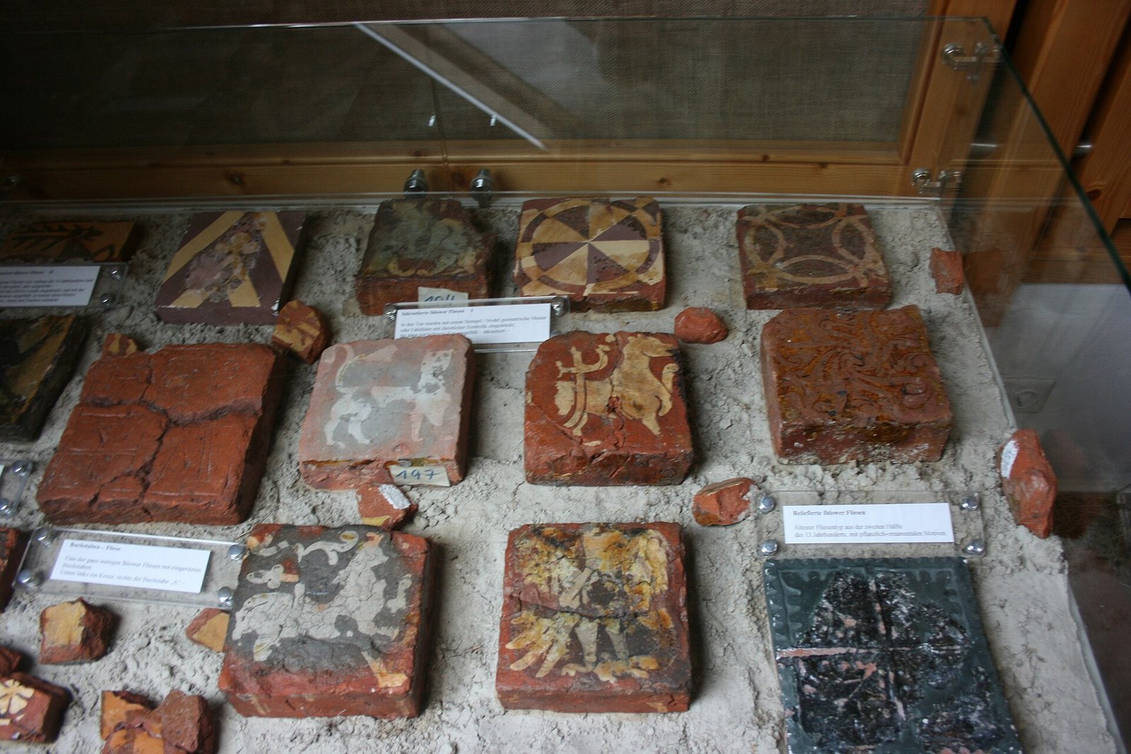
The church’s interior walls were unplastered. Brown- and green-glazed bricks and shaped bricks formed bands on columns and piers. The choir and crossing had yellow-and-red floor tiles, renewed roughly every 60 years and decorated with geometric patterns, plants, animals, and mythical creatures. The oldest tiles had plant designs; depictions of people and animals were prohibited in the monastery’s early years. A small section of the original nave floor survives as large brick slabs laid diagonally on sand. A rectangular area filled with yellow sand in the choir may have supported the main altar. A well lined with turf blocks in the north transept was added after the church and may have supplied holy water. The church had no tower, but a small bell was held in a roof turret.
Burials and devotional objects
An early cemetery in the church crossing came into use around 1234, and graves there were covered with oak planks. Excavations in the transept found ten burials, most in wooden coffins. Two graves were built of brick, and one brick-lined grave held two skeletons. Historian Hajo van Lengen proposed that some of the burials belonged to Ocko II tom Brok and his father Keno II. Ocko II’s 1435 will named Ihlow’s abbot as executor and requested burial in his father’s grave, without identifying its location.
A four-centimetre gilded-silver amulet showing Saint Christopher carrying the Christ Child was found on the left forearm of a woman buried in the former church. She was about 50–55 years old and was probably a member of the Frisian elite. The late-15th-century amulet had two attachment loops, one already broken when worn. A carefully made clay figure of Saint Margaret of Antioch was found in the conventual area. Probably made in the Lower Rhine region in the late 15th century, it retains traces of gilding and shows the saint standing on a dragon with a cross held to her chest.
Precinct and conventual buildings
Enclosure and service buildings
The precinct was roughly trapezoidal, about 250–300 metres long and 300 metres wide, and was bounded by two ramparts and ditches. Cemeteries lay to the east and north of the church. Stables, storehouses, a bakery, and a brewery are considered possible buildings within the precinct. Geophysical surveys indicate that other structures occupied the clearing, especially its southern part, although their uses have not been established.
Cloister and wings
The conventual buildings adjoined the south side of the church at right angles and enclosed a courtyard. The earliest cloister and west wing were wooden structures built beside the brick church around 1300. A later brick building in the east-wing area had three successive clay floors, suggesting intensive use, and peat blocks beneath the floor provided insulation. The first brick cloister, built in the 14th century, had a floor of plain square brick tiles. The east wing was reconstructed, the west wing rebuilt in brick, and other buildings added within and beyond the cloister. A heating system in the east wing indicates a warming room. The west wing contained an entrance to the church for lay brothers, their communal dining hall, and a large storeroom. Water points and a building with hearths near the west wing may have been used for brewing or malt-making. The cloister and west wing were rebuilt again in the 15th century; the south wing’s layout remains uncertain.
Surrounding landscape
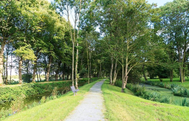
Two partly preserved monastic ponds, the ramparts, protective ditches, and numerous ridge-and-furrow fields remain visible in the surrounding woodland. The fields preserve raised and lowered strips created by cultivation. Excavations also uncovered foundations, pier bases, and floors associated with the church and monks’ house.
Art and furnishings
Ihlow Altarpiece
The late-Gothic Ihlow Altarpiece is a carved and painted work attributed to the Antwerp Guild of Saint Luke, an association of artists and craftspeople. It measures 2.13 by 2.16 metres. Local tradition places its making before 1517, while art historian Hans Georg Gmelin dated it to 1510. Its panels depict scenes from the life and Passion of Christ, including the Last Supper, Crucifixion, Resurrection, and Ascension. After the Reformation it was moved to the chapel of Aurich Castle, then given by Count Ulrich II to St. Lambert’s Church in Aurich, where it remains.
Organ
The abbey’s organ had eight stops divided among its main, chest, and pedal sections. After the dissolution it was transferred to St. Lambert’s Church in Aurich. Joachim Kayser added a rear-positive, an organ division placed behind the organist, in 1675. After repeated repairs, the instrument was replaced between 1755 and 1760 by a new organ with 27 stops by Johann Friedrich Constabel and Ernst Berner.
Hunting estate and later buildings
Hunting lodge
Enno III’s hunting lodge stood on a natural sand hill on ground occupied during the monastic period, perhaps by an economic building or a separate house for the abbot. The lodge measured about 13 by 10 metres and stood 7.5 metres high, with four storeys, two beneath the roof. Excavations revealed a stair turret, a partly cellared lower storey whose arrangement could be reconstructed, and paving from an earlier floor. Much of the building material had come from the demolished abbey.
Forest house and lime avenue
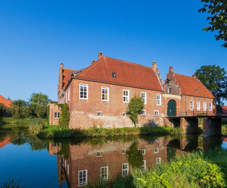
The 1804 forest house was a traditional East Frisian Gulfhof, a farmstead organized around a large central barn or threshing bay, about 28 metres long. After the first building burned, its 1834 replacement was altered to its present appearance after 1931. The lime avenue, first shown on a map in 1744, is regarded as the only surviving example of princely garden culture in East Frisia. After restoration, replacement trees were planted and the avenue extended 80 metres toward the forest-house garden.
Archaeological park
Interpretive church
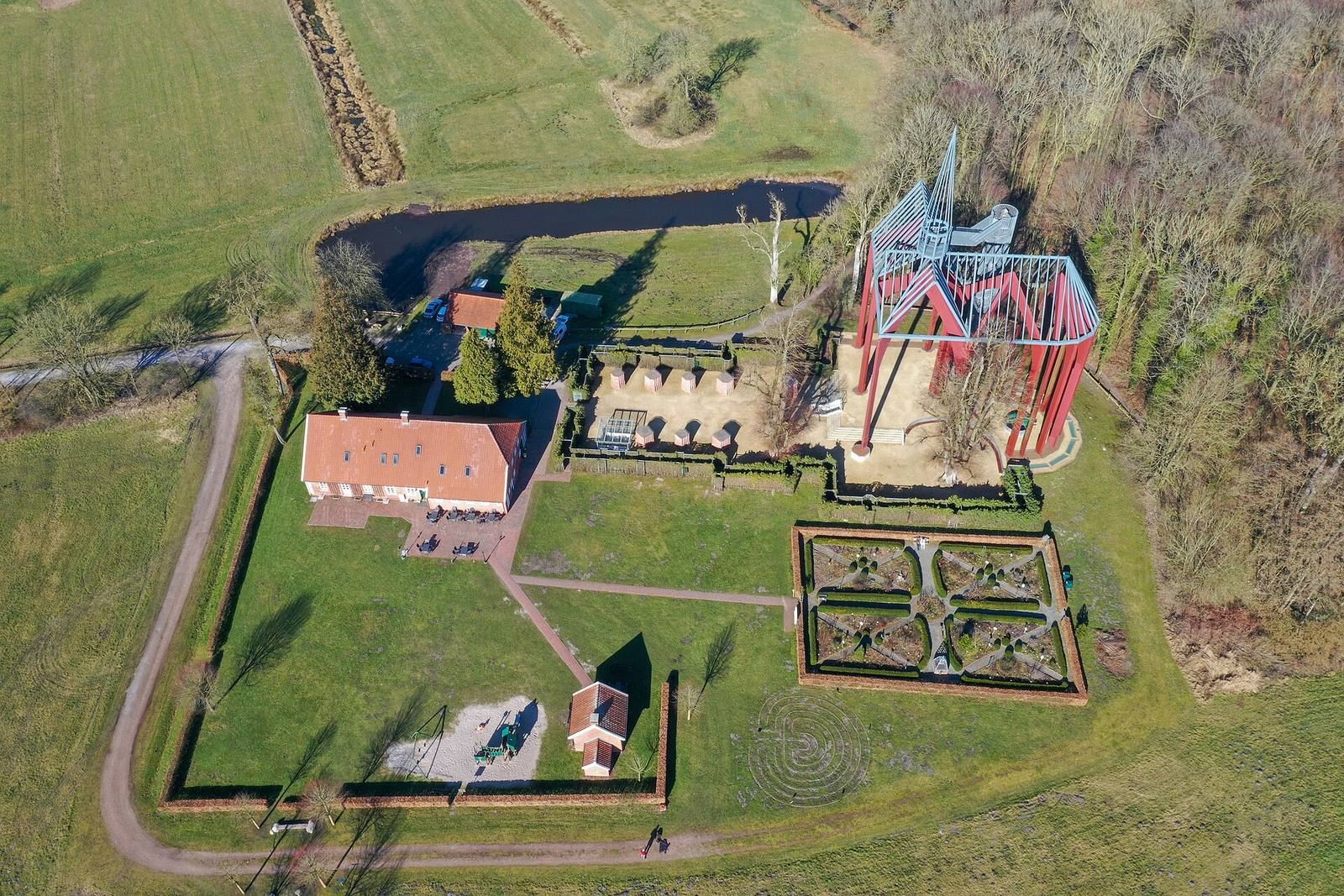
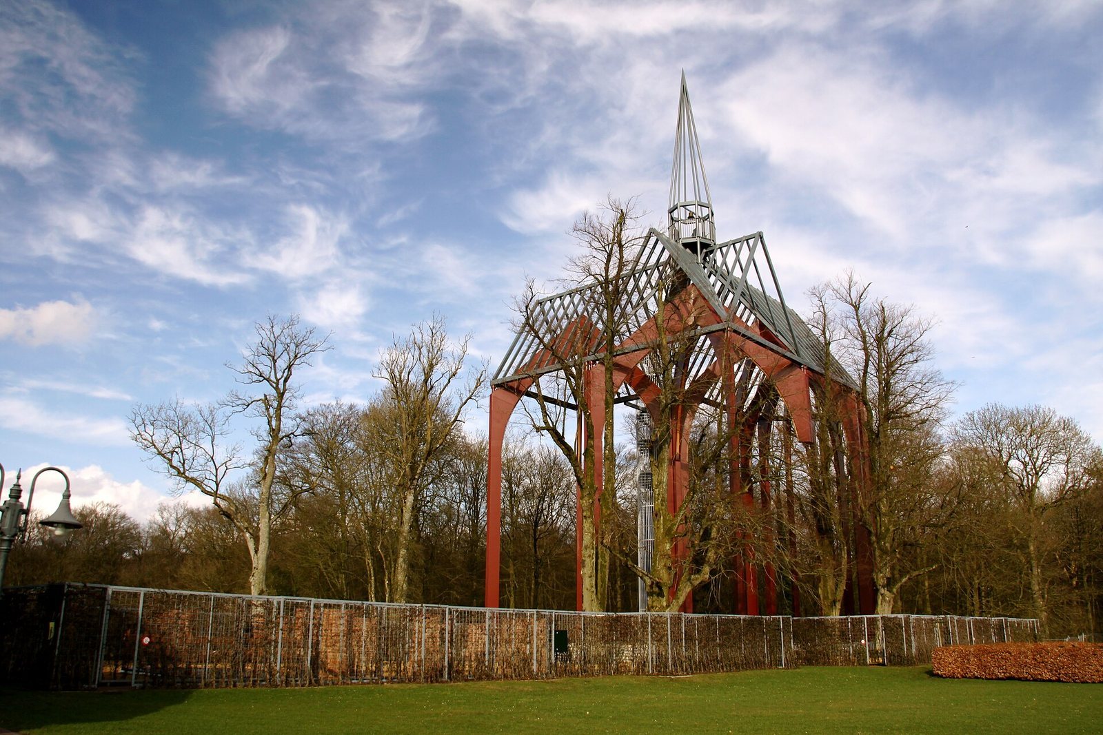
The park’s church is a full-scale interpretive reconstruction, not medieval fabric. Built between 2005 and 2009, it uses ivy-covered steel mesh to suggest the roughly one-metre-thick brick exterior walls, while wood and steel represent the piers, vault, and roof turret around the apse and left transept. The turret reaches nearly 45 metres, and the represented interior is about 25 metres high. A viewing platform stands at roughly 30 metres. Each of the approximately two-metre-high pier replicas in the nave incorporates a brick from a notable former monastery in East Frisia. A 120-kilogram bell in the turret bears an inscription meaning “That they may all be one,” from the Gospel of John.
Room of Traces and altar
Beneath the former apse and choir, the 500-square-metre Room of Traces is a purpose-built, semi-underground concrete structure about 1.5 metres below the former abbey floor. It contains exposed foundation remains and burials. The altar in the devotional space was made by Bremen sculptor Gunther Gerlach. Its spinning-top-shaped table consists of layers of glued beechwood and rests on a bronze sculpture based on a fragment of a stone slab with a consecration cross, thought to have been a corner of an earlier altar slab. The altar stands on a circular area of Solnhofen limestone bordered by turquoise-painted glass, with daylight entering through a glass dome.
Garden and land art
The monastic garden, laid out in 1987 and later returned to cultivation, covers about 200 square metres and follows a cross-shaped plan inspired by medieval cloisters and the Plan of Saint Gall, an early ninth-century drawing of an ideal monastery. Its roughly 200 plants include medicinal species, kitchen-garden crops, and flowers associated with Mary, such as roses, lilies, and daisies. A section known as the witch garden commemorates women executed after a witch trial at nearby Riepe in 1543 and grows plants associated with medieval women’s medicine and folk belief, including nightshade, mandrake, and henbane. A land-art installation above the approach path uses ribbons, flags, banners, and cloth in the colours of the East Frisian flag to represent the Seventeen Common Frisian Laws and connect Frisian independence with the Cistercian principle of prayer and work.