Fort Chambray: A Planned Citadel and Military Fort in Malta
Site at a Glance
- Popularity
- Medium
- Country
- Malta
- Primary era
- Early Modern
- Eras represented
- Early Modern, Modern
- Civilizations
- Knights Hospitaller
- Site type
- Military
- Remains
- Fort
On this page15 sections
History
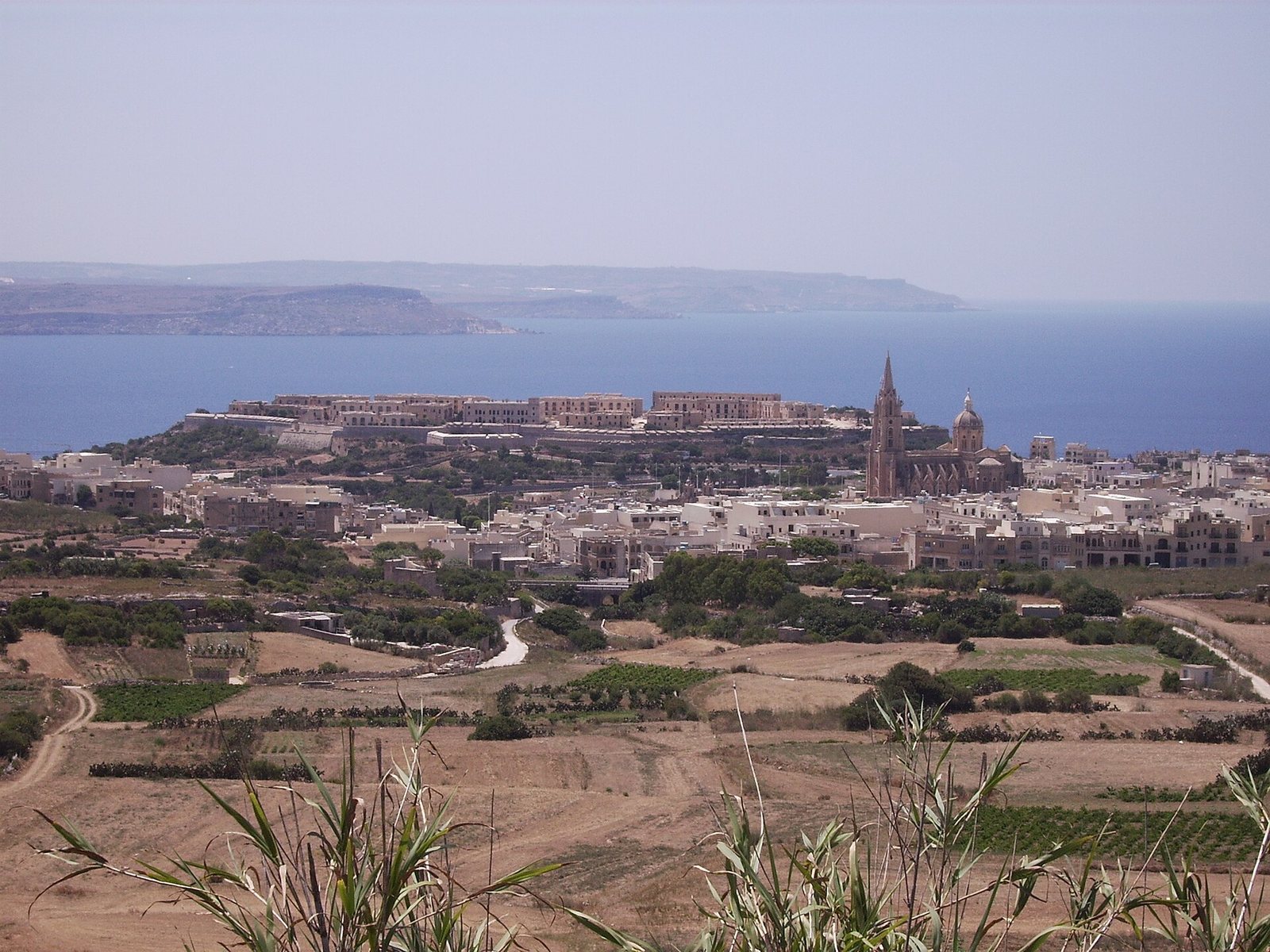
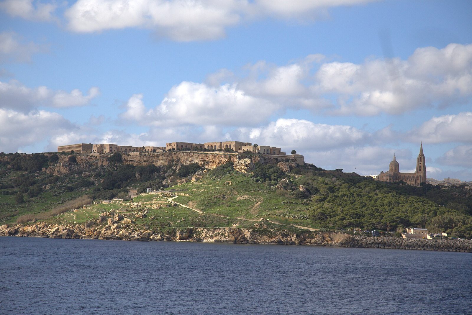
Fort Chambray is an 18th-century limestone fort at Għajnsielem on Gozo, Malta, built under the rule of the Order of Saint John, the Catholic religious and military order that governed Malta. It was intended to protect Gozo’s sea connection with Malta and serve as the core of a new fortified capital, though the town did not develop.
Plans and construction
In 1716, French military engineer Louis François d’Aubigné de Tigné drew up plans for a fortified town at Ras it-Tafal, between Mġarr Harbour and Xatt l-Aħmar. A recommendation in 1722 supported the project as a way to maintain the sea link with Malta, shelter Gozo’s inhabitants and livestock, and ease pressure on the Cittadella, Gozo’s historic fortified citadel. The scheme was postponed because funds were lacking.
In 1749, Gozo’s new governor, Jacques-François de Chambray, offered to pay for the fort. The Order’s Congregation of Fortifications and War accepted his offer on 15 September and sent military engineer Francesco Marandon to survey the site. Marandon revised de Tigné’s design, and construction began later that month under his direction, with almost 200 workers.
Work faced structural problems, a shortage of workers, and disobedience among the workforce. Excavation of the ditches and the initial construction were mostly complete by June 1752, while work on the fort itself began in October. It was nearly ready by 1757 and finished in the early 1760s.
The fort was intended to be the citadel of a new town that would replace the Cittadella as Gozo’s capital. Although a rectilinear street layout was set out within its walls, plots were not bought and the town did not take shape. As the perceived danger from the Ottoman Empire and Barbary pirates, corsairs operating from North African ports, declined, Gozitans considered rural settlement safe. Farmhouses were built both within and outside the fort.
French invasion and uprising
Fort Chambray’s military use lasted from the 1760s until 1916. It deteriorated quickly and by 1789 was being called a ruin. Minor repairs followed in 1796, and the fort was also used for a time as a prison.
During the French invasion of Malta in June 1798, many Gozitans sought shelter inside with their livestock. The fort, commanded by the knight de Megrigny, had 72 artillery pieces and initially resisted. It surrendered after French General Jean Reynier placed three companies in front of it and demanded that the garrison give up. The refugees then returned home.
French troops occupied the fort after its capture. A Gozitan uprising began on 3 September 1798, and rebels took control of the island apart from Fort Chambray and the Cittadella. French forces probably left Chambray during the night of 16–17 September.
British garrison and hospitals
After Malta and Gozo came under British rule in the early 19th century, a British garrison occupied the fort. By 1830, it housed a military hospital with four wards. The hospital expanded during the Crimean War and treated hundreds of wounded soldiers; it was later also used by British service personnel and Maltese civilians during fever epidemics.
During the Anglo-Egyptian War of 1882, a former barracks was converted into a hospital for war casualties. In the First World War, the fort became a convalescent depot. Thousands of ill or wounded patients passed through between October 1915 and its closure in March 1916. Medical staff published The Fort Chambray Gazette during this period. The military left the fort in 1916.
Civilian use and redevelopment
From 1934 to 1983, the fort housed a civilian mental hospital with capacity for up to 200 patients. Part of the complex served people with leprosy from 1937 to 1956 as Sacred Heart Hospital. Garrison Cemetery was cleared in the mid-1980s, an act condemned as cultural vandalism.
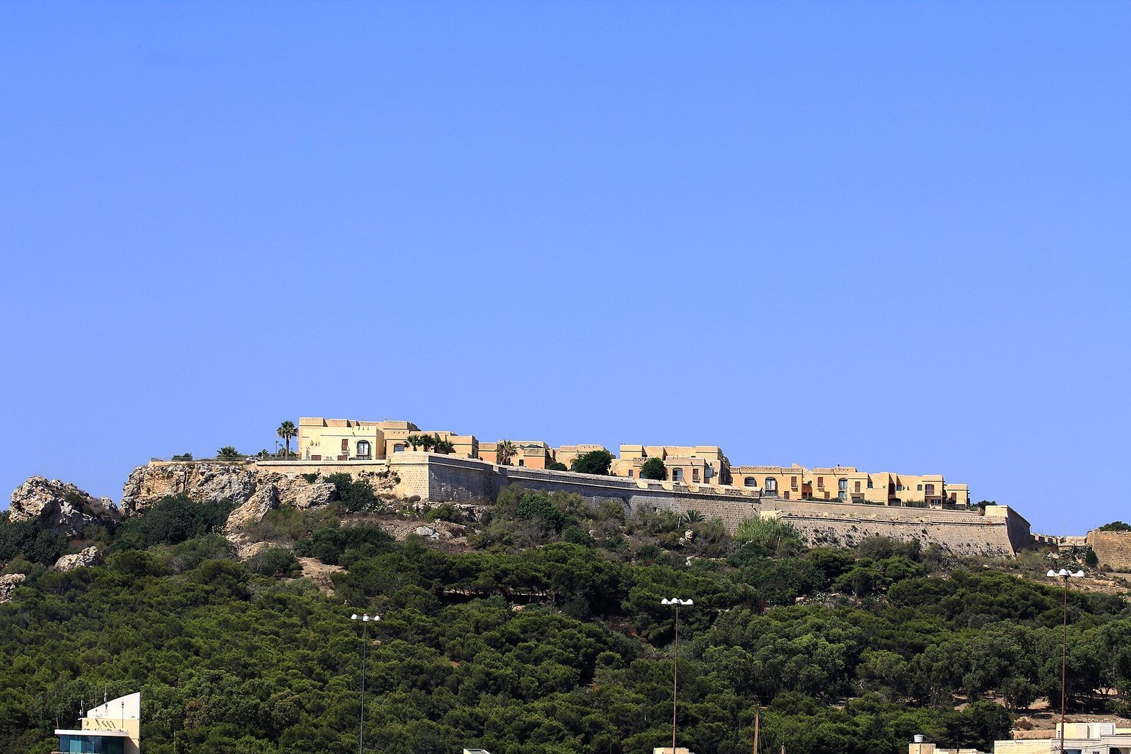
An attempt to convert part of the fort into a tourist complex began in 1979 but was not completed. A redevelopment brief issued in January 1992 called for the retention of the outer bastions, barracks, bakeries, chapels, and hospital complex, and proposed incorporating cemetery tombstones into the landscaping. Interior redevelopment began in January 1993, and a master plan was approved in 1995. The owners took over in 2007; residential units have since been built and some bastions restored. A plan for further development phases was approved in 2012. Fort Chambray is now a gated residential community.
Remains
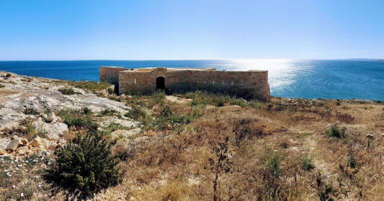
The fort is built of limestone on high ground overlooking Mġarr Harbour. Its perimeter comprises a fortified land front with outworks, two flanks facing Mġarr Harbour and Xatt l-Aħmar, and a southern boundary formed by a sea-facing cliff above the Gozo Channel.
Land-front defenses
Three bastions
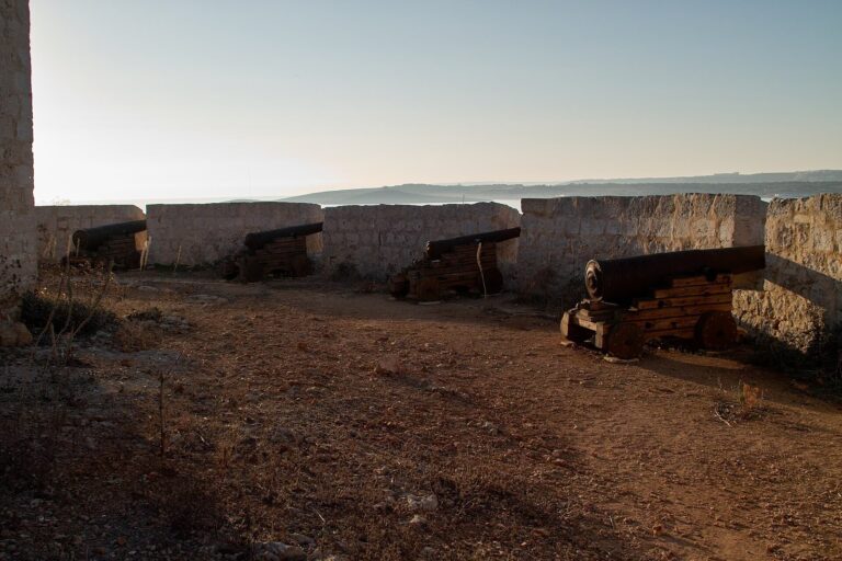
A bastion is a projection from a defensive wall that allows fire along the wall’s face. Three bastions form the land front. St. Anthony Bastion, on the right, is pentagonal and has nine embrasures, or openings for guns, on its faces and flanks. A church originally stood on it; modern buildings now occupy the bastion. The central, pentagonal St. Paul Bastion has 18 embrasures. Notre Dame Bastion, on the left, is a demi-bastion, or partial bastion, with six embrasures. Its right face has collapsed and shifted about six metres.
Gates and outworks
Curtain walls, the defensive walls joining fortifications, connect the three bastions, and one contains the main gate. A ditch protects the front. A counterguard, a defensive work placed in front of a fortification, covers St. Paul Bastion, while two ravelins, outworks set forward of the walls, protect the curtain walls. A covered way, or protected passage, runs along the entire front. The Right Ravelin contains the Advanced Gate.
Flanks and cliff perimeter
Western flank
The western flank, facing Xatt l-Aħmar, consists mainly of a curtain wall that was originally protected by a ditch. Its southernmost part is Guardian Angel Bastion, a pentagonal work with five embrasures. It also has a barbette parapet, which lets guns fire over its top, a sentry turret with a flat roof, and a powder magazine with a conical roof.
Eastern flank and cliff
The eastern flank overlooks Mġarr Harbour. An irregular line of fortifications links Notre Dame Bastion to the cliff, with two traverses, protective barriers across an exposed area, midway along the cliff. The cliff forms the fort’s southern perimeter above the Gozo Channel.
Town plan and burial grounds
Proposed fortified town
Plans from the 1750s depict a militarized town arranged on a street grid with private gardens. A large central square was to be surrounded by a church, courthouse, and the castellan’s residence, meaning the fortress commander’s home. The buildings were planned with a shared, symmetrical late-Baroque portico. Baroque is a European style of the 17th and 18th centuries known for elaborate decoration. A military parade ground was planned nearby.
Cemeteries
Three cemeteries were associated with the fort, one within its walls and two in the ditches. Tombstones from Garrison Cemetery were set aside in a secluded part of the fort. The cemetery’s human remains were transferred to Santa Maria Cemetery in Xewkija on 1 July 1991.