Castrum Tasgetium: A Late Roman Fort on the Rhine in Switzerland
Site at a Glance
- Popularity
- Medium
- Country
- Switzerland
- Primary era
- Classical
- Eras represented
- Classical, Medieval
- Civilizations
- Roman
- Site type
- City
On this page22 sections
History
Roman settlement and crossing
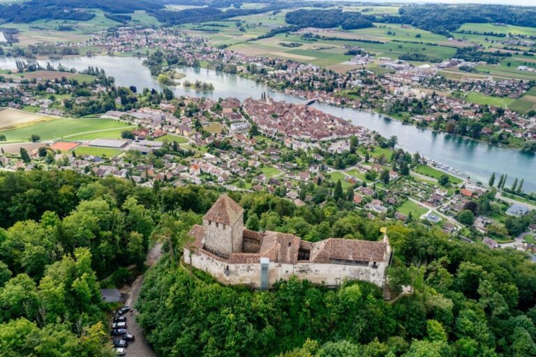
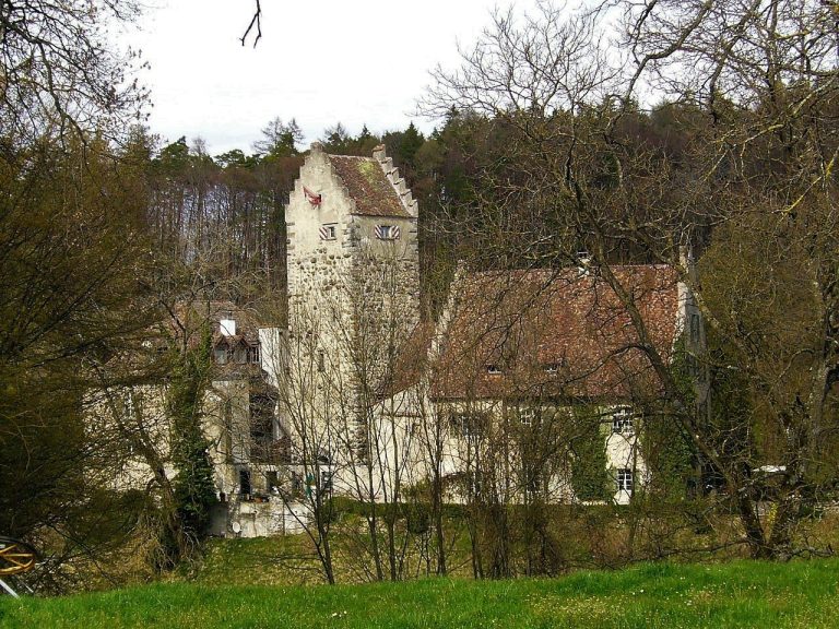
Castrum Tasgetium is a late Roman fort on the left bank of the Rhine at Stein am Rhein, Switzerland, near the river’s outflow from the Untersee. The name Tasgetium also refers to the civilian settlement and a fortified bridgehead on the opposite bank. The nearby Werd Islands and river shore had been occupied since the Neolithic. Rome brought the region under its control during the Alpine campaigns around 15 BCE and incorporated it into the province of Raetia.
The settlement grew along a Roman road during the first century CE, beside a river crossing connecting the southern Lake Constance region with routes northward and toward Pfyn, Oberwinterthur, and the Danube. With no other bridge within roughly 30 kilometres, the crossing supported river traffic and helped Tasgetium develop into a regional market and centre for crafts. The early settlement’s prosperity depended in part on the movement of people and goods along the Rhine.
From the middle of the third century, activity in the older settlement declined sharply, probably amid Alamannic incursions and worsening security. The Alamanni were Germanic peoples active in the Rhine and Lake Constance region. After about 260, the Rhine once again formed part of the Roman imperial frontier, increasing the area’s military importance.
Fort and late Roman frontier
A fort was built on the hill above the Rhine in the late third or early fourth century. An inscription places its construction during Diocletian’s reign, from 293 to 305, while a coin found in a timber building points to work beginning around 300 or 301. Constantius I, then a junior emperor responsible for Gaul and the Rhine frontier, probably directed the project. The fort secured the crossing as part of the wider Danube–Iller–Rhine defensive system. The provincial boundary in the area is uncertain, though Tasgetium probably belonged to Raetia rather than Maxima Sequanorum.
Construction brought the older civilian settlement largely to an end. Many of its buildings had fallen into disrepair, and their stone was reused in the fort or burned to make lime and mortar. A new civilian settlement formed farther west under the fort’s protection. By the fourth century, people were also collecting scrap metal among the earlier ruins. One excavated pit contained about nine kilograms of lead apparently gathered for melting.
The fort’s garrison is not known. It probably included troops serving the frontier or patrolling the river, and regular Roman soldiers remained there at least into the early fifth century. A new Rhine bridge, probably built of stone, was constructed near the fort toward the end of the third century. The crossing connected Tasgetium with other frontier forts, including those at Konstanz, Arbon, and Bregenz.
The defences were strengthened again shortly after 400. Oak stakes in the western ditch came from trees felled in the winter of 401/402, showing that the fort was still occupied at that time. Roman troops may have left after the Rhine frontier was breached in 406 or 407, although use of the site into the middle of the fifth century remains possible. By the late fifth century, regular Roman forces had probably withdrawn and the Alamanni controlled the fort.
Alamannic and medieval occupation
A small number of sixth-century graves at Eschenz and Stein am Rhein reflect Alamannic settlement in the area. A simple wooden church stood within the fort ruins by the middle of that century. In the early seventh century, a stone church served as the private church and burial place of an Alamannic aristocratic family. Later medieval buildings used Roman foundations, and settlement continued into the Middle Ages. The name Tasgetium eventually fell out of use. The hill’s German name, Burg, is known from the time of Otto I, the tenth-century ruler crowned emperor in 962.
Archaeological study and protection
Interest in the fort and crossing goes back to the sixteenth century, when inscriptions and bridge remains attracted attention; a chronicle from 1548 also mentions the old fort on the hill. Investigations of the civilian settlement began in the late nineteenth century. Work on the fort walls and interior took place from 1971 to 1987, and in 1986 substantial Roman foundations beneath the former St George’s monastery on the right bank were identified as part of the bridgehead fort.
Investigations on the Werd Islands in 1931–1935 uncovered prehistoric remains and Roman finds. From 1960, monitoring of building work and ground disturbance in Eschenz led to further discoveries. Archaeological recording and measures to preserve ancient remains improved from the 1970s. Later work included excavations near the former Vitus church in 2005–2006, underwater investigation at Orkopf in 2009, geophysical surveying in 2010, and excavation of lime kilns between the town and fort in 2016. The fort area is protected as a historic site under Switzerland’s 1966 Nature and Heritage Protection Act.
Remains
The Roman remains occupy both banks of the Rhine and the Werd Islands, with the late Roman fort on a rise above the river’s outflow from the Untersee. Its compact, slightly skewed plan is roughly diamond-shaped, while the civilian settlement extended along the shore and around the crossing. Roads, buildings, burial grounds, and bridge structures together reveal how the military site and river settlement were organized.
Late Roman fort
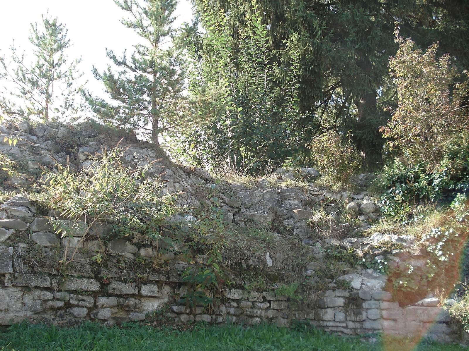
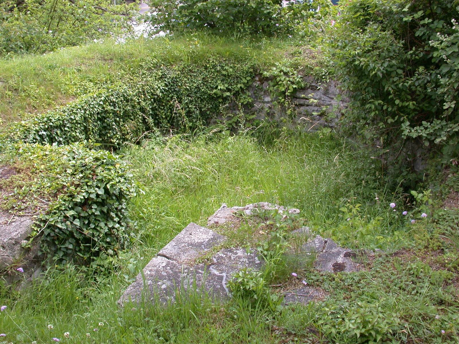
The fort enclosed about 7,900 square metres in a plan measuring approximately 88 by 91 metres. Foundations beside St John’s Church, restored in 1900 and 1911, help trace its outline. Parts of the southern and eastern walls still stand, and the conserved southern outer wall also serves as part of the cemetery boundary. St John’s Church is near the centre of the fort area.
Walls and defences
Polygonal towers occupied the four corners, and one included a sharply turning passage that served as a small secondary entrance. The east and west gates each had a pair of horseshoe-shaped towers. Four towers reinforced the southern side, including two beside the main gate, which was 3.6 metres wide. The north wall, above a steep slope toward the Rhine, was 1.8 metres thick; the other walls measured 2.8 metres.
A ditch protected the fort on its landward sides. Sharpened oak stakes set into the western ditch created an additional obstacle. Another ditch and a wooden fence may have strengthened the southern, eastern, and western approaches, although their exact position is uncertain.
Interior buildings
Two principal roads divided the interior into four areas, and one road had a surface of stone slabs. A square building at their intersection may have served as the headquarters and the commandant’s residence. Small timber and half-timber buildings stood in the western area, with wattle walls resting on horizontal beams, mortar floors, and hearths. After a fire, simpler buildings supported by upright posts took their place.
Northeastern hall
Excavation at the northeast corner exposed part of a hall-like structure that may have been a storehouse. Its surviving lengthwise wall, 0.65 metres wide, ran parallel to the north wall, and the building may have been just over 10 metres wide. Two stone projections attached separately to the wall, one sandstone and one limestone, may have supported a heavily loaded upper floor. Weapons or clothing are possible contents; use as a grain store is considered unlikely because the excavated area gave no evidence of a raised floor.
Civilian settlement
The settlement occupied a riverside strip about 600 metres long and 200 metres wide. Long, narrow house plots followed the river road and clustered around the bridge. Geophysical surveying has helped reveal parts of its extent and layout.
Houses and plots
Early homes combined living and working areas in timber or timber-framed buildings. Some were replaced by stone structures from the second century. Because the ground was wet and unstable, builders supported foundations on timber platforms and piles, sometimes adding layers of wood waste or branches for insulation. Floors were usually clay, though some had mortar laid over stone. Walls used beams, grooved planks, or woven branches coated with clay and plaster; conifer shingles show that many roofs were wooden.
Some plots facing the street had a forecourt 1.5 to 4 metres deep, partly covered like a veranda and apparently used to display goods. Hearths commonly consisted of clay slabs laid over pebbles or tiles. Timber buildings were repeatedly rebuilt, at times after fires. From the middle of the second century, stone foundations and walls supported heavier tiled roofs.
Riverside road
The main east–west road followed the Rhine shore. In the excavated stretch, a timber raft supported a gravel roadway about five metres wide, with drainage ditches on either side. A covered walkway, or portico, ran beside it on a fine-sand surface. The road may have been laid out in the late first century BCE, perhaps following an earlier route, and remained in use until the settlement was abandoned in the third century. Wheel ruts led to repeated renewal of its gravel surface; a section showing the accumulated layers is displayed at the Archaeology Museum in Frauenfeld.
Water supply and sanitation
Wooden pipes carried fresh water through the settlement to wells and basins lined with timber. Drains and sewers moved water and waste away from the damp plots and carried waste from latrines. A public basin, carefully built from wood, measured almost three metres square. Its oak boards came from a tree felled around 182 CE, while silver-fir boards joined with interlocking edges formed the walls. Iron fittings reinforced the corners. Water flowed in through a well pipe and out through an opening in the floor.
A water-flushed latrine found at the Rebmann property dates to around 77 CE based on its timbers. Its rectangular box was made of oak planks and originally had a seat board with a cut-out opening.
Baths and workshops
A public bath near the settlement’s northwestern edge measured about 21 by 13 metres and underwent several building phases. Its mortar-set rubble-stone walls enclosed three rooms with underfloor heating, and the walls were painted. An inscription names Caratus, Flavius Adjectus, Aurelius Celsus, and Ciltus as contributors to repairs.
Workshops included pottery kilns and metalworking spaces. Trades involving fire or strong smells were concentrated at the western edge. Pottery kilns had separate chambers for the fire and the wares, with a perforated floor supporting the pottery during firing. Bowls, jugs, and cups were among the products; stamps identify potters named Germanus, Attilius, and Raeticus.
Craft and household evidence
Finds point to ironworking, casting in bronze and lead, tanning or shoemaking, woodworking, and the working of bone and antler. Slag and hammer scale relate to ironworking; casting droplets, horn cores, leather waste, tools, unfinished wooden objects, and bone and antler debris provide evidence for other crafts. Wood scraps show that different species were selected for different purposes: boxwood, ash, maple, walnut, and fruitwood were used for turned objects, while silver fir and spruce were favored for writing tablets. Roots of fruit trees, blackthorn, elder, beech, and willow indicate cultivated areas in some backyards.
Waterlogged soil preserved leather goods, textiles, a three-legged stool, and carved table parts, as well as timber building elements, seeds, fruit, animal bones, and food waste. These remains provide evidence for construction methods, the choice of timber, diet, and household life. Finds from the wider area also include the Eschenz gold cup, made around 2000 BCE, and a Gallo-Roman wooden figure dated to 60–70 CE.
Crossings and bridgehead
Timber bridges
Roman bridges crossed the Rhine by way of the Werd Islands. The eastern tip of Werd provided a support, while the uppermost island acted as an abutment. The channel is broader at this location and the current weaker. Tree-ring analysis dates the first Roman timber bridge to 81 or 82 CE, and successive structures indicate repeated repairs or replacement.
The pile bridge measured 217 metres long and 6.4 metres wide. Its spans, each about 15 metres, rested on groups of ten piles measuring 30 to 45 centimetres in diameter. Another section, about 220 metres long, extended between Werd and Arach and may have included a bridge carried by boats. Around 250 CE, the bridges were renewed or substantially repaired. A fortification at Arach guarded the northern approach.
Later crossing and right-bank fort
A later bridge, probably built entirely of stone and set somewhat upstream, has not been confirmed by archaeological remains. Foundations associated with the bridgehead suggest that it may have stood east of the present Rhine bridge. The right-bank bridgehead fort lay beneath the former St George’s monastery at Stein am Rhein. It had a square plan, with a western wall at least 38 metres long, and its foundations secured the northern end of the crossing.
Cemeteries, churches, and inscriptions
Southwestern cemetery
A cemetery about 250 metres southwest of the fort yielded 47 excavated burials. Earlier graves were aligned north to south; later burials, probably Christian, ran west to east. Most were simple inhumations. Two graves were lined with stone slabs, and iron nails indicate that coffins were used. Grave goods included vessels, hairpins, bracelets, mirrors, combs, brooches, bead necklaces, and belt buckles. Burials of local elites included valuable soapstone and glass vessels, among them a bowl decorated with a hunting scene and a handled jug with an inner vessel. Whether the fort’s soldiers were buried in this cemetery is uncertain.
Churches and graves at St John’s
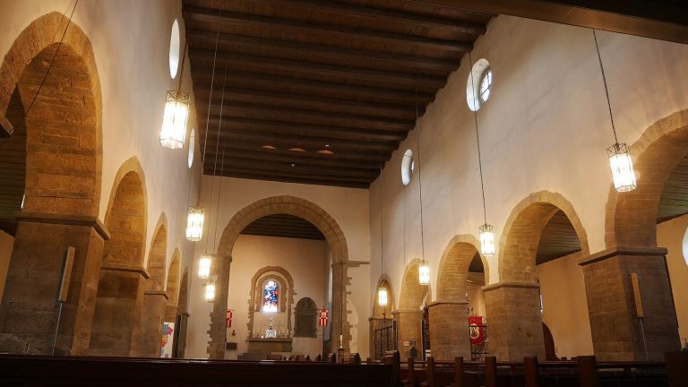
The present St John’s Church stands near the centre of the fort area. Five Roman inhumations and three cremations were found nearby in 1913. A simple timber church had been built within the fort ruins by the middle of the sixth century, followed in the early seventh century by a stone church connected with an Alamannic aristocratic family.
Two inscriptions illuminate the site’s Roman history. A dedication to Rhenus, the Roman river god associated with the Rhine, was found in 1741 while a cemetery wall was being built. A fragment of the fort’s construction inscription, found beneath the floor of St John’s Church, provides evidence for dating the fortress. The German historian Theodor Mommsen interpreted the fragment in 1850.