Castrum Regulbium: A Roman Coastal Fort at Reculver
Site at a Glance
- Popularity
- Medium
- Country
- United Kingdom
- Primary era
- Classical
- Eras represented
- Classical, Medieval
- Civilizations
- Anglo-Saxon, English, Roman
- Site type
- Military
- Remains
- Fort
On this page18 sections
History
Castrum Regulbium was a Roman fort at Reculver in Kent, United Kingdom. First established as a timber-and-earth military position after the Roman invasion of Britain in AD 43, it was later rebuilt in stone, probably in the early 3rd century. The fort guarded the northern entrance to the Wantsum Channel, a busy shipping route used for traffic and military supplies, and helped protect access to the Thames estuary.
Roman occupation and coastal defense
Twenty-four coins from the reigns of Tiberius and Nero indicate Roman activity in the area during the 1st century AD. A small fort, probably serving as a bridgehead, was built after the invasion of AD 43 and remained in use at least into the late 60s. A road linked it to Durovernum, the Roman town at Canterbury, about 13.7 kilometres to the southwest. The position also offered a view over the Wantsum Channel, which then separated the mainland from the island of Thanet. Rutupiae, near present-day Richborough, guarded the channel’s southern entrance.
Regulbium may have served as a harbor and supply base for the Roman fleet, though that role remains uncertain. The Romans later used the position as a signal site, perhaps with a lighthouse. The coins suggest military activity by about AD 65, but do not establish when a signal building was erected.
The stone fort was probably built in the early 3rd century. An inscription associated with its headquarters names a governor whose identity is uncertain: he may have been Aulus Triarius Rufinus, consul in 210, or Quintus Aradius Rufinus, probably governor around 220. The late Roman administrative document known as the Notitia Dignitatum lists the garrison as the Cohors I Baetasiorum, a Roman auxiliary unit. Tiles stamped with the unit’s initials, CIB, provide related evidence. The cohort had earlier been stationed at Maryport in Cumbria and may have built the fort. A connection with the Classis Britannica, the Roman fleet operating in and around Britain, has also been proposed, but the fleet’s presence at Regulbium is uncertain.
From about 287, the Roman commander Carausius organized defenses along the Channel coast against Saxon and Frankish raiders. Carausius had established a breakaway regime in Britain, and his successor Allectus continued the coastal program. Regulbium became part of the Litus Saxonicum, the late Roman network of coastal forts and military sites in parts of southern and eastern Britain. The garrison may also have been expected to resist forces sent by Rome’s central government during the breakaway regime.
Substantial building work took place late in the 3rd century, but the fort appears to have been abandoned soon afterward, for an uncertain period. About 100 coins dating from 270 to 300 were found near two excavated barracks. Their concentration may be connected with a temporary absence of the garrison and the barracks’ subsequent deterioration. The fort may have been occupied again around 296, after Constantius I ended the breakaway regime. Military activity declined in the first half of the 4th century, and the army seems to have left after 360. Civilian residents or newcomers may then have used the site. Occupation continued into the 5th century.
After the Roman army
After Roman military withdrawal, the site served for a time as a residence of the Anglo-Saxon kings of Kent. King Ecgberht is credited with having a church built there. In 669 he granted land to the cleric Bass to establish a monastery. In 679 King Hlothhere transferred lands and the monastery to the abbot Beorhtwald, who became Archbishop of Canterbury in 690. The Benedictine institution later became known as St Mary’s Church of Reculver.
The name appears as Regulbio in the Notitia Dignitatum and derives from a local Brythonic word meaning “great headland” or “at the headland.” Early English records use forms of Raculf, including Raculfmynster in 669 and Raculfceaster in a charter of 784; the 12th-century Anglo-Saxon Chronicle uses Raculf.
Coastal erosion gradually took land from the site and contributed to the depopulation of Reculver village from the 19th century. Much of the fort and adjoining ground was lost to the sea. The ruins were mentioned in writing during the 19th century, and excavations between 1952 and 1968 identified several building phases. The headquarters inscription was discovered in 1960. More than 24,000 small finds from the fort and its surroundings are held at Herne Bay Museum and Dover Castle. English Heritage protects the fort site.
Remains
The fort occupied a low hill near Kent’s northeastern headland, on the mainland side of the Wantsum Channel’s northern entrance and about a kilometre from the coast as it then lay. The channel has since largely silted up, and the coastline has changed substantially. Within this setting, the earlier timber-and-earth fort lay inside a later stone enclosure, whose rounded corners gave it an approximately playing-card-shaped plan.
Early fort and stone defenses
Timber-and-earth fort
Excavations in 1961–63 located the eastern and southern sides of the earlier fort. Two ditches enclosed it: the inner had a Y-shaped section and the outer a V-shaped section. The outer ditch appears to have fallen out of repair in antiquity and partly filled with clay and mud containing pottery from different periods. Its line continued northwest. The northern rampart may lie beneath later houses, a late Roman bathhouse, and a medieval cemetery.
Walls and ditches
The stone fort covered about 3.06 hectares. Its perimeter wall was originally several metres high, about 3 metres thick at the base and narrowing to 2.4 metres at the top. An earthen bank against its inner face reinforced the wall and provided a defensive walkway. Two ditches lay outside the defenses. The inner ditch measured 7.9 metres wide and 2.7 metres deep; the outer was about 5 metres wide and 2 metres deep.
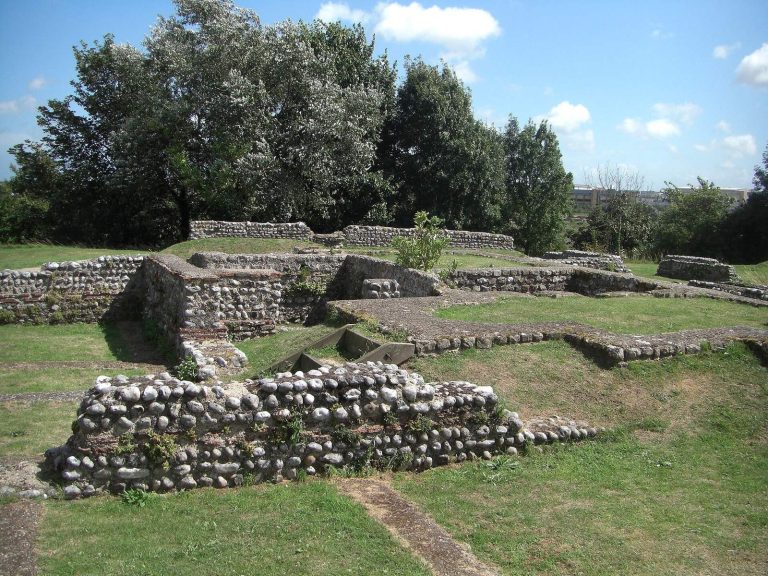
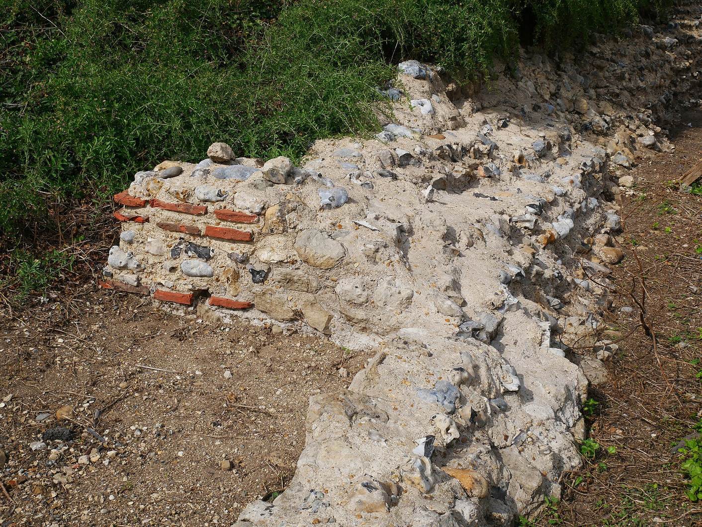
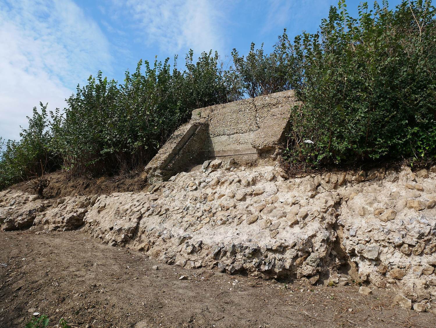
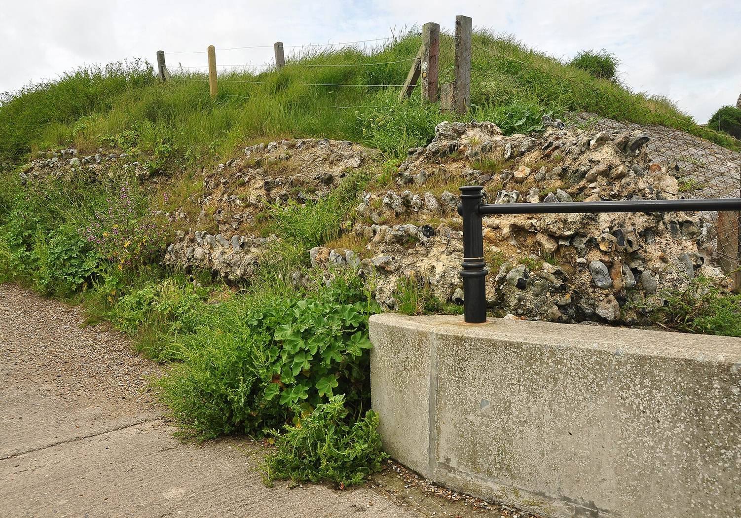
The wall core was built mainly of black flint and siliceous sandstone set in mortar, and its faces were clad in limestone blocks. Stone came from local sources, including Thanet and the area around Bishopstone Glen; the sandstone probably came from near Maidstone. The southern wall is the best-preserved stretch and meets the eastern wall at a rounded corner. Both surviving sections are heavily overgrown, with exposed wall core reaching about 2.6 metres. The northern wall, parts of the eastern wall, and most of the western wall fell into the sea as the ground eroded. Stone robbing also damaged the fort, especially its southwest corner. Two ditches in front of the eastern wall remain faintly visible, alongside later repairs in the wall and the remains of a kiln.
Gates and tower
The main gate is thought to have stood on the north side, facing the headland and coast. The position of the headquarters entrance supports this reconstruction. Another gate stood midway along each of the east and west walls. The eastern passage was about 2.7 metres wide and opened onto the principal cross-street. Overgrown foundations of a guardhouse remain beside it. Excavators also identified a tower at the southwest corner.
Buildings and streets within the fort
Headquarters and internal roads
Excavations in 1968 revealed the central headquarters building, including a standards shrine, a cellar below it, and the foundations of a cross-hall. The shrine was the place where the unit’s standards were kept. Gravelled stretches of the main cross-street, the road leading toward the main gate, and a road running inside the defenses were also found. The cross-street connected the east and west gates.
Barracks and later buildings
Excavators identified a double barrack and either the commandant’s residence or a bath building heated by hot air beneath the floor. The remains of a western barrack include postholes in a burnt layer. Their positions differ from the earlier building plan, suggesting changes to the interior during the first half of the 4th century.
In the southwest sector, foundations made of compacted layers of pebbles, probably collected from nearby beaches, belonged to a large planned building. Two larger buildings were planned instead in the northern part of the fort. Their floors consisted of compacted clay reinforced with a timber grid and substantial foundations to support floorboards. At least one had plastered, painted walls and a heavy tiled roof. Its position beside the headquarters suggests that the buildings may have accommodated senior personnel or specialists. The eastern building had deteriorated before it burned, perhaps during the arrival of newcomers. Erosion has removed much of the fort’s interior, limiting reconstruction of its buildings.
Structures and settlement beyond the walls
Signal building and oven
A square building outside the fort, near the northern entrance to the Wantsum Channel, probably served as a signal station or lighthouse, though its date is uncertain. About 61 metres southeast of the fort, a Roman oven had a firing chamber measuring about 4.9 by 4.8 metres. It may have been used to dry grain and fish.
Settlement and water supply
The civilian settlement, or vicus, lay north and west of the fort and may have covered several hectares. Much of it was lost to the sea. Roman deposits extend as far as 340 metres west of the fort and date from about AD 170 to 360. A Roman building north of the fort, observed in 1936, had a paved floor and underfloor heating; it may have been an early bathhouse outside the walls.
Earlier descriptions record cisterns measuring about 3.0 to 3.7 square metres, lined with oak planks and sealed with clay. They were thought to have collected rainwater, and a Roman bathing scraper was found in a similar cistern. West of the fort, twelve Roman wells were identified, ten with rectangular shafts. The wells passed through the softer Thanet Beds, local sand-and-clay deposits, into harder sandstone to reach groundwater. Three women’s skeletons accompanied by jewelry were found in wells. They were probably victims of violence whose bodies were placed there, rather than ritual burials or accidental deaths.
Finds, burials, and St Mary’s Church
Inscription and military finds
The headquarters inscription was recovered in 1960 in eleven fragments beneath the standards shrine. Its letters had originally been painted red. It may have stood on the shrine’s front wall before falling into the cellar when the building was destroyed. Ian Archibald Richmond reconstructed about three-quarters of its text. The inscription includes the Latin term aedes principiorum for the headquarters standards shrine, its earliest known use, and an early secure use of basilica, meaning a military hall.
Tiles stamped CIB are associated with the Cohors I Baetasiorum. Finds from the fort and its surroundings include more than 24,000 small objects, now held at Herne Bay Museum and Dover Castle.
Infant burials
The remains of ten infants were found within the fort. Five lay in building foundations or walls alongside coins dating from AD 270 to 360. These burials may have been part of a ritual practice, but it is uncertain whether the infants were already dead or stillborn, buried alive, or killed.
St Mary’s Church
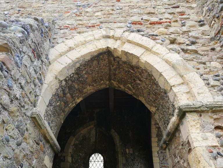
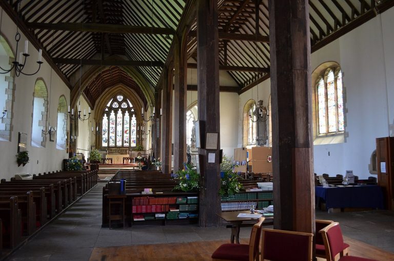
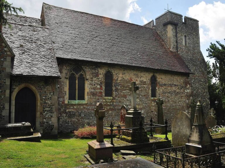
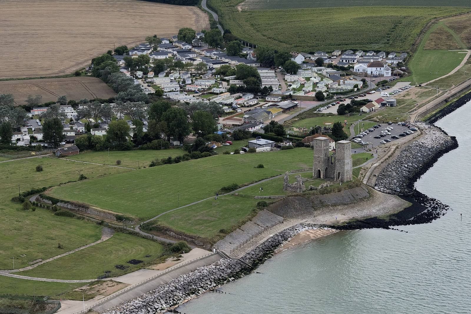
The ruined St Mary’s Church stands within the fort site. Roman bricks from fort buildings were reused in its construction. Its distinctive twin towers were built in the 12th century and served as a navigational landmark in the channel.