Castra of Verőce: A Late Roman Landing Fort in Hungary
Site at a Glance
- Popularity
- Very Low
- Country
- Hungary
- Primary era
- Classical
- Eras represented
- Classical
- Civilizations
- Roman
- Site type
- Military
- Remains
- Fort
On this page11 sections
History
The Castra of Verőce was a late Roman landing fort beside the Danube at Verőce, Hungary. Roman builders constructed it either near the end of Constantius II’s reign or during the period of Valentinian I, both Roman emperors. It stood on the Barbaricum side, the Roman term for lands beyond the imperial frontier, and formed part of the Pannonian Limes, Rome’s frontier system in Pannonia. The fort guarded a river crossing and helped monitor the Danube and frontier positions farther south.
Construction and frontier role
The fort belonged to section 3 of the Pannonian Limes. Kisoroszi lay to its west, Visegrád-Sibrik, also known as Pone Navata, to the southwest, Dunabogdány to the south, and Tahitótfalu-Balhavár to the southeast. Szentendre Island divided the river nearby and held several late Roman frontier posts. A separate small fort or landing station stood across the river from Verőce.
At the apex of the Danube Bend, the fort could watch the southern-bank chain of watchtowers to the southwest and relay warnings to posts farther south. Its position may also have allowed Roman troops to attack the rear of forces attempting to breach the Limes Sarmatiae, a major earthwork frontier system farther south.
Stamped building materials provide evidence for the fort’s chronology. Of the tiles, 301 carry the name of Frigeridus, a dux, or senior Roman military commander, who served in Valeria from 371 to 373. Another 52 name the tribunes Lupicinus, Terentianus, Olimpus, and Caris. Lupicinus held the rank of tribune, a Roman military officer, after 368 and before 377. The first known reference to Bonus as a magister, a Roman official whose specific office is unclear, has been placed either near the end of Constantius II’s era or in the following Valentinian period.
Twelve wall bricks bear abbreviations including AR, ARN, and ARAN, whose meanings remain uncertain. One proposed reading expands OF ARN as “auxiliary workshops of the river frontier,” but that interpretation is also uncertain. The construction date remains either late in Constantius II’s reign or in the period of Valentinian I.
Late Roman changes and later occupation
The fort remained occupied into the late fourth or early fifth century. Archaeologist István Paulovics proposed that, perhaps around 380, the Romans demolished the side towers and their connecting walls and levelled their locations. On this interpretation, the central building then stood alone beside the river.
Germanic settlers occupied the site after the Roman period. Finds from this later use belong to the post-Roman occupation and do not establish trade between Romans and communities beyond the frontier.
Excavation and protection
Paulovics excavated the fort in 1934. Hungary’s 2001 heritage law protects the fort and other Limes sites as nationally valuable archaeological cultural property; archaeological finds are state property.
Remains
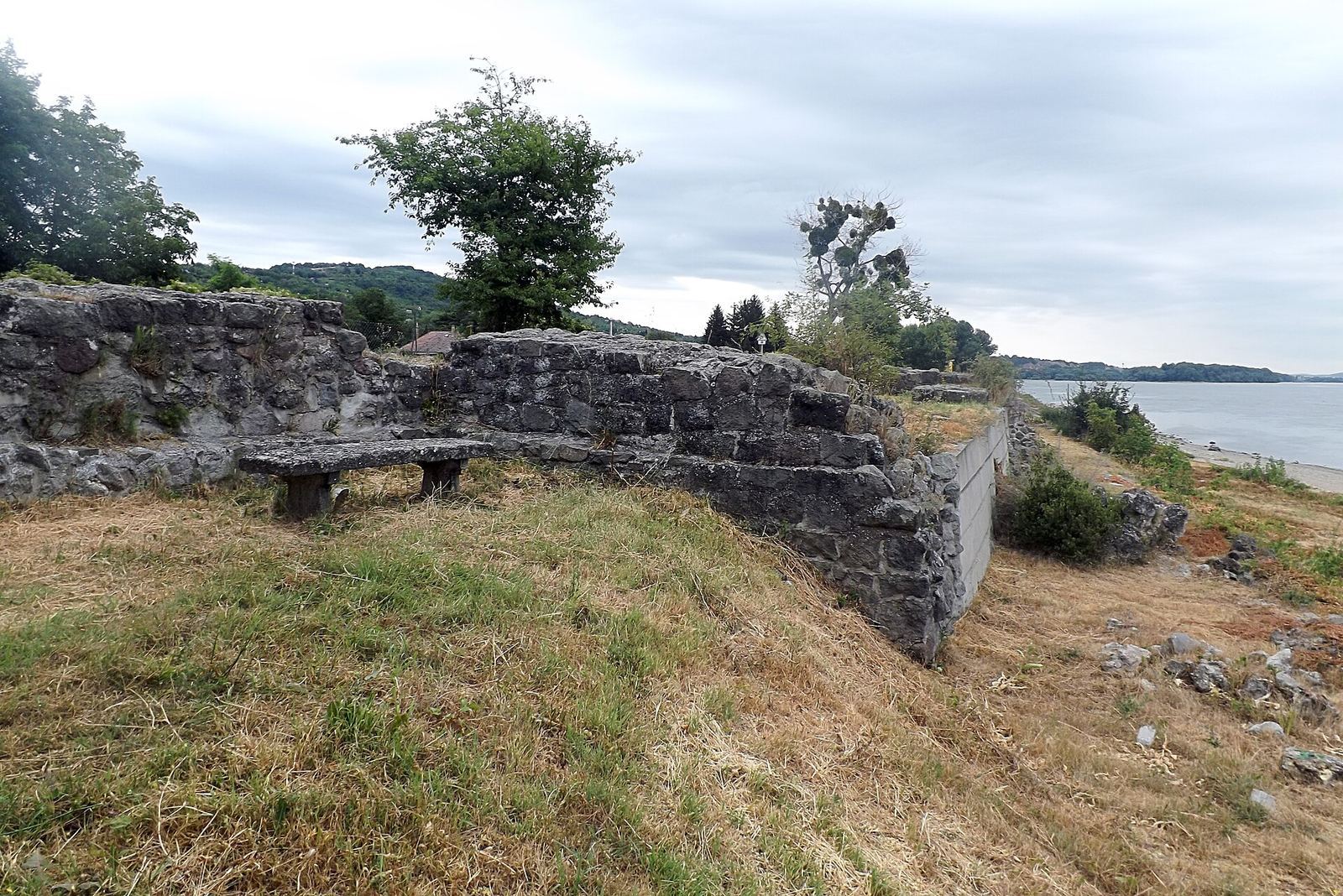
The fort’s plan combined a rectangular central building of stone and brick with walls and square towers extending toward the river. The river-facing works formed a landing area for boats. The site lies immediately north of the Danube in the Dunamező area of Verőce, where the river leaves the constricted Danube Bend and opens southward; Szentendre Island divides its course.
Building and landing defenses
Central building
The rectangular central structure measured 18 by 23 metres. Its walls were about 2.8 metres thick and rested on foundations 3.2 metres wide. The building served as both a residence and a watchtower. Excavation exposed two successive floor levels, and archaeologist Sándor Soproni considered the older one to predate Valentinian I.
Two adjacent square foundations for brick piers stood at the centre of the building and supported a multi-storey structure with a heavy tiled roof. Lead plates and roof tiles were found on the upper floor. Wilhelm Schleiermacher suggested that the building originally had four such supports; the supports nearest the entrance had already been reused by the time they were found. Archaeologist Mihály Nagy argued that, like many fourth-century buildings in the region, its measurements followed the orthodoron, a unit of length, rather than the Roman foot.
River walls and landing area
From each narrow end of the central building, a wall about 14 metres long and 2 metres thick ran at a right angle to a square tower measuring 5 by 5 metres. A further wall extended from each tower toward the shore, forming a landing area for boats. It is uncertain whether the river-facing side of the fort was open. An earlier reconstruction showed an open front, while a later interpretation allows for a closed frontage with a special entrance or a wider opening. Schleiermacher proposed that the arrangement may have protected vessels while they were hauled ashore.
Groups of oak posts found in the riverbed about 30 metres from the flank towers had supported the walls extending into the water and their terminal towers. Erosion over more than fifteen centuries has removed most of the waterfront construction. The excavated foundations have since been restored.
Archaeological finds
Roman-period objects
A small glass bottle with a sharply constricted neck dates to the second half of the fourth or early fifth century. Other finds include worked iron, beakers decorated with blue glass threads, and pottery. Together, these objects support occupation into the fifth century.
Post-Roman finds
A Germanic pot came from the uppermost fill of a well, while graves and Baltic amber were found in the fort area. These belong to the later, post-Roman occupation rather than Roman activity. The amber does not demonstrate Roman-era trade with peoples beyond the frontier, and archaeologist András Mócsy cautioned that it offered little help in dating the site.