Belvoir Fortress: A Crusader Stronghold in Israel

Site at a Glance
- Rating
- 4.6
- Popularity
- Medium
- Country
- Israel
- Primary era
- Medieval
- External website
- Open
- Eras represented
- Classical, Medieval, Early Modern
- Civilizations
- Crusader, Kingdom of Jerusalem, Knights Hospitaller, Ottoman
- Site type
- Military
- Remains
- Castle
On this page17 sections
History
Belvoir Fortress is a Crusader fortress in Israel, built by the Knights Hospitaller during the 12th century in the military architecture of the Crusader states. It stands on the eastern edge of the Issachar Plateau in the lower Galilee, overlooking the Jordan Valley from a summit 312 meters above sea level. Its position made it an important defensive and administrative center on the eastern approaches to the Kingdom of Jerusalem.
Early settlement and the Crusader estate
The summit was probably inhabited during the biblical settlement period and formed part of the territory associated with the Israelite tribe of Issachar. An Egyptian stone monument found at the site provides evidence of an earlier historical presence. A Jewish settlement known as Kokhav occupied the location during the third century, in the Talmudic period. Excavations have revealed domestic buildings and the remains of an important public structure, probably a synagogue.
Some scholars have identified the site with Grofina, a place mentioned in the Mishnah in connection with signal fires announcing the sanctification of the new moon. This association remains an interpretation of the ancient settlement, while the excavated remains establish the presence of a Jewish community and public building at the site.
During the Crusader period, the area belonged to the Principality of Galilee, a territory centered on Tiberias and subordinate to the Kingdom of Jerusalem. After internal disputes within the Crusader state, the estate of Kokhav was granted to the French-origin Velos family of Tiberias. The family established a fortified farmstead there, probably between 1138 and 1140 during the reign of King Fulk. The precise date and extent of royal involvement remain uncertain.
The farmstead served several purposes. It administered the surrounding estate, provided a base for its management, and offered refuge in times of danger. Its location also allowed the Crusaders to monitor important routes leading toward the kingdom. These included the ancient road between Damascus and Beisan through Irbid, as well as crossings of the Jordan at Jisr al-Majami and Sheikh Hussein.
The Hospitaller fortress
In 1168, Ivo Velos sold the farmstead and its lands to the Knights Hospitaller, formally the Order of Saint John of Jerusalem. This military-religious order operated hospitals and maintained fortified possessions in the Crusader states. The sale cost 1,400 gold bezants. The Hospitallers demolished the existing buildings and constructed the fortress whose remains survive today.
Under the Hospitallers, the estate expanded to about 200 square kilometers and included dozens of local villages. Belvoir became a central element of the kingdom’s frontier defenses. Its concentric plan, with multiple defensive enclosures arranged one inside another, made it one of the two known fortress-within-a-fortress castles of the Crusader Levant. The other was Krak des Chevaliers in western Syria. Belvoir’s design later influenced fortification practice and has been described as a major achievement of Crusader military architecture.
In 1182, Muslim and Crusader forces fought on the Issachar Plateau a few kilometers west of Belvoir. The Muslim army was defeated, but returned the next year and captured the nearby fortress of Forbelet. The wider struggle intensified after Saladin, the Muslim sultan who united major territories in Egypt and Syria, defeated the main Crusader army at the Battle of Hattin in 1187 and recovered much of the Kingdom of Jerusalem.
Siege, surrender, and dismantling
Belvoir was one of only three major fortresses that continued to resist after Hattin. Saladin’s forces reached it in July 1187 and began a siege that lasted approximately eighteen months. The garrison surrendered on 5 January 1189 and was permitted to withdraw to Tyre.
After Saladin’s death in 1193, Belvoir and northern Palestine came under the rule of al-Mu’azzam, the Ayyubid sultan of Damascus. The Ayyubids were the dynasty founded by Saladin that governed parts of Egypt, Syria, and the Levant. When al-Kamil, sultan of Egypt, reached an agreement with Frederick II, Holy Roman Emperor, concerning the restoration of Christian control over Jerusalem, al-Mu’azzam adopted a policy of destroying fortresses beyond Damascus’s new defensive line.
The defenders abandoned Belvoir in 1219. Its dismantling was completed in 1228, when the upper levels were collapsed onto the lower ones and the moat was filled. The Hospitallers regained the estate in 1241, but did not restore the ruined fortress. By 1263, the site had fallen definitively to the forces of Baybars, the Mamluk sultan. The Mamluks were the military ruling elite who established a sultanate in Egypt and Syria.
Later settlement and archaeological work
After several centuries of abandonment, a Bedouin community founded the village of Kawkab al-Hawa among the fortress ruins during the 18th century. During the British Mandate, the village became the target of several operations by the Special Night Squads under Orde Charles Wingate in 1938.
On 16 May 1948, during the 1948 war, forces of the Golani Brigade captured Kawkab al-Hawa after a mortar bombardment caused its inhabitants to flee. Iraqi forces attempted to recapture the village and fortress, but Golani troops repelled them on 18 May in an ambush. Iraqi forces then limited their activity to shelling and withdrew from the area on 22 May.
In 1959, Meir Har-Zion, an Israeli military figure, established the Shoshana Estate near the fortress in memory of his sister, who had been killed by Bedouins in the Judean Desert. Archaeological clearance began in 1963 under Nehemia Zori of the Israel Department of Antiquities and resumed from 1966 to 1968 under Meir Ben-Dov. The work removed the remains of Kawkab al-Hawa and accumulated debris, exposing the inner fortress that earlier explorers had mistaken for a keep.
The fortress was restored and opened to the public in March 1969, after which it was managed as a national park. A Franco-Israeli archaeological team resumed investigations in 2013. Work in 2013 and 2014 included detailed topographic recording, classification of arrow slits, and examination of stone-cutting techniques. Soundings south of the fortress found a late Ottoman installation, while investigations north of the fortress examined a large deposit of stone created during the 1960s clearance. The site is protected as a national park. A sculpture garden was established south of the fortress in 1994, a vulture-feeding station was established north of it, and a lookout named for former Israeli Chief of Staff Dan Shomron was created at the southeastern foot of the main entrance in 2011.
Remains
Belvoir occupies a summit at the eastern edge of the plateau. The eastern side overlooks the Jordan Valley and the western bank of the Jordan, while the position also looks toward the Jezreel Valley and Mount Tabor. The surviving fortress is a concentric complex made up of a nearly square outer enclosure, a surrounding dry moat, and a smaller inner fortress, or castrum, functioning as a secondary stronghold within the outer defenses.
Outer defenses and approaches
Enclosure and moat
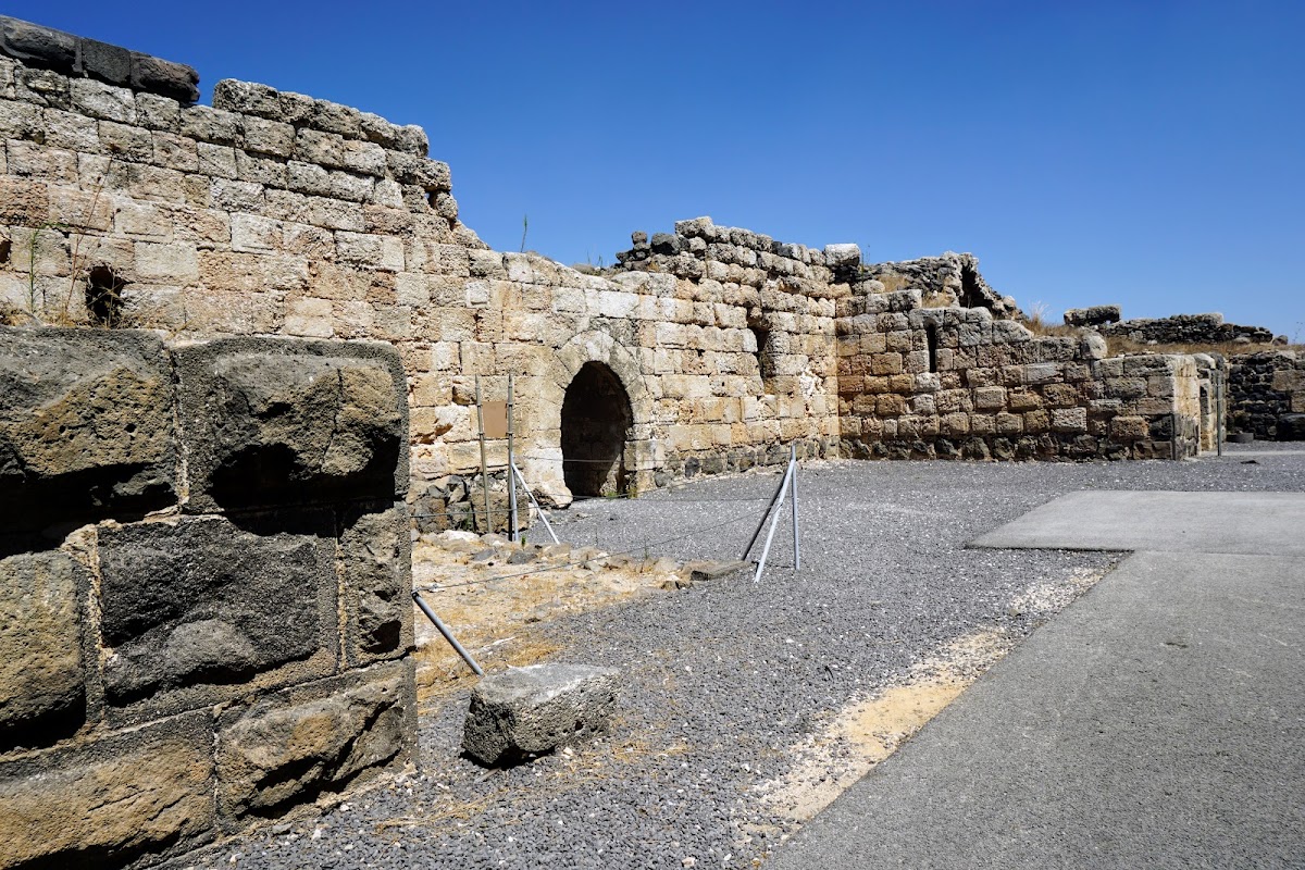
The outer enclosure measures approximately 110 meters across. Its walls are about 3 meters thick and have a stated perimeter of approximately 480 meters. The builders used black basalt quarried during the excavation of the moat, together with light limestone transported from more distant quarries. Lead and iron reinforced the joints between the building stones.
The dry moat extends along the northern, western, and southern sides of the fortress. It is approximately 20 meters wide and about 12 meters deep. On the eastern side, the steep natural slope prevented siege towers and other assault equipment from approaching the wall, so no moat was required there. The eastern defenses were strengthened by a sloping outer face, known as a talus, and by an external tower, or barbican, that commanded the ground below the wall.
Walls, towers, and firing positions
The outer walls stand on vaulted arches approximately 7 meters wide. This construction created hollow walls containing two levels of rooms. These spaces were used for storing food and ammunition and for housing livestock and horses. The roofs formed a patrol walkway along the defenses.
The outer defenses had two levels of firing positions. The upper positions lay along the crenellated patrol walk, while the lower positions were inside the vaulted wall rooms, where archers fired through arrow slits. Towers projected from the corners and middle sections of the outer walls. Rising approximately 7 meters, they allowed defenders to direct fire along the walls and against attackers attempting to undermine them. Four of the seven towers contained concealed passages leading to the bottom of the moat, allowing sorties against besieging forces.
Eastern tower and main entrance
The large eastern tower occupied the fortress’s outermost eastern corner and formed a separate, heavily fortified defensive position. It is almost completely destroyed. Its position and construction suggest that it may have served as a final refuge for the garrison after the main fortress fell.
The principal entrance lay in the southeastern corner. A light limestone gateway led into a broad approach passage bounded on one side by the outer wall and the main eastern tower and on the other by the principal wall. The passage turned sharply before rising to the inner gate, preventing a rapid, direct assault. Seven arrow slits overlooked the approach, of which three remain in place. The inner gate had a mechanical portcullis, probably made of iron, that could be raised or lowered.
Western gate
A second entrance passed through the western wall. A bridge extended from it across the moat, with one section built of stone and another of wood. The wooden section could be lifted. During the Muslim siege of 1188, the defenders sealed this gate.
Inner fortress
Enclosure and gate system
The inner fortress forms a smaller square enclosure approximately 50 meters on each side, with a tower at every corner. It stood about 2 meters higher than the outer walls, giving defenders a view beyond the outer defenses. Entry was from the west through a gate system composed of two gates and corridors set at right angles. This indirect arrangement forced attackers to slow down and reduced the momentum of a rapid assault.
Vaulted ranges and courtyard
The inner walls contained barrel-vaulted rooms on two levels. A barrel vault is a continuous curved ceiling shaped like the half-section of a barrel. The lower southern vault served as the knights’ refectory, or dining hall. The eastern vault contained the kitchen and the remains of three large ovens. Upper vaults provided living quarters for the knights. The second floor of the gate tower housed the fortress chapel, while an inner courtyard occupied the space between the vaulted ranges.
The inner fortress probably also contained a large chapter house, where the order’s members conducted communal business, and a dormitory for the brothers. The outer courtyard held spaces associated with stables, storerooms, and other habitation areas. A bathhouse based on the principles of a Turkish hammam, a heated complex organized around rooms for washing and bathing, occupied the northeastern corner of the outer courtyard.
Water systems and reused stone
Cisterns and water supply
Plastered cisterns were excavated in both the inner and outer courtyards. Plastered channels and ceramic pipes collected rainwater and carried it into the storage tanks, providing water during sieges. In peacetime, drinking water was brought from the Ein al-Hadid spring, several hundred meters south of the fortress.
Jewish architectural elements
The Crusader builders reused architectural elements from a nearby Byzantine-period synagogue. These materials include carved friezes, pilasters, and fragments of a lintel bearing a menorah. Jewish architectural stones, including pieces decorated with menorahs, were incorporated into the Crusader walls after being taken from the earlier Jewish settlement at the site. The quantity of reused blocks led Meir Ben-Dov to suggest that the synagogue stood close to the fortress.
Archaeological clearance and excavation exposed the inner fortress, preserved sections of the outer and inner defensive systems, and produced a substantial deposit of displaced limestone blocks north of the fortress. Some excavated finds are held in archaeological storage at Bet Shemesh, while important carved fragments from the chapel are displayed at the Israel Museum in Jerusalem.