Tell Ubeidiya: An Archaeological Tell on the Jordan River


Site at a Glance
- Rating
- 4.1
- Popularity
- Very Low
- Country
- Israel
- Primary era
- Bronze Age
- External website
- Open
- Eras represented
- Bronze Age, Early Modern
- Civilizations
- Canaanite, Ottoman
- Site type
- City
On this page12 sections
History
Tell Ubeidiya is an archaeological mound in Israel on the western bank of the Jordan River, preserving evidence of human occupation from the Early Bronze Age through the Ottoman period. Its ancient remains include fortified settlements from the Middle Bronze Age and Late Bronze Age, while its later history is connected with the former Muslim village of Ubeidiya, also known as Al-Ubaydiyya.
Bronze Age settlements
The tell contains evidence from the Early Bronze Age, Middle Bronze Age, and Late Bronze Age. Excavations directed by the archaeologist Moshe Stekelis in 1960 revealed fortified cities from the Middle and Late Bronze Ages. These settlements controlled a crossroads leading through the Jordan crossings, giving the site an important position within the movement of people and goods across the area.
Tell Ubeidiya has been identified in different interpretations with the biblical city of Beth-shemesh and with Yenoam, a Canaanite city named in Egyptian inscriptions. Yochanan Aharoni and John Garstang supported the identification with Yenoam, while William Foxwell Albright proposed Beth-shemesh. Neither identification is certain.
Later occupation and archaeological investigation
Renewed excavations beginning in 2012 added evidence for occupation during the Early Bronze Age and for renewed settlement from the Persian period through the Ottoman period. The long sequence of occupation reflects repeated use of the mound and its surrounding area over several historical periods.
Ubeidiya village
The later settlement of Ubeidiya was a Muslim village during the Ottoman and British Mandate periods. An Ottoman register from 1555 to 1556 described the area as cultivated land in the Tiberias district of Safad province and classified it as land belonging to the sultan. A second Ottoman tax register, dated 1596, also listed the village in the Tiberias district.
Pierre Jacotin marked the settlement as Abadieh on his 1799 map. Edward Robinson described it in 1838 as a Muslim village in the Tiberias district, south of the Sea of Galilee. A Palestine Exploration Fund survey in 1881 estimated its population at about 200 Muslims, while a population list from about 1887 gave approximately 310 inhabitants, all Muslims.
The village had an elementary school founded during the Ottoman period. Under the British Mandate it formed part of the Tiberias Subdistrict. Its population was 336 Muslims in 1922 and 625 Muslims living in 137 houses in 1931. By 1944 to 1945, the population had reached 870 Muslims, and the village held 5,173 dunams of land. This included citrus and banana cultivation, irrigated or orchard land, cereal fields, and built-up land.
Abandonment and later research
After the United Nations partition proposal of 1947, which recommended separate Jewish and Arab states in Mandatory Palestine, conflict intensified in the Galilee. Fighting around Tiberias created fear among the inhabitants of Ubeidiya. Residents left for the Nazareth area on March 3, 1948, and the village was abandoned on March 5. It is also described as having been deserted in April as violence spread through nearby towns and villages. The buildings were later destroyed, and former residents became refugees in neighboring countries, particularly Syria.
The site continued to be investigated during the twentieth and twenty-first centuries. In 1992, the remains of the former village were recorded, while the surrounding land was reported to be cultivated mainly for cotton.
Remains
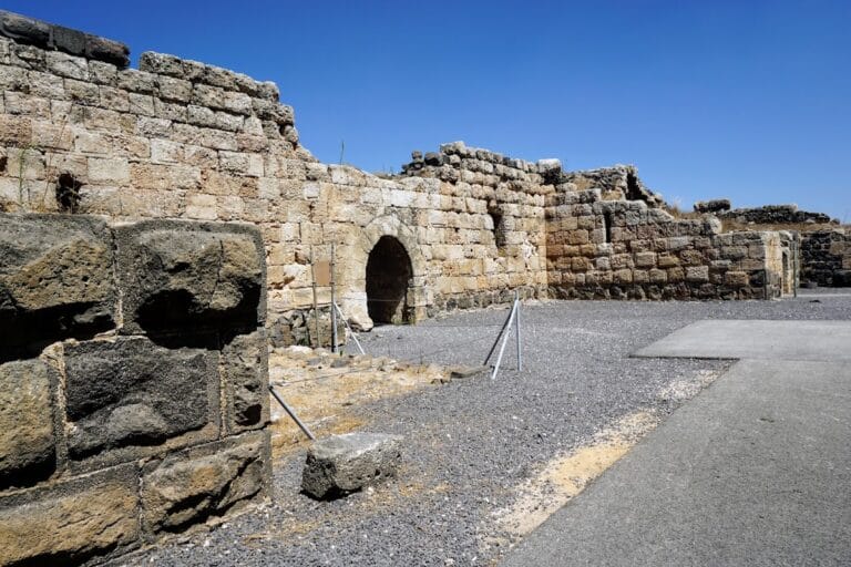
Tell Ubeidiya is a rounded artificial mound on the Jordan River’s western bank, near the mouth of the Yavniel stream and about 1 kilometer southwest of Beit Zera. The mound and its surroundings contain remains from both ancient fortified settlements and the later village. The surviving physical evidence includes ancient urban remains, mud-house ruins, agricultural features, and the structures associated with water-powered flour mills.
Bronze Age urban remains
Excavation exposed fortified urban settlements belonging to the Middle Bronze Age and Late Bronze Age. Their position on the tell placed the settlements beside the Jordan crossings and the route through the area. The excavated remains provide the physical evidence for the ancient fortified cities associated with Tell Ubeidiya.
Village fabric and agricultural landscape
Houses and terraces
The former village occupied the tell and the land around it. Its houses were built of stone and mud, and mud-house remains survive among house ruins, stone piles, wall bases, and terraces. The surrounding plain was cultivated, with small date palms and few other trees. Cotton is now the main crop reported for the surrounding agricultural land.
Water mills
Mill buildings
Two flour mills used water from the Yavniel stream. The mill buildings were constructed from basalt and fieldstone bonded with lime-based mortar. Their vertical mill shafts were made from limestone, a stone that was easier to cut. An aqueduct carried water to openings at the tops of the shafts.
Water channels and machinery
Water passed through the shafts at high speed and turned paddle wheels, powering the milling machinery. The surviving section of the mill water-channel walls is the most prominent indication of the former village. Together with the mill structures, house remains, terraces, wall bases, and date palms, it preserves part of the settlement’s physical layout.
Nearby sites