Khirbet Kerak: An Ancient Tell on the Sea of Galilee
Site at a Glance
- Popularity
- Medium
- Country
- Israel
- Primary era
- Bronze Age
- Eras represented
- Stone Age, Bronze Age, Classical, Medieval
- Civilizations
- Ancient Greek, Byzantine, Roman, Umayyad
- Site type
- City
On this page25 sections
History
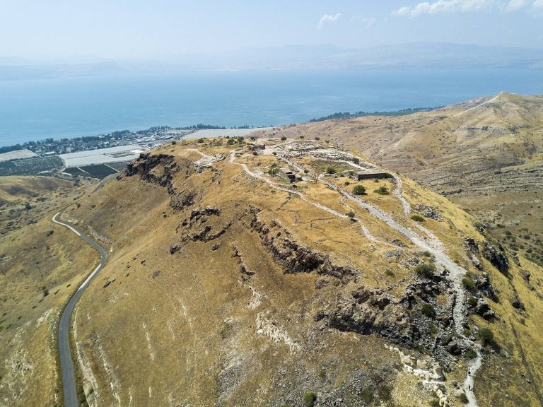
Khirbet Kerak is an ancient tell, an archaeological mound formed through successive building and occupation, on the southwestern shore of the Sea of Galilee in Israel, near the Jordan River’s outlet from the lake. People lived here during the Chalcolithic, or Copper Age, about 6,000 years ago. Around 5,000 years ago, the settlement developed into a substantial Early Bronze Age city, described as the region’s second-largest after Jericho.
Chalcolithic and Early Bronze Age settlement
The Early Bronze Age town grew through four building phases over roughly a thousand years, becoming a regional urban center that covered about 20 hectares at its height. A stone palette found in 2009 bears Egyptian motifs and has been interpreted as evidence of trade or political connections with Egypt’s First Dynasty, the earliest historically attested royal dynasty of ancient Egypt, around 3000 BCE.
A pottery tradition first identified at the site, Khirbet Kerak Ware, appeared around 2800 BCE, during Early Bronze Age III. Its arrival coincided with a marked change from local pottery traditions and reflects influences from eastern Anatolia and the Upper Euphrates. The ware is regarded as a Levantine expression of the Early Transcaucasian, or Kura-Araxes, culture, a prehistoric tradition that spread from the Caucasus into parts of the Near East. Migration by kin-based groups has been proposed as one explanation for these changes.
The town was destroyed or abandoned around 2000 BCE. Activity resumed in the Middle Bronze Age, with evidence belonging to both its first and second phases. A further long interval followed: no habitation is evident between about 1200 and 450 BCE, after which the site was reused during the Persian period.
Hellenistic and Roman settlement
A settlement from the Hellenistic period, the era of Greek political and cultural influence after Alexander the Great’s conquests, has been cautiously identified as Philoteria. It may have been founded under Ptolemaic rule in the third century BCE and named by Ptolemy II, a ruler of the Ptolemaic kingdom in Egypt, for his sister Philotera. Seleucid king Antiochus III captured Philoteria in 218 BCE. The city also appears among the Hellenistic settlements taken by Alexander Jannaeus, a Hasmonean ruler of Judea, probably early in his reign. One proposed chronology places the settlement’s end in the early Hellenistic period. The neighboring town of Sinnabris was also known as Sennabris during Hellenistic times.
In the Roman period, Bet Yerah, also called Kerakh, and Sinnabris were two settlements associated with the old tell. The Jerusalem Talmud, a major collection of Jewish rabbinic law and discussion, describes both as walled towns and also uses Kerakh for Bet Yerah. Kerakh is an Aramaic word meaning “fortress”; the Arabic name Khirbet al-Karak derives from it.
In 67 CE, during the First Jewish Revolt, an uprising against Roman rule that began the previous year, the Roman army under Vespasian camped at Sinnabris after capturing Yodfat. From there, the troops prepared to advance toward the Golan. Sinnabris served as their headquarters, while soldiers camped around the southern shore of the Sea of Galilee. The display of Roman forces was intended to weaken the resolve of the rebels at Gamla.
Byzantine, Umayyad, and medieval phases
A Byzantine church was built at the site and enlarged in several stages. It was destroyed in the seventh century after the Arab conquest and may subsequently have served as a manor house. In the same century, Umayyad caliphs established a winter palace at al-Sinnabra on the church’s remains. Attributed to Mu’awiya and Abdel Malik, the complex provided a winter retreat for Mu’awiya, Marwan I, and other caliphs. The Umayyads were the first major Islamic dynasty, ruling from the mid-seventh century into the eighth.
The Jordan River’s channels around the tell shifted over time. The river once flowed north and west of the site; in rainy years during the nineteenth century, water also ran through a southern channel, temporarily surrounding the mound. The shift to the river’s present southern course has no certain date. It probably occurred late in the Byzantine period, though some scholars have connected it to construction of the Umayyad palace.
In 1113, Crusader and Muslim forces fought near al-Sannabra during the medieval campaigns between Christian and Muslim powers in the eastern Mediterranean. Before the 1187 Battle of Hattin, Saladin and his forces passed through al-Sinnabra on their way to take command of the roads around Kafr Sabt. The town was abandoned after the Crusader conquest and was not rebuilt.
Archaeology and modern history
Nineteenth-century investigators from the Palestine Exploration Fund examined the tell and considered whether it might be ancient Taricheae. In 1905, Haim Margaliot Kalvarisky acquired the land through Yehoshua Hankin; it later passed to the Zionist movement. Arthur Ruppin proposed a Jewish garden city there, inspired by Theodor Herzl’s imagined “New Tiberias” resort in Altneuland, and circulated plans in Europe.
In the 1920s, Eleazar Sukenik and William Foxwell Albright surveyed the site. Albright recognized a distinctive pottery type and gave it the name Khirbet Kerak Ware. A road project prompted salvage work in 1933, and excavations in 1936 recovered a coin hoard dating to the fourth century BCE, with coins from Tyre and coins bearing the names of Alexander the Great and his successors.
Excavations from 1945 to 1946 exposed sections of the town wall and residential buildings. Work from 1949 to 1953 identified occupation layers, a synagogue, and a fortified compound in the northern part of the tell. The compound was mistakenly interpreted as a fifth- or sixth-century synagogue, in part because a column base carried a seven-branched candelabrum. The Oriental Institute of the University of Chicago excavated in 1952 and 1953, then returned in 1963 and 1964; its investigations identified the Byzantine church and Umayyad-period buildings. Excavations in 2010 established that the northern compound was the palace complex of al-Sinnabra, rather than a Byzantine synagogue.
Further investigations included salvage work in 1967 and 1976, excavations in the 1980s and 1990s, and a granary project begun in 2003. Tel Aviv University teams continued fieldwork in seasons through 2015, including work on layers associated with Khirbet Kerak Ware in 2014. A separate salvage excavation took place that year on the grounds of Bet Yerah High School, before construction of a sports hall.
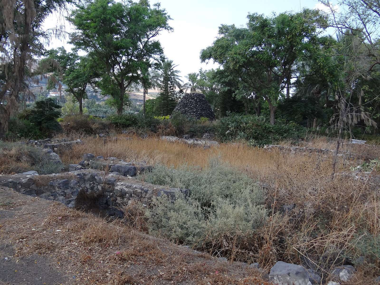
In 1909, a memorial ceremony for Herzl was held on the tell. A stone cairn from that commemoration remains among the site’s later features.
Remains
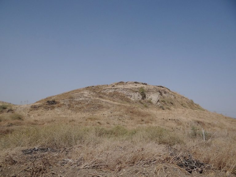
The tell rises about 15 metres above the lake. Its triangular footprint is roughly 1.2 kilometres long and 380 metres wide, with its broad end to the south and its northern tip tapering. The site covers an estimated 60 to 75 acres. Its archaeological layers preserve successive settlements, from early dwellings to Bronze Age urban construction and later religious and residential complexes.
Chalcolithic and Early Bronze Age remains
Early occupation
Chalcolithic levels include pits used to store and cook food. Small mud buildings belong to a later phase of occupation, preceding the larger Early Bronze Age settlement.
Urban layout and defenses
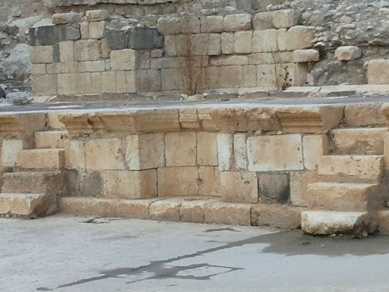
The four Early Bronze Age building levels range from sometimes oval pit dwellings to mud-brick structures, buildings with basalt foundations and mud-brick walls, and, finally, structures built of basalt. An orderly, right-angled street plan is present in Early Bronze Age II. Three connected, parallel mud-brick walls defended the southern and western sides, while the lake bordered the north and east. Together the walls were about eight metres thick. Sections of all three survive, and at least one wall extended toward Degania A. A southern entrance was built of basalt.
Granary and silos
The Early Bronze Age II granary, also called the Circles Building, was begun in the northern part of the tell but left unfinished. Its basalt wall foundations formed a paved platform about nine metres wide within a structure measuring roughly 30 by 40 metres. Seven large, sunken circles in the pavement were each divided into four compartments by two cross-walls. Courtyard ovens contained Khirbet Kerak pottery. The building is generally understood as a public granary, with an estimated capacity of more than 1,500 tonnes of grain, enough to supply about 6,000 people for a year.
Foundations around the building belong to eight circular mud-brick grain silos, each about eight metres in diameter. Two additional silos have been proposed, although their foundations were not found. At the beginning of Early Bronze Age III, the granary area was converted to residential use.
Water tunnel
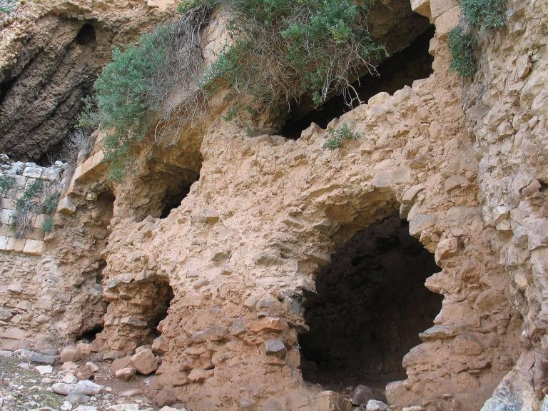
A tunnel beneath a wall leads in the direction of the Sea of Galilee. It may have been designed to bring water to the settlement or to provide access to the lake. If it served either purpose, it would represent an exceptionally early water-supply installation.
Stone palette
The stone palette found in 2009 is decorated with Egyptian motifs, including an ankh, an ancient Egyptian symbol. Its discovery provides a material counterpart to the proposed connections between the Early Bronze Age town and Egypt.
Middle Bronze Age remains
Features from the Middle Bronze Age include a paved street and a potter’s workshop, as well as a tomb and sections of town wall. The street and workshop belong to Middle Bronze Age I; the tomb and wall sections date to Middle Bronze Age II.
Hellenistic remains
Houses and villas
Hellenistic townhouses followed an orderly, right-angled plan within the earlier Bronze Age defenses. The settlement extended about 700 metres from north to south and 200 metres from east to west. Some houses had decorated wall plaster. Four late Hellenistic villas have been identified and proposed as early examples of a large urban mansion type later found in Roman-Byzantine Palestine. One villa measures 22 by 12 metres and contains eleven rooms decorated with marble, stucco, and mosaics, arranged around a colonnaded courtyard.
Town wall
The Hellenistic town was enclosed by a wall more than 1,600 metres long, about four metres high and six to seven metres wide. Square and round towers alternated along its length. A concealed passage provided a way out of the town.
Roman-period buildings
Fortress and bathhouse
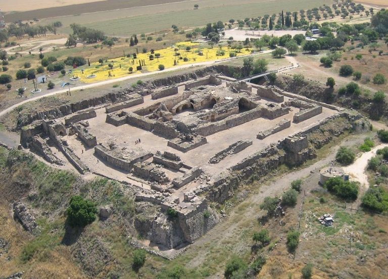
The Roman-period fortress was a square structure measuring 60 metres on each side, built from dressed fieldstones and strengthened by a tower at each corner. A column found inside bears carvings of a seven-branched lampstand, a palm branch, a citron, and an incense shovel; it may have been reused from an earlier building.
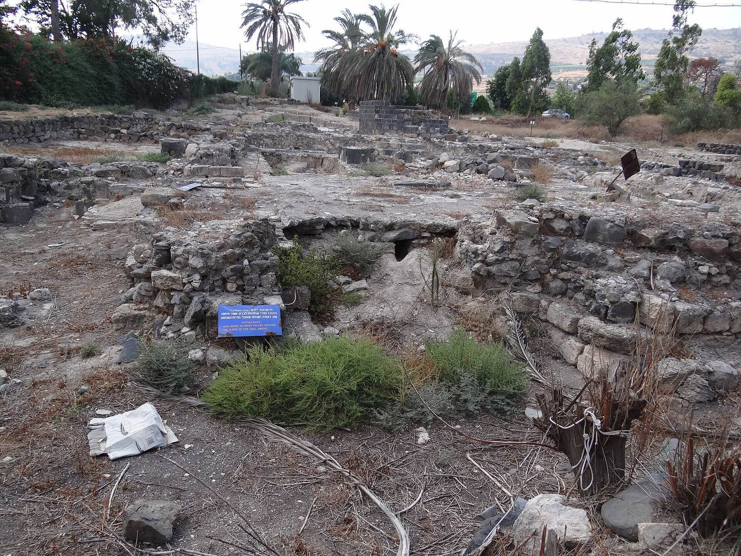
The bathhouse included a cold room measuring 11 by 10 metres, faced with white marble and topped by a ceiling decorated with gold-colored mosaic. A hot room stood to its south and a warm room to its east. Both were heated by a hypocaust, an underfloor system that circulates hot air beneath a raised floor.
Synagogue and study house
The large synagogue measured 37 by 22 metres. Two rows of columns divided its interior into a central hall and two side aisles. A rounded recess, or apse, in the south wall faced Jerusalem and served as the shrine. Colorful floor mosaics showed plants and animals. The remains of a study house were found nearby.
Byzantine and Umayyad buildings
Church and aqueduct
The Byzantine church had a basilical plan, with a long central hall and side aisles, and a mosaic floor. It was enlarged several times; a mosaic laid during its final expansion dates that work to 529. An aqueduct about 16 kilometres long carried water from the Yavne’el stream to the town.
Palace of al-Sinnabra
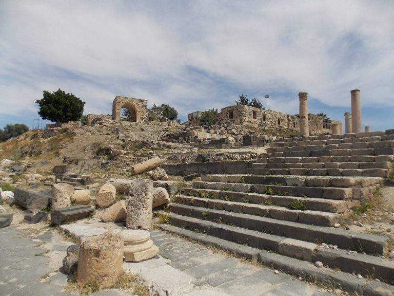
The northern fortified compound, identified as the Umayyad palace of al-Sinnabra, stands over the earlier granary and was built above the remains of the Byzantine church. Its bathhouse was joined to a large hall with an apse and colorful mosaics. The complex’s position incorporates the remains of the earlier church into the later building.
Later archaeological and commemorative features
Residential remains and pottery
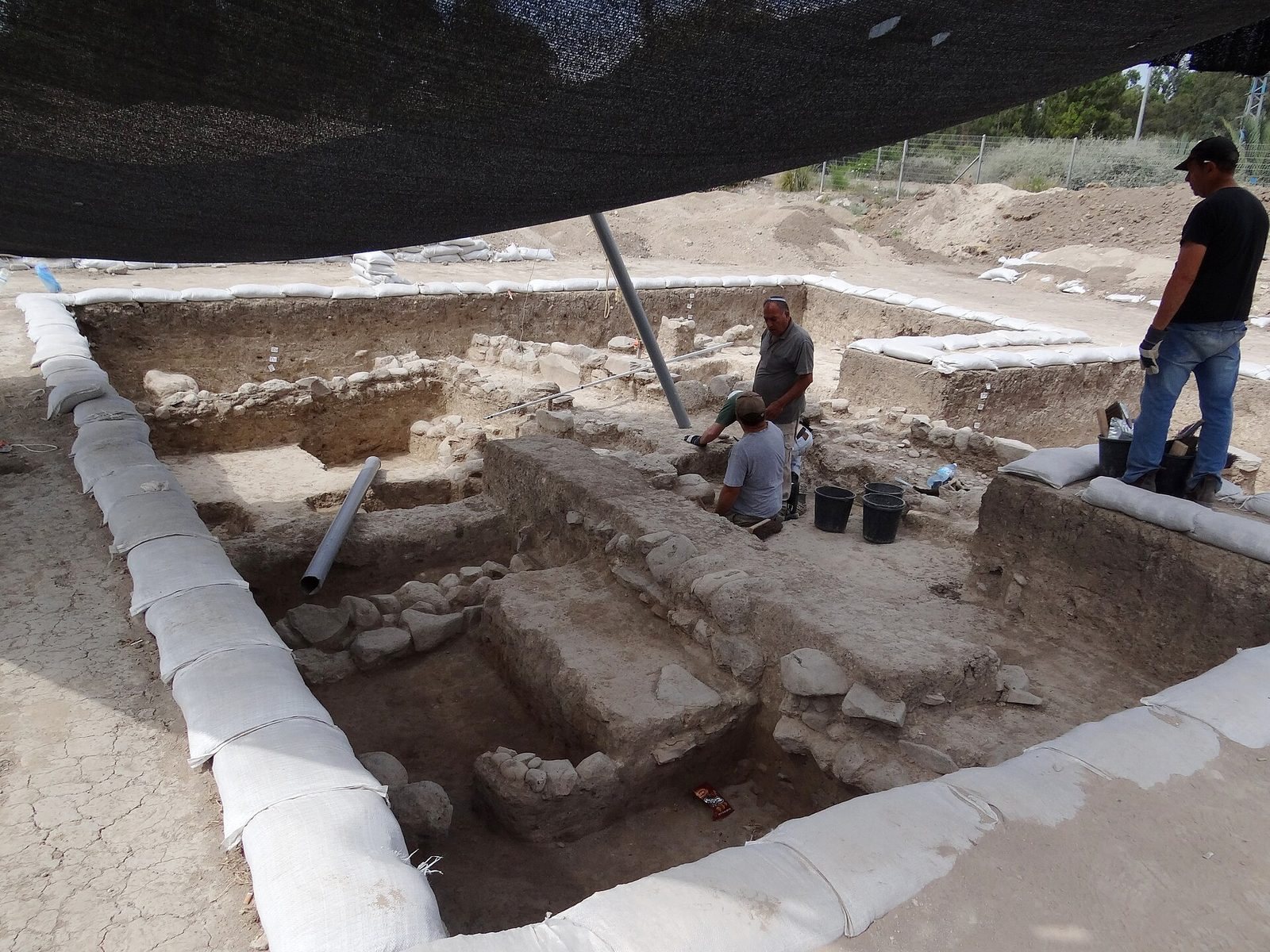
The 2014 salvage excavation on the high-school grounds uncovered residential buildings, some divided by a narrow alley. Finds included broken and intact pottery jars and small Abydos-type jugs, a form named for the ancient Egyptian site of Abydos. Their fine finish suggests that the vessels may have held liquids such as wine or oil. The remains date to about 4,800 years ago; the excavated area was later covered.
Herzl memorial cairn
A stone cairn erected during the 1909 memorial ceremony for Theodor Herzl remains on the tell.