Tel Rehov: An Archaeological Site Associated with an Ancient City
Site at a Glance
- Popularity
- High
- Country
- Israel
- Primary era
- Iron Age
- Eras represented
- Bronze Age, Iron Age
- Civilizations
- Canaanite, Israelite
- Site type
- City
On this page16 sections
History
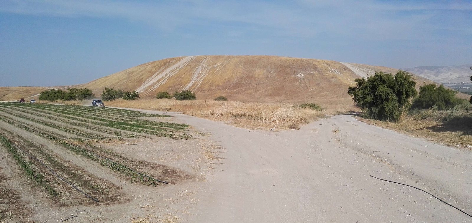
Tel Rehov is an archaeological mound in Israel’s Beth She’an Valley and one proposed location of the ancient city of Rehov. Rehov was a Canaanite city-state capital from around the 16th to 13th centuries BCE and a major regional city during the Late Bronze Age and Iron Age. The name means “broad” or “wide place.”
The identification is supported by related forms of the name preserved at a holy tomb about 1 km south of the mound and at Farwana, a separate Jewish town about 0.8 to 1 km northwest. During the Byzantine period, Farwana was known as Rohob or Roob. The Rehov mentioned in the Hebrew Bible was in another territory.
Bronze Age Rehov
Rehov appears in at least three records from the 15th to 13th centuries BCE, including the Taanach letters, a group of Late Bronze Age documents from the southern Levant. A stela from ancient Beit She’an describes a revolt against the Egyptian pharaoh Seti I and indicates that Rehov did not take part. After the reign of Thutmose III, the city may have come under Egyptian control. An Egyptian scarab found at the site bears an inscription naming Amenemhat, a scribe associated with the overseer of sealed items.
The site was occupied in the Late Bronze Age and across Iron Age I and II, from the 12th to 9th centuries BCE. During the 10th century BCE, Rehov had commercial and cultural connections with Cyprus, Phoenicia, the Philistines, and other parts of the eastern Mediterranean. Weights, a loom, and two-colored pottery are among the finds associated with these links.
Iron Age city and regional power
During Iron Age II, Rehov belonged to the northern Kingdom of Israel. It has been interpreted as a lowland center that opposed the Omrides, the ruling dynasty of that kingdom. Archaeologist William G. Dever estimated that the city had about 2,000 inhabitants in the 9th and 8th centuries BCE; its population included both Israelites and Canaanites.
Rehov is named in the conquest list of the Egyptian pharaoh Shoshenq I, whose campaign took place around 925 BCE. A destruction layer at the site may be connected with that campaign, but the link is uncertain. Inscriptions from Rehov and its surroundings refer to the family of Nimshi, an ancestor associated with the royal lineage of Jehu. Jehu, a king of Israel, is described as Nimshi’s son or descendant and was anointed by a disciple of the prophet Elisha.
A pottery sherd found in 2013 carries a partly preserved inscription reconstructed as the rare name “Elisha.” The reading is disputed, and the proposed connection to the biblical prophet remains uncertain. The interpretation has been linked to the sherd’s date in the second half of the 9th century BCE, the rarity of the name, and the site’s proximity to Abel-meholah, traditionally identified as Elisha’s hometown. Incense altars found at Rehov have also been considered at odds with teachings attributed to the prophets.
A large beekeeping operation was active at the site from the mid-10th to early 9th century BCE, before fire destroyed its hives. An altar decorated with fertility figurines stood beside them and has been interpreted as evidence of religious practice. The remains of the installation and what they reveal about the bees are described below.
Assyrian conquest and later occupation
Assyria conquered Rehov in 732 BCE. A destructive fire attributed to the Assyrians marked the end of the Canaanite city, which was not rebuilt. Later graves at the site have been interpreted as burials of officials or military officers serving the Assyrian Empire.
The lower mound was abandoned after Stratum IV, one of the site’s archaeological layers. The uppermost identified layer, Stratum I, consists of scattered finds from the Islamic period, while Strata II to VII belong to the Iron Age. A village occupied the summit from the early Islamic period into the late Middle Ages, and a village also existed on the north side of the mound during the Middle Ages.
Identification and archaeological investigation
Felix-Marie Abel identified the tell with ancient Rehov in the early 20th century. W. F. Albright surveyed it in the 1920s and assigned its main occupation to the 13th through 10th centuries BCE. Surveys by Avraham Bergman and Ruth Brandstater followed in the 1940s. Local residents later collected objects from the site, including an Old Babylonian cylinder seal.
Surface surveys and a geophysical study of the lower mound took place in 1995 and 1996. Amihai Mazar of the Hebrew University of Jerusalem directed 11 seasons of excavation from 1997 to 2012. A small rescue excavation in 2002 followed damage to Bronze Age shaft tombs during trenching near the site’s edge.
Tel Rehov’s layered remains and numerous radiocarbon dates, which estimate age using carbon-14, have informed debate over competing high and low schemes for dating the Iron Age in the Levant. Greek pottery from layers VI to IV, dated to the 10th and 9th centuries BCE, has also contributed to discussions of Levantine chronology and the dating of Greek pottery.
Remains
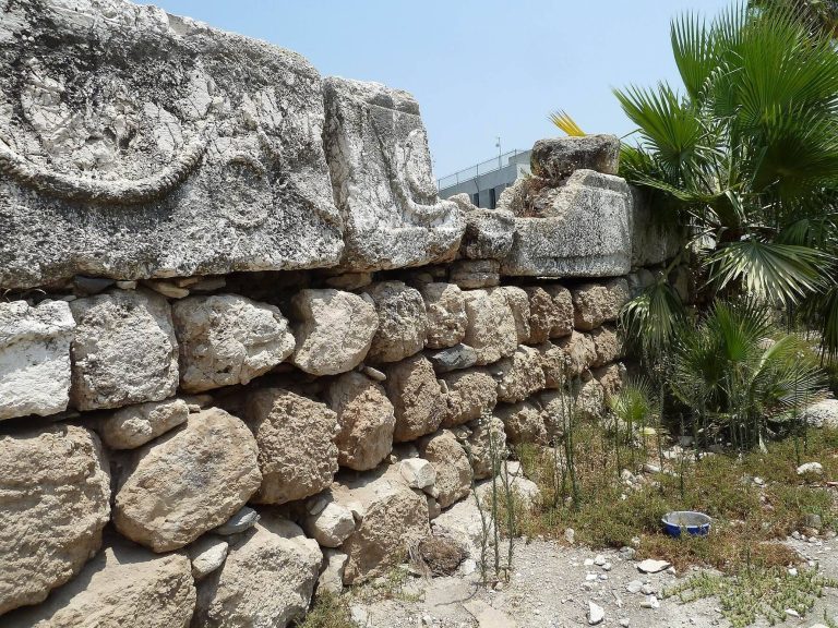
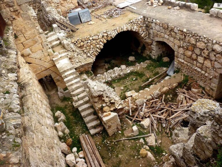
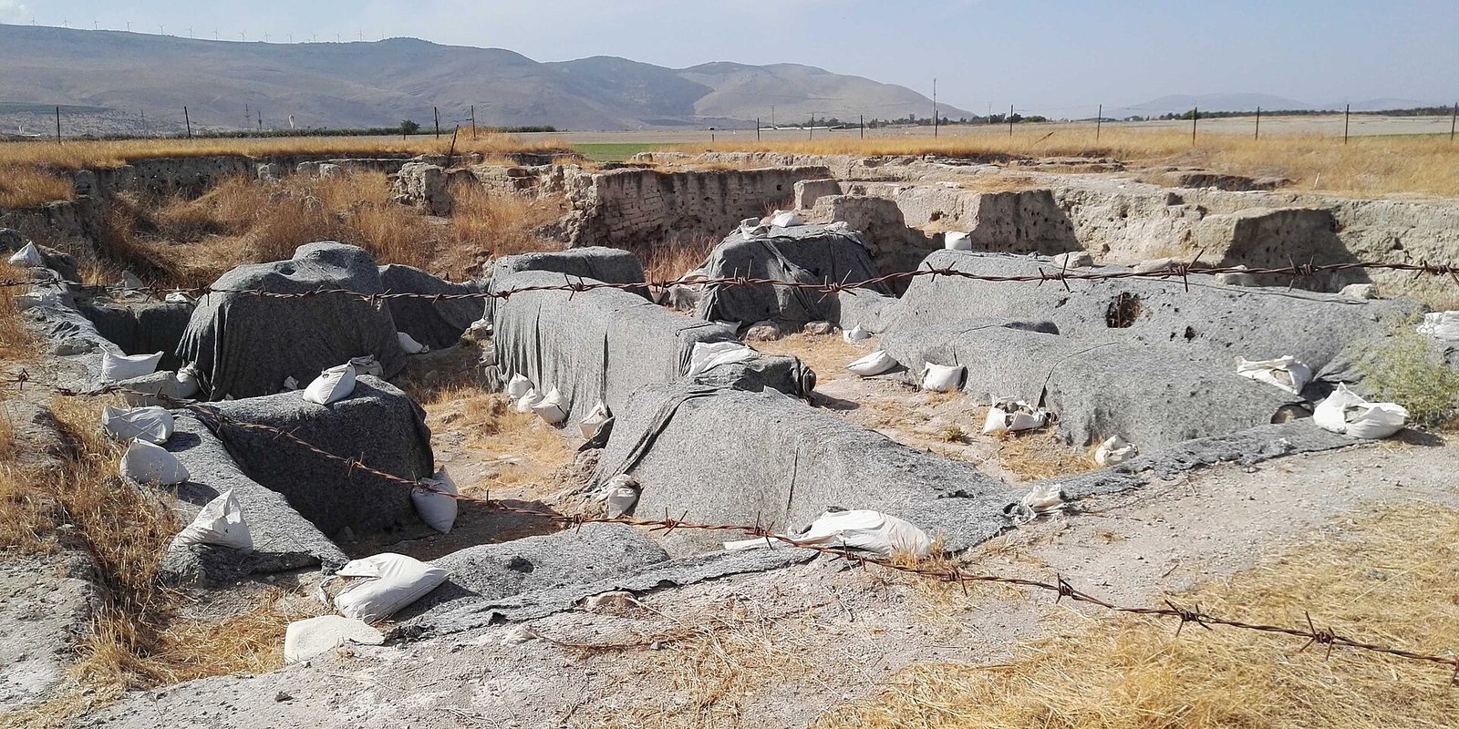
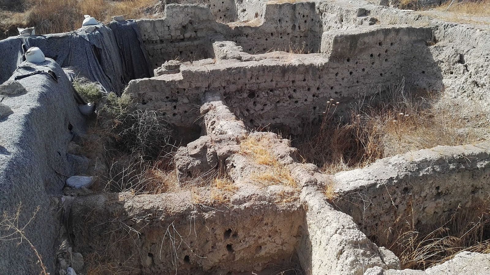
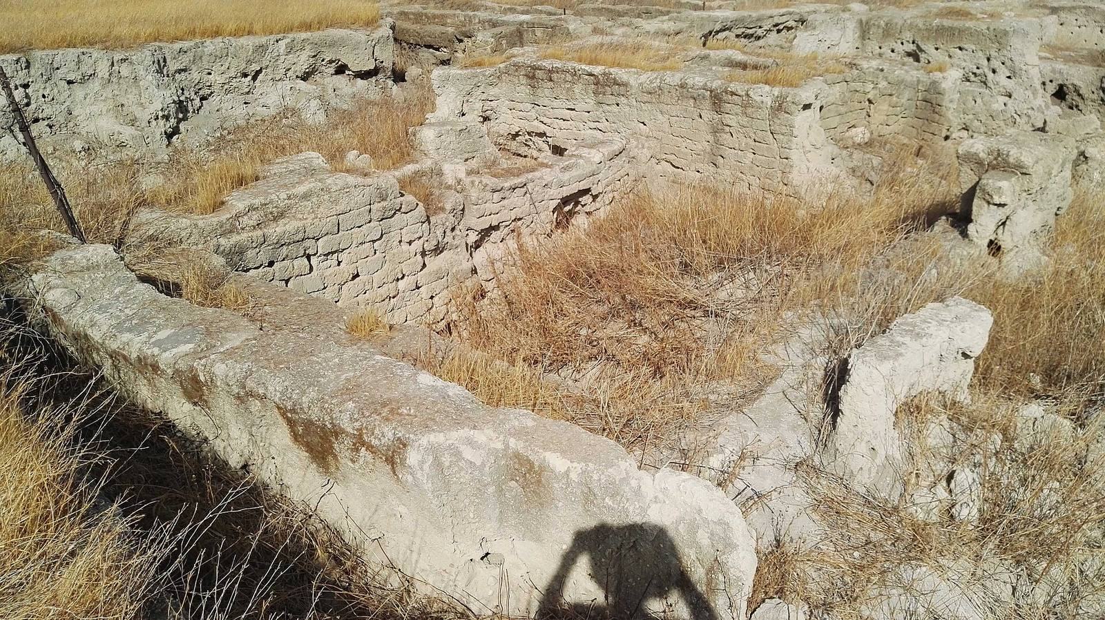
Tel Rehov lies about 5 km south of Beit She’an and 3 km west of the Jordan River, at elevations of roughly 126 to 160 m below sea level. The mound has upper and lower sections and covers about 10 to 11 hectares including its slopes; their combined summits cover about 7 hectares. The remains are built mainly of mud brick on stone foundations.
Fortifications and built features
Upper-mound fortification
An 8 m-wide mud-brick wall encircles the upper mound. A sloping defensive surface, or glacis, was built against it. Excavators attributed the fortification to Early Bronze III.
Oven and kilns
A well-preserved oven at the site dates from the Late Bronze Age into the 8th century BCE. Its condition has allowed researchers to examine its interior residues and compare its form and dimensions with proposed reconstructions. Three kilns excavated in the early 1950s were probably used to make pottery.
Burials and inscriptions
Shaft tombs
Bronze Age shaft tombs, burial chambers reached through vertical shafts, lay at the edge of the site. The 2002 rescue excavation recovered human remains, pottery fragments, ostrich eggshell fragments, and two complete bronze daggers from the affected area.
Written finds
A Proto-Canaanite inscription, written in an early alphabetic script used in the southern Levant, was found in topsoil during the 1940s survey. One 10th-century BCE jar bears two identical three-letter inscriptions in that script. Ten jar inscriptions dating to the 10th century BCE have been found at the tell, three of them in Hebrew. Other inscriptions from the 10th and 9th centuries BCE refer to Nimshi’s family. The partly preserved sherd inscription reconstructed as “Elisha” is also among the site’s written finds, though that reading is disputed.
Beekeeping installation
Hives and bee remains
In Stratum V, Area C, excavators found 30 intact hives and remains of another 100 to 200. Made from straw and unfired clay, the hollow cylinders measured about 80 cm long and 40 cm across, with walls roughly 4 cm thick. One end was sealed, with a small opening at the center for the bees. The hives stood in orderly rows of about 100. Remains of bees, larvae, and pupae were also recovered. The hives were destroyed by fire.
Wheat found beside the hives was radiocarbon-dated at the University of Groningen. DNA analysis published in 2010 identified the bees as a subspecies similar to the Anatolian bee, now found only in Turkey. The inhabitants probably brought the bees to Rehov because they were less aggressive and could produce three to eight times more honey than local Israeli bees. Other imports at the site, later Egyptian descriptions of transporting bees in large pottery vessels or portable hives, and an 8th-century BCE Assyrian account of moving bees from the Taurus Mountains to Suhu support the possibility that the bees were imported.
Altar beside the hives
An altar decorated with fertility figurines stood beside the beekeeping installation. Its position and decoration have been taken as evidence of religious practice at Rehov.
Nearby Farwana synagogue
The synagogue at Farwana belonged to a separate nearby Jewish town, not to Tel Rehov. It was built in three phases between the 4th and 7th centuries CE, and three successive floor levels show that the building was renovated twice. The synagogue measured about 18 by 24 m. Most of its interior served as a prayer hall, with two rows of basalt columns and a large platform beside the south wall, toward Jerusalem; rooms stood on either side of the platform.
A later phase added a northern entrance hall, or narthex, with one entrance and three doorways into the prayer hall. Mosaic paving covered the complex. The narthex mosaic carries a 6th-century Aramaic inscription described as the longest mosaic inscription found in the Land of Israel. Its 365 words are arranged in eight sections and 29 lines, addressing Jewish religious law on the boundaries of the Land of Israel, tithes, the Sabbatical Year, and Beit She’an’s status in relation to the territory of those who returned from Babylon. The Sabbatical Year is the seventh year of the biblical agricultural cycle, when particular restrictions on land use apply.
Paintings and eight inscriptions were found on plastered pilasters and walls. A marble parapet carved with a seven-branched menorah, a ritual lampstand in Jewish tradition, is believed to have enclosed the raised platform. It is now displayed at the synagogue in Kibbutz Ein HaNetziv. A gold-coin hoard found near an abandoned building at Farwana prompted further investigation. Archaeological excavations there took place from 1974 to 1979 under Fanny Vitto’s direction; a mosaic inscription had been found in 1973, and her team uncovered the synagogue mosaic after the hoard was discovered.