Wartberg Castle Site (Kosbrunn): A Medieval Noble Stronghold
Site at a Glance
- Rating
- 3.3
- Popularity
- Very Low
- Country
- Germany
- Primary era
- Medieval
- Eras represented
- Medieval
- Civilizations
- Holy Roman Empire
- Site type
- Military
- Remains
- Castle
On this page9 sections
History
The Wartberg Castle Site (Kosbrunn) occupies the wooded summit of Warenberg in Pegnitz, Germany. Established before 1149, it was a high-medieval noble castle associated with the Wartberg family and later became a Bamberg episcopal possession and administrative center.
The Wartberg family and Bamberg control
Friedrich von Wartberg appears as a witness in documents from 1149 and 1188. In 1149 he ranked twelfth among 19 members of free-noble families, between the lords of Volsbach and Nemmersdorf. In 1188 his name appears between Eberhard the Younger of Wolfsberg and Eschuin of Rabenstein, a ministerial, or a lord’s administrative or military servant. These positions suggest that the Wartbergs were probably free nobles, whose status differed from that of ministerials. It is uncertain whether they formed an independent family or descended from another free-noble line. The two Friedrichs were probably father and son, although the name was common among noble families. Friedrich’s place in the 1149 list also raises a possible connection with the Walpoten, a Franconian noble family.
Before 1243, Wartberg, Gößweinstein Castle, and several villages had been pledged to the House of Schlüsselberg, a Franconian noble lineage. Ulrich von Schlüsselberg, Gottfried’s brother and provost of St. Stephen’s in Bamberg, was to hold Gößweinstein and Obersenftenberg until Gottfried’s testamentary provisions were fulfilled. A Bamberg bishopric register for 1323 to 1327 lists Wartberg as episcopal property. Ulrich may have transferred it to the bishopric after the Wartberg family died out.
Gottfried’s 1308 will allotted Hermann Motschiedler 40 pounds Haller, a medieval monetary amount, for Wartberg. The castle was probably then held by the Schlüsselbergs and managed by Hermann on their behalf. In 1333, Hermann witnessed a deed recording Agnes’s renunciation of her inheritance. Agnes was the daughter of Konrad von Schlüsselberg, who had fallen at Neideck Castle.
A 1348 register places Wartberg within the Gößweinstein administrative district, which included Körbeldorf and five estates near the castle. The record also describes the castle’s guard: a bailiff, a local official with administrative or judicial authority, worked with a watchman and a servant who also served as gatekeeper. Two other men participated in the guard, one living below the castle and the other working as a knife smith. In 1383, Premislaw, Duke of Teschen and royal court judge, confirmed the Bamberg bishopric’s right to use and benefit from its properties.
Rabenstein control and fifteenth-century conflict
In 1400, Heinrich von Rabenstein granted Wartberg to Fritz Wannbacher. Wilhelm von Wiesenthau used the title “of Wartberg” in 1409 and 1410. The castle was probably destroyed around this period in the Hussite Wars, conflicts associated with the Hussite movement in the early fifteenth century. Later pledge agreements required work to restore it.
In 1435, Wartberg was pledged to Thomas and Lorenz von Rabenstein for a loan of 500 gulden, a historical monetary unit. The agreement required them to supply timber for work on the tower at their own expense. On 10 October 1437, Bishop Anton von Rotenhan sold the castle to Lorenz for 850 gulden, while reserving the right to buy it back. Lorenz was also required to spend 300 pounds Haller repairing damage from the Hussite Wars. He was last recorded as “of Wartberg” on 23 January 1463 and probably died soon afterward. The castle passed through his widow to her son Georg XIII von Egloffstein from her first marriage.
Bishop Anton subsequently occupied Wartberg. After Georg’s objections failed, he declared hostilities against the bishop in 1466, seized the castle, and raided the bishopric’s territory and Bamberg. He held prisoners at Wartberg, but the bishop recaptured the castle and freed them. The conflict ended in 1467, when Georg and his mother surrendered their claim. The bishop then pledged the castle to Hermann von Rabenstein.
Episcopal district and destruction
By 1472 at the latest, Wartberg had become the seat of a Bamberg episcopal administrative district. Heinz von Rabenstein served as its administrator in 1472, 1474, and 1475. The castle and district remained pledged to successive holders: Hans von Ochs and Hans von Giech in 1477, Konz von Egloffstein in 1514, Pankraz Lochner von Hüttenbach in 1534, and Wolf von Rabenstein of Kirchahorn in 1546. From 1548, Wolf’s son Daniel held the pledge. Daniel shared it with his brother Hektor from 1565, and the arrangement was renewed in 1561 and 1581.
Wartberg was destroyed during the Second Margrave War of 1552 to 1555, a Franconian conflict in which Margrave Albrecht Alcibiades fought chiefly against Catholic prince-bishoprics while seeking to establish a duchy of his own. The castle was probably captured and burned on 24 or 25 September 1553, and it was not rebuilt. A 1562 jurisdictional description called it destroyed, while an administrative description from 1565 described it as deserted. From 1561, pledge documents refer to the administrative district rather than the castle. The Rabensteins held the district until the Bamberg bishopric redeemed it in 1617. Episcopal administrative accounts survive for 1618 to 1622.
Remains
Setting and approach
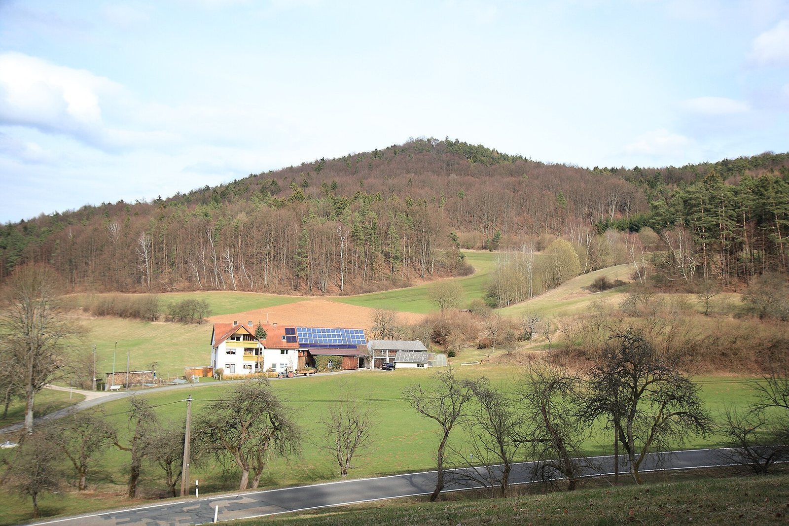
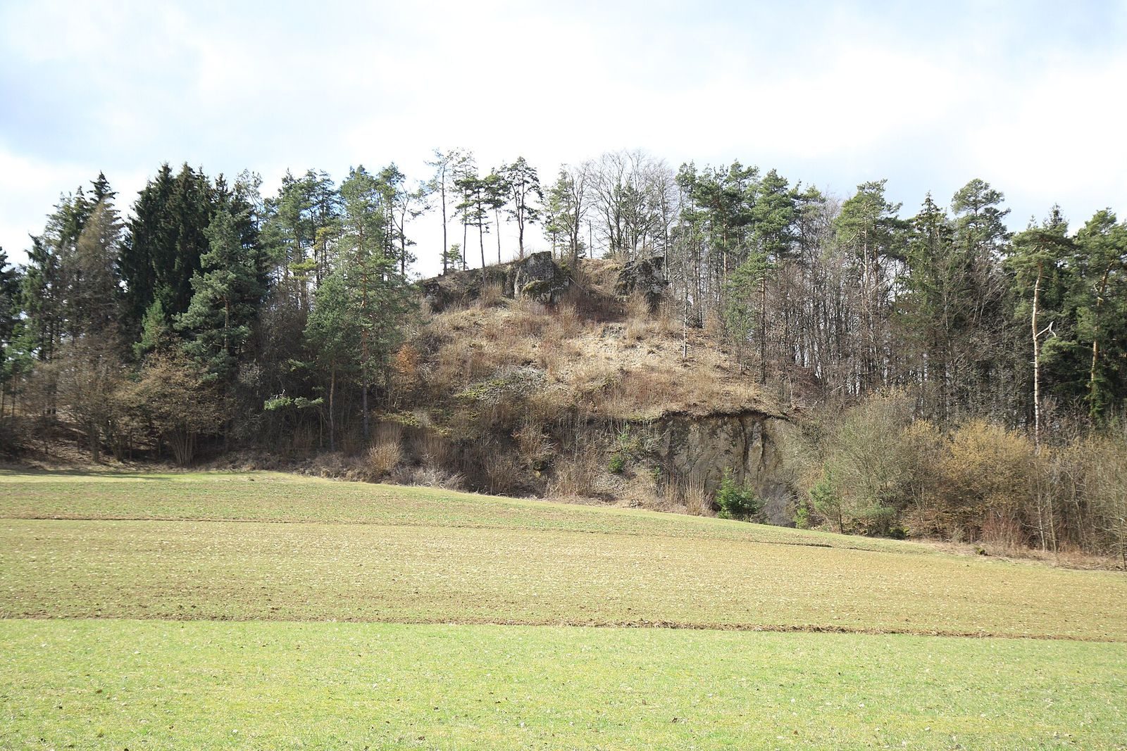
The castle occupied a roughly 42-by-11-metre rock summit on wooded dolomite Warenberg, at an elevation of 608 metres. The site lies about 700 metres east of Kosbrunn and 160 metres above the village, within the Franconian Switzerland–Franconian Jura Nature Park. Warenberg is linked by a narrow saddle to the nearby 627-metre Kleiner Kulm. The ground falls steeply north and west toward the valley, while the other sides rise about 12 metres above the surrounding Jura plateau. A historic road ran past the saddle from Velden through Plech, Neudorf, and Körbeldorf toward Büchenbach, Trockau, Gesees, and Bayreuth. The castle was probably positioned to monitor this route.
A neck ditch, a defensive trench across a narrow approach, separates the castle rock from the saddle. It measures about 50 metres long and 17 metres wide, and was partly cut into the rock. An earth mound on its western side marks the excavated material. The saddle was levelled, and buildings once stood there. The approach to the rock likely crossed this saddle and the ditch.
Castle rock and surviving traces
Foundations and finds
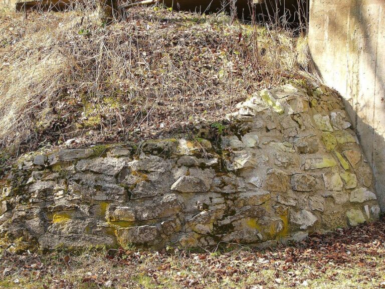
A few foundation-wall remains and surface depressions mark former buildings on the summit. The wooded, heavily overgrown plateau makes the layout difficult to distinguish. Stones from the castle, some bearing traces of mortar, cover the slopes. Roof-tile fragments and pottery sherds have been found both in the castle area and on the slopes. The buildings were probably constructed from rubble-stone masonry, made with irregular stones.
Possible tower and other buildings
Castle researcher Hellmut Kunstmann interpreted a feature in the southern part of the plateau as a possible tower-like building. Its proposed interior diameter is six metres, with walls about two metres thick. It may have served as the castle’s main defensive tower and guarded an approach from the south across the saddle and ditch. A depression to the northeast may mark a cistern, while another depression farther north probably indicates the location of the main building.