Doña Blanca Archaeological Site: A Phoenician City in Spain
Site at a Glance
- Popularity
- High
- Country
- Spain
- Primary era
- Classical
- Eras represented
- Stone Age, Iron Age, Classical, Medieval
- Civilizations
- Carthaginian, Crown of Castile, Phoenician
- Site type
- City
On this page19 sections
History
The Doña Blanca archaeological site near Cádiz, Spain, preserves a Phoenician city whose principal urban phase began in the eighth century BC. The Phoenicians, people of eastern Mediterranean city-states whose settlements spread across the Mediterranean, occupied the site for centuries. Doña Blanca is among the earliest known Phoenician cities on the Iberian Peninsula and is important for understanding Phoenician settlement in the western Mediterranean and contact with the indigenous communities of Lower Andalusia.
Early occupation
The earliest remains date to the late Copper Age, when copper began to be used alongside stone tools, near the end of the third millennium BC. Scattered huts occupied the area before it was abandoned. It remained uninhabited until the middle of the eighth century BC, when people returned and established a city.
Phoenician and Punic phases
The Phoenician city was continuously inhabited from the eighth century until the end of the third century BC. Its urban layout was remodelled several times, and two further defensive walls were added. The site ranks among the earliest known Phoenician cities in Iberia, alongside Cádiz and Cerro del Castillo. Cádiz may have been founded earlier: ancient chronologies place its foundation around 1200–1100 BC, while the known urban phase at Doña Blanca dates from the eighth century BC. The city’s preservation makes it especially useful for studying Phoenician colonization and relations with the people of Lower Andalusia.
A river port formed part of the site during a Punic phase. Punic refers to the Phoenician culture associated with Carthage and its sphere of influence. The harbor’s use is linked to Carthaginian activity from the fourth century BC to 205 BC. After the city’s final phase, the site was abandoned once more.
Later settlement and the tower
An Almohad rural settlement was established at Doña Blanca in the twelfth century. The Almohads were a Muslim dynasty that ruled parts of North Africa and the Iberian Peninsula during the medieval period.
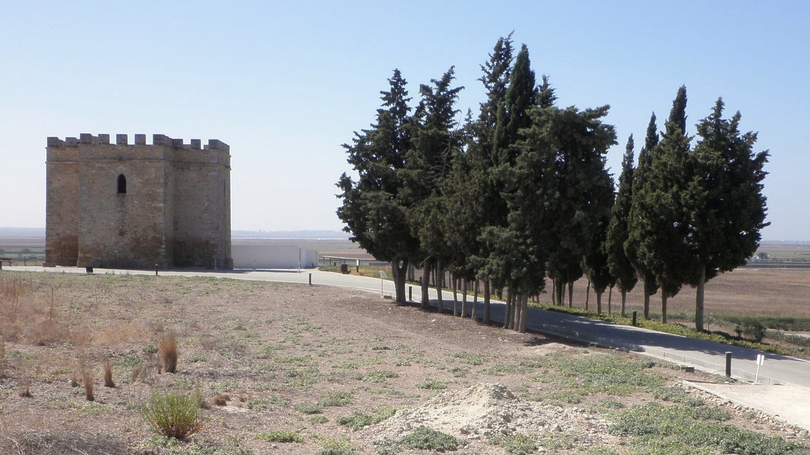
The Doña Blanca Tower was built in the late fifteenth century as a watchtower overlooking the Bay of Cádiz and the lower Guadalete River. It also served as a chapel. A later historical interpretation connected the tower with the imprisonment and death in 1361 of Doña Blanca de Borbón, wife of Pedro I, a fourteenth-century king of Castile. Other scholars have identified the building as a hermitage. The tower fell into ruin after the Spanish War of Independence and was rebuilt in the second half of the nineteenth century.
Excavation and protection
Excavations began in 1979 beside the tower, where the initial work sought to establish the site’s sequence of occupation. Investigations continued into the 1990s. The Ministry of Culture acquired the site in May 1990. Doña Blanca received national historic-artistic monument status in 1981 and is protected as an Asset of Cultural Interest, a legal designation for significant cultural property. Its protected boundaries were defined and extended through measures in 1999 and 2001.
A geophysical survey, a non-invasive study of the ground, identified additional structures beside excavated areas in 2017. At that time, interpretation without excavation was being considered.
Remains
The archaeological area covers about 200 hectares on the slopes and summit of the Sierra de San Cristóbal, a ridge roughly 130 metres high between the maritime zone and the countryside. The central settlement forms an artificial mound built up from successive occupation layers and building remains. Deposits across it reach about seven to eight metres in depth; a trench beside the tower reached natural ground nine metres below the hill’s surface. The remains include terraced houses, streets, defensive works, a burial ground, and features associated with the wider landscape.
Settlement and houses
Early dwellings
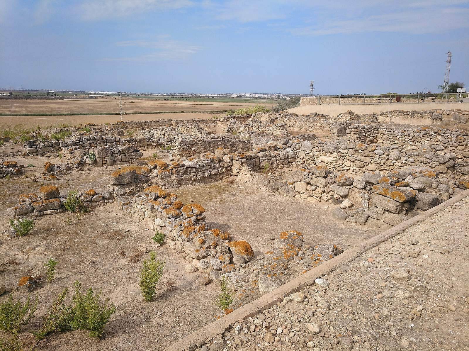
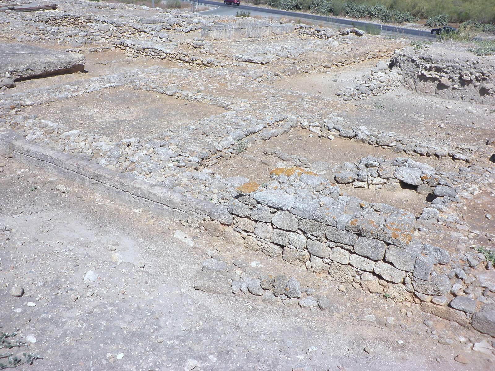
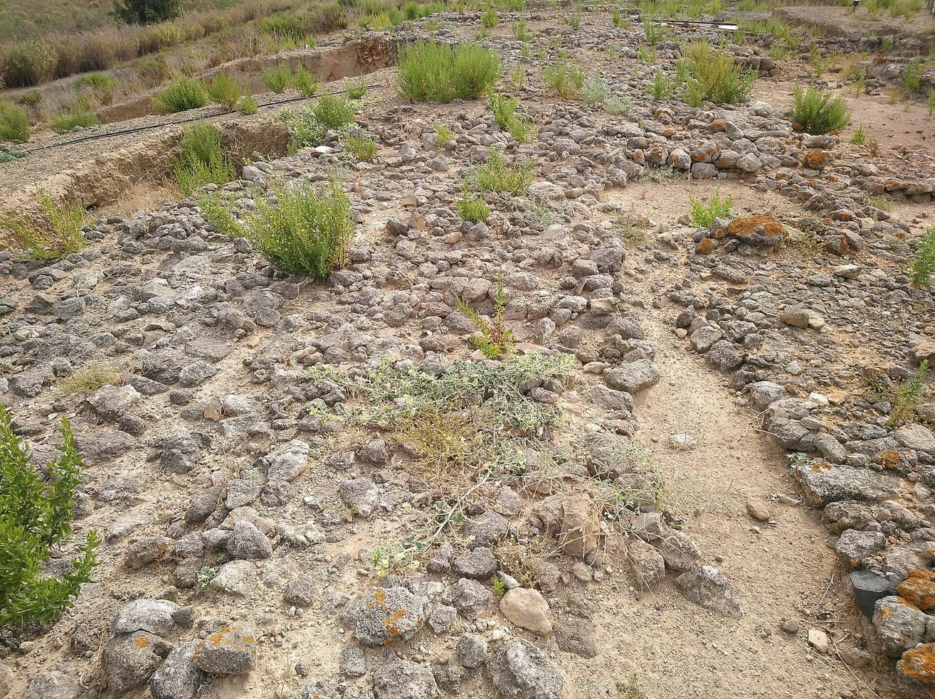
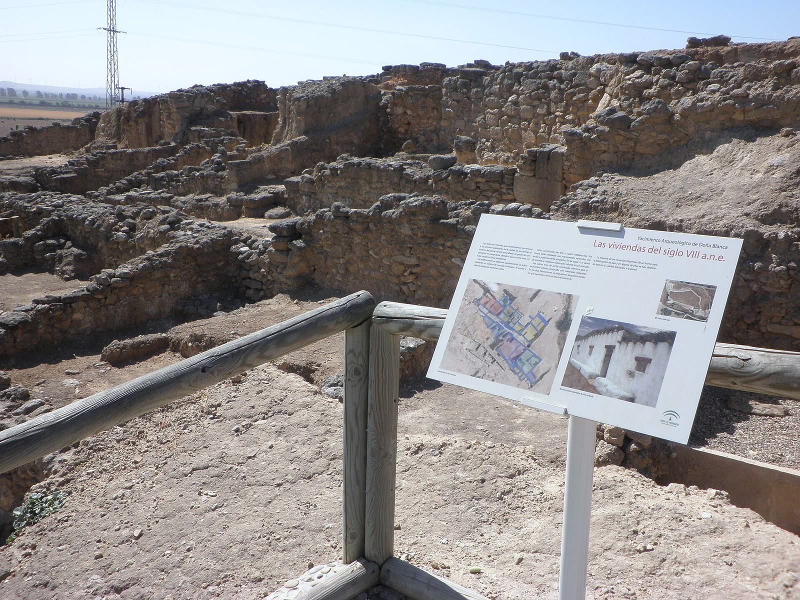
The earliest huts were scattered and adapted to the original terrain. Houses from the eighth century BC stood on artificial terraces that followed the slope. Most had three or four square rooms. Their walls rested on stone foundations and had upper courses of adobe, sun-dried earth, coated with clay and finished with lime. Floors were made of compacted red clay. Roofs used wooden beams with plant coverings, either flat or sloping in one direction. Most houses contained a vaulted clay bread oven, about one metre across at its base.
Later urban quarter
An excavated area of about 1,000 square metres contains houses and other buildings from the fourth and third centuries BC. Houses occupied fairly regular blocks alongside broad, straight streets. One excavated street runs parallel to a wall and measures about 36 metres long and four metres wide. Its surface combines compacted clay, pottery fragments, and small stones. House walls have stone foundations, with calcarenite, a sedimentary rock composed mainly of carbonate grains, sometimes used at corners and doorways. Rooms had clay floors, while some courtyards were paved with stone.
Wine-making spaces
Rooms beside the houses contain vats and ovens associated with wine production, along with areas used to decant liquids. The complete wine-making installation is among the oldest known worldwide and apparently the oldest in the West. Wine was mainly accessible to the upper classes and was used in rituals connected with deities.
Defences
Early wall and ditch
The eighth-century-BC defensive wall rose directly from natural ground. Built of irregular stonework bonded with red clay, it survives to a height of three metres in excavated areas. A V-shaped ditch in front of it is about 20 metres wide and four metres deep. The wall remained in use until the sixth century BC. In the fifth century BC, a replacement wall partly incorporated the earlier one.
Later fortified circuit
The final defensive circuit dates to the fourth or third century BC. Its remains include two parallel walls joined by smaller cross-walls, creating small enclosed spaces within the fortification. Another visible section consists of well-shaped calcarenite blocks of varying sizes, fitted and locked together. Similar stonework appears in Punic defences at Cartagena and Carteia that date to the period of the Barcids, a prominent Carthaginian family active in Iberia during the third century BC.
River port
The Punic river port is an identified feature of the site and was the largest in the Mediterranean.
Burial ground
The necropolis, or burial ground, lies across the Carrera de El Portal on the foothills of the Sierra de San Cristóbal. An excavated burial mound measures about 20 metres across and rises to 1.80 metres. Its central area was used for cremation. Around it are 63 burials, including ash urns of different types and simple hollows cut into the natural ground.
Doña Blanca Tower
The tower is a small building with a Greek-cross plan, in which four arms of equal length extend around a central point.
Associated sites and landscape
Surrounding archaeological remains
The wider archaeological area includes the Copper Age settlement of Dehesa, the Sun and Moon Hypogeum, an underground structure often used as a tomb, and the settlement and burial ground of Las Cumbres. Quarries in the area were used from prehistoric times through the eighteenth century. A separate settlement on the Sierra de San Cristóbal, dating to the fourth century BC, contains dwellings and industrial installations.
Changes to the landscape
Sediment carried by the Guadalete River filled parts of the bay. The plain south of the site was once under the sea, and the river mouth lay near El Portal. Tree felling, grazing, and agriculture altered the local vegetation. Forests of cork oak, carob, and pine that once grew in the area no longer remain.