Metapontum: An Achaean Greek Colony in Southern Italy
Site at a Glance
- Popularity
- Very High
- Country
- Italy
- Primary era
- Classical
- Eras represented
- Iron Age, Classical
- Civilizations
- Ancient Greek
- Site type
- City
On this page28 sections
History
Metapontum was an Achaean Greek colony in Contrada Sansone near Bernalda, Italy, within Magna Graecia, the Greek-settled regions of southern Italy. Its foundation is generally placed around 700–690 BCE, although dates around 720 BCE and 650–630 BCE have also been proposed. The city prospered on its fertile territory and became an important point of contact between Greek settlers and the Indigenous peoples of southern Italy.
Foundation and early territory
A foundation tradition describes settlers from Croton and Sybaris arriving under Leucippus to prevent Tarentum from taking control of the area. Stories of the settlement differ: one tells of an agreement with the Tarentines, while another says Leucippus secured the land by deception. Other traditions describe fighting with the Tarentines and neighboring Oenotrians before the Greeks established themselves.
Ancient stories also gave Metapontum a mythic past distinct from its Greek colonization. One traced its beginnings to Pylians returning from the Trojan War with Nestor; another connected the city with Epeius, the hero associated with building the Trojan Horse, whose tools were said to be kept in Athena’s temple. Other accounts named Daulius, a ruler of Crisa, or said the city was first called Metabo after a hero. A further legend linked its name to King Metapontus and the escape of Arne’s sons, Aeolus and Beotus, after they killed his first wife, Siris. Some scholars have proposed that the name instead derives from the pre-Greek name Métabos.
Iron Age communities occupied the wider territory before the colony’s foundation, but it remains uncertain whether a settlement already stood on the city site. Metapontum’s agricultural landscape was organized from the Archaic period, an early phase of Greek history, into regular rectangular plots covering more than 10,000 hectares. About 1,300 plots are estimated, generally around six hectares each, with straight roads and drainage channels. Rural settlement was established by at least the sixth century BCE; permanent habitation across the countryside became more widespread from the middle of the fourth century BCE, alongside improved security.
Alliances and civic life
Metapontum allied with its Achaean founding cities, Croton and Sybaris, and joined them in a military league against the Ionian Greek colony of Siris. The conflict, dated approximately 570–540 BCE, apparently ended with the capture and destruction of Siris. Metapontum’s position also brought Greek settlers into contact first with the Oenotrians and later with the Lucanians.
The teachings of Pythagoras, an ancient Greek philosopher and mathematician, attracted a strong following in Metapontum. After his followers, known as Pythagoreans, were expelled from Croton, Pythagoras settled in the city and died there. Metapontum also mediated during disturbances at Croton. Its religious and civic observances included dedicating a golden harvest at Delphi, honoring Aristeas with a statue in the forum and an Apollo altar among laurels, and continuing sacrifices to the Neleidae, the legendary descendants of Neleus and ancestors of the Pylian royal line. In the second century CE, the Greek travel writer Pausanias noted that the city maintained a treasury at Olympia.
During the Athenian expedition to Sicily, Metapontum initially remained neutral in 415 BCE. It joined Athens the following year and supplied a small auxiliary force under the Athenian commanders Demosthenes and Eurymedon. The city avoided the destruction inflicted by Dionysius of Syracuse and appears to have suffered comparatively little from Lucanian attacks.
Rival powers and Roman conquest
Timoleon landed at Metapontum in 345 BCE during an expedition to Sicily, but the city did not support him. In 332 BCE, Metapontum allied with Alexander I of Epirus against the Lucanians and Bruttians. After Alexander’s defeat and death at Pandosia in 326 BCE, his remains were taken to Metapontum for burial.
In 303 BCE the city opposed the intervention of Cleonymus of Sparta. He attacked with Lucanian support, was later received as a friend, and nevertheless imposed a large tribute and committed other abuses. Metapontum was still wealthy, but its inhabitants’ luxury and lack of military strength had become proverbial. The city probably supported Pyrrhus of Epirus during his Italian campaign. Rome took Metapontum in 270 BCE, after conquering much of southern Italy and capturing Tarentum.
The Second Punic War and decline
During the Second Punic War, Rome’s conflict with Carthage, Metapontum sided with Hannibal soon after the Roman defeat at Cannae in 216 BCE, but a Roman garrison held the city. When Hannibal captured Tarentum in 212 BCE, Metapontum expelled the Roman troops and openly joined Carthage. Hannibal stationed forces there and used the city as a major base. After Carthage’s defeat at the Metaurus in 207 BCE, he withdrew his troops and evacuated Metapontum’s inhabitants to shield them from Roman retaliation.
The evacuation brought a severe decline. Lucanians and Peucetians later repopulated the settlement and were gradually Romanized; Metapontum became a small community based on agriculture and fishing. In 73 or 72 BCE, enslaved rebels led by Spartacus sacked the city. By the second century CE, Pausanias described it as reduced to its theatre and part of its circuit wall.
Later history and archaeological investigation
Metapontum subsequently belonged to Roman, Ostrogothic, Byzantine, Norman, Aragonese, and Neapolitan territories before becoming part of modern Italy in 1861. Excavations and surveys in the nineteenth and twentieth centuries clarified the city’s layout and history. In the late nineteenth century, Michele Lacava and his family spent fifteen years excavating around the Apollo temple, as well as in neighborhoods, streets, and fortifications. Lacava was the first to describe and map the circuit wall. Aerial photography later revealed evidence obscured by land-reform work, and American teams excavated the Pantanello cemetery during the second half of the twentieth century.
Remains
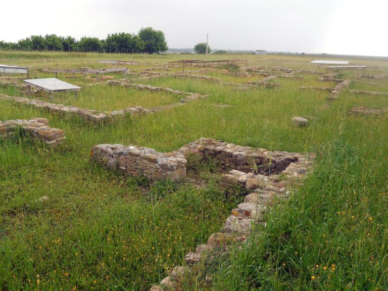
The remains show a walled city with a regular street grid, adjoining sanctuary and civic areas, and a number of temples both within and beyond the walls. Stone foundations supported upper walls of sun-dried mud brick in parts of the city. The surrounding landscape, river deposits, and changing water levels have also shaped what survives.
Landscape and early settlement
Rivers and coastal setting
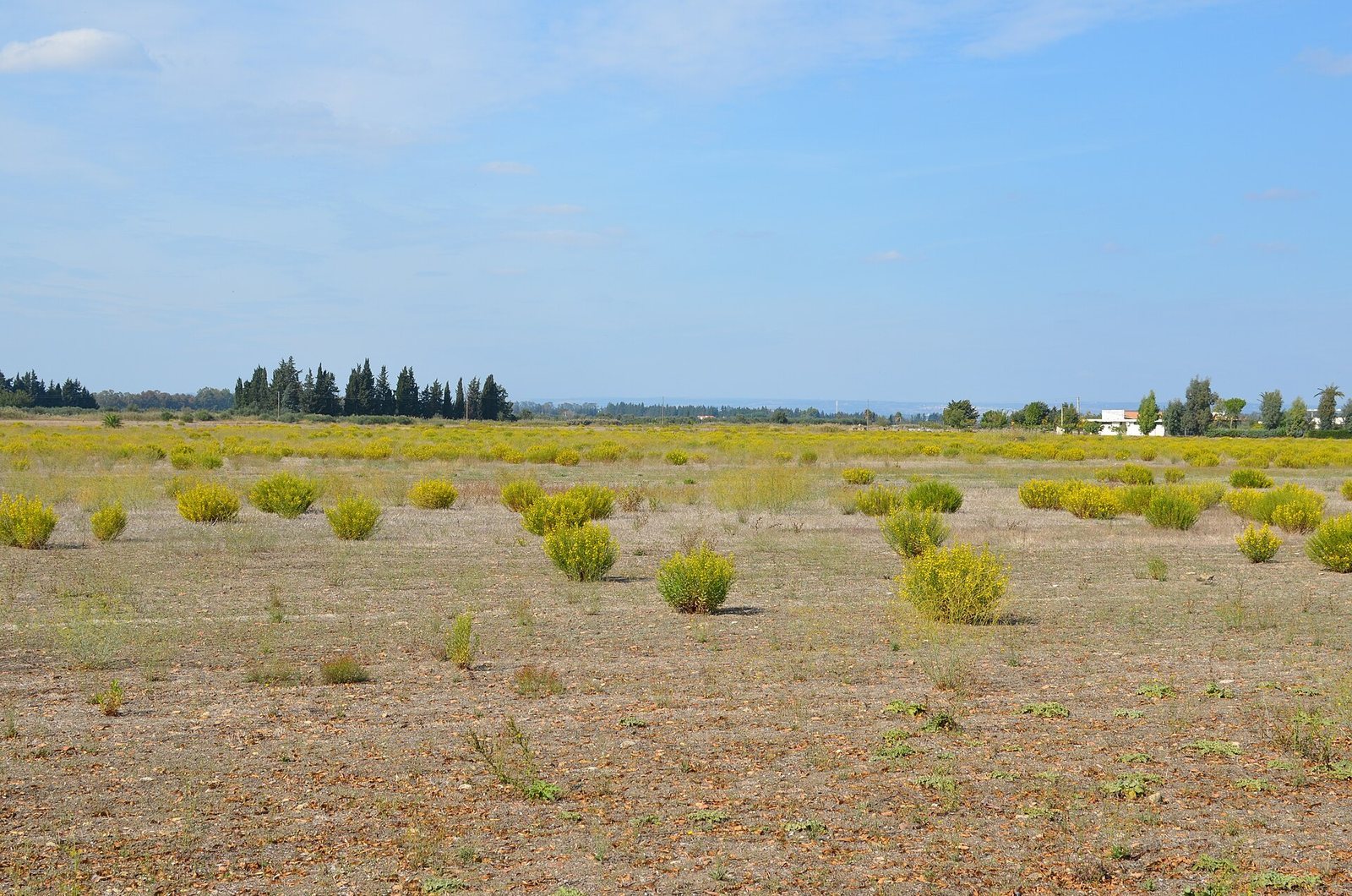
The ancient city stood between the Bradano and Basento rivers, with the Basento probably approaching its southern edge. Both rivers have since shifted south, while the sea is now about a kilometre farther away than it was in antiquity. A canal probably linked the city to lagoons at Santa Pelagina, which served as its harbor. Repeated floods left river-deposited soil across the site; north of the Apollo sanctuary, this layer is now nearly a metre thick. The higher ground occupied by the Roman fortified settlement, or castrum, was an exception. Changes in groundwater levels, already under way in the fourth century BCE, probably contributed to the sinking of Archaic temples.
Incoronata
About seven kilometres west of Metapontum, Incoronata occupied a defensible hill on the right bank of the Basento. Its steep sides, plateau-like top, and spring formed the setting for settlement remains dating from the eleventh to eighth centuries BCE. These include hut floors, ash-filled refuse heaps, animal bones, and painted pottery. A fragment of a Greek drinking cup, possibly made in Corinth and dated to the first half of the eighth century BCE, indicates Greek presence in the area decades before the colony’s foundation. Similar huts and Indigenous-style material have also been found at Metapontum itself.
Between the late eighth and early seventh centuries BCE, small rectangular houses with dry-stone foundations and adobe upper walls replaced the earlier huts at Incoronata. Greek and eastern Mediterranean pottery and manufactured goods are plentiful in this phase. The settlement was violently destroyed shortly after the middle of the seventh century BCE, around the time Metapontum was established.
City defenses and plan
Walls and water channels
The city wall enclosed a quadrilateral, with a broad, wedge-shaped projection on its western side. Its stone-block base was 2.5 metres thick and carried an upper section of adobe. Some sections date to the sixth century BCE, a dating supported by Greek-letter marks cut into the masonry blocks. The northern side appears to have been built in the fifth century BCE and remodeled in the fourth and third centuries BCE. A ditch followed the wall around the city. One channel carried spring water; another connected the city with the harbor and discharged toward the sea.
Streets and house blocks
The street grid was established around the middle of the sixth century BCE. The visible plan belongs to the fourth and third centuries BCE but preserves the earlier arrangement. Major streets ran east to west and crossed streets running north to south. Some were 12 metres wide and others 5 metres wide. Together they divided the city into house blocks about 35 metres across and nearly 190 metres long, aligned perpendicular to the coast, with their short ends facing the major avenues. Large drains beneath the main streets collected water from smaller channels.
Sanctuary and civic center
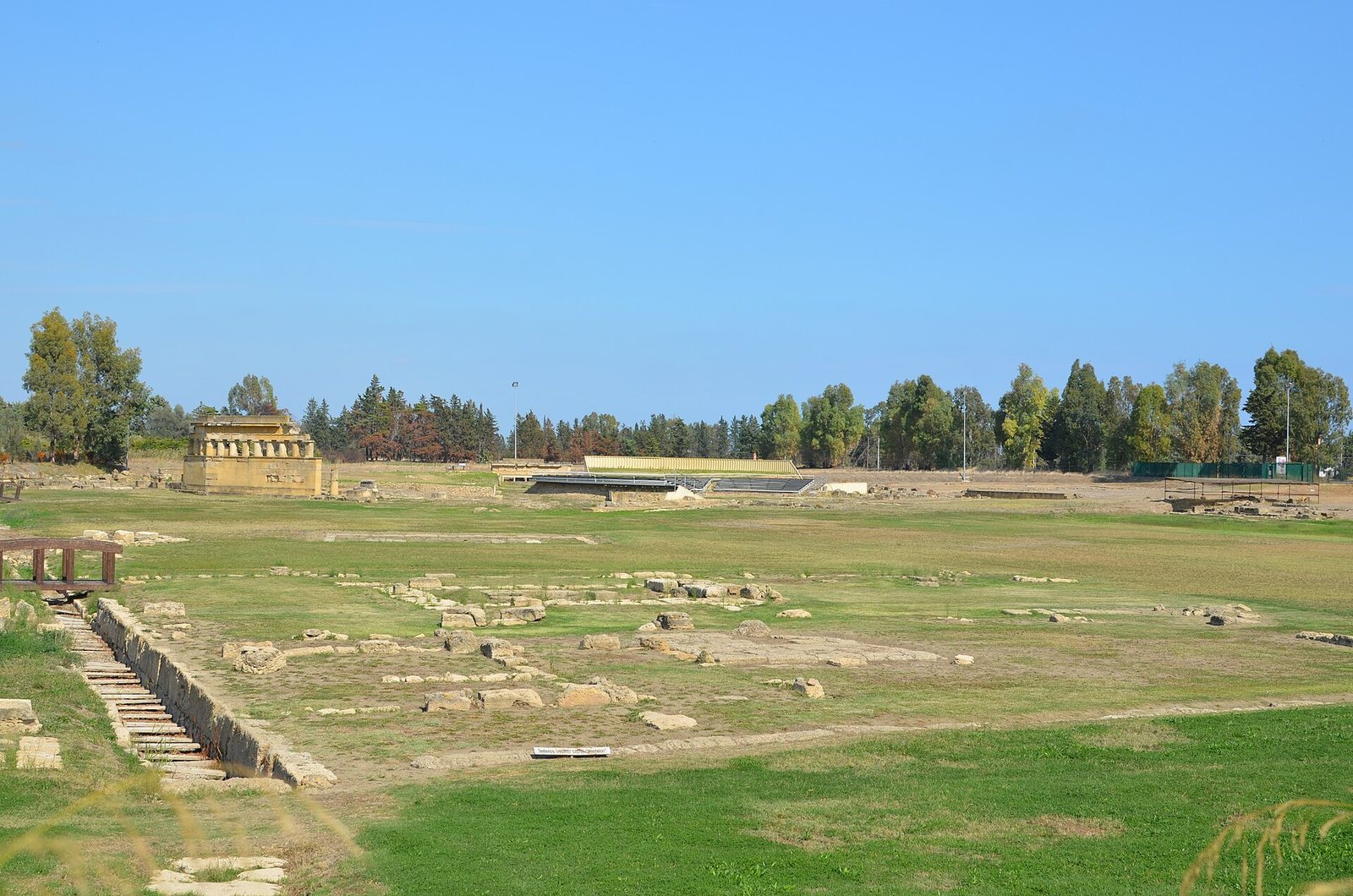
The sanctuary and agora, a Greek city’s civic and marketplace center, occupied adjoining areas outside the northern part of the city. An enclosing wall around the sacred area followed the street orientation. The agora lay east of the sanctuary, separated from it by a portico with pilasters. Its full boundary is uncertain; a large portico on the seaward side may have formed one edge. Rebuilt around the beginning of the third century BCE, this portico has been excavated for 60 metres. It is 15 metres wide, with a Doric colonnade facing the agora and rooms along its eastern side.
An altar and inscribed marker from the Archaic period provide early evidence of the agora in the area later occupied by the theatre. The inscription identifies it as the Agora of Zeus, placing the civic space under the god’s protection.
Temples in the central sanctuary
Temple C
Temple C began around 580 BCE as a modest rectangular shrine 6.40 metres wide; only parts of its foundations survive. Recovered roof tiles include fine terracotta plaques showing a sacred marriage among seated divinities in a mule-drawn cart, as well as a sphinx-shaped roof ornament. Between 480 and 470 BCE, a new arrangement was built on a closely set platform of stone blocks, some reused, while retaining the earlier orientation. Fragments of an island-marble roof with lion-head water spouts and marble roof ornaments decorated with stalk and palmette forms point to the quality of the later building. Its design belongs to the Severe style, an early classical Greek art style.
Temple A
Temple A was built in two phases and is identified with Apollo. The first, in the first quarter of the sixth century BCE, was a column-surrounded temple measuring 23.30 by 46.40 metres, apparently left unfinished. Its orientation resembled Temple C’s but differed from the street grid. Around 530 BCE, builders dismantled its blocks for reuse in a replacement on the same site. The later building faced a different direction and aligned with Temple B. It had an unusually long plan, probably eight columns across its eastern front and seventeen along each side, with a double row at the eastern end. A long, narrow inner chamber had half-columns built into its walls, while the porch had no columns.
A late-Archaic inscription dedicated by Theagenes links Temple A with Apollo Lykaios. Found in the nineteenth century, it is now in the museum at Potenza. Irregular stones between Temples A and B, including stones placed on limestone markers or small pillars and stone anchors, have been interpreted as offerings.
Temple B
Temple B was constructed in two phases, around 570 and 530 BCE. The earlier phase was unfinished, but its foundations became part of the later temple, which kept the same location and orientation and extended the front by 2.50 metres. Its overall plan resembled the so-called Basilica at Poseidonia. It probably had nine columns on each short side and seventeen on each long side. A central row of columns divided the inner chamber; these single-block columns were later reused. The upper structure is poorly preserved, but it appears to have had a continuous outer wall fitted with half-columns. Painted inscriptions on the backs of architectural terracottas identify the temple with Hera.
Temple D
The northernmost temple in the central line, Temple D was built around 470 BCE. Its Ionic style, a Greek column style with scroll-shaped capitals, and other features have led to its identification as a temple of Artemis or Aphrodite. The foundation trench is the main surviving part, but numerous recovered fragments have allowed the upper structure to be reconstructed. The ground plan and inner chamber remain legible; reconstructed columns with carved bases and capitals, together with an assembled horizontal structure above the columns, are displayed at the site.
Sanctuaries beyond the city
The Temple of Hera at the Palatine Tables
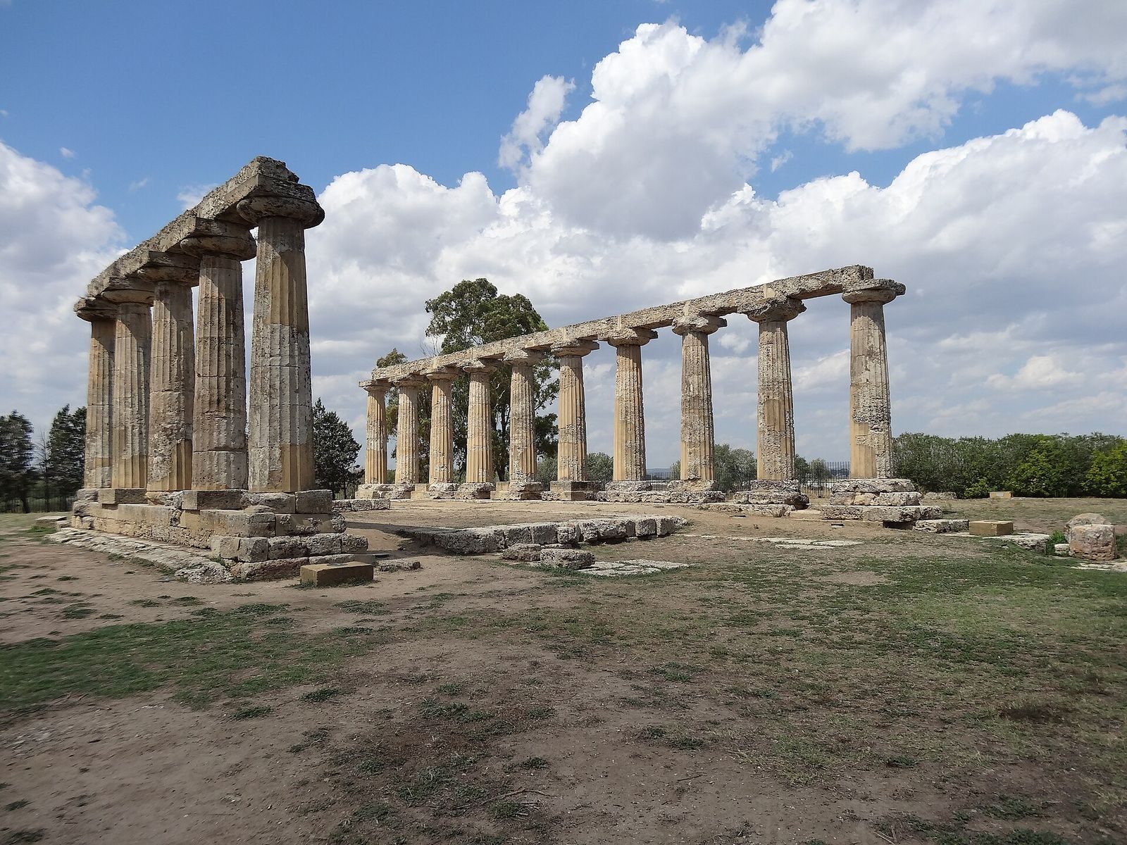
The temple of Hera known as the Palatine Tables stood outside the city to the north, on the first hill at the edge of the coastal plain. Dating to around 530 BCE, it has a Doric design, a Greek column style with simple capitals, and columns around all four sides. Its stepped platform measures 16.06 by 33.30 metres. The building had six columns on each short side and twelve on each long side; fifteen remain, five to the south and ten to the north, along with the platform and horizontal beams above the columns. The inner plan is visible, including a porch and spaces corresponding to the main sanctuary and a restricted inner area. The sanctuary’s boundary is uncertain. It included buildings older than the temple, as did an altar 26 metres in front of the façade. The temple’s architectural terracottas resemble those of the Basilica at Poseidonia.
San Biagio alla Venella
The suburban sanctuary of San Biagio alla Venella lay on the left bank of the Basento, 16 kilometres from the city. Near a sacred spring stood an elongated rectangular building, probably a monumental fountain, whose earliest phase dates to the late seventh century BCE. A deposit of offerings included terracottas of a winged female divinity, fawns, children, weapons, and pomegranates shown on a headdress. A limestone block bearing a possible late-sixth-century BCE dedication to Zeus Aglaios, meaning the Radiant, probably marked the sacred area.
Assembly place and theatre
Citizen assembly place
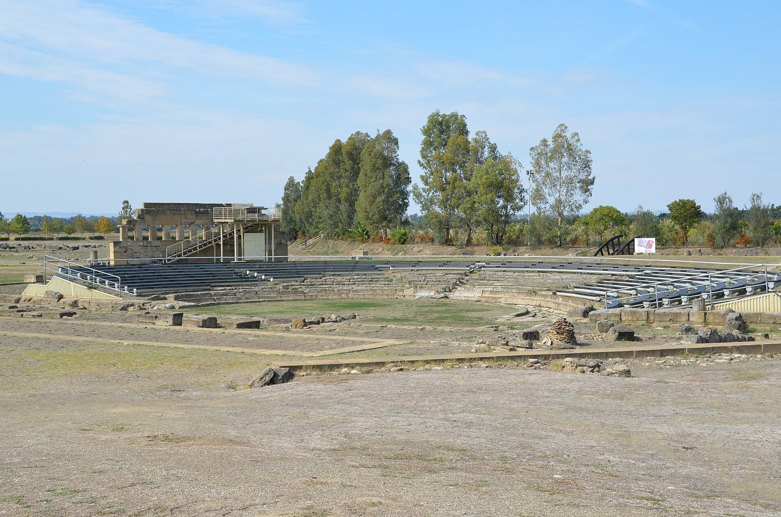
The Ecclesiasterion, a place for citizen assemblies, developed from an earlier wooden structure. Around the middle of the seventh century BCE, a circular wall was built to support a simple earth embankment. Around 470 BCE, two semicircular seating areas were formed opposite one another on the embankment, with entrances at the ends of the main axis. The seating extended along a circumference of nearly 62 metres. Stone seats were added later, leaving a rectangular space at the center, probably for speakers.
Theatre
Built in the second half of the sixth century BCE over the assembly place, the theatre stood on an embankment of earth and sand because the ground had no natural slope. Its south-facing, semicircular seating area reached a maximum diameter of 77.40 metres. Seven rows of seats are recorded, including a first stone row reserved for officials; blocks behind them probably supported wooden benches. Modern steps are also visible in the seating area. The circular performance space measured 17.40 metres across, had three steps, and was bordered by a drainage channel. Little of the stage survives. Fallen upper blocks have allowed reconstruction of the exterior façade, which had Doric half-columns supporting a horizontal structure decorated with alternating carved blocks and panels. The theatre could seat about 4,000 people.
Burials and coinage
Cemeteries
The Greek colony’s cemetery lay northwest of the city, outside the walls. Excavation uncovered 253 burials along a road accompanied by a parallel rainwater channel. Grave deposits date from the second quarter of the sixth century to the end of the third century BCE. They include many red-figure vessels, a style in which figures stand out against a dark background, among them oil containers, large bowls, and small vessels used for oil or perfume. Crucinia and Pantanello are also named as cemetery areas.
Coins
Metapontum minted its own coins, many of which have been recovered. An early silver coin, dated to the fifth or fourth century BCE, shows an ear of grain in relief on one face and repeats the design as an indented image on the other, a method known as incuse. The face also bears the letters META. It measures 24 millimetres and weighs 7.75 grams. A fourth-century silver coin, 22 millimetres across and weighing 7.35 grams, depicts a youthful figure, possibly Dionysus the Libyan, with goat horns on one face and an ear of grain on the other.
Another fourth-century silver coin shows the bust of Leucippus wearing a Corinthian helmet, with a seated dog behind him. Its reverse bears META and depicts a plant with an ear of grain and a flying dove, with the letters AM beneath the bird. It measures 21 millimetres and weighs 7.73 grams. A related early-third-century coin also depicts Leucippus. The grain emblem was characteristic of Metapontum’s coinage; later designs commonly used the head of Ceres, the Roman name for the Greek goddess Demeter. Leucippus first appears on coins around the middle to late fourth century BCE, possibly in connection with Alexander I of Epirus’s campaign in southern Italy.