Fort of São Pedro: A Portuguese Coastal Defense Fort
Site at a Glance
- Popularity
- Very Low
- Country
- Portugal
- Primary era
- Early Modern
- Eras represented
- Early Modern, Modern
- Civilizations
- Portuguese
- Site type
- Military
- Remains
- Fort
On this page8 sections
History
Construction and early names
The Portuguese built the Fort of São Pedro, also known as the Fort of Poça, in Estoril, Portugal, as part of a coastal defensive line between the Fort of São Julião da Barra and Cabo da Roca. Work began on 5 April 1642 and was completed in 1643. The wider line’s forts were built between 1642 and 1648.
The first name was the Fort of São Teodósio, probably chosen in honor of King John IV’s first male heir. The initial plan also used the name Fort of Santo António da Cruz da Assubida. Architect Mateus do Couto prepared the design, and António Luís de Meneses, governor of the Fort of Cascais, supervised construction. The fort became known as the Fort of São Pedro during the eighteenth century.
Eighteenth-century service and nineteenth-century repairs
Commander José Martins lived at the fort in 1720. Later inspections found it closed and in need of repairs to its walls and guard-post chimney, as well as a new warehouse door. The work was estimated at 70,000 réis, Portugal’s currency before the escudo. Two iron cannons were considered serviceable in principle, but poor maintenance and inoperative firing mechanisms prevented their use. By 1735 the fort had three cannons, still judged inadequate, and required major repairs. In 1751 the cost of repairs had risen to about 200,000 réis; the connecting trench was ruined, and rebuilding the walls was estimated at 230,000 réis.
By 1831 the fort was substantially ruined. A repair campaign from July to November addressed its walls, protective features, gunpowder store, warehouse, quarters, windows, and main gate. Workers also rebuilt sections along the covered walkway and repaired the open gun platform. The work addressed the Portuguese coat of arms above the entrance, which had been chipped during a French incursion. One defensive barrier remained unfinished, although troops returned. On 17 February 1832, Field Marshal Gabriel António Franco de Castro, a senior military officer responsible for inspecting fortifications in the northern Tagus district, reported that work had stopped after the laborers were withdrawn. He believed materials for completion remained at the fort and urged the military to finish the repairs. By 1 May, its garrison included seven corporals, militia soldiers, and two veterans under a military governor; its two cannons had calibers of 12 and 18.
On 15 February 1843, the fort was transferred to the Misericórdia de Cascais, a local charitable institution, for use as a support facility for the thermal baths at Poça Beach.
From military fort to civilian use
A coastal trench was destroyed soon after 1892 during construction of a new thermal-baths building and gardens. At the beginning of 1894, the concession passed to the Empresa dos Banhos da Poça. On 4 July 1924, the Supreme Administrative Court annulled the company’s lease. The Ministry of the Interior’s Division for Assistance rented the premises in 1931, intending to establish an animal shelter there. In 1935, the remaining objects and utensils of the former bath company were transferred to its former concession. The premises were ceded to the Autonomous Roads Board, among other bodies, in 1940. On 15 July 1947, they passed to the Cascais Tourism Board for a tea house, and extensive remodeling was completed before its inauguration in 1954.
The fort was rented again in 1957 and converted into a bar and restaurant, prompting alterations and extensions. A proposed expansion was halted by Cascais’s Municipal Commission for Art and Archaeology on 17 May 1972. The commission required changes to respect the fort’s original exterior appearance and architecture. The former gun platform and quarters were later adapted for use as a discotheque.
Remains
Setting and defensive plan
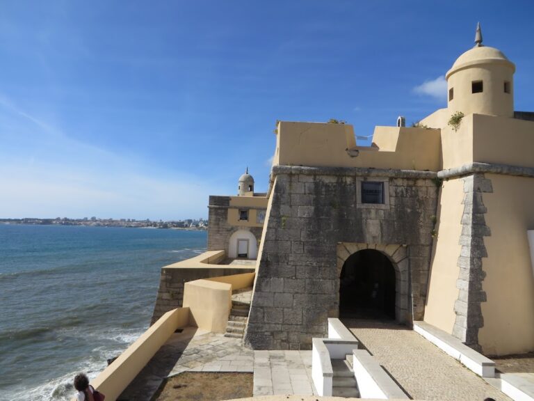
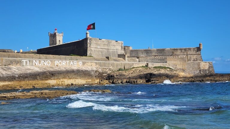
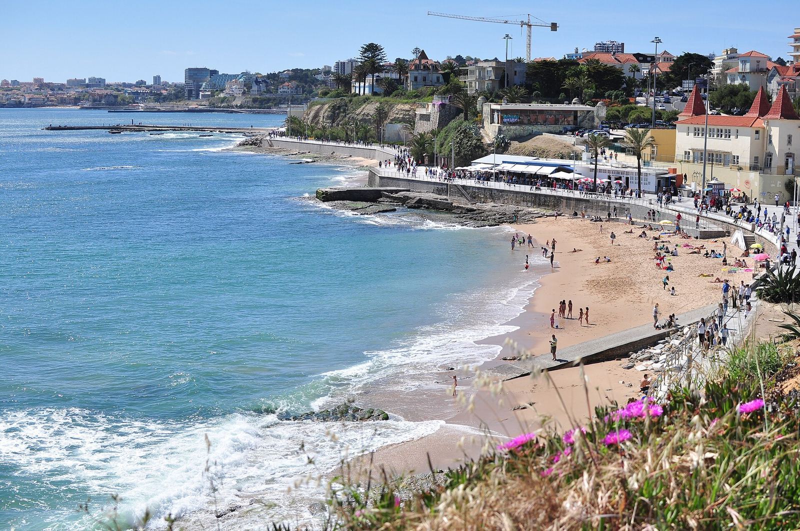
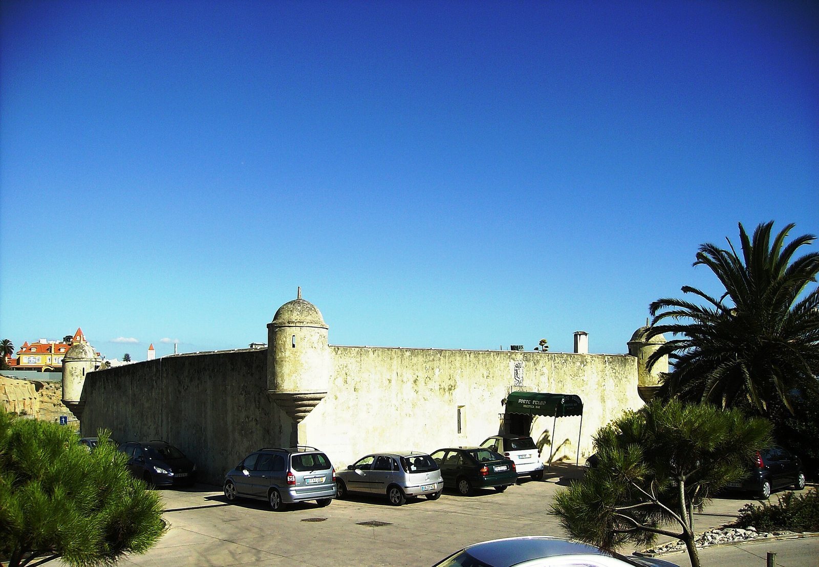
The fort occupies a flattened hilltop platform on the western slope of Poça Beach, in an urban part of Estoril, on the right bank of the Cadaveira stream. The Fort of São João stands nearby, in front of it. The small fort has a rectangular plan and is built of masonry and limestone, with coast-facing defensive walls. Its seventeenth-century arrangement included a long wall with raised firing cover, artillery positions along the eastern and southern sides, and barracks against the western, landward wall. Angled low defensive walls on the north and west formed the principal gun platform. In 1854, the battery was measured as 66 centimeters high and 110 centimeters wide. The eastern platform measured 15.4 meters long and the southern one 7.04 meters.
Buildings and entrance features
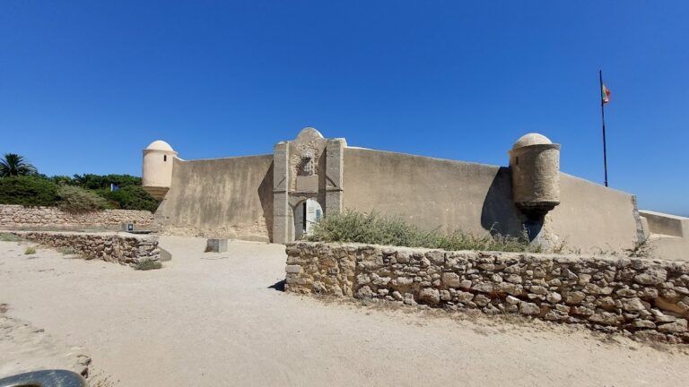
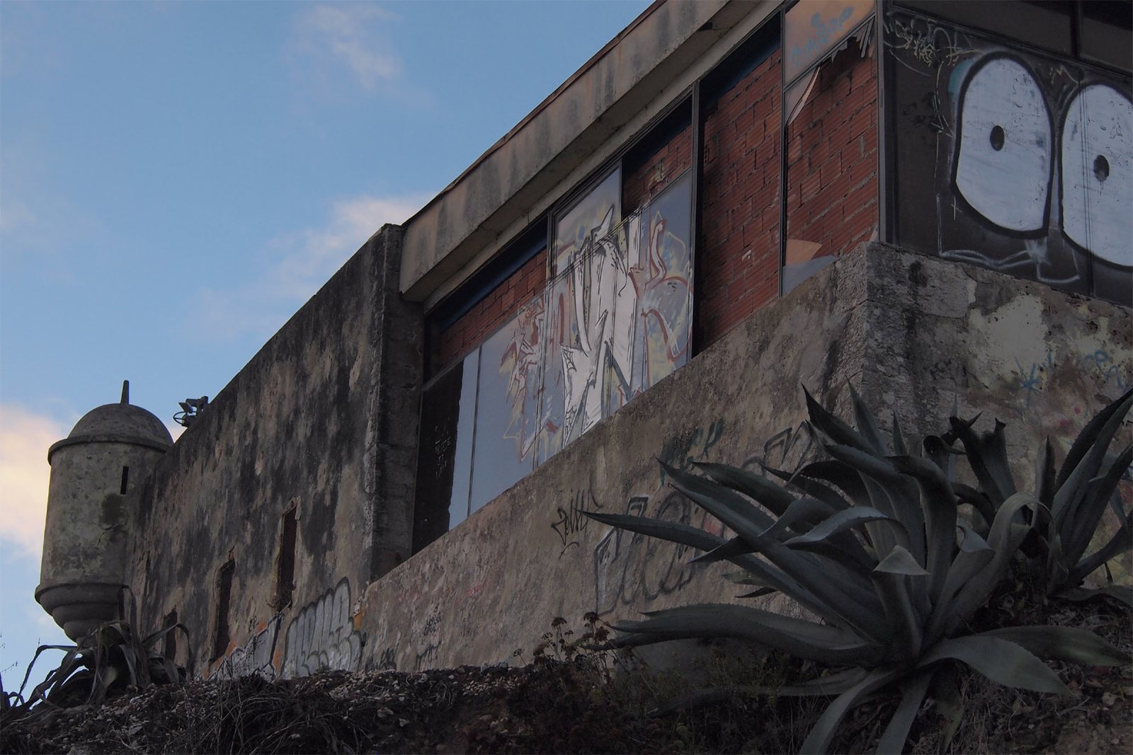
Near the entrance stands the main fortified building, divided into four compartments with vaulted ceilings, meaning curved masonry ceilings. The main gate opened into an intermediate courtyard linking the different parts of the fort. The first division on the left served as quarters and a kitchen, while the principal gun position lay opposite the entrance. A powder store and a house stood to the left of the barracks, which could accommodate twelve people. An eight-step stair beside the guardhouse wall led to the level above the quarters, used by infantry. The terrace above the main building served as a defensive position and firing line. Small projecting corner turrets, with stepped bases and spherical openings, occupied the fort’s corners. Above the simple arched entrance porch, an inscription concerns the fort’s early history and a Portuguese coat of arms bears a crown and crest; the arms have a crack on the left.
Coastal trench
The former trench ran along the coast between the Fort of São Pedro and the Fort of São João, crossed the Cadaveira stream, and continued toward the opposite bank. In 1892, its surviving fabric included masonry slopes and firing positions for infantry.